Cold spell occuring from May 12 2011 to June 03 2011 at 45.0°N 138.5°E

Download data: JSON

Event type: Cold spell

Countries affected (identified with ArcGIS Online; provided only for geographical reference):

  • China
  • Japan
  • Laos
  • North Korea
  • Philippines
  • Russian Federation
  • South Korea
  • Vietnam

Duration: 23 days

Time span: May 12 2011 to June 03 2011

Statistics over entire affected area:

  • Mean temperature anomaly: -3.6 °C
  • Mean temperature: 14.6 °C
  • Minimum temperature anomaly: -12.0 °C
  • Minimum temperature: -4.1 °C

Event center: 45.0°N 138.5°E

Area affected: 6358199 km$^2$
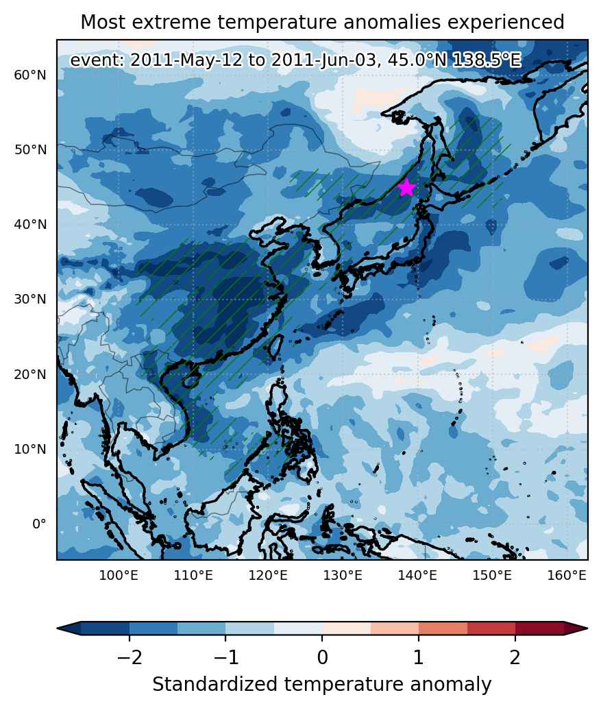

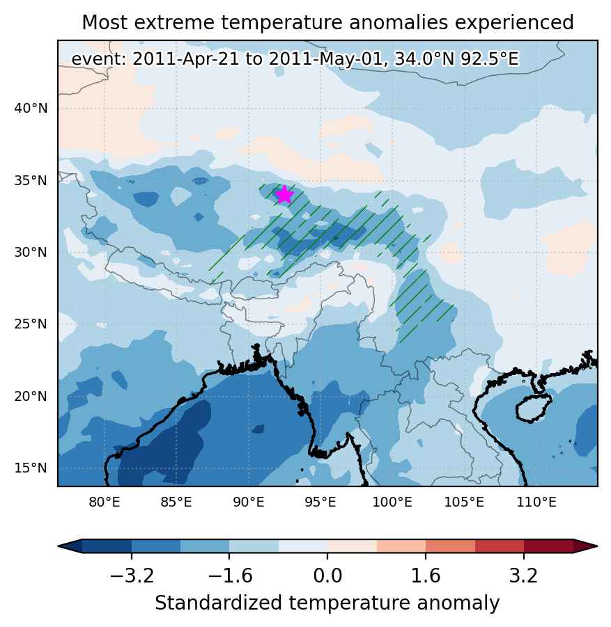
Fig. 1: Map of most extreme temperature anomalies (standardized) experienced during the event. The purple star indicates the center of the extreme event. Green hatching illustrates all areas under the effect of extremes at some time during the event.
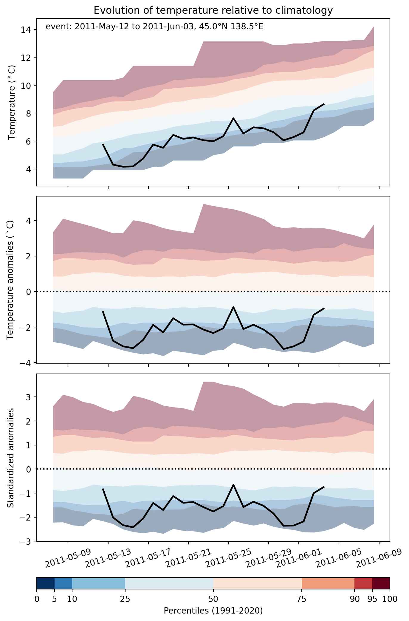


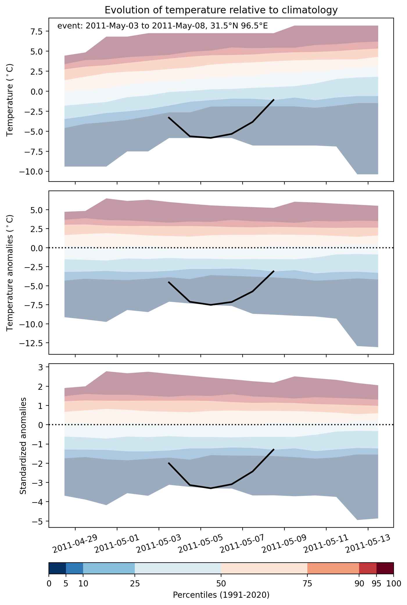
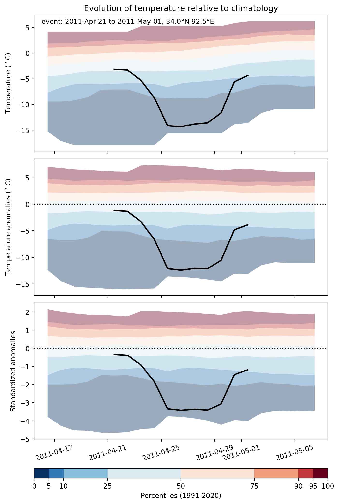
Fig. 2: Evolution of temperature at the center of the event. The climatological percentile distribution is illustrated with color shadings.
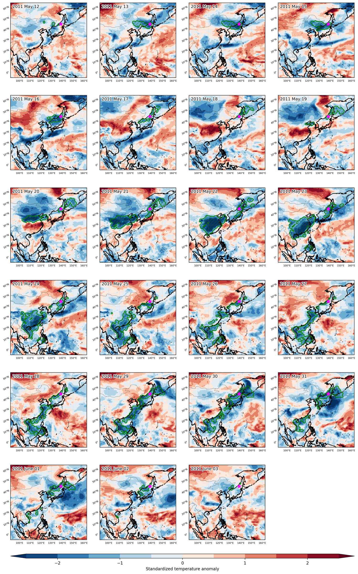


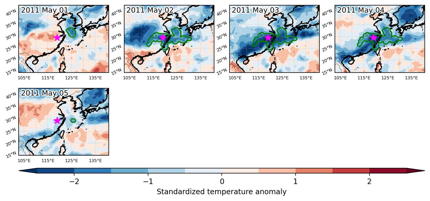
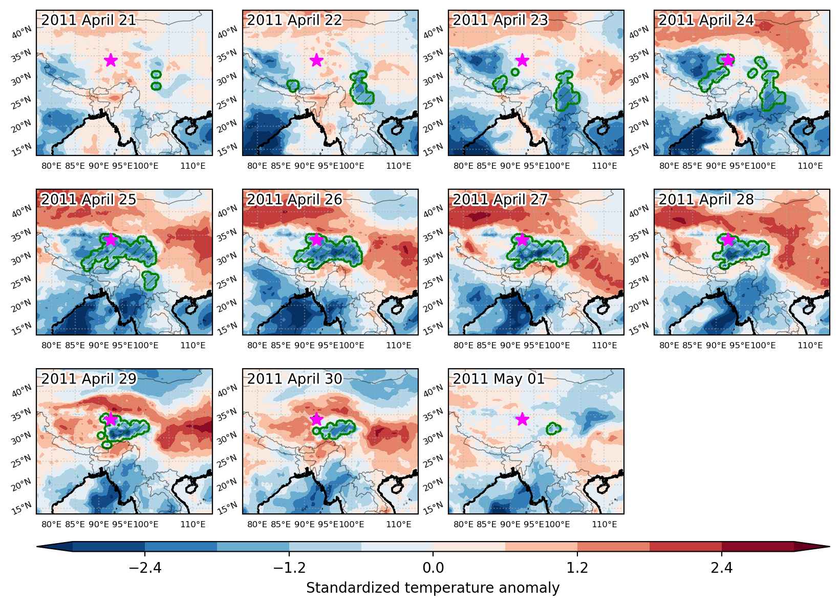
Fig. 3: Maps illustrating the evolution of standardized temperature anomalies during the event.

Event ID: Cold_spell_2011-May-12_to_2011-Jun-03_138.5_45.0
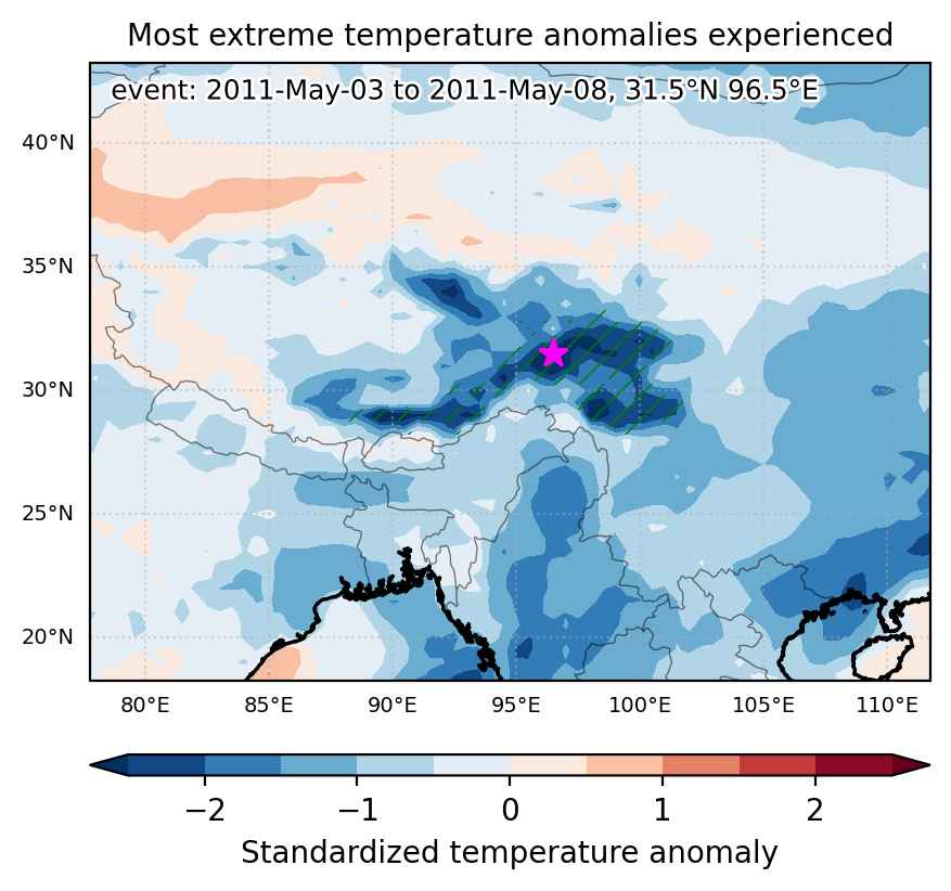
Cold spell occuring from May 03 2011 to May 08 2011 at 31.5°N 96.5°E

Download data: JSON

Event type: Cold spell

Countries affected (identified with ArcGIS Online; provided only for geographical reference):

  • China

Duration: 6 days

Time span: May 03 2011 to May 08 2011

Statistics over entire affected area:

  • Mean temperature anomaly: -5.3 °C
  • Mean temperature: -3.5 °C
  • Minimum temperature anomaly: -10.0 °C
  • Minimum temperature: -10.8 °C

Event center: 31.5°N 96.5°E

Area affected: 279373 km$^2$


Fig. 1: Map of most extreme temperature anomalies (standardized) experienced during the event. The purple star indicates the center of the extreme event. Green hatching illustrates all areas under the effect of extremes at some time during the event.


Fig. 2: Evolution of temperature at the center of the event. The climatological percentile distribution is illustrated with color shadings.


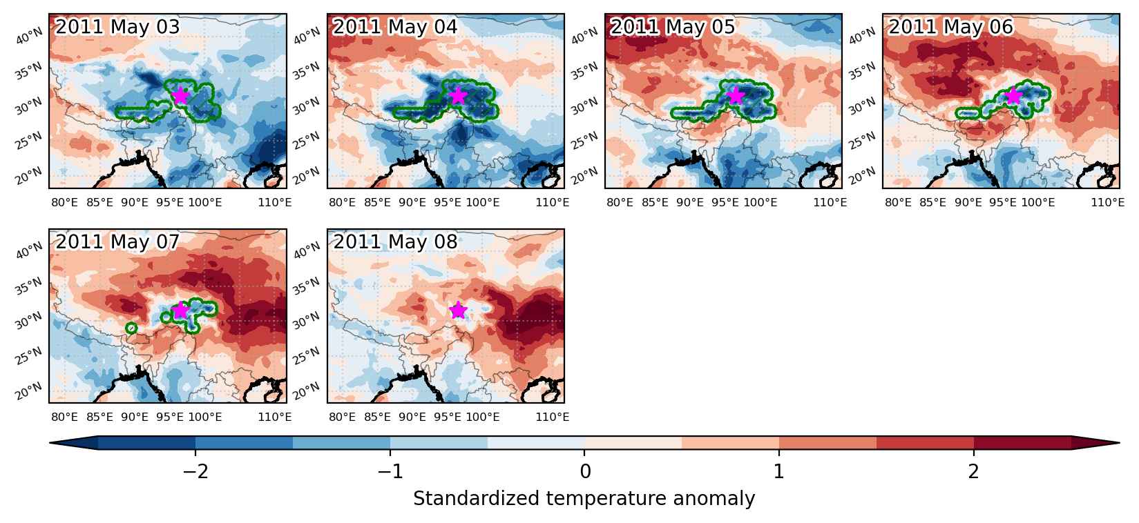
Fig. 3: Maps illustrating the evolution of standardized temperature anomalies during the event.

Event ID: Cold_spell_2011-May-03_to_2011-May-08_96.5_31.5

Cold spell occuring from May 01 2011 to May 05 2011 at 29.5°N 119.0°E

Download data: JSON

Event type: Cold spell

Countries affected (identified with ArcGIS Online; provided only for geographical reference):

  • China

Duration: 5 days

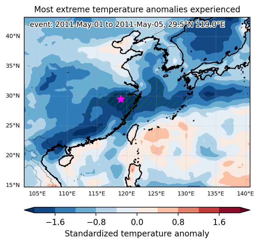
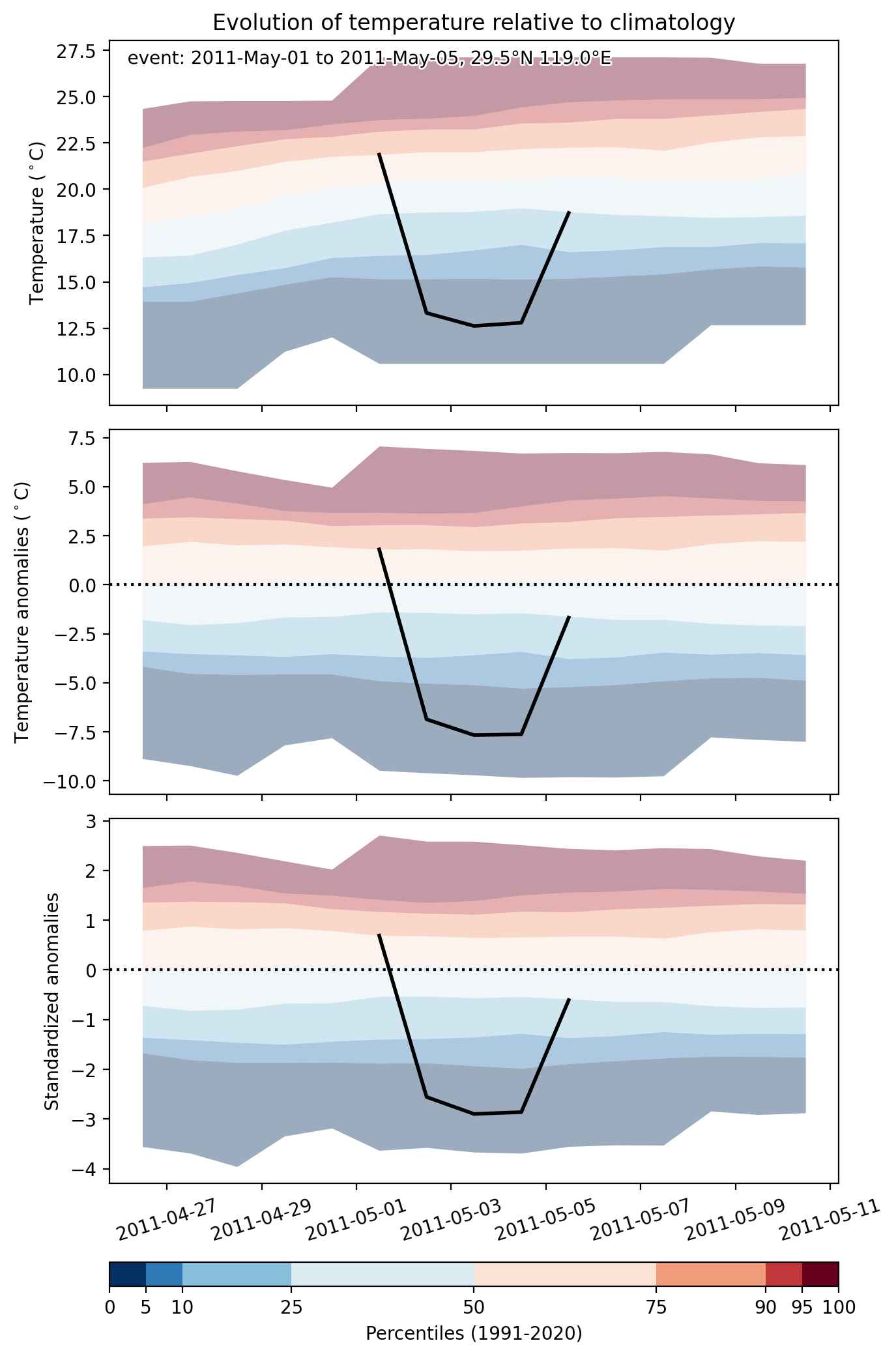
Time span: May 01 2011 to May 05 2011

Statistics over entire affected area:

  • Mean temperature anomaly: -4.3 °C
  • Mean temperature: 15.2 °C
  • Minimum temperature anomaly: -9.0 °C
  • Minimum temperature: 10.5 °C

Event center: 29.5°N 119.0°E

Area affected: 450663 km$^2$


Fig. 1: Map of most extreme temperature anomalies (standardized) experienced during the event. The purple star indicates the center of the extreme event. Green hatching illustrates all areas under the effect of extremes at some time during the event.


Fig. 2: Evolution of temperature at the center of the event. The climatological percentile distribution is illustrated with color shadings.


Fig. 3: Maps illustrating the evolution of standardized temperature anomalies during the event.

Event ID: Cold_spell_2011-May-01_to_2011-May-05_119.0_29.5

Cold spell occuring from April 21 2011 to May 01 2011 at 34.0°N 92.5°E

Download data: JSON

Event type: Cold spell

Countries affected (identified with ArcGIS Online; provided only for geographical reference):

  • China

Duration: 11 days

Time span: April 21 2011 to May 01 2011

Statistics over entire affected area:

  • Mean temperature anomaly: -5.8 °C
  • Mean temperature: -4.7 °C
  • Minimum temperature anomaly: -12.4 °C
  • Minimum temperature: -15.9 °C

Event center: 34.0°N 92.5°E

Area affected: 573144 km$^2$


Fig. 1: Map of most extreme temperature anomalies (standardized) experienced during the event. The purple star indicates the center of the extreme event. Green hatching illustrates all areas under the effect of extremes at some time during the event.


Fig. 2: Evolution of temperature at the center of the event. The climatological percentile distribution is illustrated with color shadings.


Fig. 3: Maps illustrating the evolution of standardized temperature anomalies during the event.

Event ID: Cold_spell_2011-Apr-21_to_2011-May-01_92.5_34.0

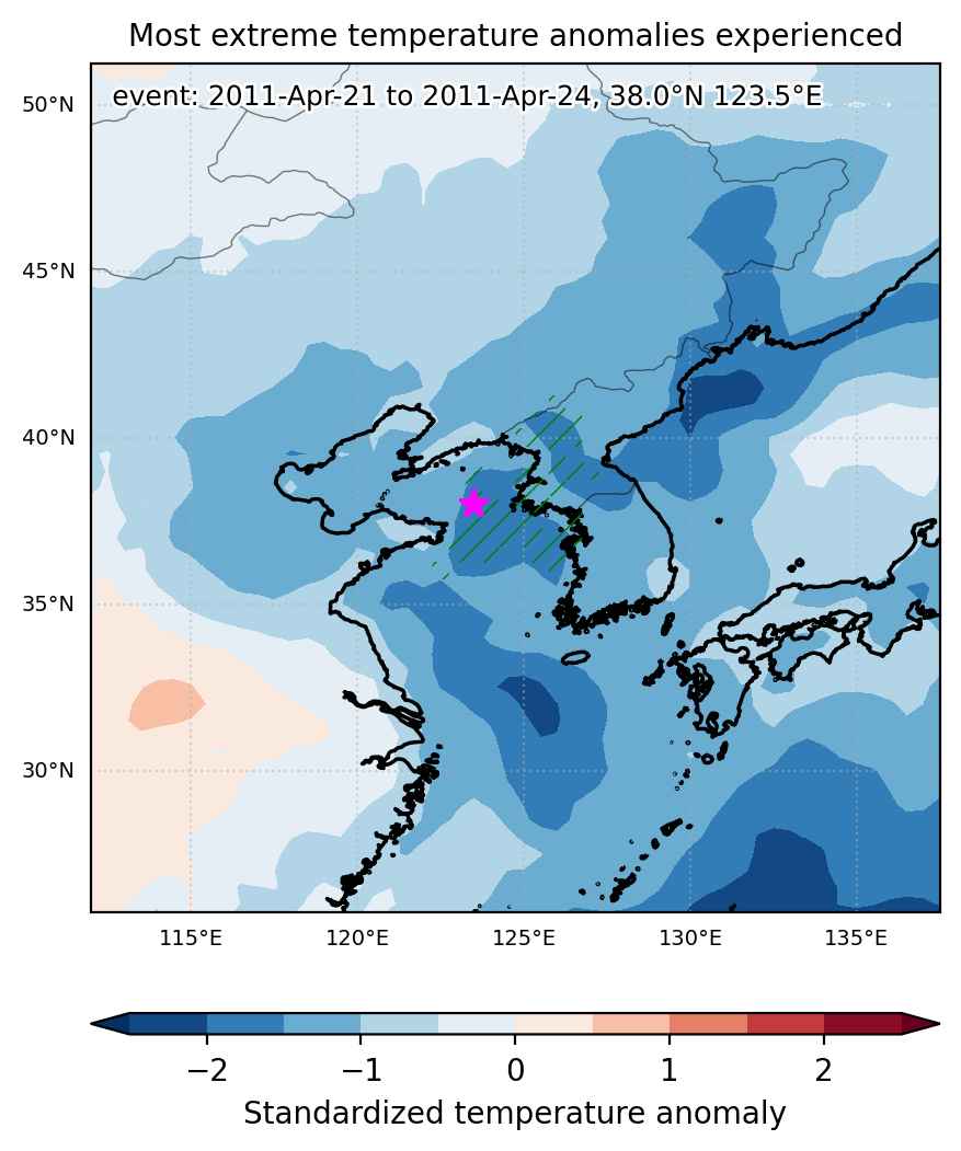
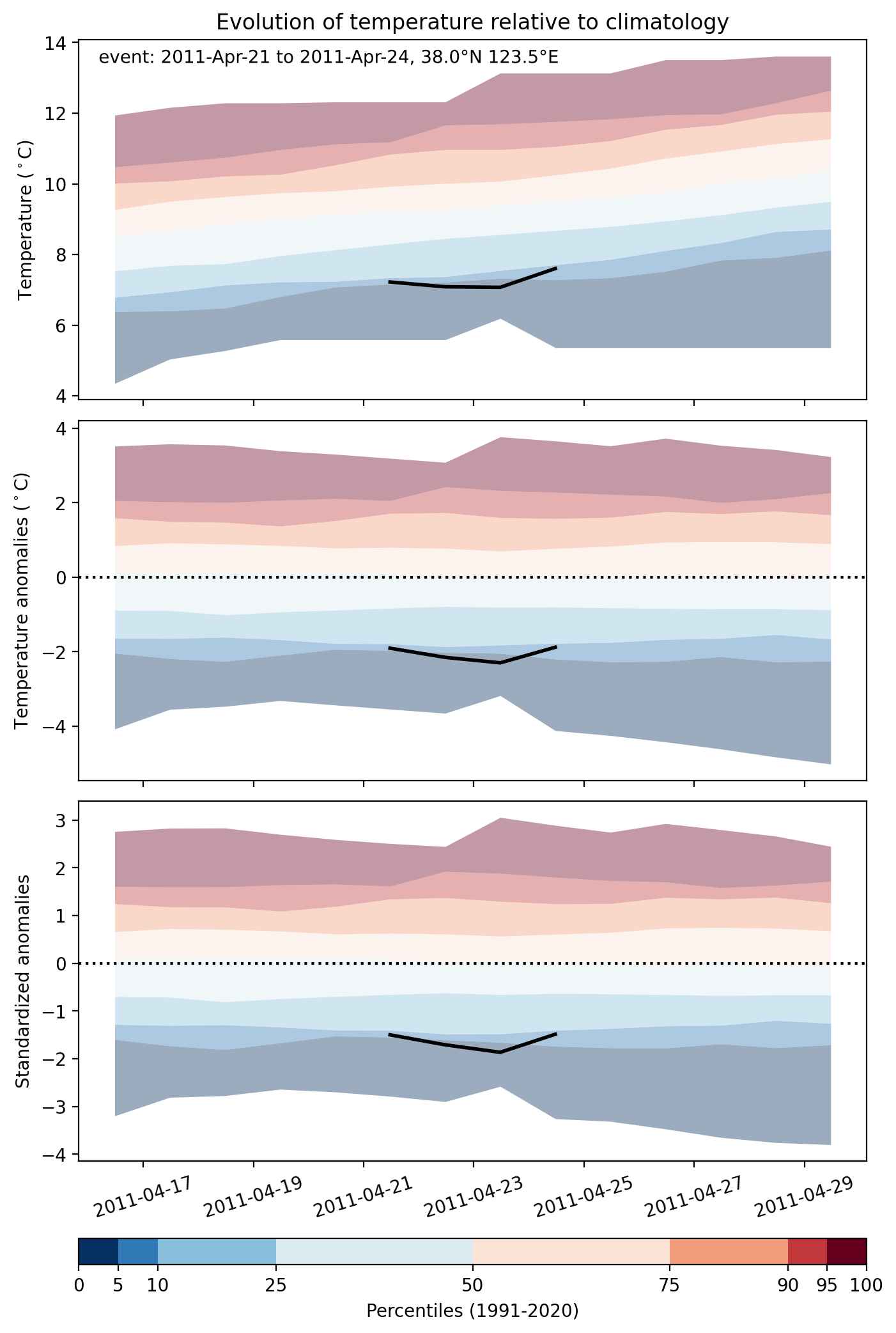
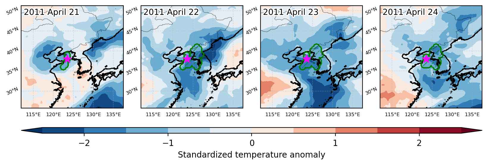
Cold spell occuring from April 21 2011 to April 24 2011 at 38.0°N 123.5°E

Download data: JSON

Event type: Cold spell

Countries affected (identified with ArcGIS Online; provided only for geographical reference):

  • China
  • North Korea
  • South Korea

Duration: 4 days

Time span: April 21 2011 to April 24 2011

Statistics over entire affected area:

  • Mean temperature anomaly: -3.1 °C
  • Mean temperature: 7.2 °C
  • Minimum temperature anomaly: -7.6 °C
  • Minimum temperature: 2.0 °C

Event center: 38.0°N 123.5°E

Area affected: 102107 km$^2$


Fig. 1: Map of most extreme temperature anomalies (standardized) experienced during the event. The purple star indicates the center of the extreme event. Green hatching illustrates all areas under the effect of extremes at some time during the event.


Fig. 2: Evolution of temperature at the center of the event. The climatological percentile distribution is illustrated with color shadings.


Fig. 3: Maps illustrating the evolution of standardized temperature anomalies during the event.

Event ID: Cold_spell_2011-Apr-21_to_2011-Apr-24_123.5_38.0

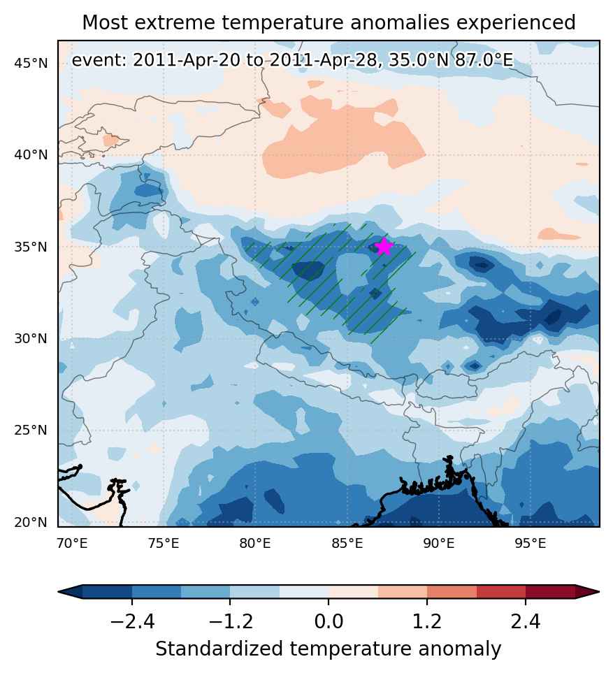
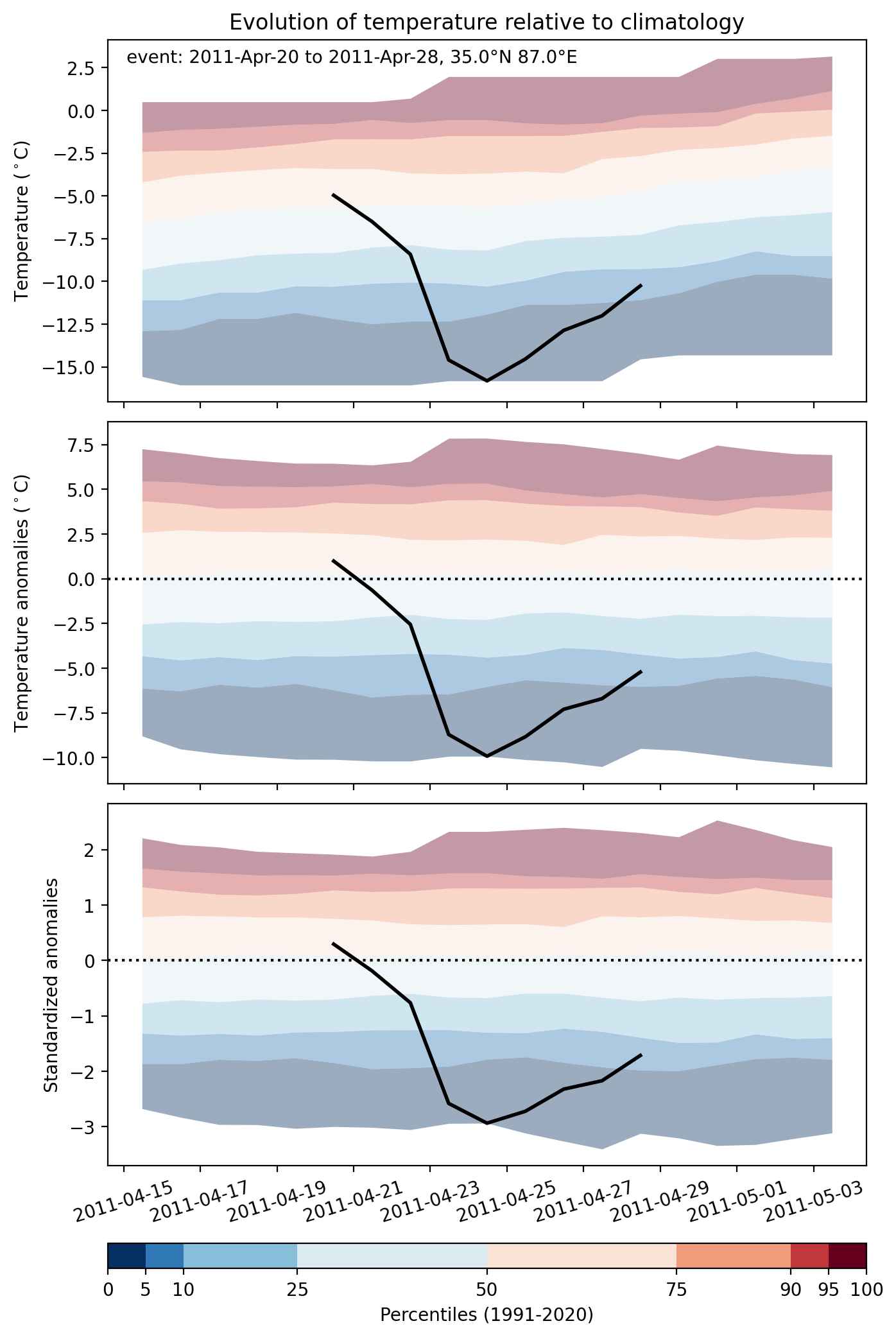
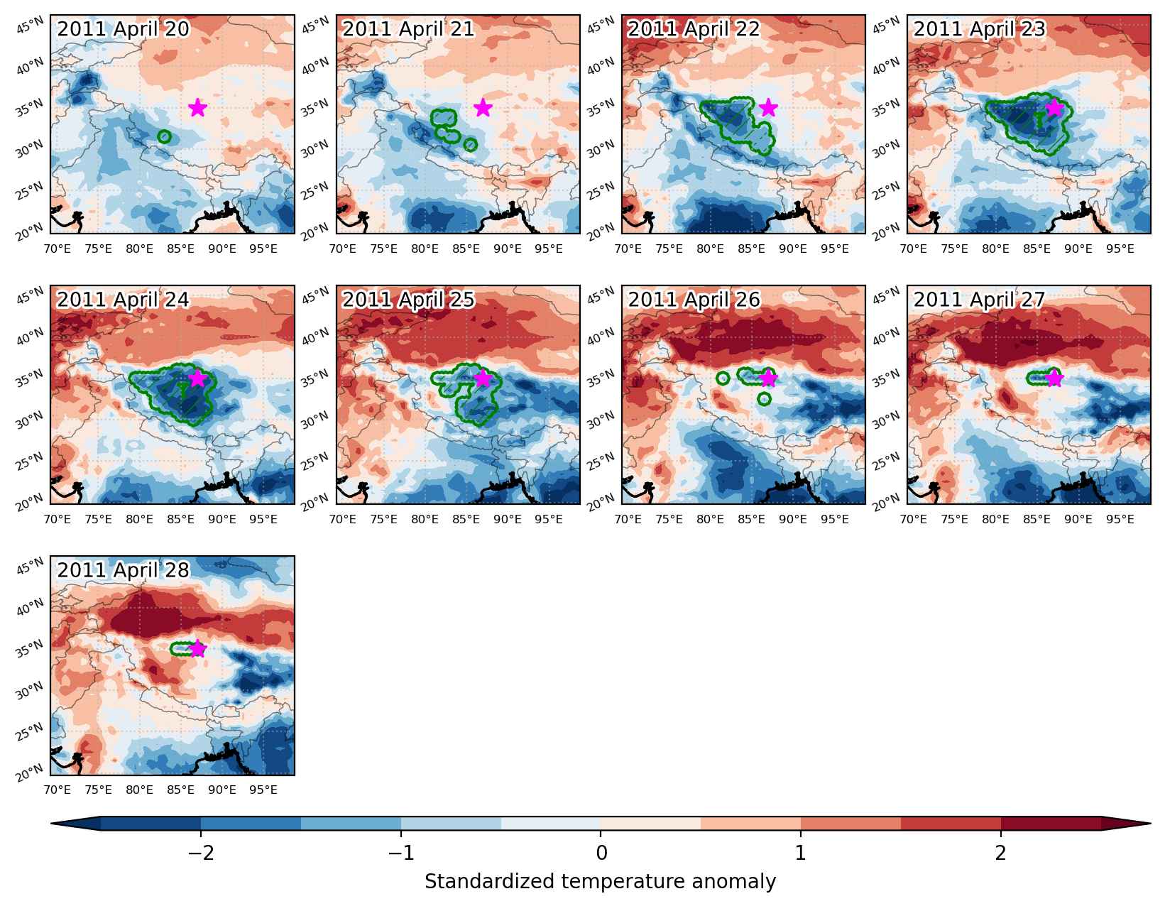
Cold spell occuring from April 20 2011 to April 28 2011 at 35.0°N 87.0°E

Download data: JSON

Event type: Cold spell

Countries affected (identified with ArcGIS Online; provided only for geographical reference):

  • China

Duration: 9 days

Time span: April 20 2011 to April 28 2011

Statistics over entire affected area:

  • Mean temperature anomaly: -5.4 °C
  • Mean temperature: -9.2 °C
  • Minimum temperature anomaly: -10.8 °C
  • Minimum temperature: -18.4 °C

Event center: 35.0°N 87.0°E

Area affected: 304638 km$^2$


Fig. 1: Map of most extreme temperature anomalies (standardized) experienced during the event. The purple star indicates the center of the extreme event. Green hatching illustrates all areas under the effect of extremes at some time during the event.


Fig. 2: Evolution of temperature at the center of the event. The climatological percentile distribution is illustrated with color shadings.


Fig. 3: Maps illustrating the evolution of standardized temperature anomalies during the event.

Event ID: Cold_spell_2011-Apr-20_to_2011-Apr-28_87.0_35.0

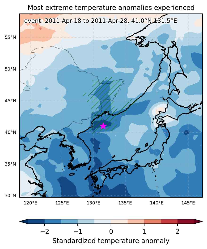
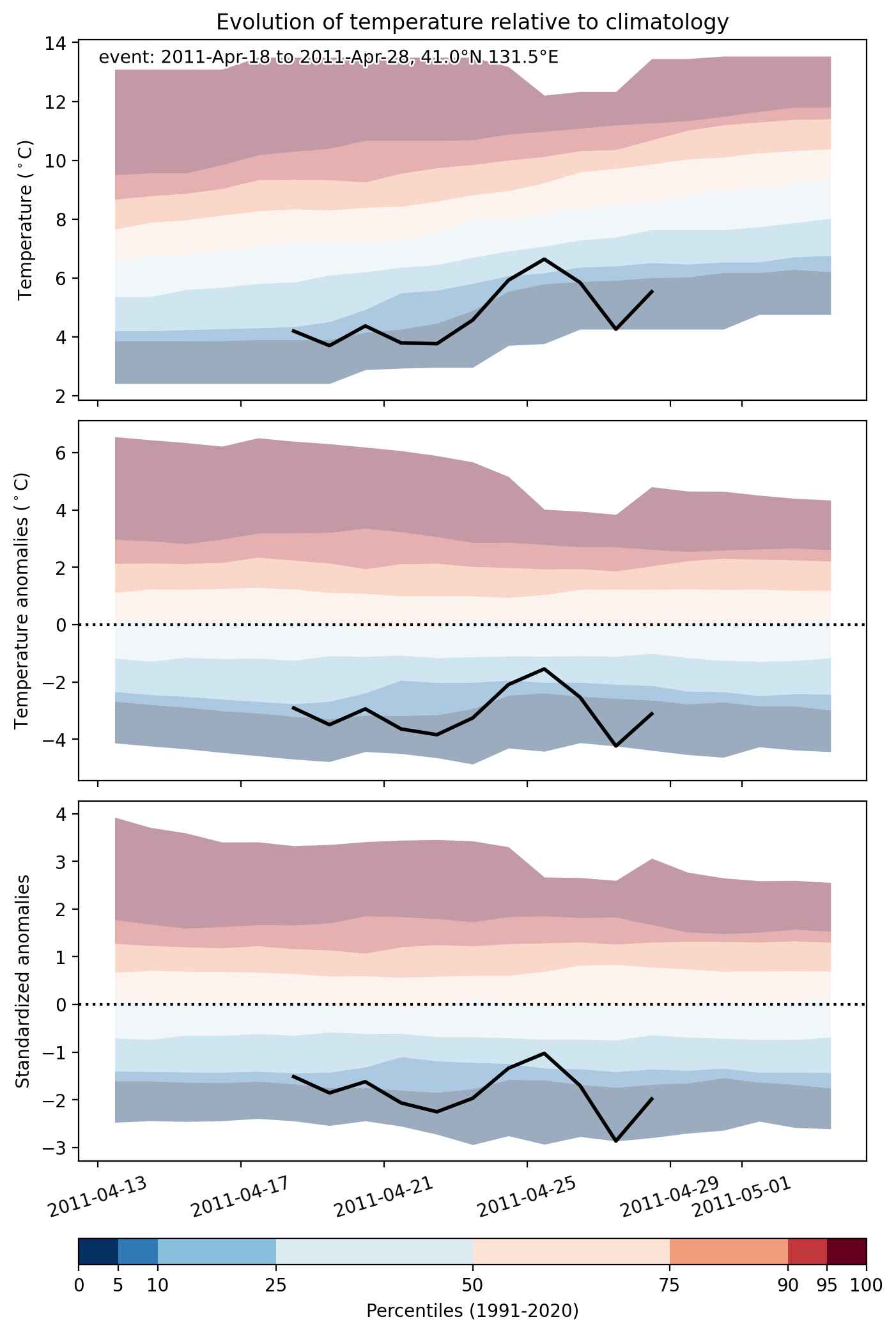
Cold spell occuring from April 18 2011 to April 28 2011 at 41.0°N 131.5°E

Download data: JSON

Event type: Cold spell

Countries affected (identified with ArcGIS Online; provided only for geographical reference):

  • China
  • North Korea
  • Russian Federation

Duration: 11 days

Time span: April 18 2011 to April 28 2011

Statistics over entire affected area:

  • Mean temperature anomaly: -4.6 °C
  • Mean temperature: 2.8 °C
  • Minimum temperature anomaly: -7.9 °C
  • Minimum temperature: -1.2 °C

Event center: 41.0°N 131.5°E

Area affected: 324027 km$^2$


Fig. 1: Map of most extreme temperature anomalies (standardized) experienced during the event. The purple star indicates the center of the extreme event. Green hatching illustrates all areas under the effect of extremes at some time during the event.


Fig. 2: Evolution of temperature at the center of the event. The climatological percentile distribution is illustrated with color shadings.


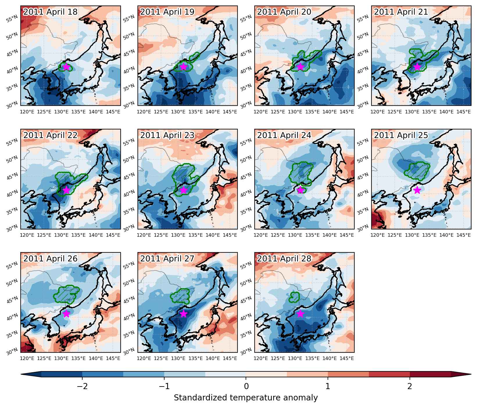
Fig. 3: Maps illustrating the evolution of standardized temperature anomalies during the event.

Event ID: Cold_spell_2011-Apr-18_to_2011-Apr-28_131.5_41.0

Cold spell occuring from April 14 2011 to May 09 2011 at 18.5°N 95.0°E

Download data: JSON

Event type: Cold spell

Countries affected (identified with ArcGIS Online; provided only for geographical reference):

  • Bangladesh
  • Cambodia
  • China
  • India
  • Laos
  • Myanmar
  • Sri Lanka
  • Thailand

Duration: 26 days

Time span: April 14 2011 to May 09 2011

Statistics over entire affected area:

  • Mean temperature anomaly: -2.2 °C
  • Mean temperature: 26.9 °C
  • Minimum temperature anomaly: -7.1 °C
  • Minimum temperature: 16.9 °C

Event center: 18.5°N 95.0°E

Area affected: 4482018 km$^2$


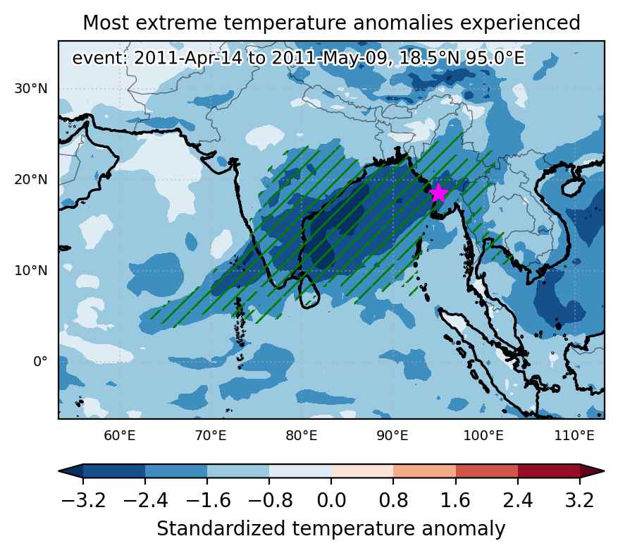
Fig. 1: Map of most extreme temperature anomalies (standardized) experienced during the event. The purple star indicates the center of the extreme event. Green hatching illustrates all areas under the effect of extremes at some time during the event.


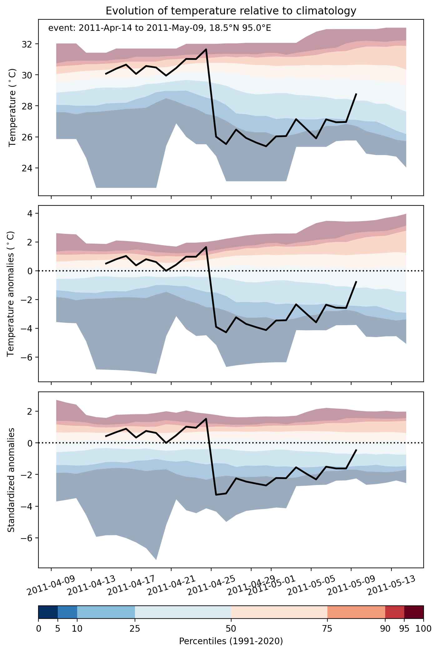
Fig. 2: Evolution of temperature at the center of the event. The climatological percentile distribution is illustrated with color shadings.


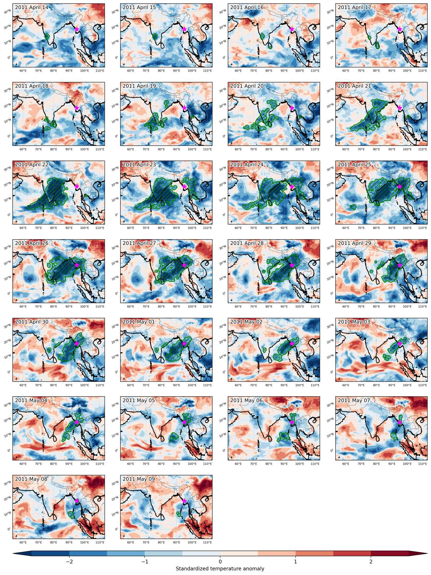
Fig. 3: Maps illustrating the evolution of standardized temperature anomalies during the event.

Event ID: Cold_spell_2011-Apr-14_to_2011-May-09_95.0_18.5

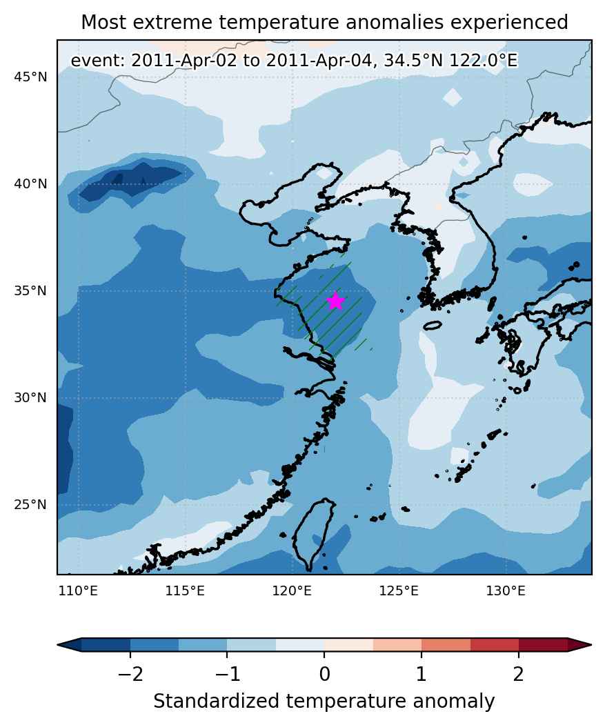
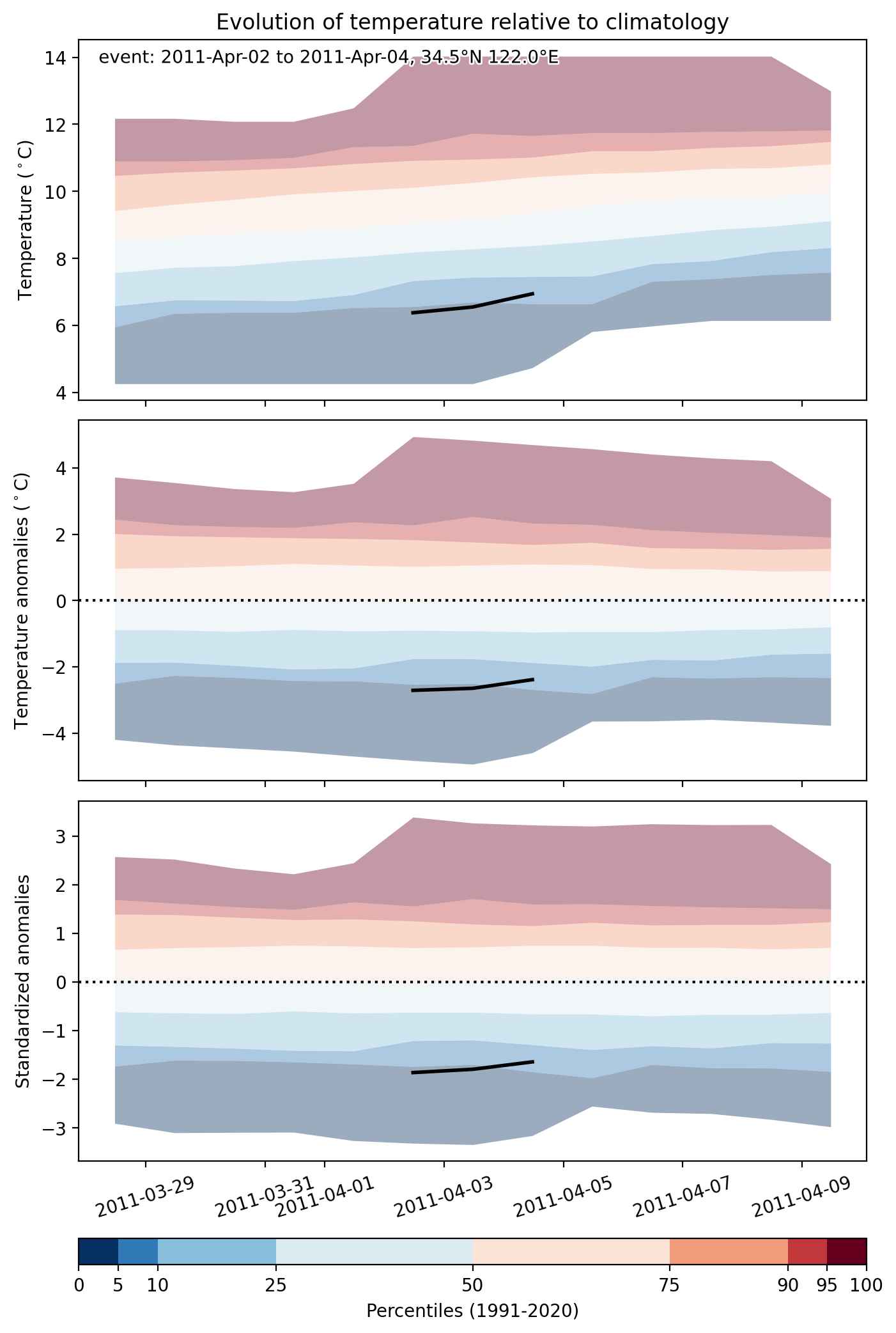
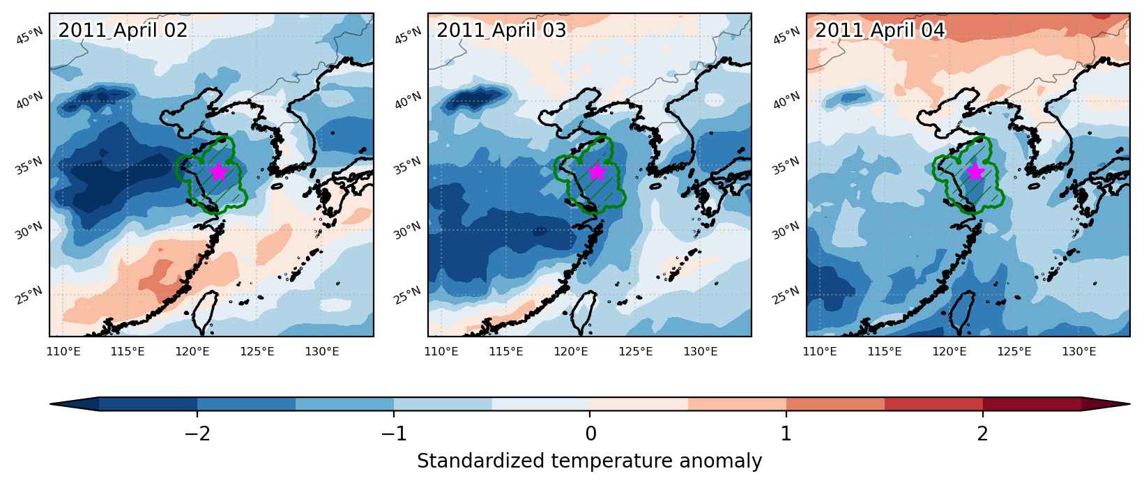
Cold spell occuring from April 02 2011 to April 04 2011 at 34.5°N 122.0°E

Download data: JSON

Event type: Cold spell

Countries affected (identified with ArcGIS Online; provided only for geographical reference):

  • China

Duration: 3 days

Time span: April 02 2011 to April 04 2011

Statistics over entire affected area:

  • Mean temperature anomaly: -2.7 °C
  • Mean temperature: 7.0 °C
  • Minimum temperature anomaly: -5.8 °C
  • Minimum temperature: 5.2 °C

Event center: 34.5°N 122.0°E

Area affected: 110307 km$^2$


Fig. 1: Map of most extreme temperature anomalies (standardized) experienced during the event. The purple star indicates the center of the extreme event. Green hatching illustrates all areas under the effect of extremes at some time during the event.


Fig. 2: Evolution of temperature at the center of the event. The climatological percentile distribution is illustrated with color shadings.


Fig. 3: Maps illustrating the evolution of standardized temperature anomalies during the event.

Event ID: Cold_spell_2011-Apr-02_to_2011-Apr-04_122.0_34.5

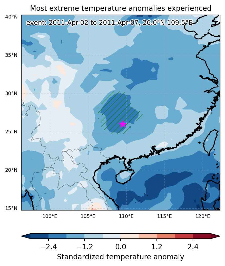
Cold spell occuring from April 02 2011 to April 07 2011 at 26.0°N 109.5°E

Download data: JSON

Event type: Cold spell

Countries affected (identified with ArcGIS Online; provided only for geographical reference):

  • China

Duration: 6 days

Time span: April 02 2011 to April 07 2011

Statistics over entire affected area:

  • Mean temperature anomaly: -7.9 °C
  • Mean temperature: 7.2 °C
  • Minimum temperature anomaly: -10.6 °C
  • Minimum temperature: 3.6 °C

Event center: 26.0°N 109.5°E

Area affected: 238692 km$^2$


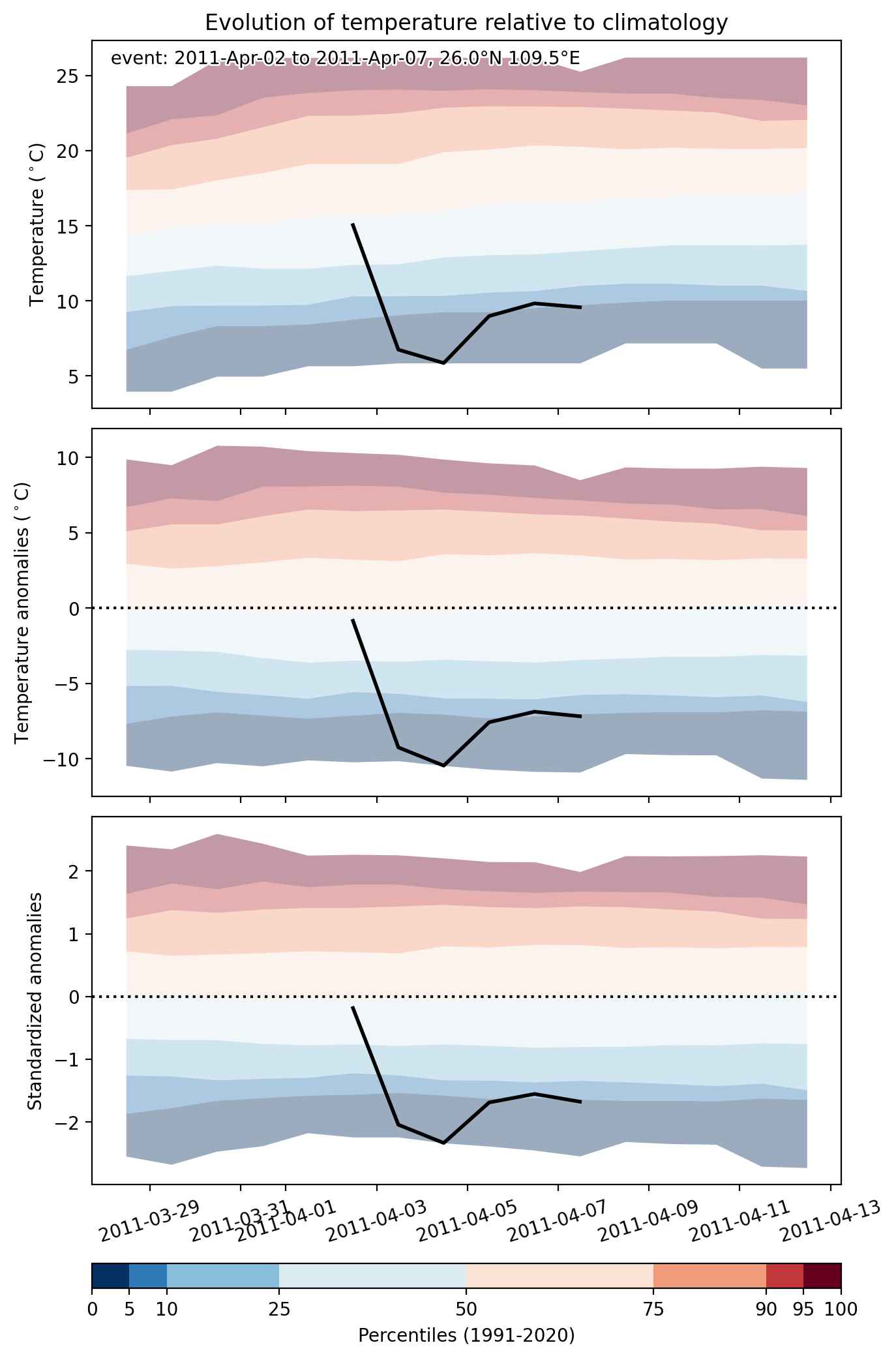
Fig. 1: Map of most extreme temperature anomalies (standardized) experienced during the event. The purple star indicates the center of the extreme event. Green hatching illustrates all areas under the effect of extremes at some time during the event.


Fig. 2: Evolution of temperature at the center of the event. The climatological percentile distribution is illustrated with color shadings.


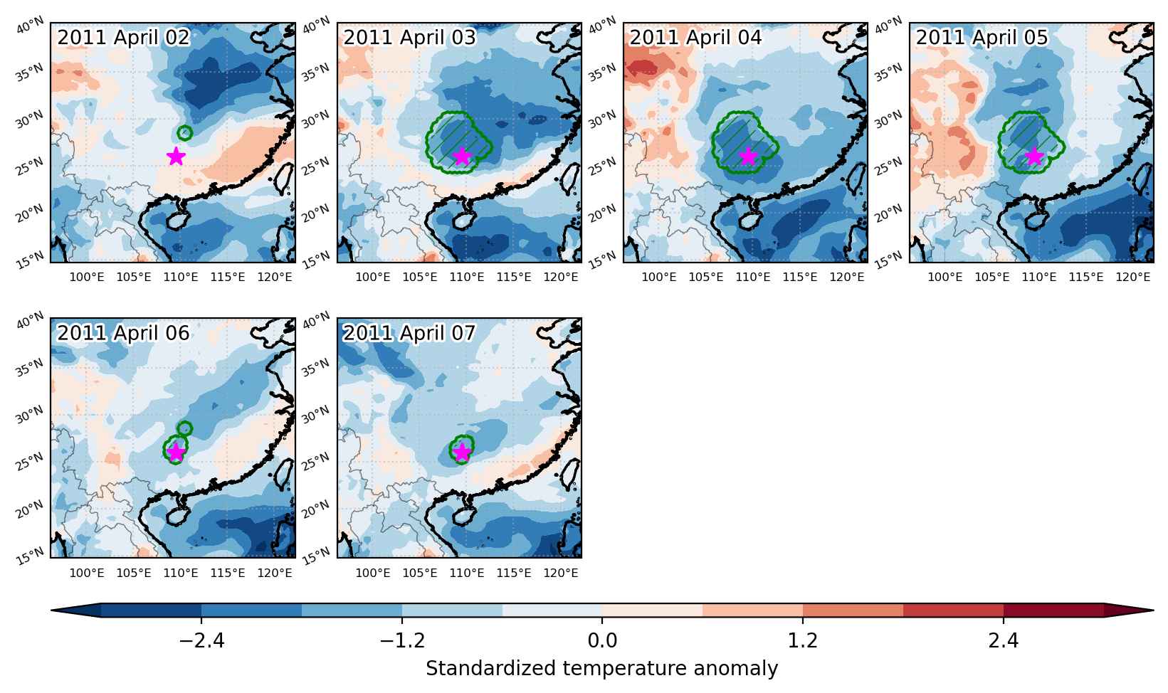
Fig. 3: Maps illustrating the evolution of standardized temperature anomalies during the event.

Event ID: Cold_spell_2011-Apr-02_to_2011-Apr-07_109.5_26.0