Heat wave occuring from December 07 2012 to December 09 2012 at 28.5°N 259.5°E

Download data: JSON

Event type: Heat wave

Countries affected (identified with ArcGIS Online; provided only for geographical reference):

  • Mexico
  • United States

Duration: 3 days

Time span: December 07 2012 to December 09 2012

Statistics over entire affected area:

  • Mean temperature anomaly: 6.9 °C
  • Mean temperature: 20.2 °C
  • Maximum temperature anomaly: 8.2 °C
  • Maximum temperature: 22.9 °C

Event center: 28.5°N 259.5°E

Area affected: 76662 km$^2$
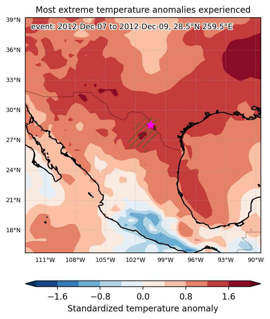

Fig. 1: Map of most extreme temperature anomalies (standardized) experienced during the event. The purple star indicates the center of the extreme event. Green hatching illustrates all areas under the effect of extremes at some time during the event.
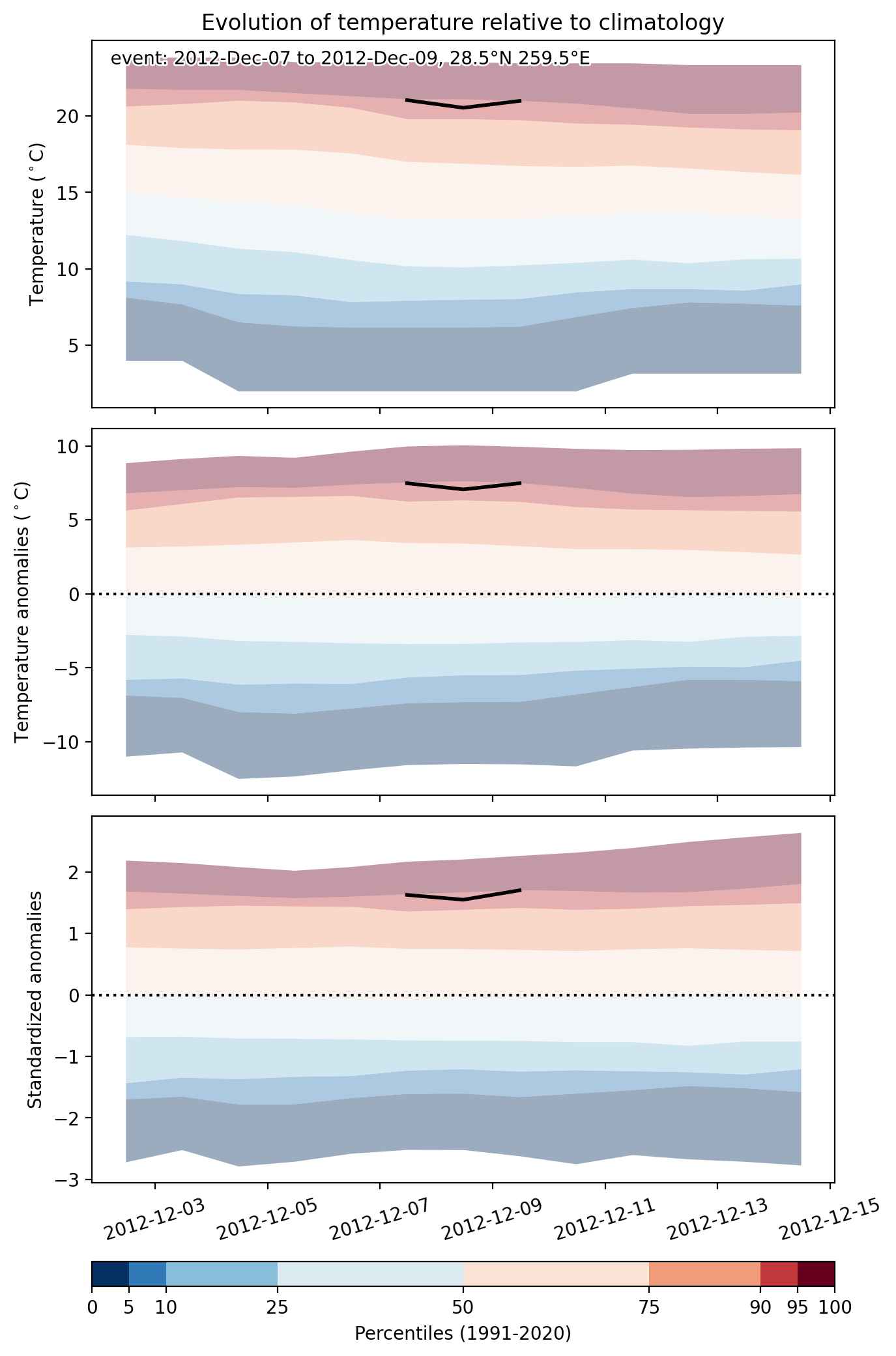


Fig. 2: Evolution of temperature at the center of the event. The climatological percentile distribution is illustrated with color shadings.
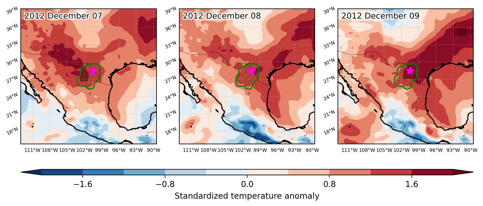


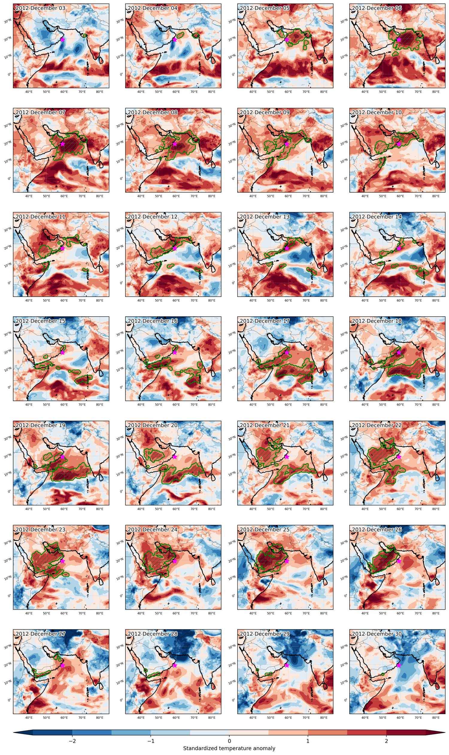
Fig. 3: Maps illustrating the evolution of standardized temperature anomalies during the event.

Event ID: Heat_wave_2012-Dec-07_to_2012-Dec-09_259.5_28.5
Heat wave occuring from December 06 2012 to December 09 2012 at 32.0°N 256.0°E

Download data: JSON

Event type: Heat wave

Countries affected (identified with ArcGIS Online; provided only for geographical reference):

  • Mexico
  • United States

Duration: 4 days

Time span: December 06 2012 to December 09 2012

Statistics over entire affected area:

  • Mean temperature anomaly: 6.2 °C
  • Mean temperature: 13.6 °C
  • Maximum temperature anomaly: 9.1 °C
  • Maximum temperature: 18.1 °C

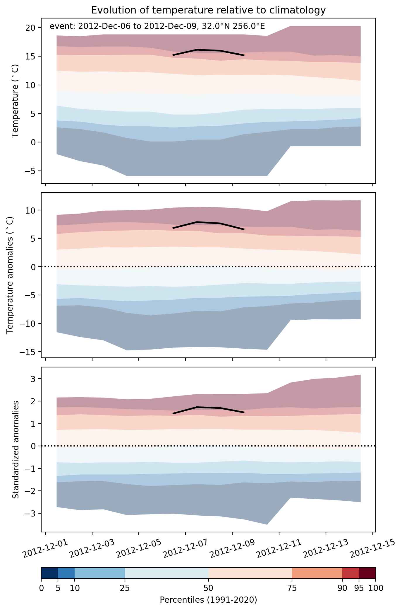
Event center: 32.0°N 256.0°E

Area affected: 81311 km$^2$


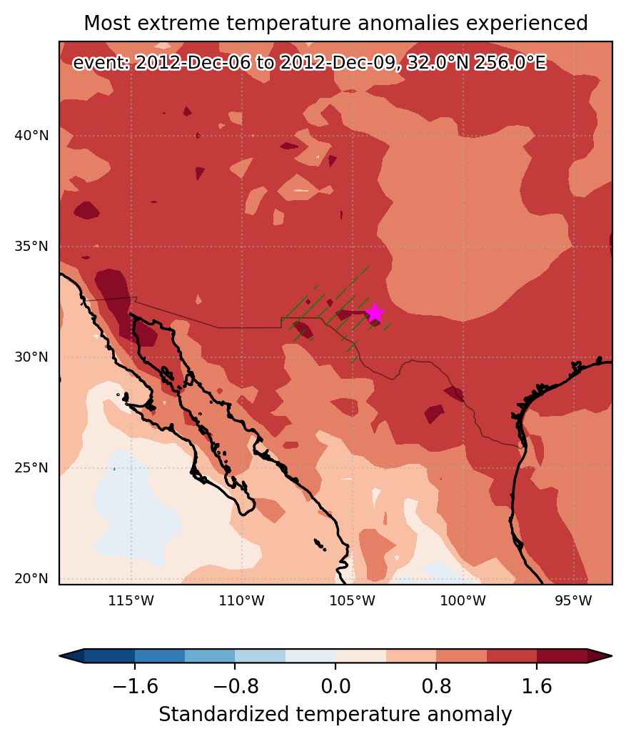
Fig. 1: Map of most extreme temperature anomalies (standardized) experienced during the event. The purple star indicates the center of the extreme event. Green hatching illustrates all areas under the effect of extremes at some time during the event.


Fig. 2: Evolution of temperature at the center of the event. The climatological percentile distribution is illustrated with color shadings.


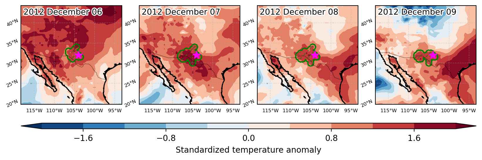
Fig. 3: Maps illustrating the evolution of standardized temperature anomalies during the event.

Event ID: Heat_wave_2012-Dec-06_to_2012-Dec-09_256.0_32.0

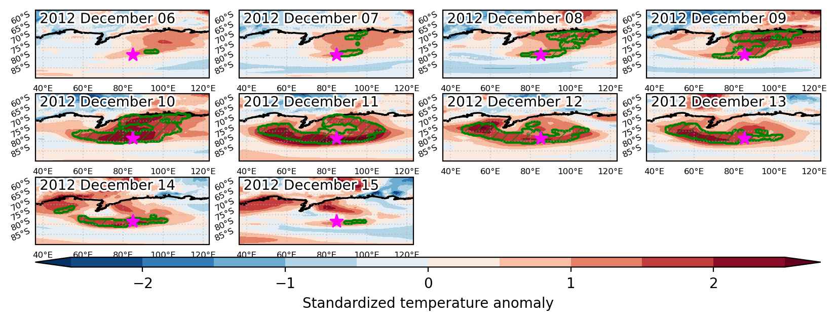
Heat wave occuring from December 06 2012 to December 15 2012 at -78.5°S 85.0°E

Download data: JSON

Event type: Heat wave

Countries affected (identified with ArcGIS Online; provided only for geographical reference):

  • Antarctica

Duration: 10 days

Time span: December 06 2012 to December 15 2012

Statistics over entire affected area:

  • Mean temperature anomaly: 5.5 °C
  • Mean temperature: -23.5 °C
  • Maximum temperature anomaly: 8.8 °C
  • Maximum temperature: -0.1 °C

Event center: -78.5°S 85.0°E

Area affected: 1305420 km$^2$


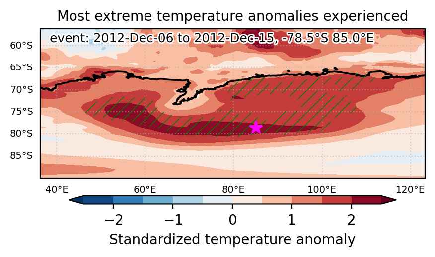
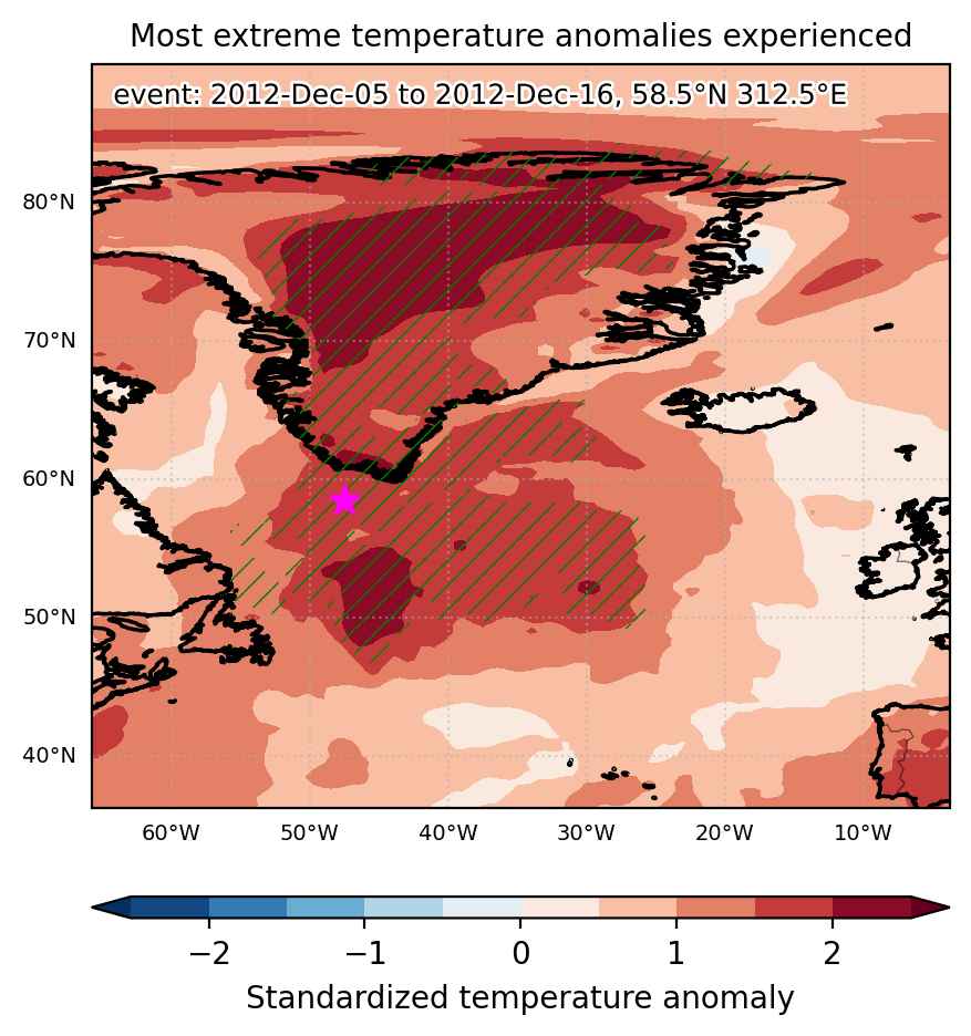
Fig. 1: Map of most extreme temperature anomalies (standardized) experienced during the event. The purple star indicates the center of the extreme event. Green hatching illustrates all areas under the effect of extremes at some time during the event.


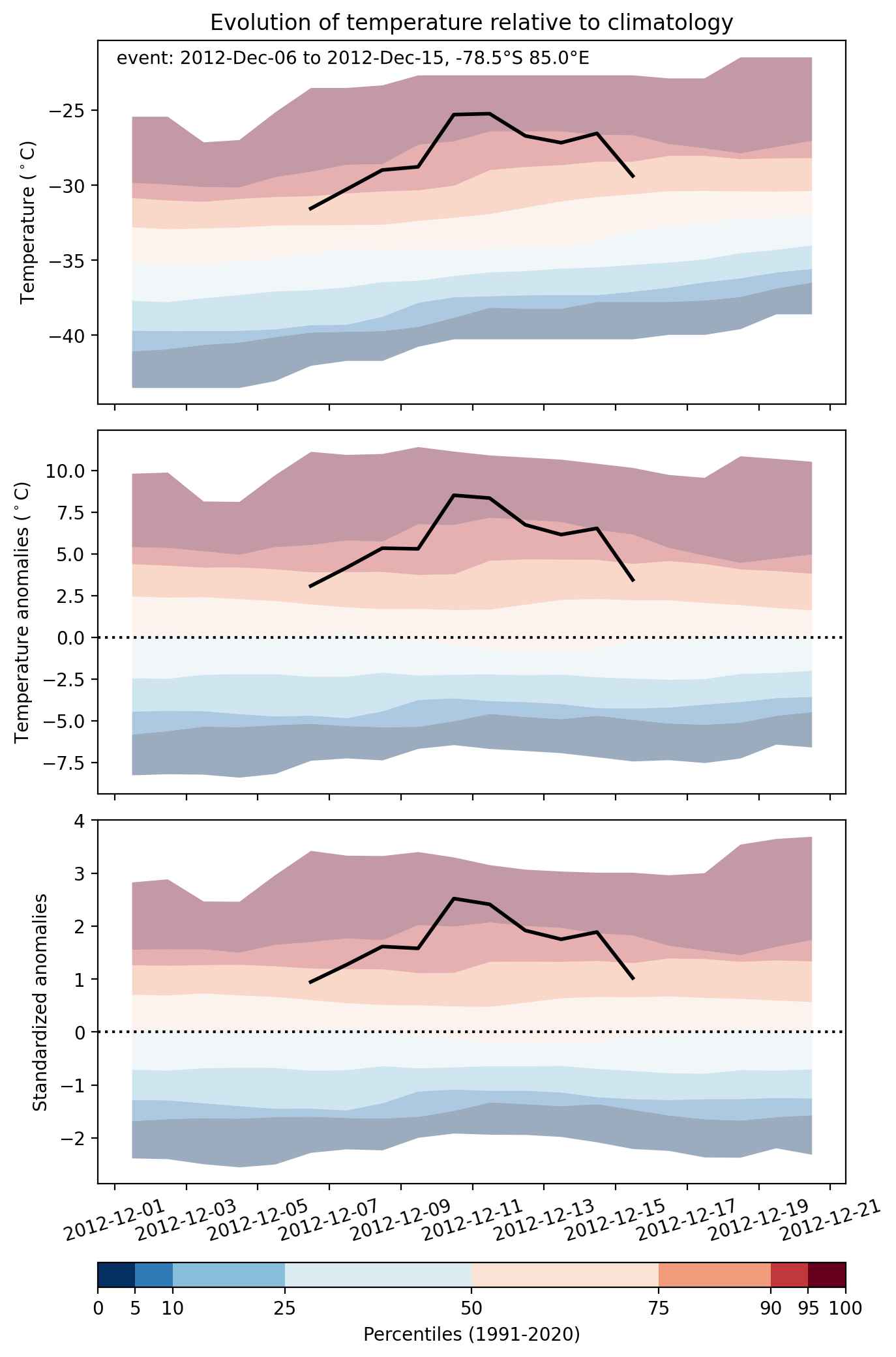
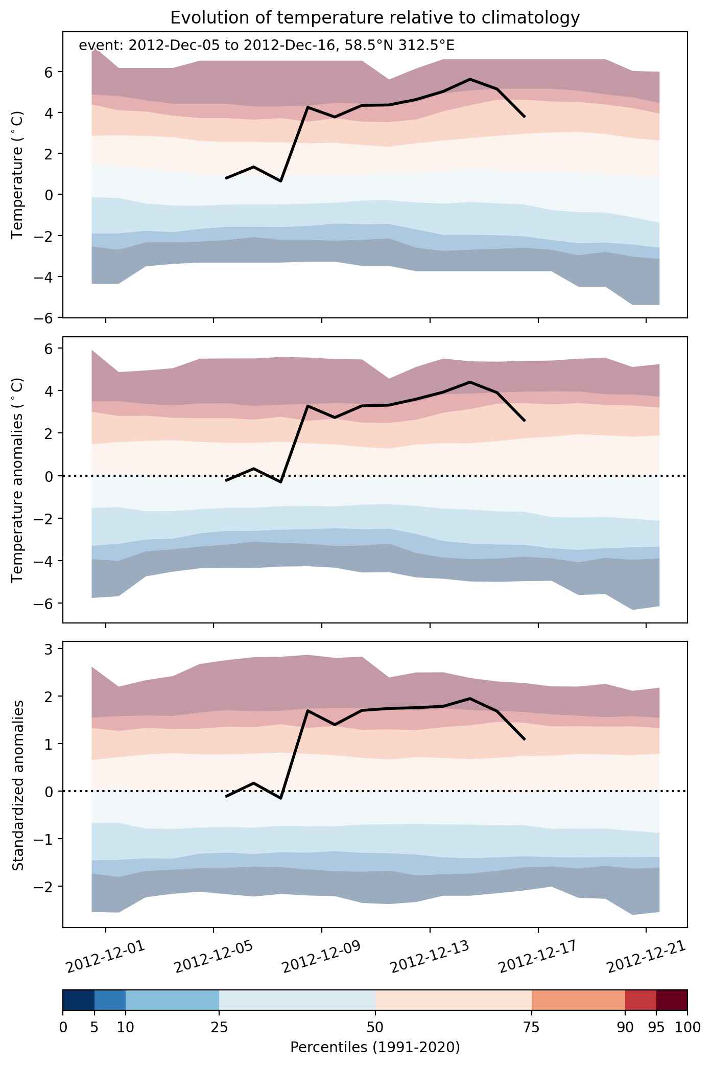
Fig. 2: Evolution of temperature at the center of the event. The climatological percentile distribution is illustrated with color shadings.


Fig. 3: Maps illustrating the evolution of standardized temperature anomalies during the event.

Event ID: Heat_wave_2012-Dec-06_to_2012-Dec-15_85.0_-78.5

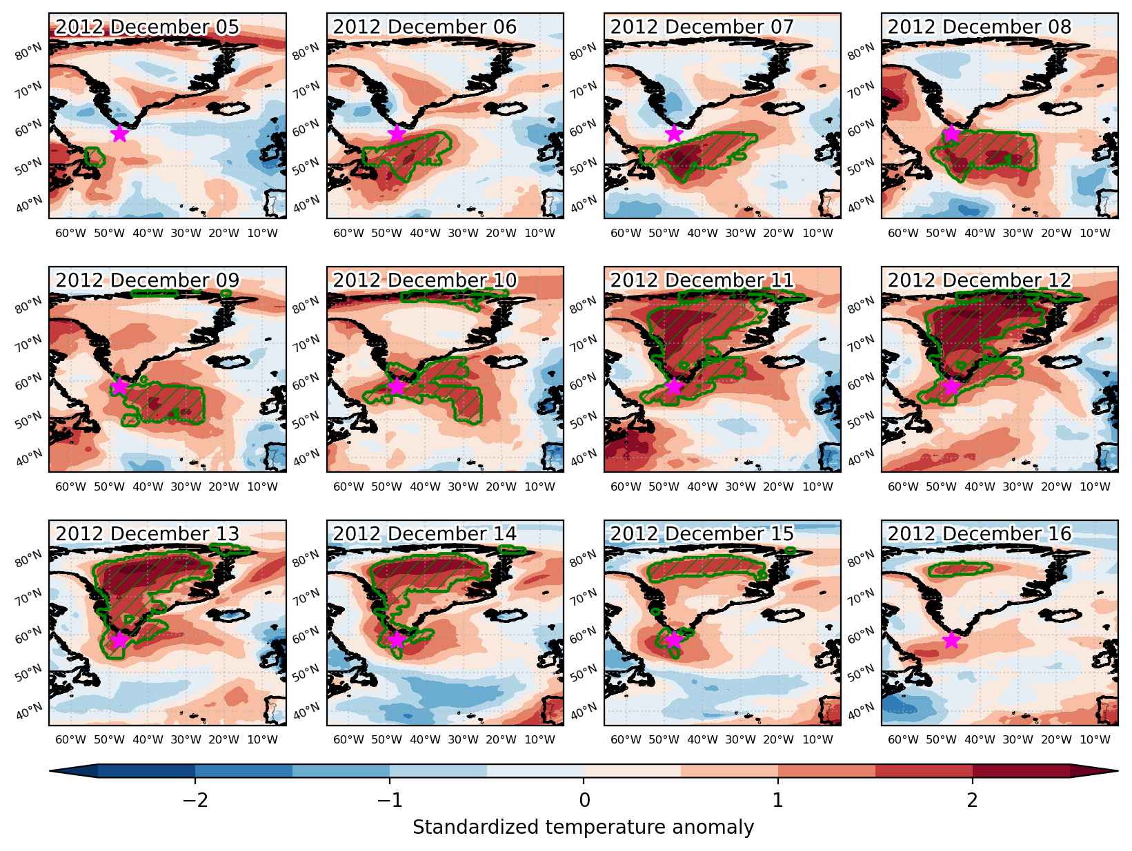
Heat wave occuring from December 05 2012 to December 16 2012 at 58.5°N 312.5°E

Download data: JSON

Event type: Heat wave

Countries affected (identified with ArcGIS Online; provided only for geographical reference):

  • Canada
  • Greenland

Duration: 12 days

Time span: December 05 2012 to December 16 2012

Statistics over entire affected area:

  • Mean temperature anomaly: 9.0 °C
  • Mean temperature: -6.8 °C
  • Maximum temperature anomaly: 19.1 °C
  • Maximum temperature: 13.9 °C

Event center: 58.5°N 312.5°E

Area affected: 3208776 km$^2$


Fig. 1: Map of most extreme temperature anomalies (standardized) experienced during the event. The purple star indicates the center of the extreme event. Green hatching illustrates all areas under the effect of extremes at some time during the event.


Fig. 2: Evolution of temperature at the center of the event. The climatological percentile distribution is illustrated with color shadings.


Fig. 3: Maps illustrating the evolution of standardized temperature anomalies during the event.

Event ID: Heat_wave_2012-Dec-05_to_2012-Dec-16_312.5_58.5

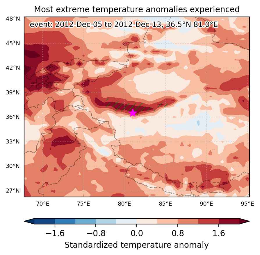
Heat wave occuring from December 05 2012 to December 13 2012 at 36.5°N 81.0°E

Download data: JSON

Event type: Heat wave

Countries affected (identified with ArcGIS Online; provided only for geographical reference):

  • China

Duration: 9 days

Time span: December 05 2012 to December 13 2012

Statistics over entire affected area:

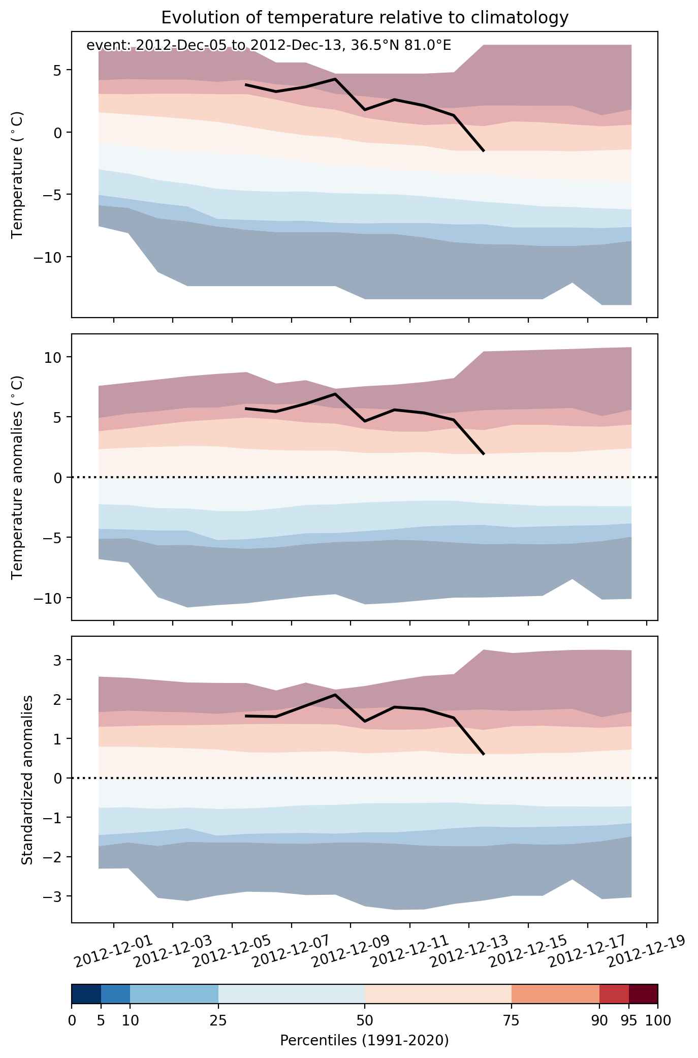
  • Mean temperature anomaly: 4.6 °C
  • Mean temperature: 1.6 °C
  • Maximum temperature anomaly: 6.9 °C
  • Maximum temperature: 4.3 °C

Event center: 36.5°N 81.0°E

Area affected: 63955 km$^2$


Fig. 1: Map of most extreme temperature anomalies (standardized) experienced during the event. The purple star indicates the center of the extreme event. Green hatching illustrates all areas under the effect of extremes at some time during the event.


Fig. 2: Evolution of temperature at the center of the event. The climatological percentile distribution is illustrated with color shadings.


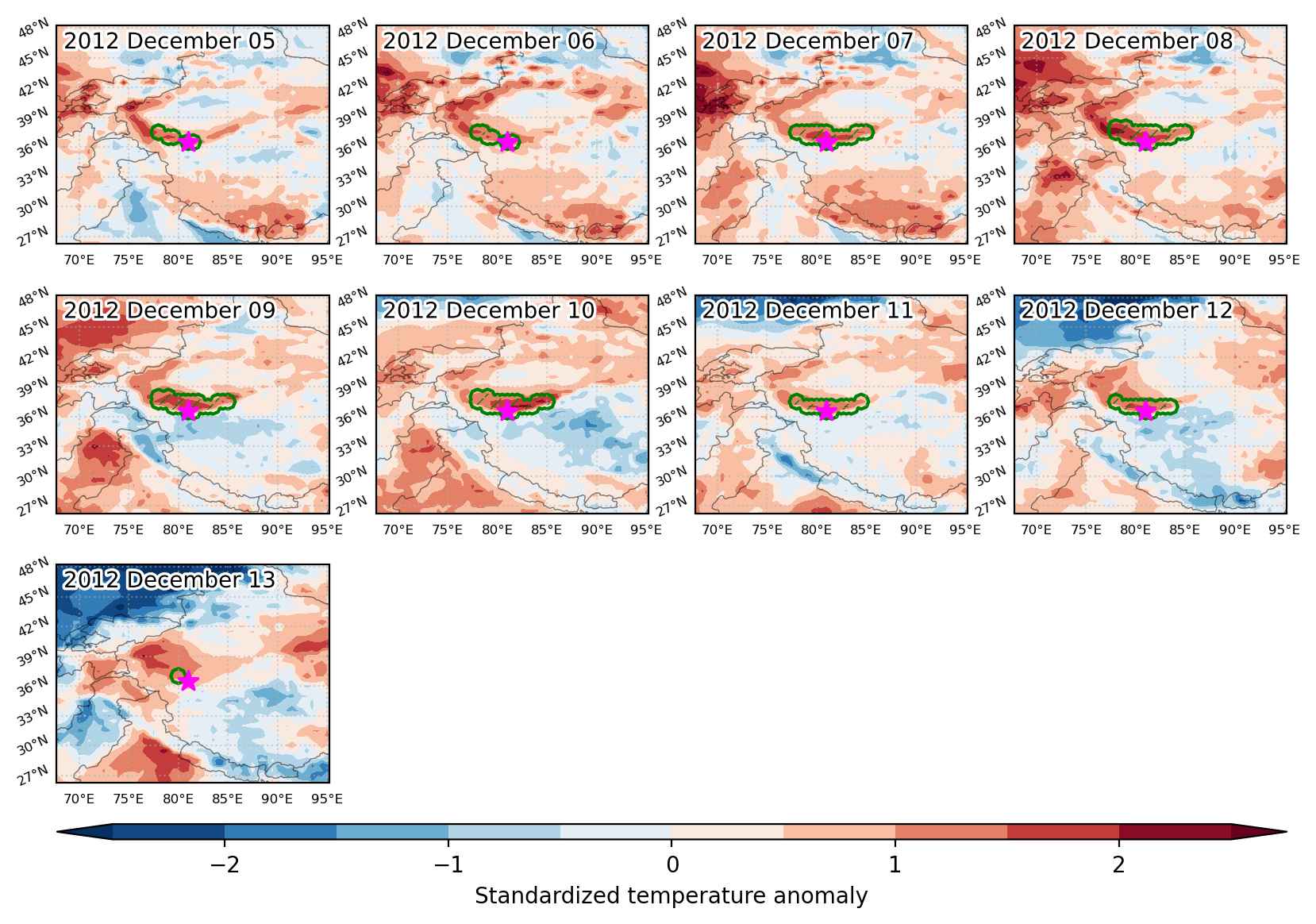
Fig. 3: Maps illustrating the evolution of standardized temperature anomalies during the event.

Event ID: Heat_wave_2012-Dec-05_to_2012-Dec-13_81.0_36.5

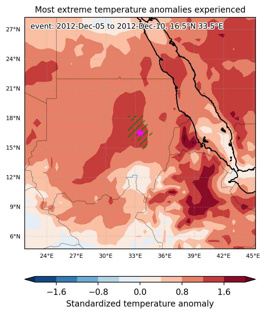
Heat wave occuring from December 05 2012 to December 10 2012 at 16.5°N 33.5°E

Download data: JSON

Event type: Heat wave

Countries affected (identified with ArcGIS Online; provided only for geographical reference):

  • Sudan

Duration: 6 days

Time span: December 05 2012 to December 10 2012

Statistics over entire affected area:

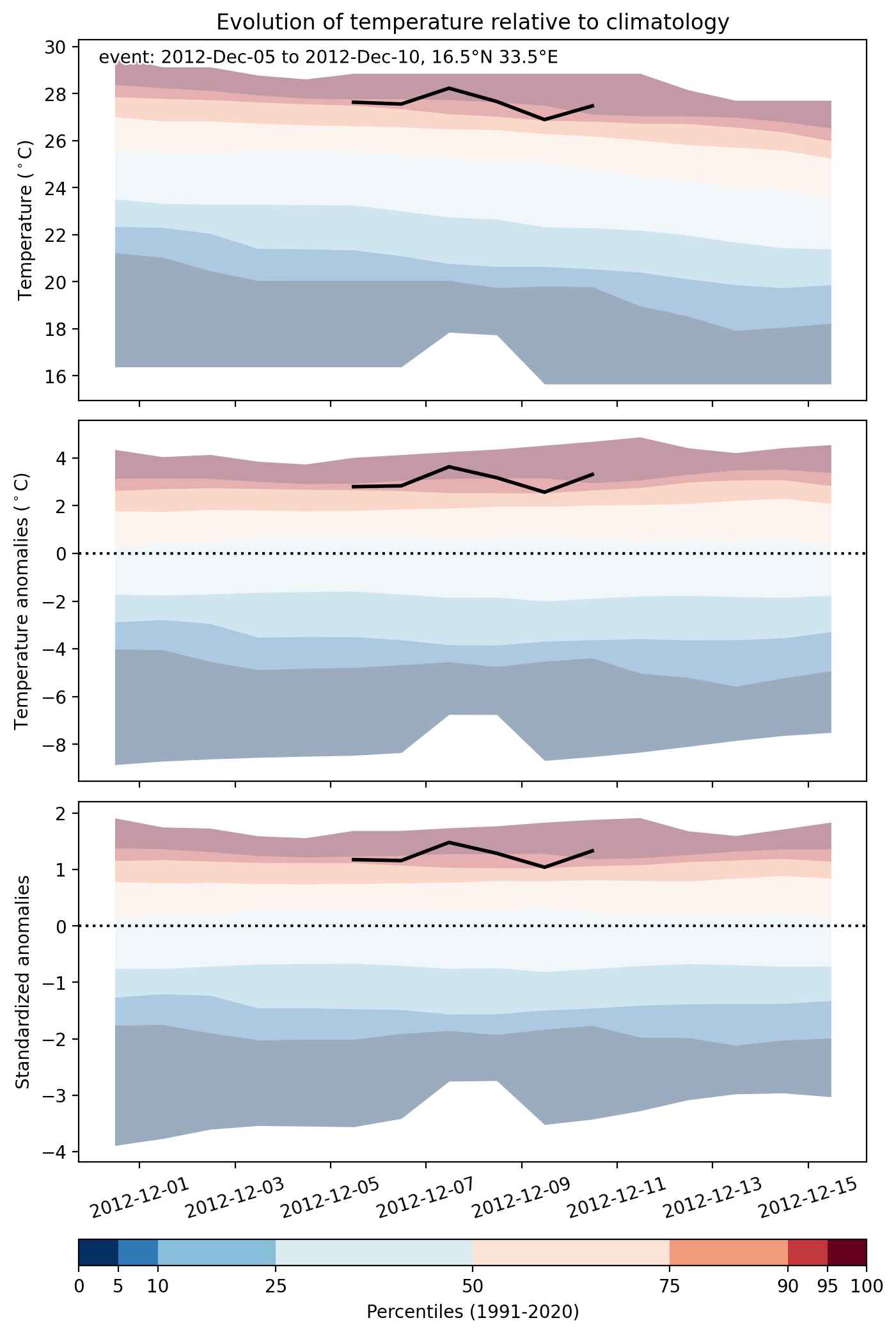
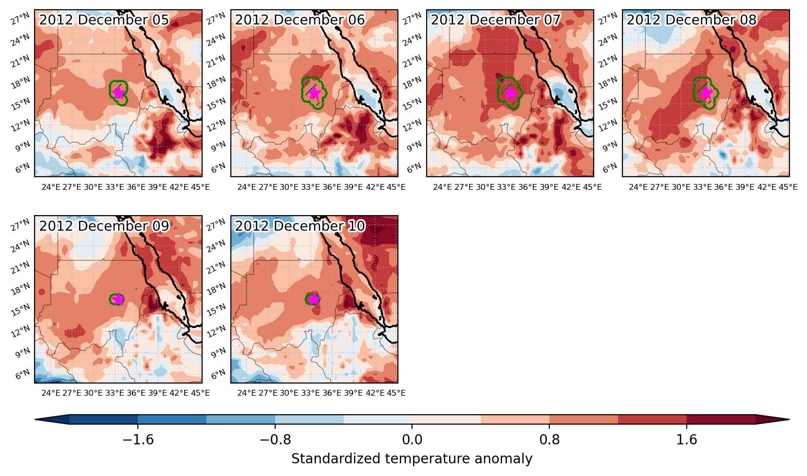
  • Mean temperature anomaly: 3.2 °C
  • Mean temperature: 27.7 °C
  • Maximum temperature anomaly: 5.0 °C
  • Maximum temperature: 30.0 °C

Event center: 16.5°N 33.5°E

Area affected: 62163 km$^2$


Fig. 1: Map of most extreme temperature anomalies (standardized) experienced during the event. The purple star indicates the center of the extreme event. Green hatching illustrates all areas under the effect of extremes at some time during the event.


Fig. 2: Evolution of temperature at the center of the event. The climatological percentile distribution is illustrated with color shadings.


Fig. 3: Maps illustrating the evolution of standardized temperature anomalies during the event.

Event ID: Heat_wave_2012-Dec-05_to_2012-Dec-10_33.5_16.5

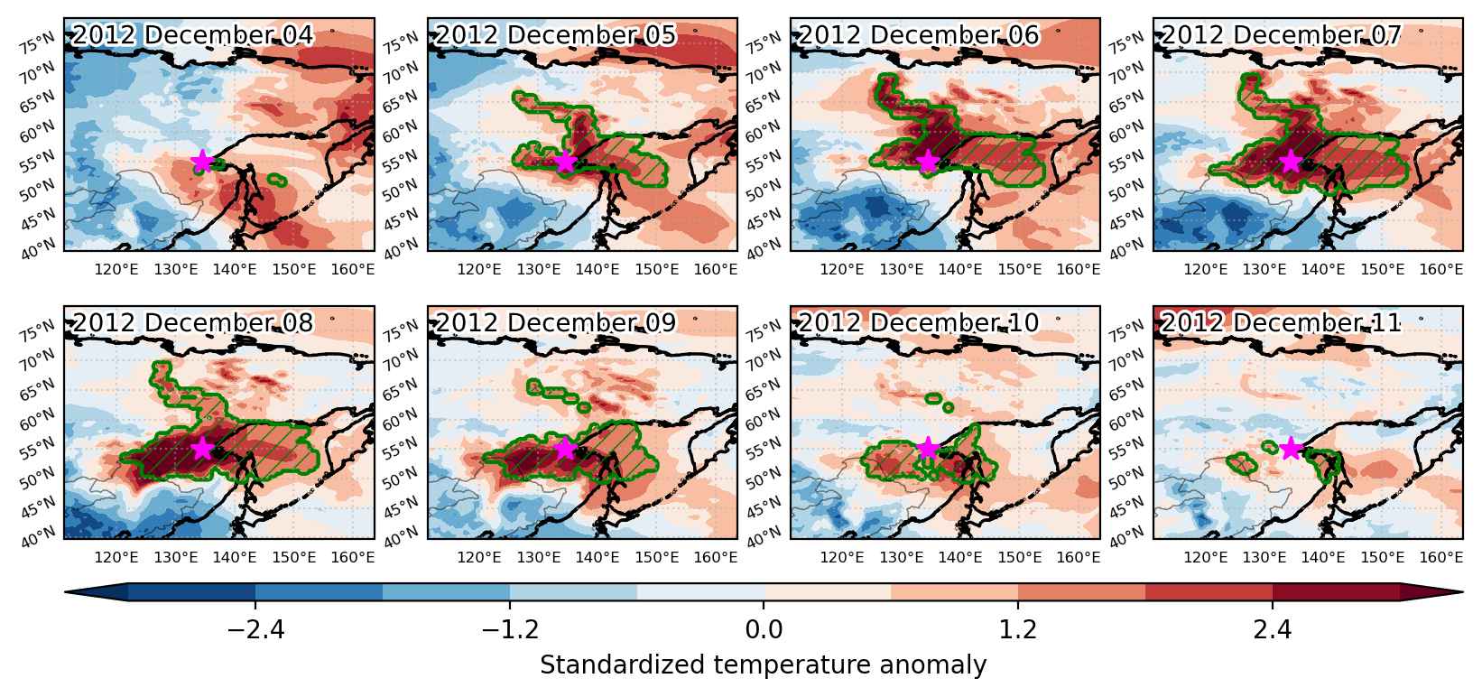
Heat wave occuring from December 04 2012 to December 11 2012 at 55.0°N 134.5°E

Download data: JSON

Event type: Heat wave

Countries affected (identified with ArcGIS Online; provided only for geographical reference):

  • China
  • Russian Federation

Duration: 8 days

Time span: December 04 2012 to December 11 2012

Statistics over entire affected area:

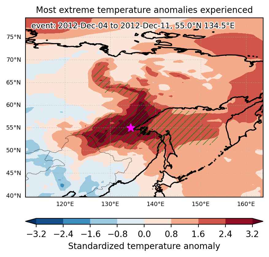
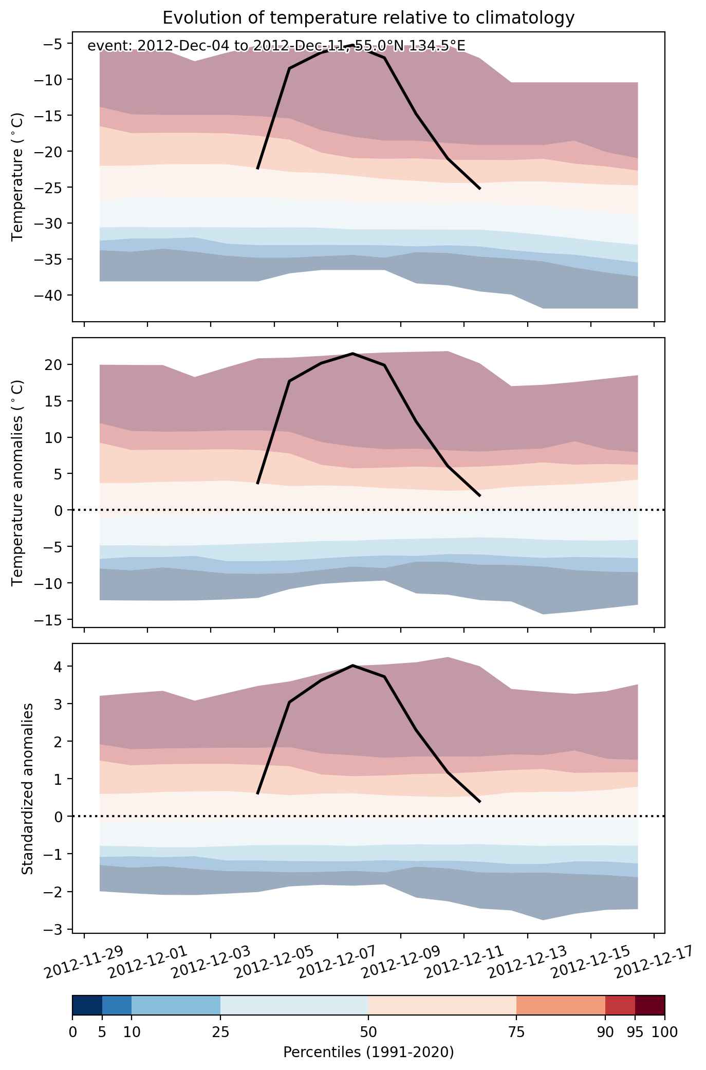
  • Mean temperature anomaly: 10.6 °C
  • Mean temperature: -8.8 °C
  • Maximum temperature anomaly: 28.5 °C
  • Maximum temperature: 2.4 °C

Event center: 55.0°N 134.5°E

Area affected: 1730876 km$^2$


Fig. 1: Map of most extreme temperature anomalies (standardized) experienced during the event. The purple star indicates the center of the extreme event. Green hatching illustrates all areas under the effect of extremes at some time during the event.


Fig. 2: Evolution of temperature at the center of the event. The climatological percentile distribution is illustrated with color shadings.


Fig. 3: Maps illustrating the evolution of standardized temperature anomalies during the event.

Event ID: Heat_wave_2012-Dec-04_to_2012-Dec-11_134.5_55.0

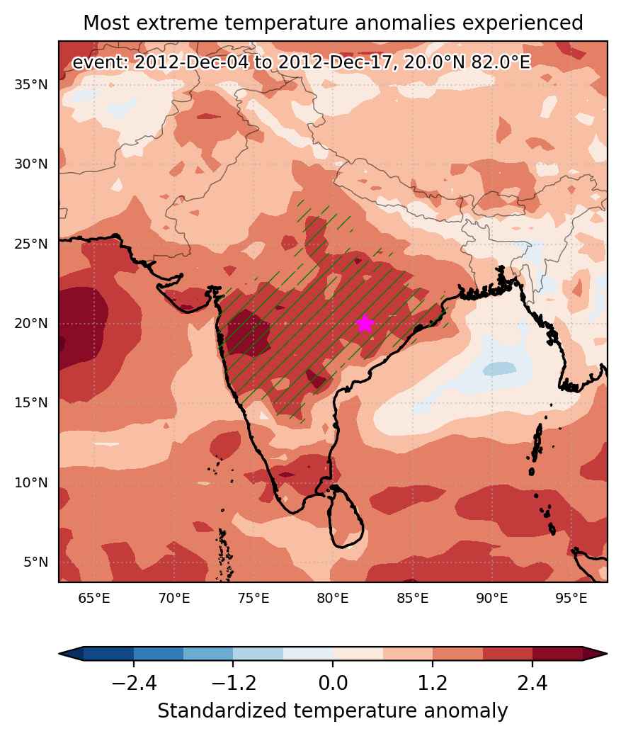
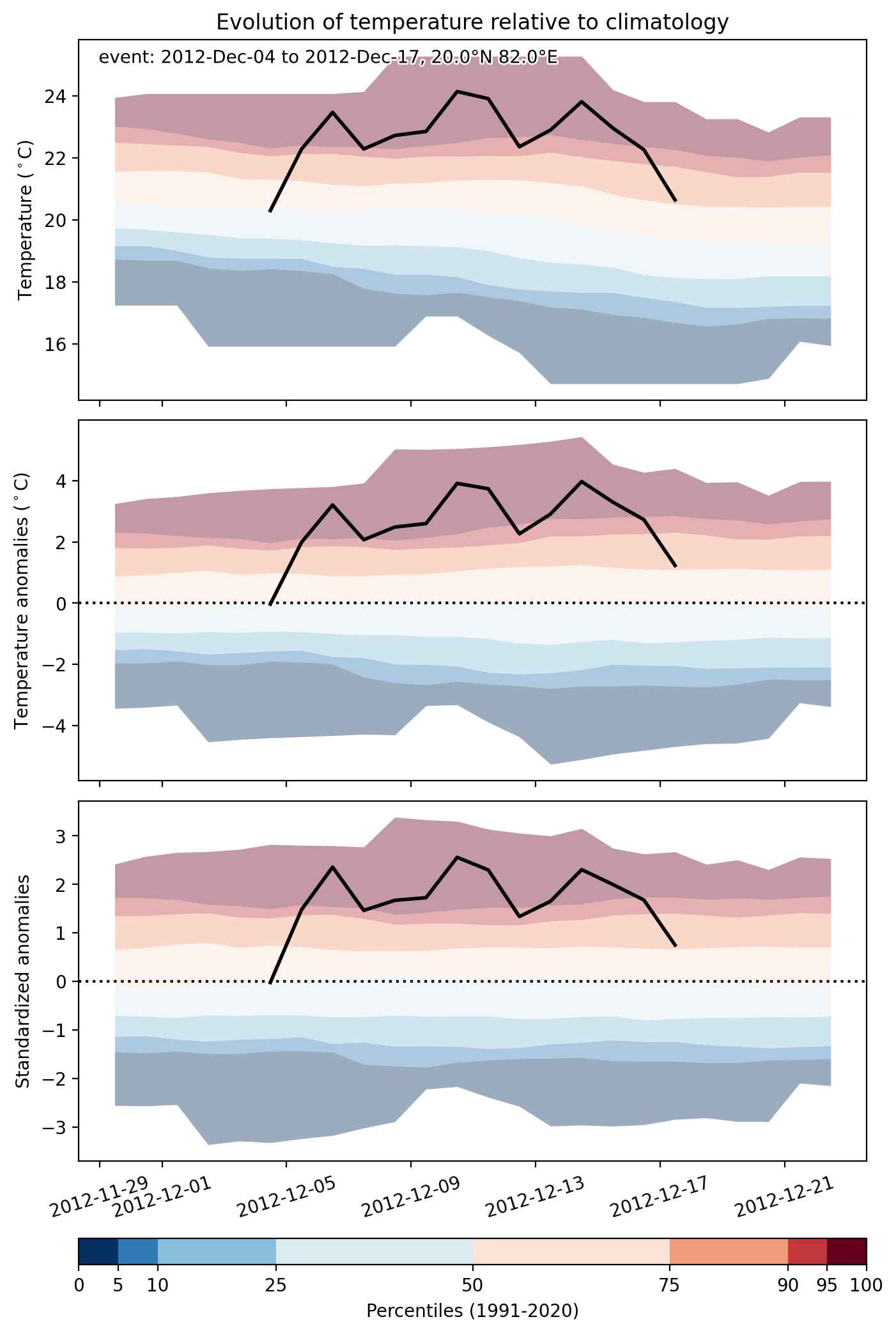
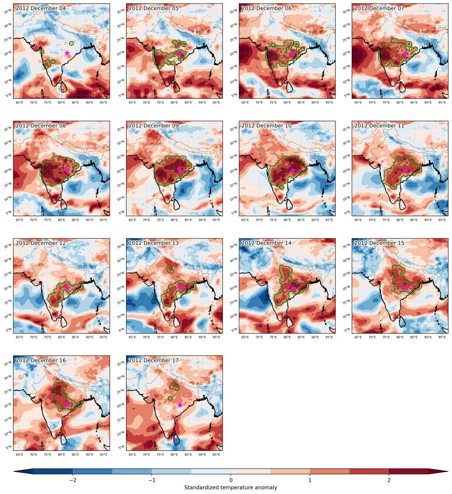
Heat wave occuring from December 04 2012 to December 17 2012 at 20.0°N 82.0°E

Download data: JSON

Event type: Heat wave

Countries affected (identified with ArcGIS Online; provided only for geographical reference):

  • India

Duration: 14 days

Time span: December 04 2012 to December 17 2012

Statistics over entire affected area:

  • Mean temperature anomaly: 3.0 °C
  • Mean temperature: 24.1 °C
  • Maximum temperature anomaly: 5.6 °C
  • Maximum temperature: 28.5 °C

Event center: 20.0°N 82.0°E

Area affected: 1126802 km$^2$


Fig. 1: Map of most extreme temperature anomalies (standardized) experienced during the event. The purple star indicates the center of the extreme event. Green hatching illustrates all areas under the effect of extremes at some time during the event.


Fig. 2: Evolution of temperature at the center of the event. The climatological percentile distribution is illustrated with color shadings.


Fig. 3: Maps illustrating the evolution of standardized temperature anomalies during the event.

Event ID: Heat_wave_2012-Dec-04_to_2012-Dec-17_82.0_20.0

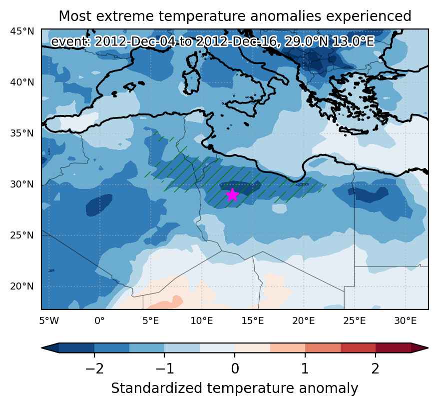
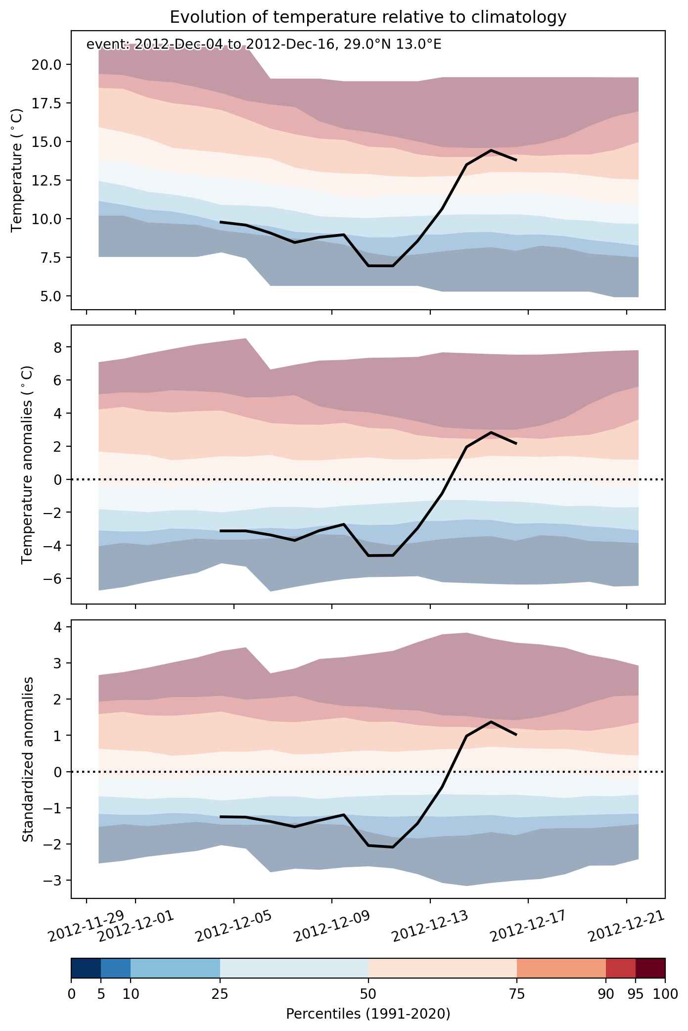
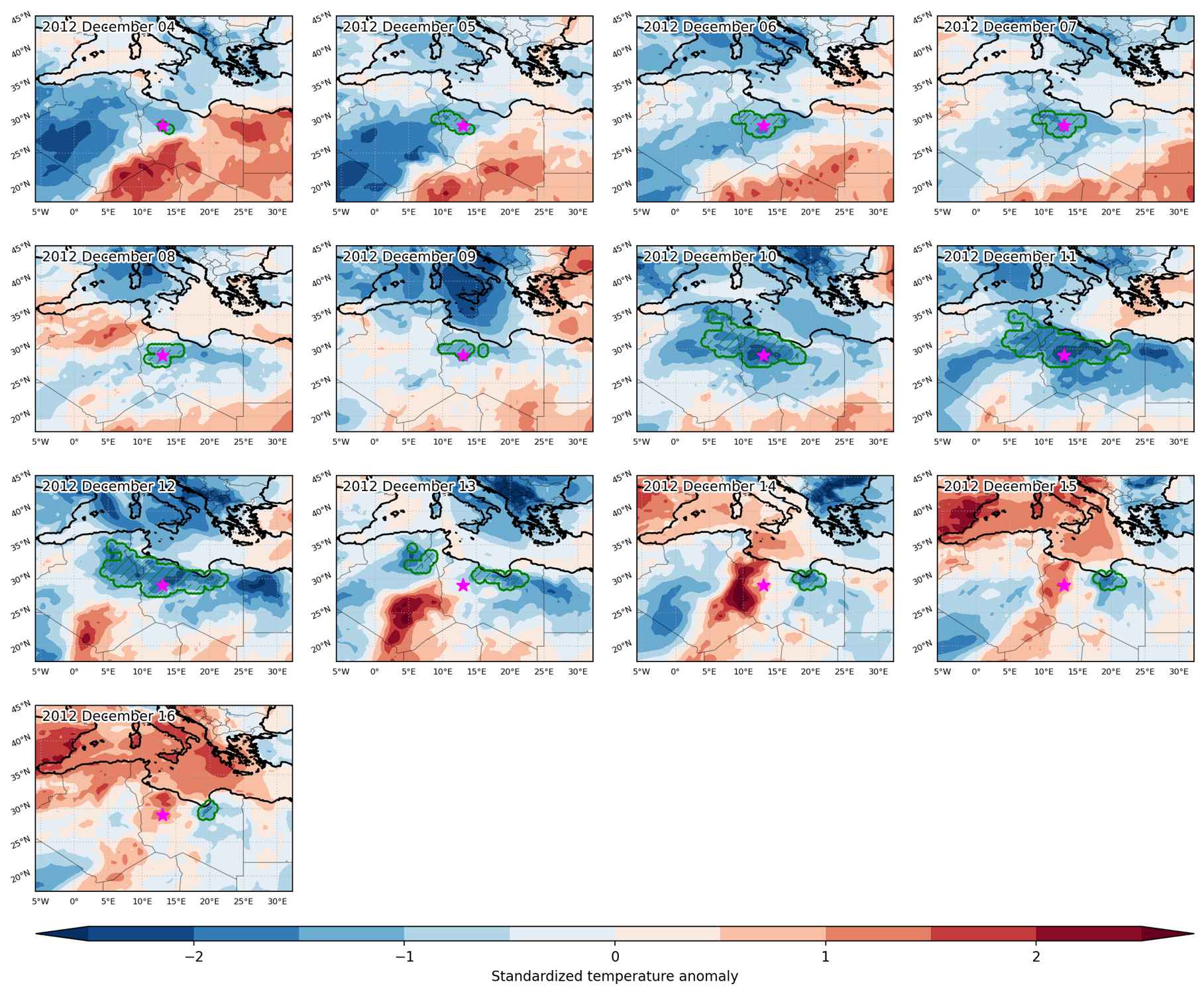
Cold spell occuring from December 04 2012 to December 16 2012 at 29.0°N 13.0°E

Download data: JSON

Event type: Cold spell

Countries affected (identified with ArcGIS Online; provided only for geographical reference):

  • Algeria
  • Libya
  • Tunisia

Duration: 13 days

Time span: December 04 2012 to December 16 2012

Statistics over entire affected area:

  • Mean temperature anomaly: -3.6 °C
  • Mean temperature: 8.7 °C
  • Minimum temperature anomaly: -5.5 °C
  • Minimum temperature: 5.7 °C

Event center: 29.0°N 13.0°E

Area affected: 508715 km$^2$


Fig. 1: Map of most extreme temperature anomalies (standardized) experienced during the event. The purple star indicates the center of the extreme event. Green hatching illustrates all areas under the effect of extremes at some time during the event.


Fig. 2: Evolution of temperature at the center of the event. The climatological percentile distribution is illustrated with color shadings.


Fig. 3: Maps illustrating the evolution of standardized temperature anomalies during the event.

Event ID: Cold_spell_2012-Dec-04_to_2012-Dec-16_13.0_29.0

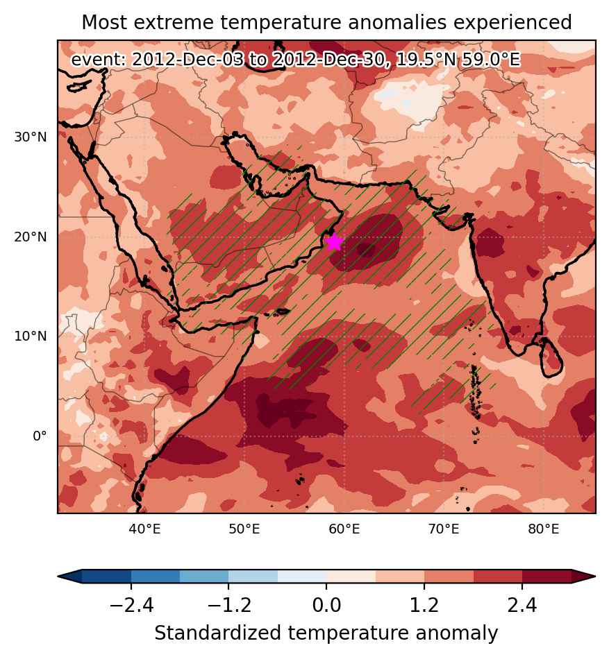
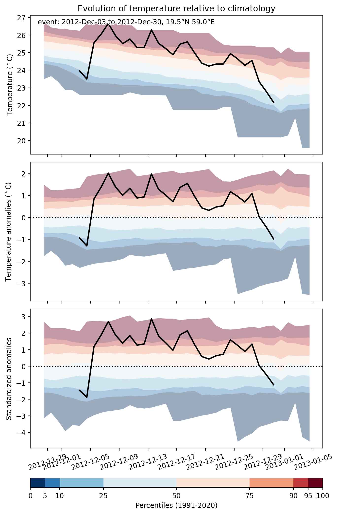
Heat wave occuring from December 03 2012 to December 30 2012 at 19.5°N 59.0°E

Download data: JSON

Event type: Heat wave

Countries affected (identified with ArcGIS Online; provided only for geographical reference):

  • India
  • Iran
  • Oman
  • Pakistan
  • Qatar
  • Saudi Arabia
  • Somalia
  • United Arab Emirates
  • Yemen

Duration: 28 days

Time span: December 03 2012 to December 30 2012

Statistics over entire affected area:

  • Mean temperature anomaly: 2.2 °C
  • Mean temperature: 25.1 °C
  • Maximum temperature anomaly: 7.1 °C
  • Maximum temperature: 28.8 °C

Event center: 19.5°N 59.0°E

Area affected: 5339446 km$^2$


Fig. 1: Map of most extreme temperature anomalies (standardized) experienced during the event. The purple star indicates the center of the extreme event. Green hatching illustrates all areas under the effect of extremes at some time during the event.


Fig. 2: Evolution of temperature at the center of the event. The climatological percentile distribution is illustrated with color shadings.


Fig. 3: Maps illustrating the evolution of standardized temperature anomalies during the event.

Event ID: Heat_wave_2012-Dec-03_to_2012-Dec-30_59.0_19.5