Cold spell occuring from July 10 2019 to July 17 2019 at -7.5°S 142.0°E

Download data: JSON

Event type: Cold spell

Countries affected (identified with ArcGIS Online; provided only for geographical reference):

  • Indonesia
  • Papua New Guinea

Duration: 8 days

Time span: July 10 2019 to July 17 2019

Statistics over entire affected area:

  • Mean temperature anomaly: -1.2 °C
  • Mean temperature: 24.0 °C
  • Minimum temperature anomaly: -2.1 °C
  • Minimum temperature: 22.8 °C

Event center: -7.5°S 142.0°E

Area affected: 70444 km$^2$
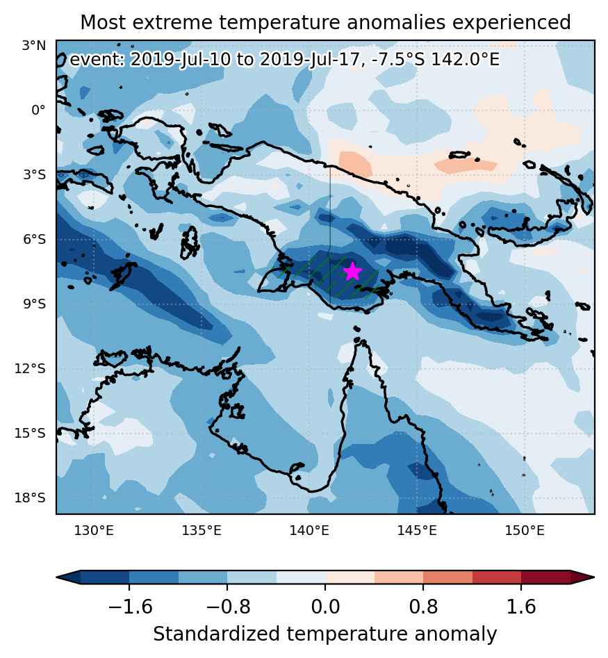

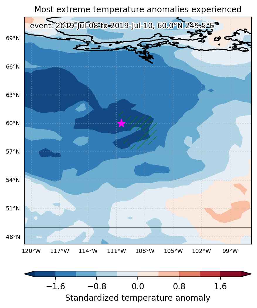
Fig. 1: Map of most extreme temperature anomalies (standardized) experienced during the event. The purple star indicates the center of the extreme event. Green hatching illustrates all areas under the effect of extremes at some time during the event.
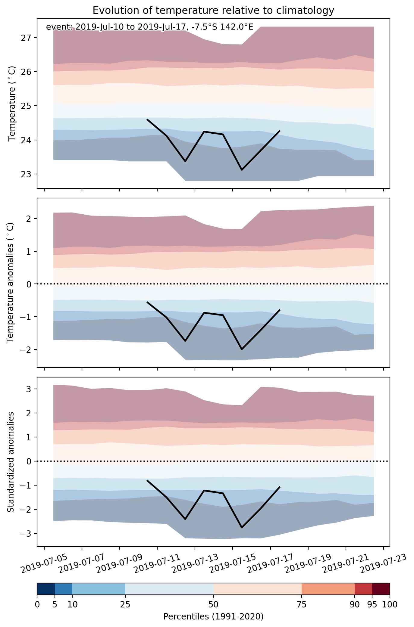


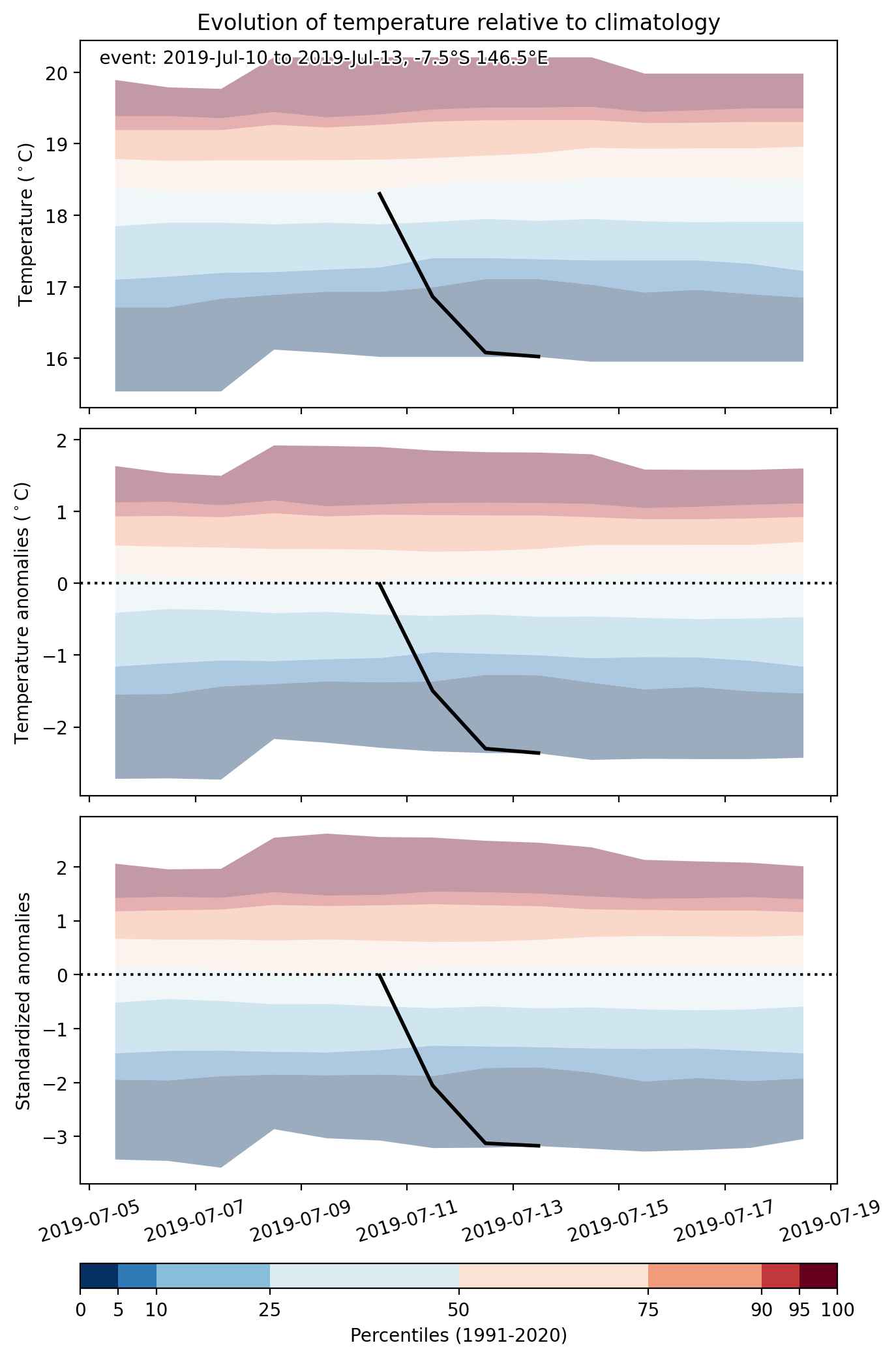
Fig. 2: Evolution of temperature at the center of the event. The climatological percentile distribution is illustrated with color shadings.
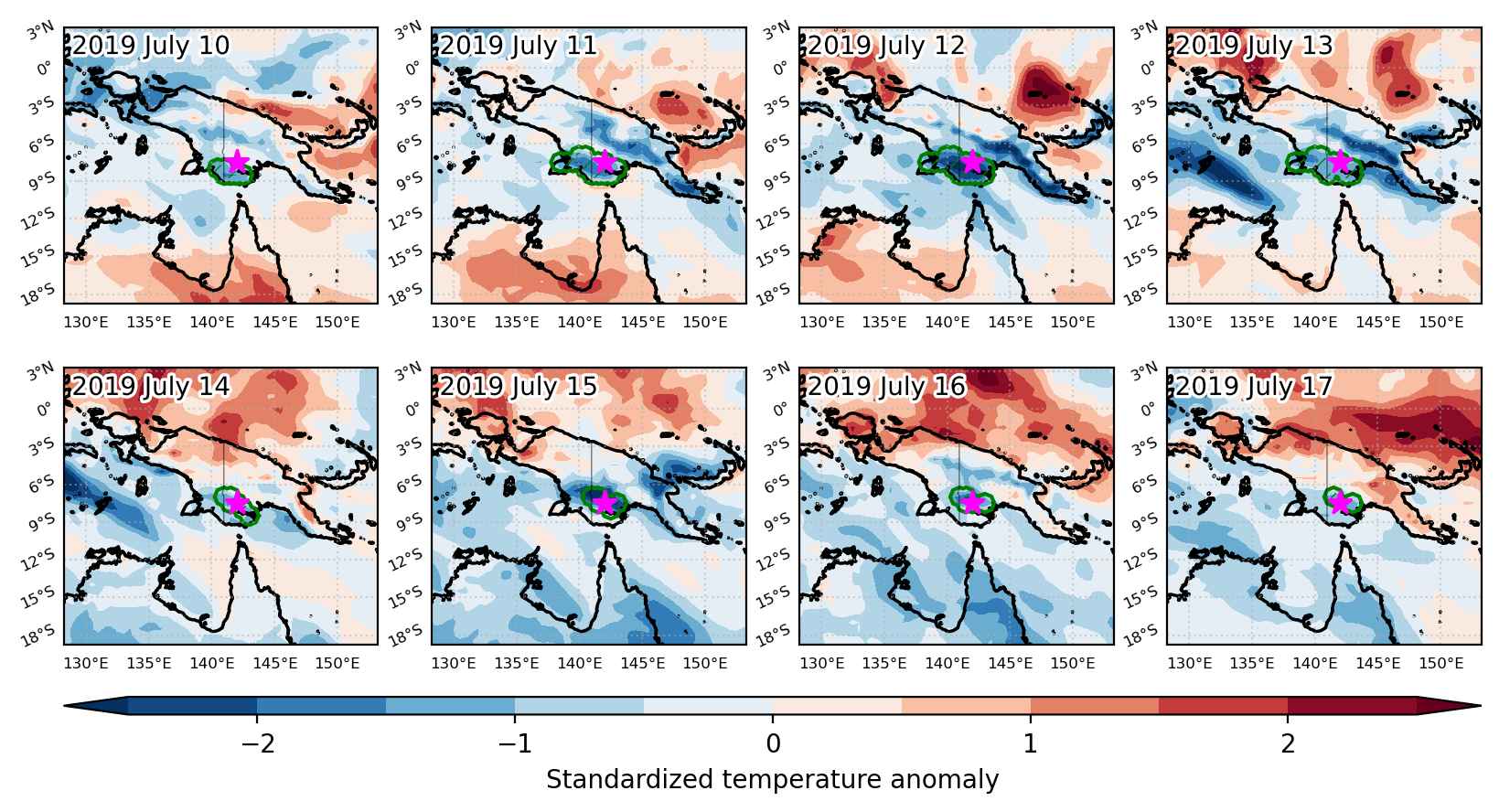


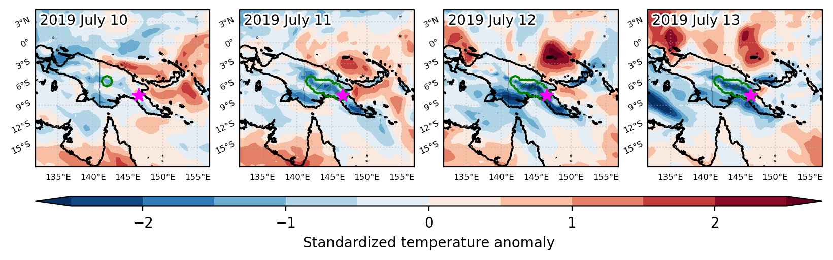
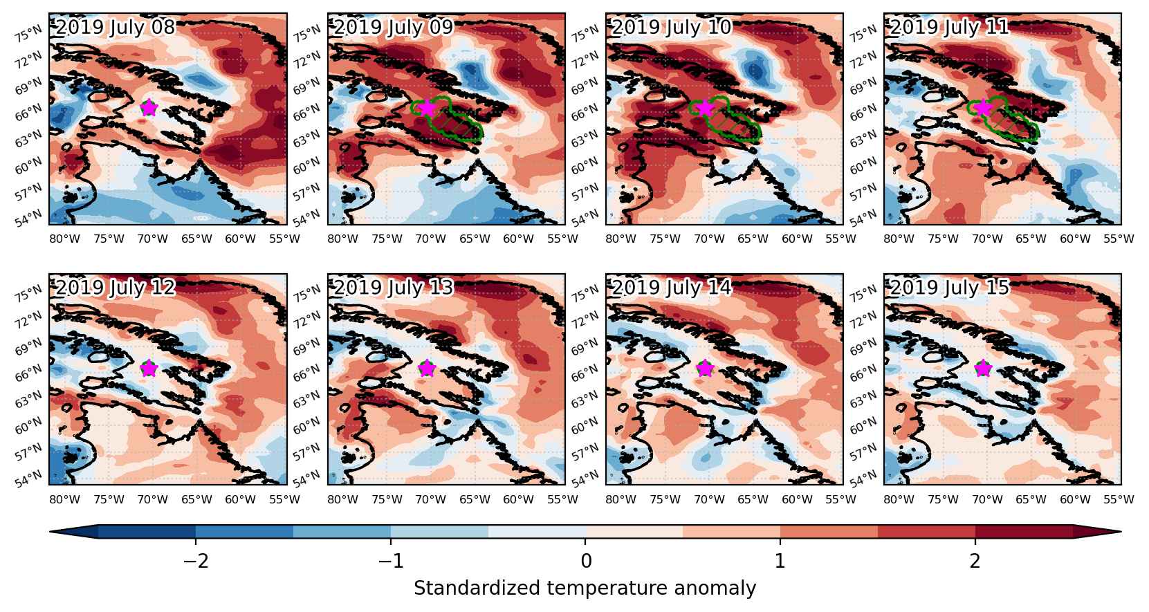
Fig. 3: Maps illustrating the evolution of standardized temperature anomalies during the event.

Event ID: Cold_spell_2019-Jul-10_to_2019-Jul-17_142.0_-7.5
Cold spell occuring from July 10 2019 to July 13 2019 at -7.5°S 146.5°E

Download data: JSON

Event type: Cold spell

Countries affected (identified with ArcGIS Online; provided only for geographical reference):

  • Papua New Guinea

Duration: 4 days

Time span: July 10 2019 to July 13 2019

Statistics over entire affected area:

  • Mean temperature anomaly: -1.8 °C
  • Mean temperature: 16.6 °C
  • Minimum temperature anomaly: -3.0 °C
  • Minimum temperature: 11.6 °C

Event center: -7.5°S 146.5°E

Area affected: 55276 km$^2$


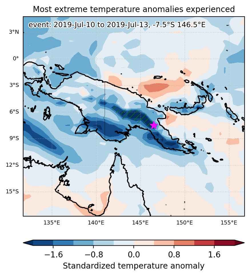
Fig. 1: Map of most extreme temperature anomalies (standardized) experienced during the event. The purple star indicates the center of the extreme event. Green hatching illustrates all areas under the effect of extremes at some time during the event.


Fig. 2: Evolution of temperature at the center of the event. The climatological percentile distribution is illustrated with color shadings.


Fig. 3: Maps illustrating the evolution of standardized temperature anomalies during the event.

Event ID: Cold_spell_2019-Jul-10_to_2019-Jul-13_146.5_-7.5

Heat wave occuring from July 09 2019 to July 15 2019 at 15.0°N 346.0°E

Download data: JSON

Event type: Heat wave

Countries affected (identified with ArcGIS Online; provided only for geographical reference):

  • Mauritania
  • Senegal

Duration: 7 days

Time span: July 09 2019 to July 15 2019

Statistics over entire affected area:

  • Mean temperature anomaly: 2.6 °C
  • Mean temperature: 33.5 °C
  • Maximum temperature anomaly: 3.6 °C
  • Maximum temperature: 35.6 °C

Event center: 15.0°N 346.0°E

Area affected: 53713 km$^2$


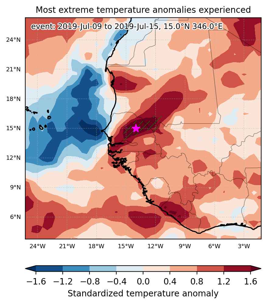
Fig. 1: Map of most extreme temperature anomalies (standardized) experienced during the event. The purple star indicates the center of the extreme event. Green hatching illustrates all areas under the effect of extremes at some time during the event.


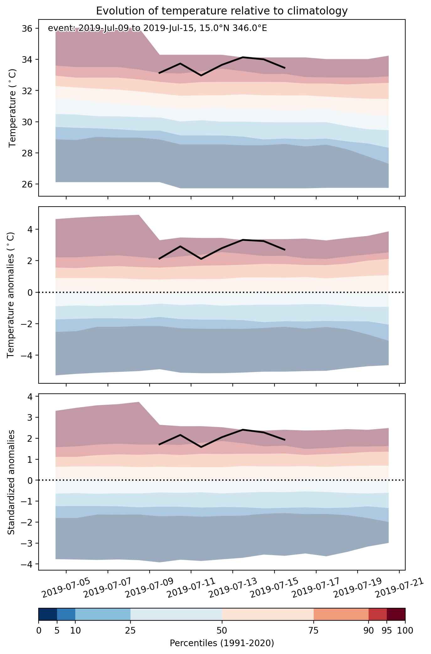
Fig. 2: Evolution of temperature at the center of the event. The climatological percentile distribution is illustrated with color shadings.


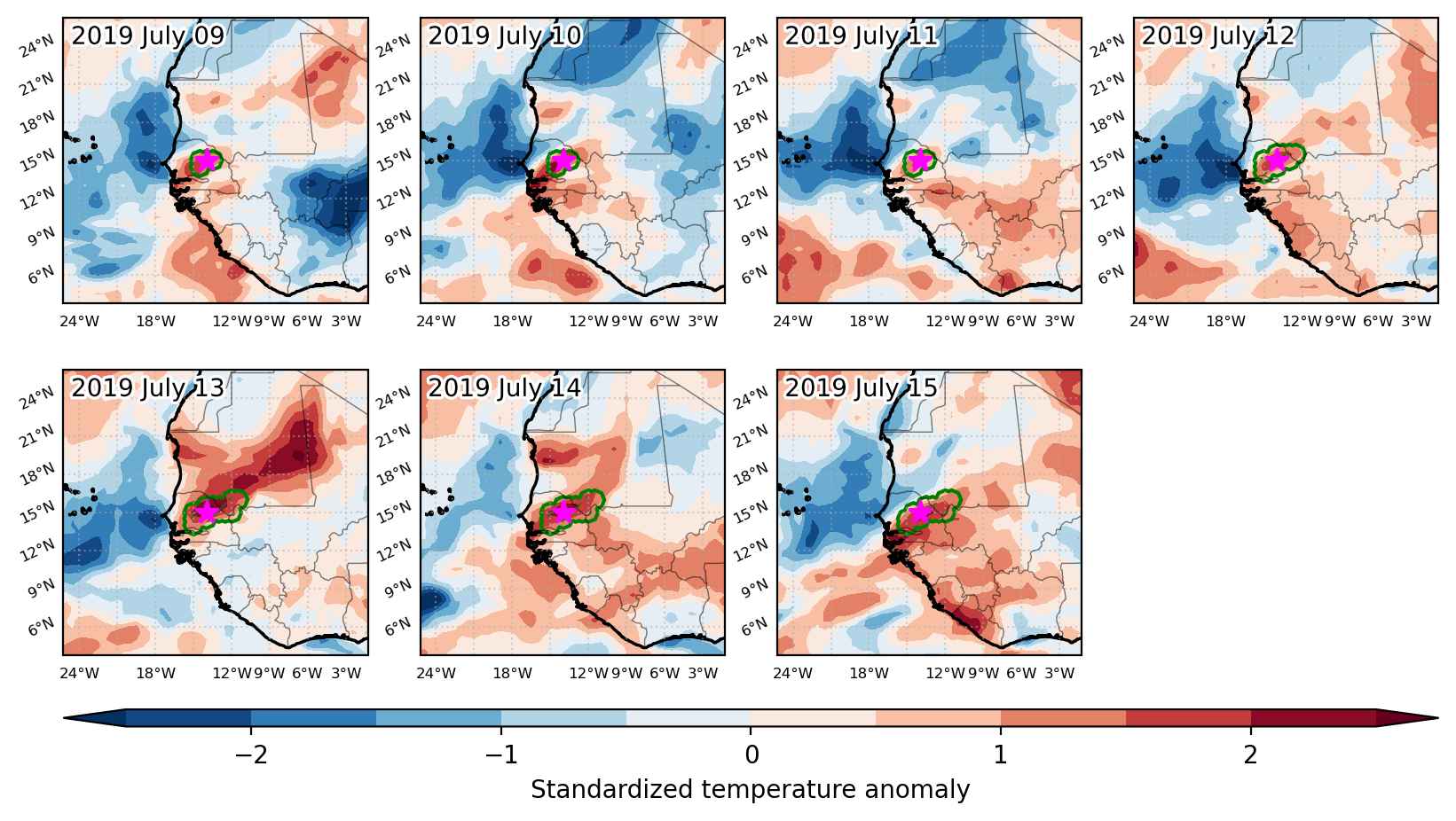
Fig. 3: Maps illustrating the evolution of standardized temperature anomalies during the event.

Event ID: Heat_wave_2019-Jul-09_to_2019-Jul-15_346.0_15.0

Heat wave occuring from July 09 2019 to July 14 2019 at -0.5°S 103.5°E

Download data: JSON

Event type: Heat wave

Countries affected (identified with ArcGIS Online; provided only for geographical reference):

  • Indonesia
  • Malaysia

Duration: 6 days

Time span: July 09 2019 to July 14 2019

Statistics over entire affected area:

  • Mean temperature anomaly: 1.3 °C
  • Mean temperature: 28.4 °C
  • Maximum temperature anomaly: 1.9 °C
  • Maximum temperature: 29.2 °C

Event center: -0.5°S 103.5°E

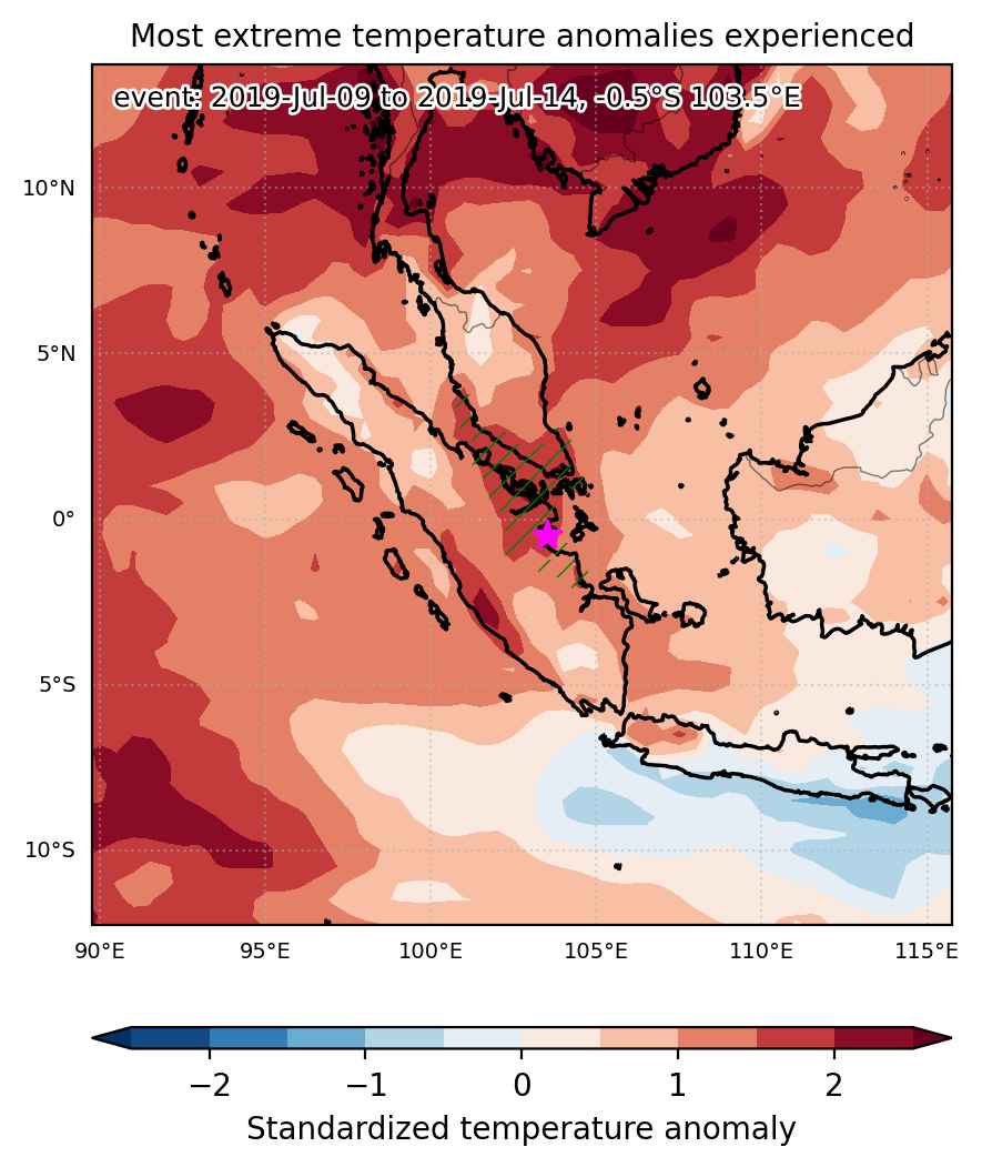
Area affected: 117415 km$^2$


Fig. 1: Map of most extreme temperature anomalies (standardized) experienced during the event. The purple star indicates the center of the extreme event. Green hatching illustrates all areas under the effect of extremes at some time during the event.


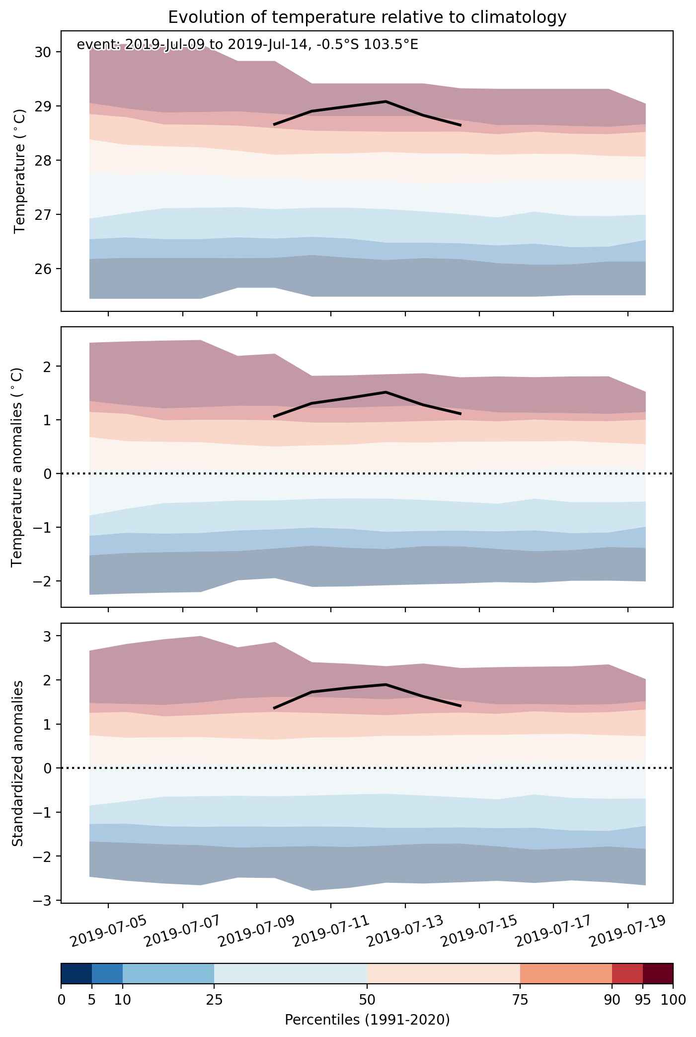
Fig. 2: Evolution of temperature at the center of the event. The climatological percentile distribution is illustrated with color shadings.


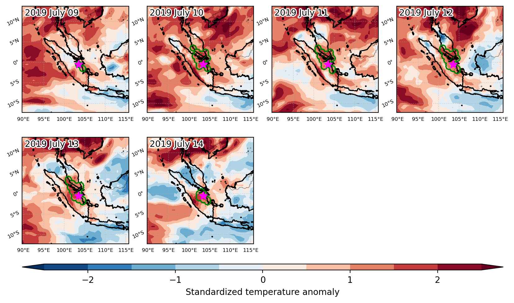
Fig. 3: Maps illustrating the evolution of standardized temperature anomalies during the event.

Event ID: Heat_wave_2019-Jul-09_to_2019-Jul-14_103.5_-0.5

Heat wave occuring from July 09 2019 to July 12 2019 at -18.0°S 177.5°E

Download data: JSON

Event type: Heat wave

Countries affected (identified with ArcGIS Online; provided only for geographical reference):

  • Fiji

Duration: 4 days

Time span: July 09 2019 to July 12 2019

Statistics over entire affected area:

  • Mean temperature anomaly: 1.3 °C
  • Mean temperature: 25.9 °C
  • Maximum temperature anomaly: 2.6 °C
  • Maximum temperature: 26.8 °C

Event center: -18.0°S 177.5°E

Area affected: 106344 km$^2$


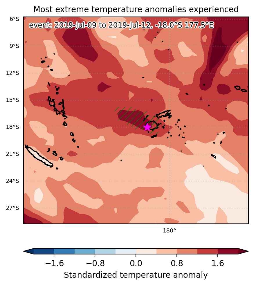
Fig. 1: Map of most extreme temperature anomalies (standardized) experienced during the event. The purple star indicates the center of the extreme event. Green hatching illustrates all areas under the effect of extremes at some time during the event.


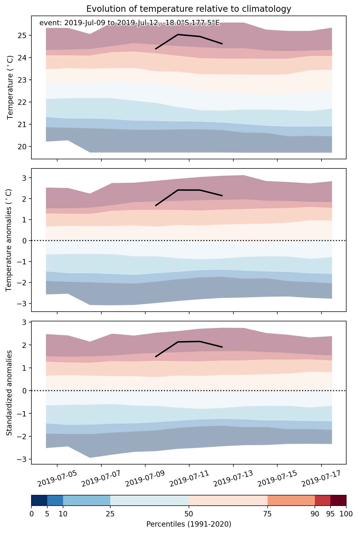
Fig. 2: Evolution of temperature at the center of the event. The climatological percentile distribution is illustrated with color shadings.


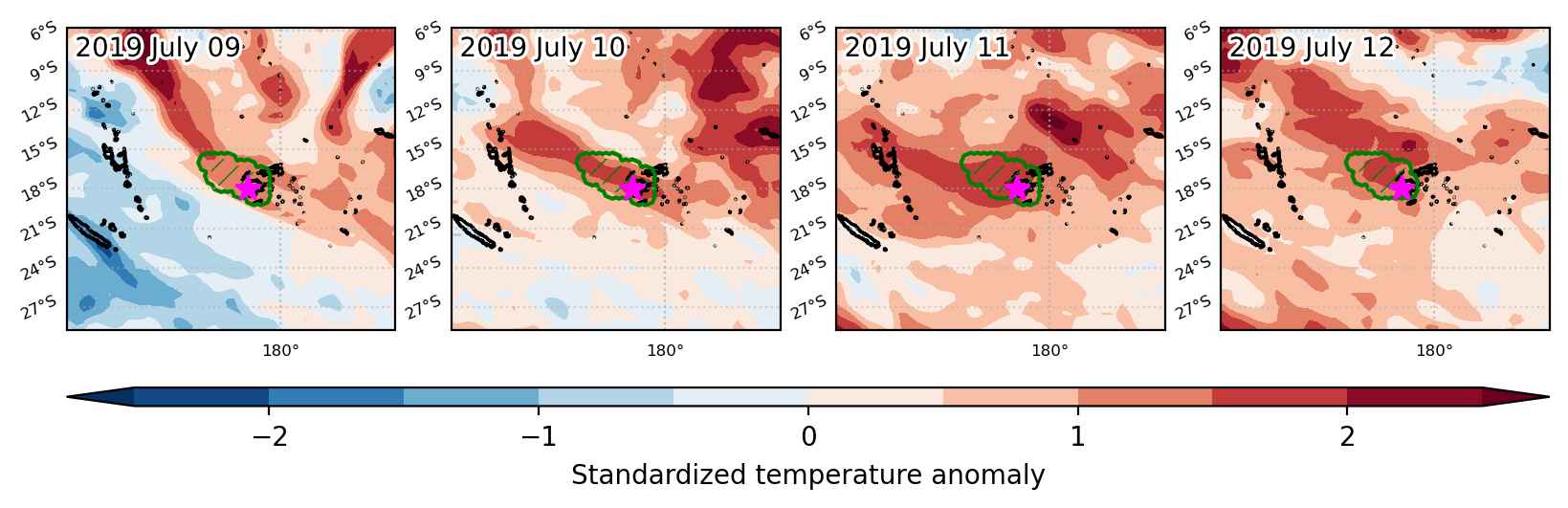
Fig. 3: Maps illustrating the evolution of standardized temperature anomalies during the event.

Event ID: Heat_wave_2019-Jul-09_to_2019-Jul-12_177.5_-18.0

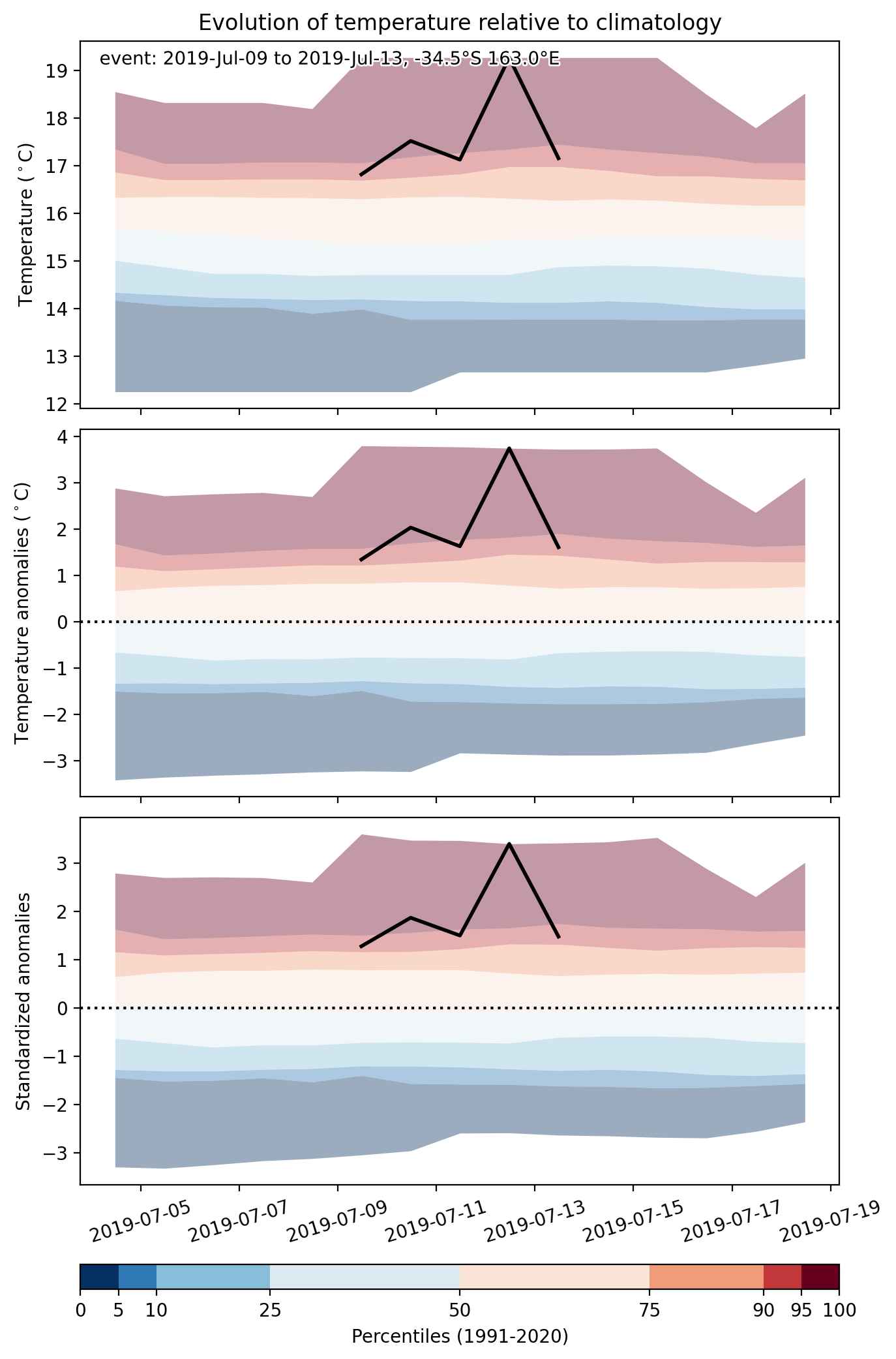
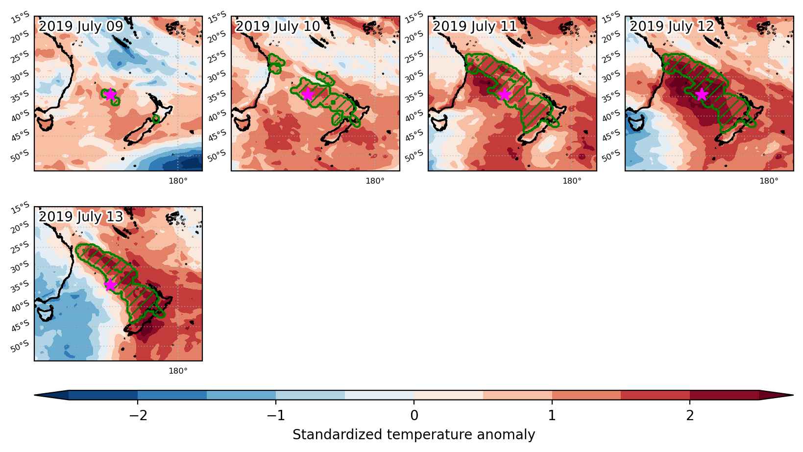
Heat wave occuring from July 09 2019 to July 13 2019 at -34.5°S 163.0°E

Download data: JSON

Event type: Heat wave

Countries affected (identified with ArcGIS Online; provided only for geographical reference):

  • New Zealand

Duration: 5 days

Time span: July 09 2019 to July 13 2019

Statistics over entire affected area:

  • Mean temperature anomaly: 2.0 °C
  • Mean temperature: 17.5 °C
  • Maximum temperature anomaly: 3.8 °C
  • Maximum temperature: 22.0 °C

Event center: -34.5°S 163.0°E

Area affected: 1240383 km$^2$


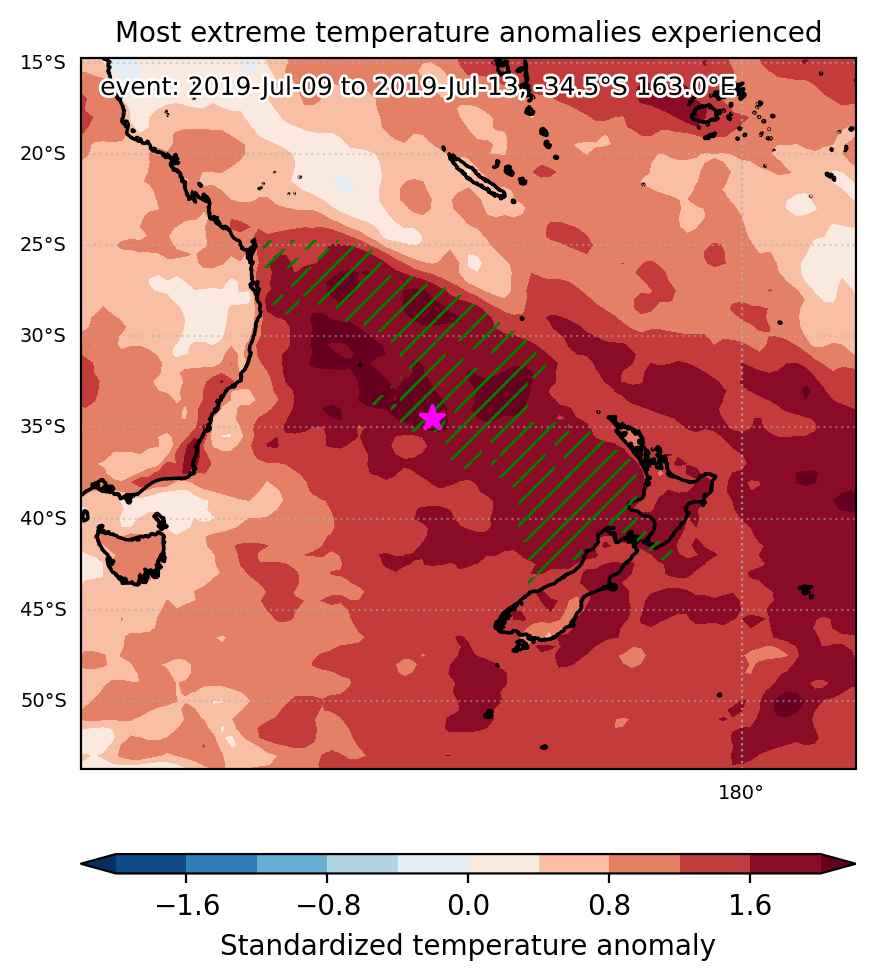
Fig. 1: Map of most extreme temperature anomalies (standardized) experienced during the event. The purple star indicates the center of the extreme event. Green hatching illustrates all areas under the effect of extremes at some time during the event.


Fig. 2: Evolution of temperature at the center of the event. The climatological percentile distribution is illustrated with color shadings.


Fig. 3: Maps illustrating the evolution of standardized temperature anomalies during the event.

Event ID: Heat_wave_2019-Jul-09_to_2019-Jul-13_163.0_-34.5

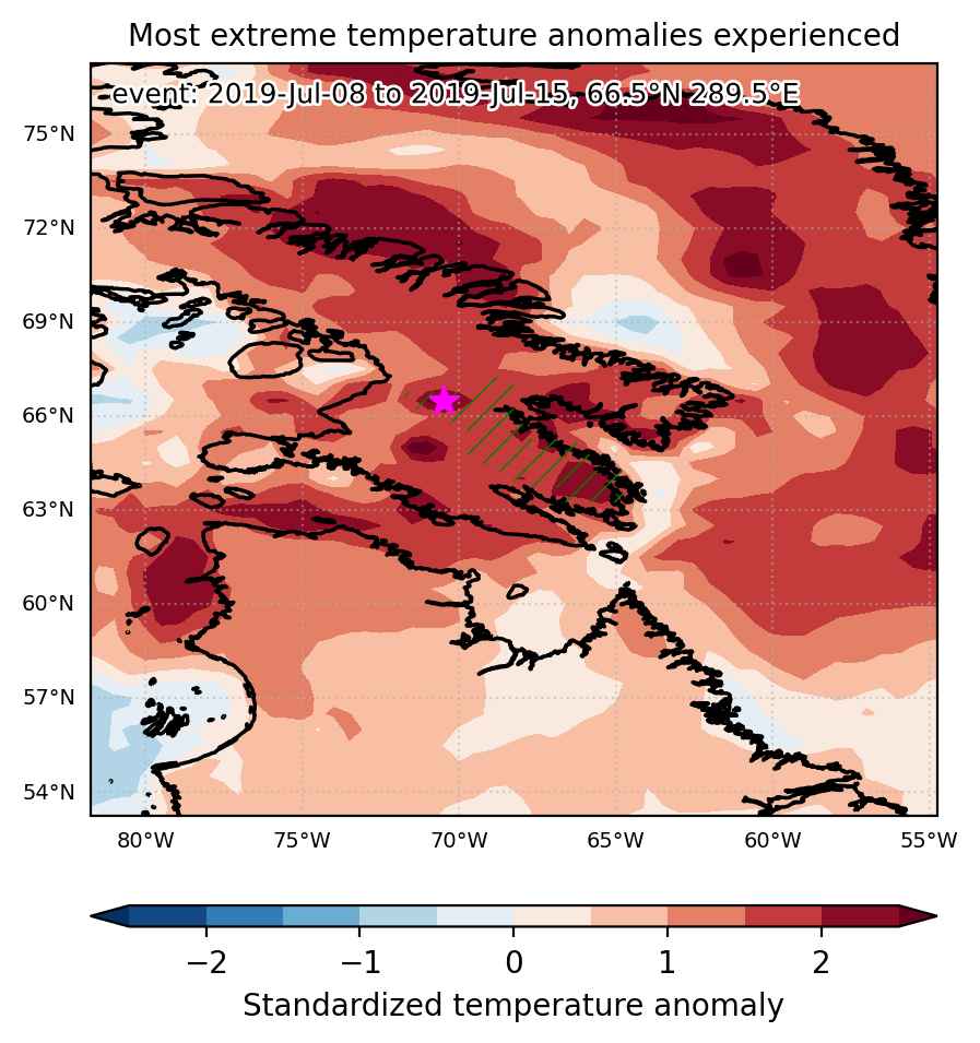
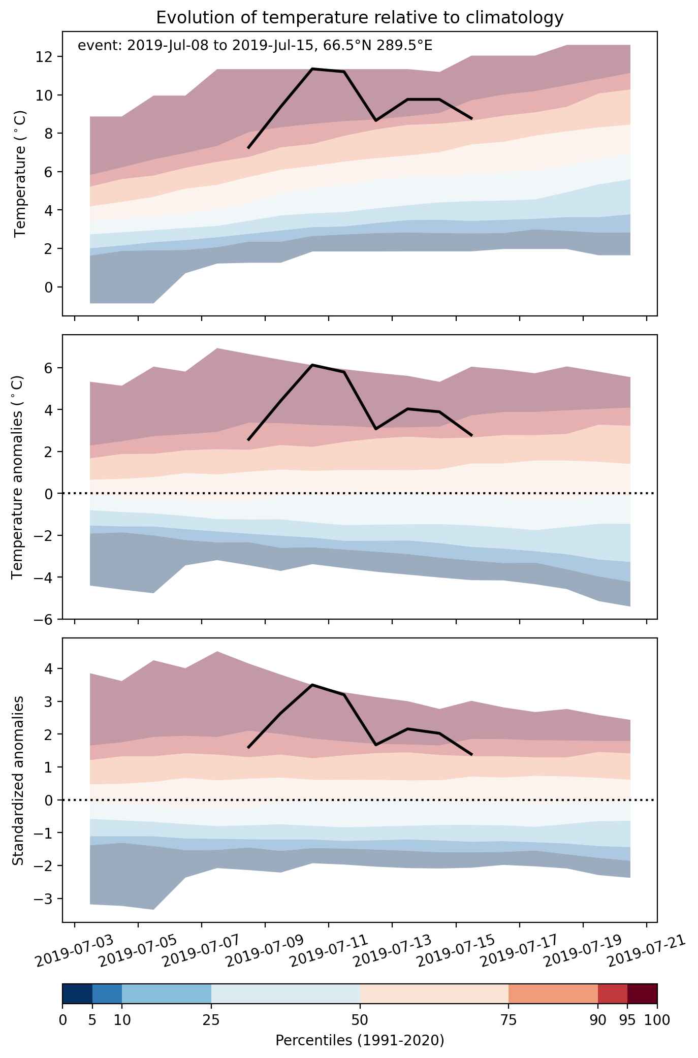
Heat wave occuring from July 08 2019 to July 15 2019 at 66.5°N 289.5°E

Download data: JSON

Event type: Heat wave

Countries affected (identified with ArcGIS Online; provided only for geographical reference):

  • Canada

Duration: 8 days

Time span: July 08 2019 to July 15 2019

Statistics over entire affected area:

  • Mean temperature anomaly: 5.6 °C
  • Mean temperature: 13.3 °C
  • Maximum temperature anomaly: 8.4 °C
  • Maximum temperature: 16.6 °C

Event center: 66.5°N 289.5°E

Area affected: 54661 km$^2$


Fig. 1: Map of most extreme temperature anomalies (standardized) experienced during the event. The purple star indicates the center of the extreme event. Green hatching illustrates all areas under the effect of extremes at some time during the event.


Fig. 2: Evolution of temperature at the center of the event. The climatological percentile distribution is illustrated with color shadings.


Fig. 3: Maps illustrating the evolution of standardized temperature anomalies during the event.

Event ID: Heat_wave_2019-Jul-08_to_2019-Jul-15_289.5_66.5

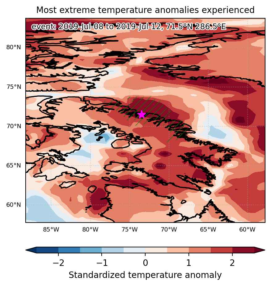
Heat wave occuring from July 08 2019 to July 12 2019 at 71.5°N 286.5°E

Download data: JSON

Event type: Heat wave

Countries affected (identified with ArcGIS Online; provided only for geographical reference):

  • Canada

Duration: 5 days

Time span: July 08 2019 to July 12 2019

Statistics over entire affected area:

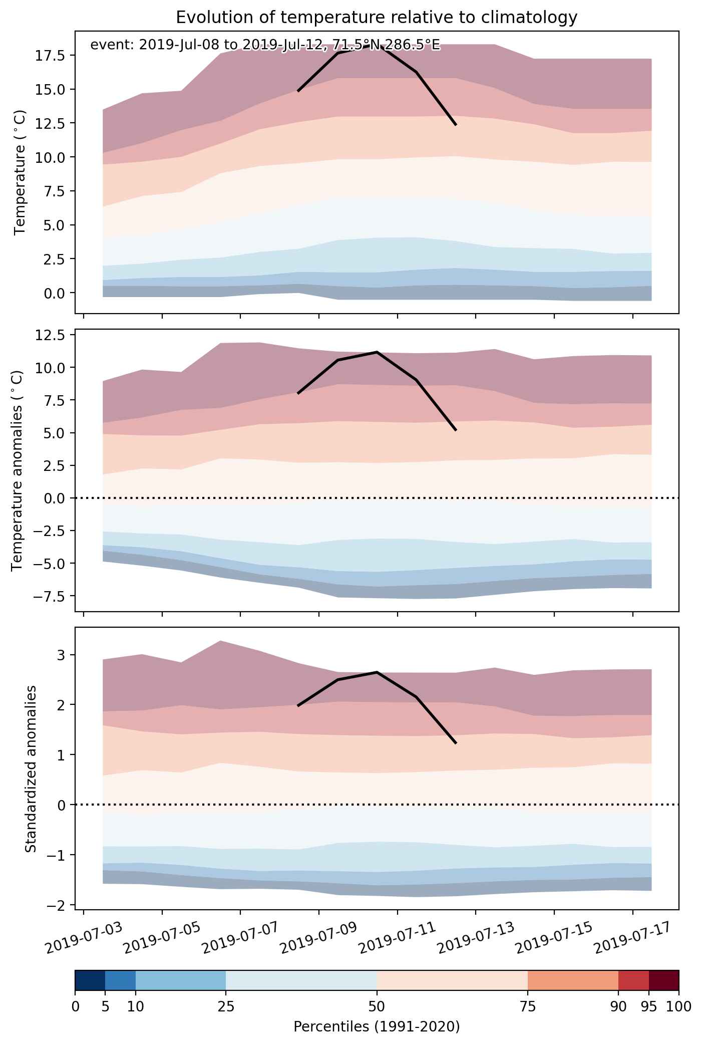
  • Mean temperature anomaly: 5.2 °C
  • Mean temperature: 9.3 °C
  • Maximum temperature anomaly: 11.4 °C
  • Maximum temperature: 18.7 °C

Event center: 71.5°N 286.5°E

Area affected: 97124 km$^2$


Fig. 1: Map of most extreme temperature anomalies (standardized) experienced during the event. The purple star indicates the center of the extreme event. Green hatching illustrates all areas under the effect of extremes at some time during the event.


Fig. 2: Evolution of temperature at the center of the event. The climatological percentile distribution is illustrated with color shadings.


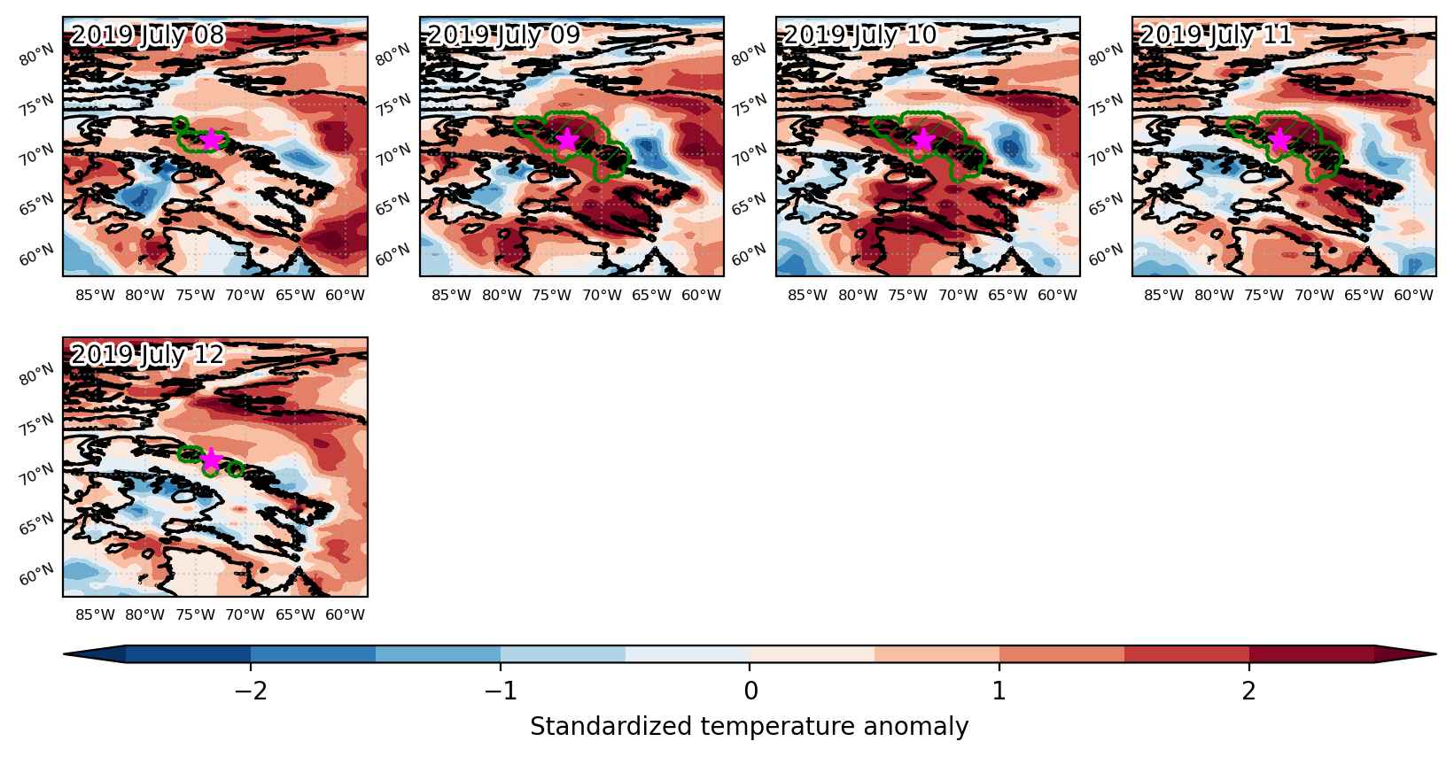
Fig. 3: Maps illustrating the evolution of standardized temperature anomalies during the event.

Event ID: Heat_wave_2019-Jul-08_to_2019-Jul-12_286.5_71.5

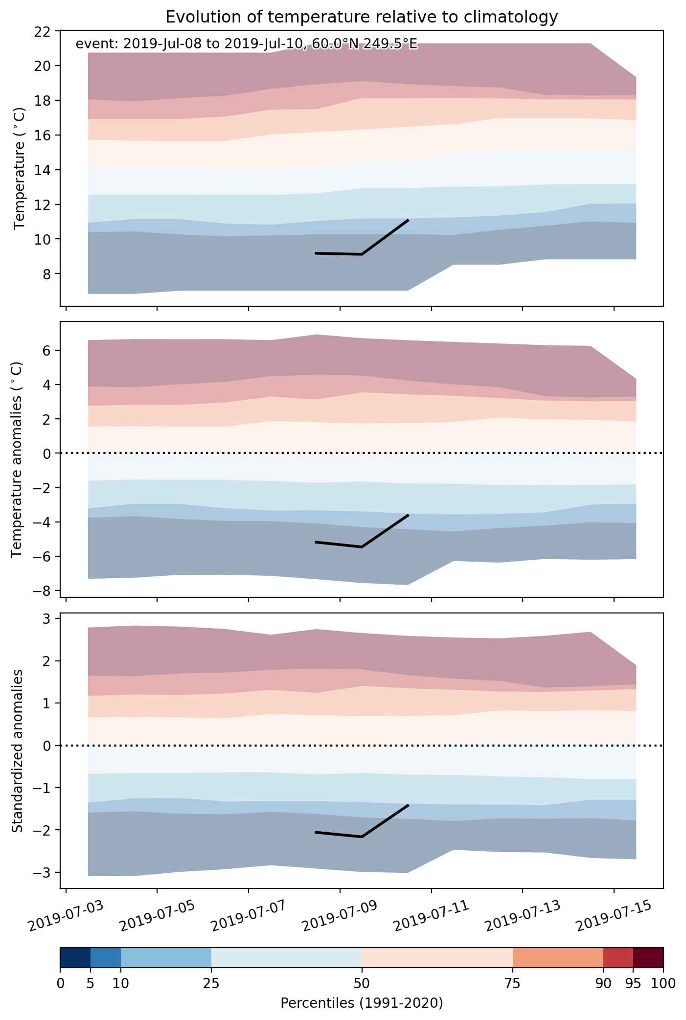
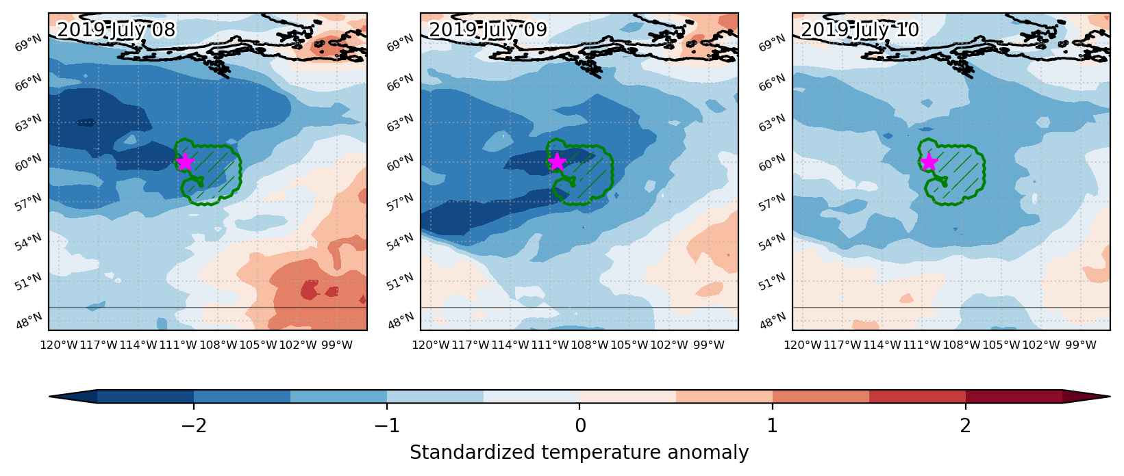
Cold spell occuring from July 08 2019 to July 10 2019 at 60.0°N 249.5°E

Download data: JSON

Event type: Cold spell

Countries affected (identified with ArcGIS Online; provided only for geographical reference):

  • Canada

Duration: 3 days

Time span: July 08 2019 to July 10 2019

Statistics over entire affected area:

  • Mean temperature anomaly: -5.2 °C
  • Mean temperature: 10.7 °C
  • Minimum temperature anomaly: -7.3 °C
  • Minimum temperature: 7.9 °C

Event center: 60.0°N 249.5°E

Area affected: 53634 km$^2$


Fig. 1: Map of most extreme temperature anomalies (standardized) experienced during the event. The purple star indicates the center of the extreme event. Green hatching illustrates all areas under the effect of extremes at some time during the event.


Fig. 2: Evolution of temperature at the center of the event. The climatological percentile distribution is illustrated with color shadings.


Fig. 3: Maps illustrating the evolution of standardized temperature anomalies during the event.

Event ID: Cold_spell_2019-Jul-08_to_2019-Jul-10_249.5_60.0

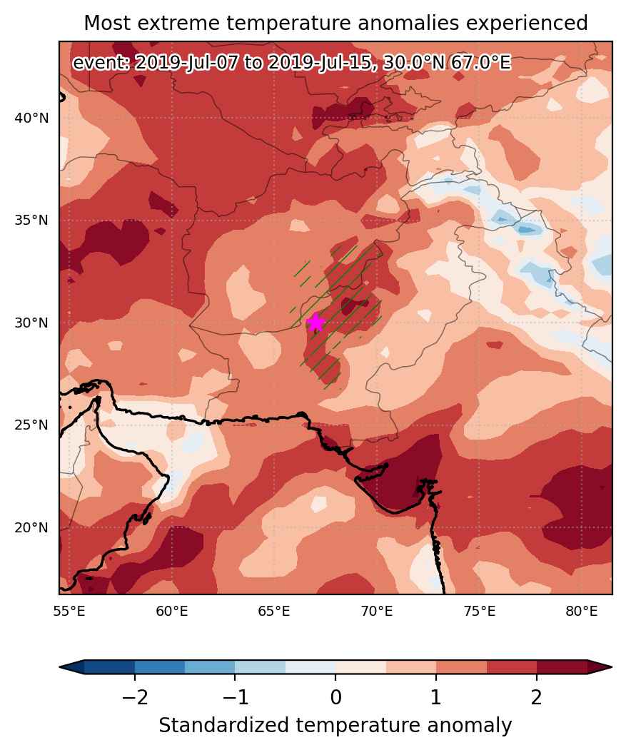
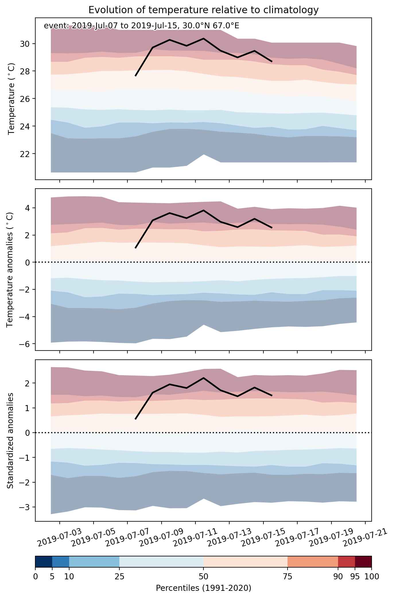
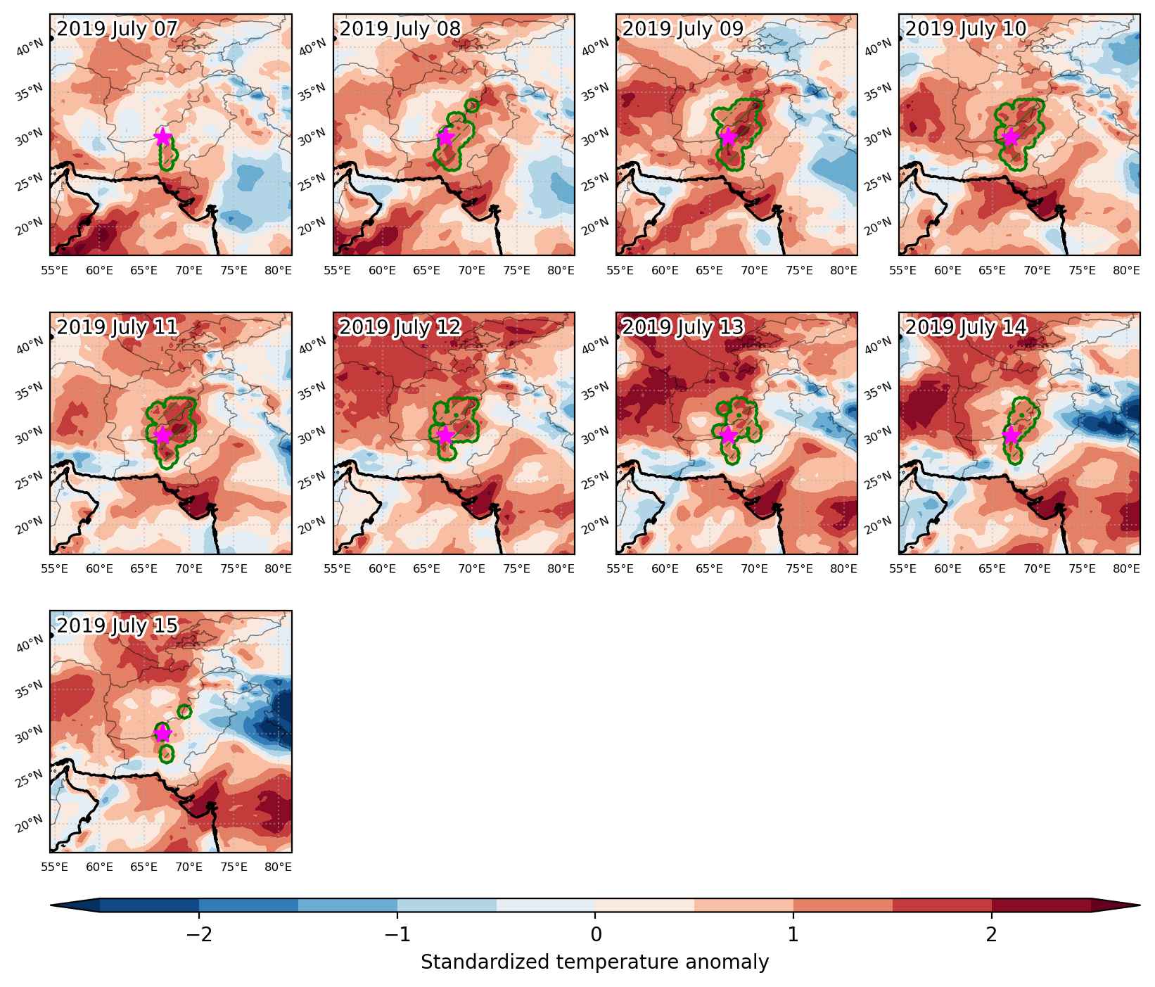
Heat wave occuring from July 07 2019 to July 15 2019 at 30.0°N 67.0°E

Download data: JSON

Event type: Heat wave

Countries affected (identified with ArcGIS Online; provided only for geographical reference):

  • Afghanistan
  • Pakistan

Duration: 9 days

Time span: July 07 2019 to July 15 2019

Statistics over entire affected area:

  • Mean temperature anomaly: 3.0 °C
  • Mean temperature: 31.3 °C
  • Maximum temperature anomaly: 5.4 °C
  • Maximum temperature: 41.5 °C

Event center: 30.0°N 67.0°E

Area affected: 185934 km$^2$


Fig. 1: Map of most extreme temperature anomalies (standardized) experienced during the event. The purple star indicates the center of the extreme event. Green hatching illustrates all areas under the effect of extremes at some time during the event.


Fig. 2: Evolution of temperature at the center of the event. The climatological percentile distribution is illustrated with color shadings.


Fig. 3: Maps illustrating the evolution of standardized temperature anomalies during the event.

Event ID: Heat_wave_2019-Jul-07_to_2019-Jul-15_67.0_30.0