Heat wave occuring from February 19 2019 to February 22 2019 at 3.5°N 113.5°E

Download data: JSON

Event type: Heat wave

Countries affected (identified with ArcGIS Online; provided only for geographical reference):

  • Brunei Darussalam
  • Malaysia

Duration: 4 days

Time span: February 19 2019 to February 22 2019

Statistics over entire affected area:

  • Mean temperature anomaly: 1.3 °C
  • Mean temperature: 26.5 °C
  • Maximum temperature anomaly: 2.1 °C
  • Maximum temperature: 28.1 °C

Event center: 3.5°N 113.5°E

Area affected: 89454 km$^2$
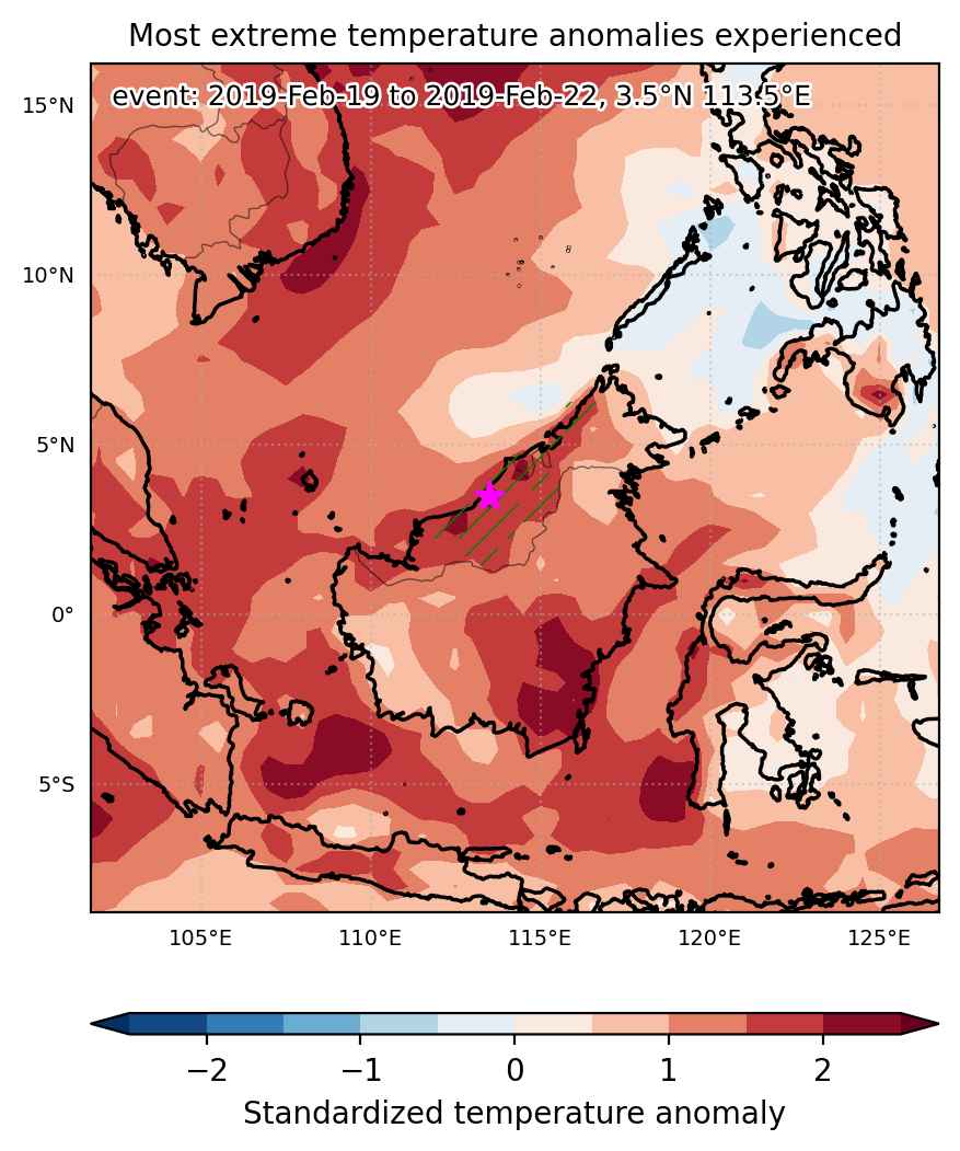

Fig. 1: Map of most extreme temperature anomalies (standardized) experienced during the event. The purple star indicates the center of the extreme event. Green hatching illustrates all areas under the effect of extremes at some time during the event.
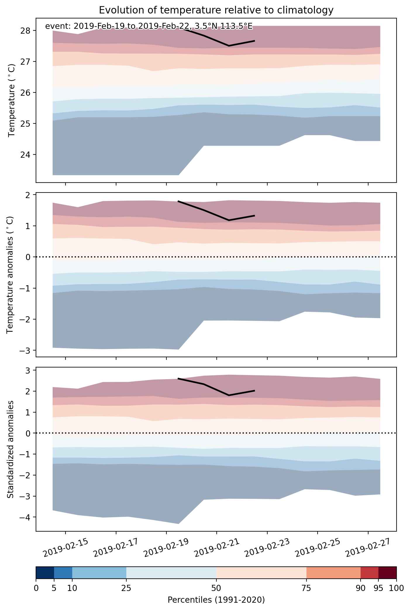


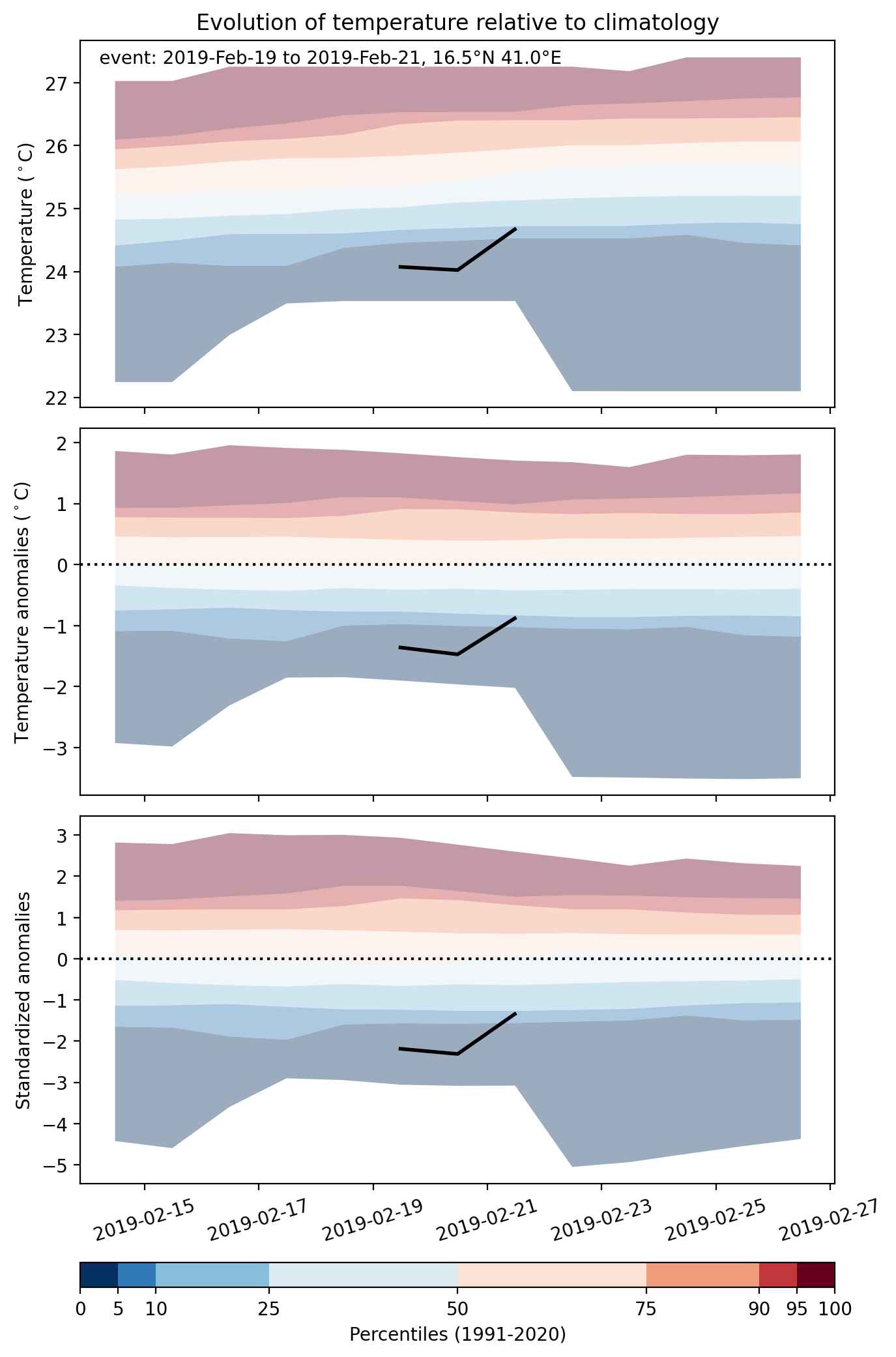
Fig. 2: Evolution of temperature at the center of the event. The climatological percentile distribution is illustrated with color shadings.
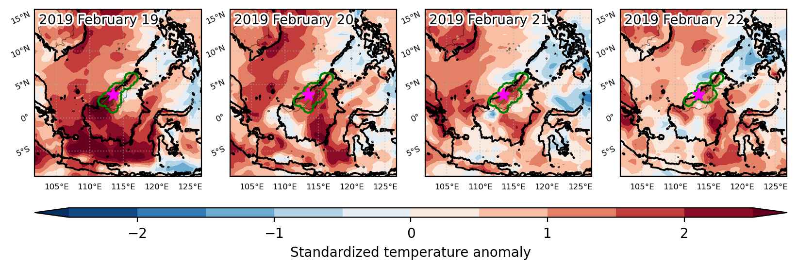


Fig. 3: Maps illustrating the evolution of standardized temperature anomalies during the event.

Event ID: Heat_wave_2019-Feb-19_to_2019-Feb-22_113.5_3.5
Cold spell occuring from February 19 2019 to February 21 2019 at 16.5°N 41.0°E

Download data: JSON

Event type: Cold spell

Countries affected (identified with ArcGIS Online; provided only for geographical reference):

  • Eritrea

Duration: 3 days

Time span: February 19 2019 to February 21 2019

Statistics over entire affected area:

  • Mean temperature anomaly: -1.5 °C
  • Mean temperature: 23.9 °C
  • Minimum temperature anomaly: -2.9 °C
  • Minimum temperature: 22.0 °C

Event center: 16.5°N 41.0°E

Area affected: 56237 km$^2$


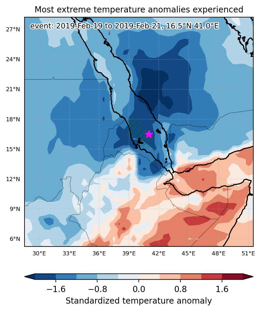
Fig. 1: Map of most extreme temperature anomalies (standardized) experienced during the event. The purple star indicates the center of the extreme event. Green hatching illustrates all areas under the effect of extremes at some time during the event.


Fig. 2: Evolution of temperature at the center of the event. The climatological percentile distribution is illustrated with color shadings.


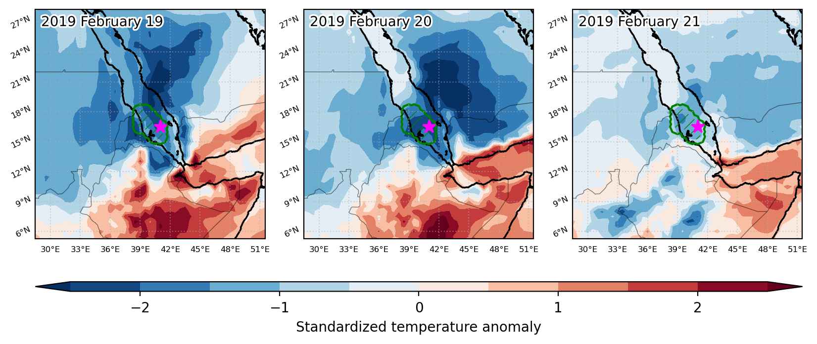
Fig. 3: Maps illustrating the evolution of standardized temperature anomalies during the event.

Event ID: Cold_spell_2019-Feb-19_to_2019-Feb-21_41.0_16.5

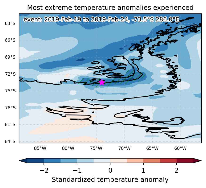
Cold spell occuring from February 19 2019 to February 24 2019 at -73.5°S 286.0°E

Download data: JSON

Event type: Cold spell

Countries affected (identified with ArcGIS Online; provided only for geographical reference):

  • Antarctica

Duration: 6 days

Time span: February 19 2019 to February 24 2019

Statistics over entire affected area:

  • Mean temperature anomaly: -6.8 °C
  • Mean temperature: -13.3 °C
  • Minimum temperature anomaly: -10.5 °C
  • Minimum temperature: -17.9 °C

Event center: -73.5°S 286.0°E

Area affected: 50580 km$^2$


Fig. 1: Map of most extreme temperature anomalies (standardized) experienced during the event. The purple star indicates the center of the extreme event. Green hatching illustrates all areas under the effect of extremes at some time during the event.


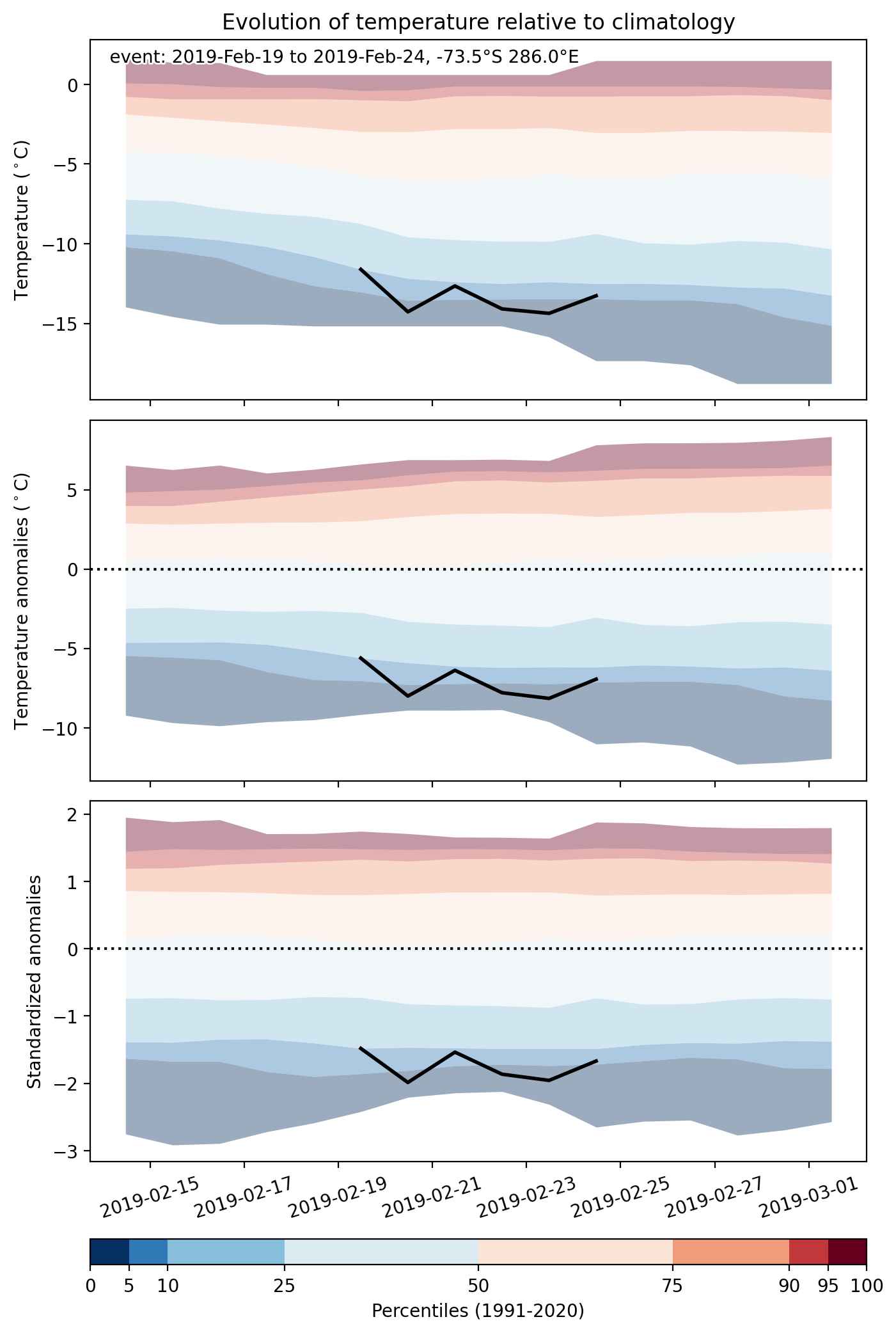
Fig. 2: Evolution of temperature at the center of the event. The climatological percentile distribution is illustrated with color shadings.


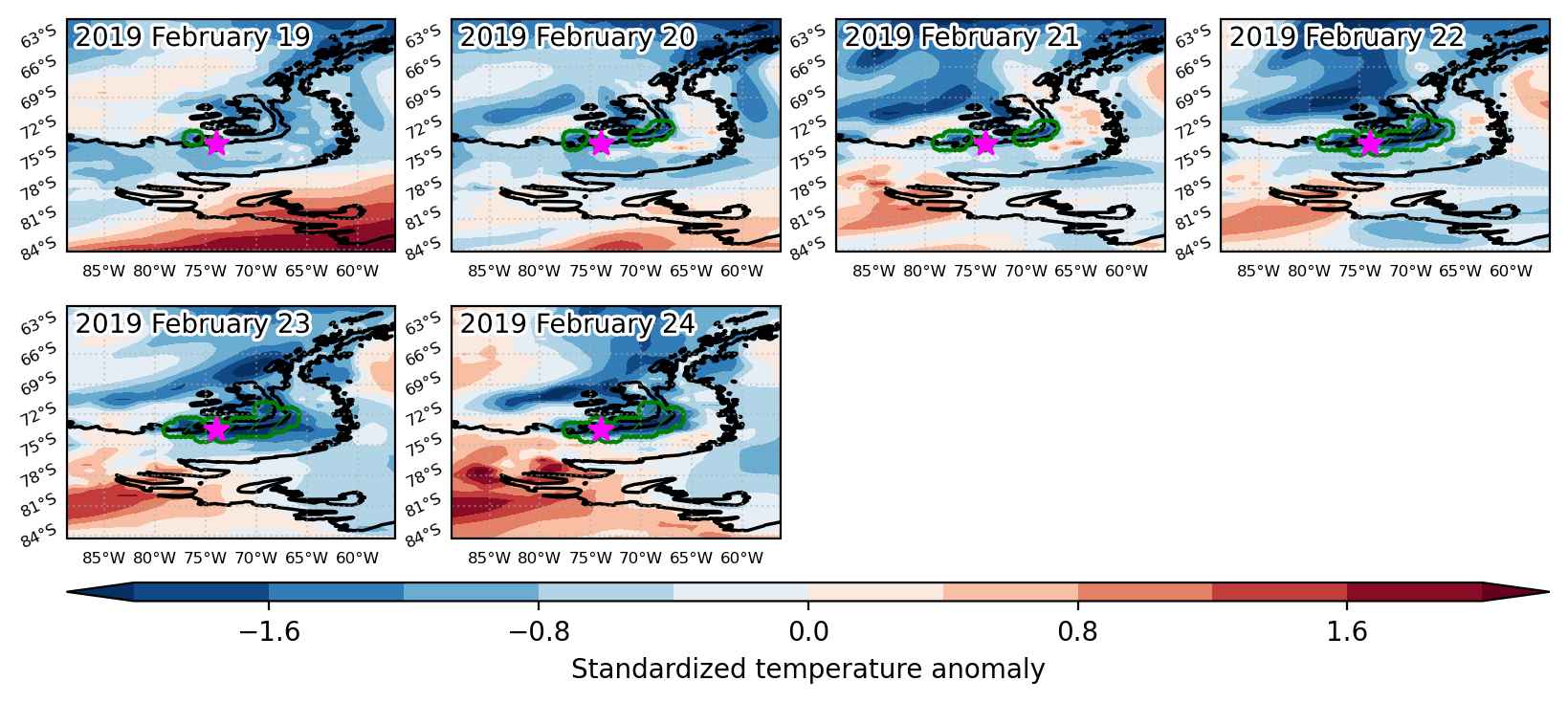
Fig. 3: Maps illustrating the evolution of standardized temperature anomalies during the event.

Event ID: Cold_spell_2019-Feb-19_to_2019-Feb-24_286.0_-73.5

Heat wave occuring from February 18 2019 to February 23 2019 at -73.0°S 354.0°E

Download data: JSON

Event type: Heat wave

Countries affected (identified with ArcGIS Online; provided only for geographical reference):

  • Antarctica

Duration: 6 days

Time span: February 18 2019 to February 23 2019

Statistics over entire affected area:

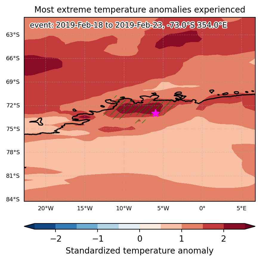
  • Mean temperature anomaly: 6.0 °C
  • Mean temperature: -8.5 °C
  • Maximum temperature anomaly: 9.1 °C
  • Maximum temperature: -0.6 °C

Event center: -73.0°S 354.0°E

Area affected: 65343 km$^2$


Fig. 1: Map of most extreme temperature anomalies (standardized) experienced during the event. The purple star indicates the center of the extreme event. Green hatching illustrates all areas under the effect of extremes at some time during the event.


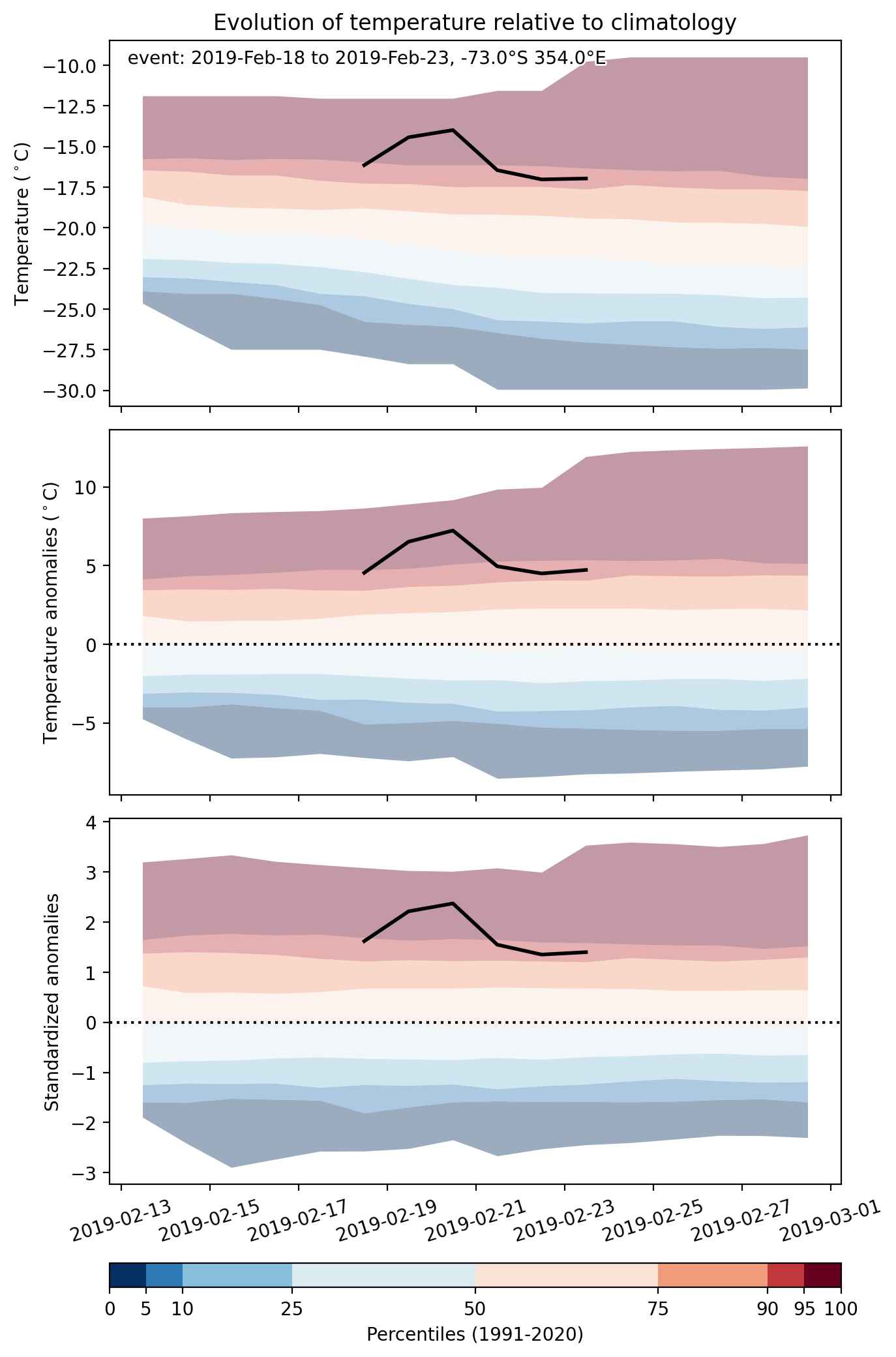
Fig. 2: Evolution of temperature at the center of the event. The climatological percentile distribution is illustrated with color shadings.


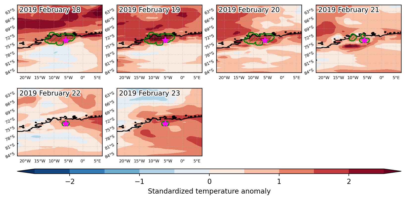
Fig. 3: Maps illustrating the evolution of standardized temperature anomalies during the event.

Event ID: Heat_wave_2019-Feb-18_to_2019-Feb-23_354.0_-73.0

Cold spell occuring from February 18 2019 to February 25 2019 at 37.5°N 320.0°E

Download data: JSON

Event type: Cold spell

Countries affected (identified with ArcGIS Online; provided only for geographical reference):

  • Canada

Duration: 8 days

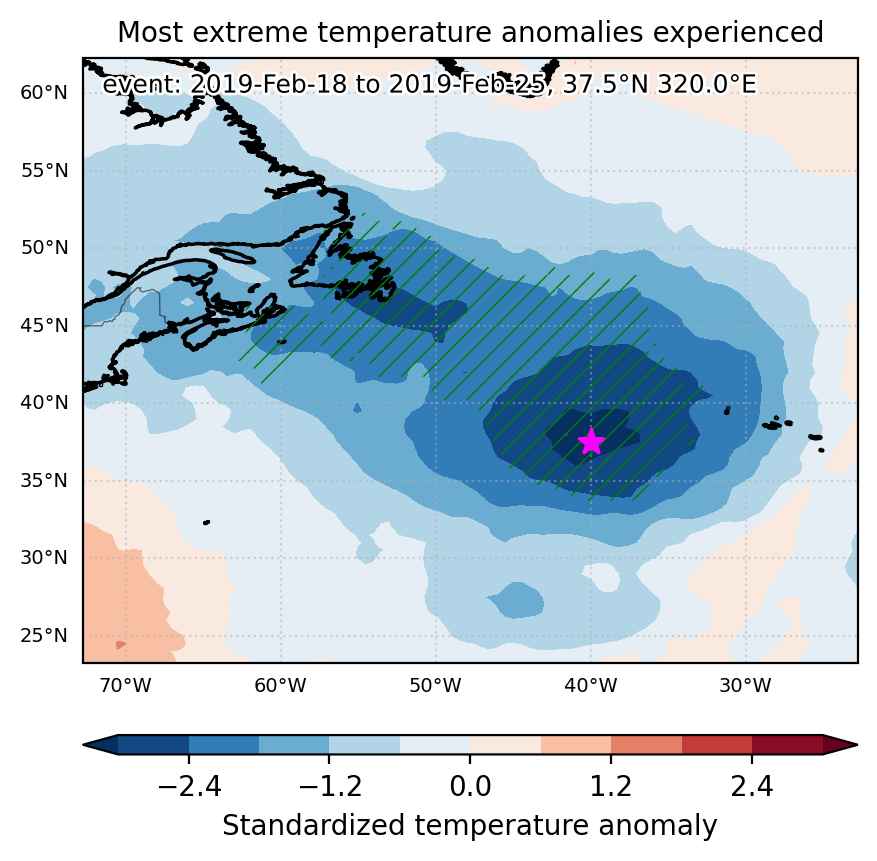
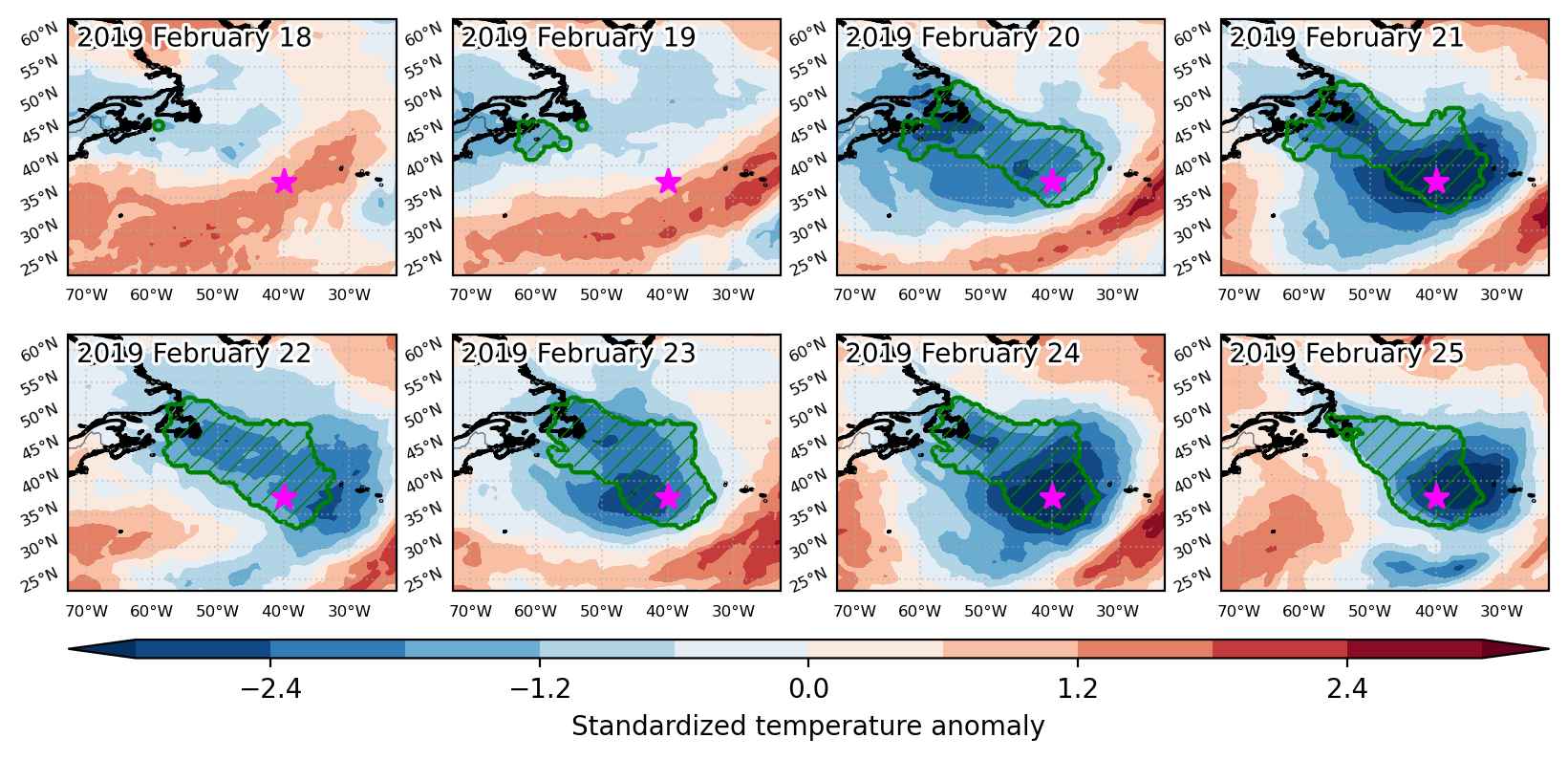
Time span: February 18 2019 to February 25 2019

Statistics over entire affected area:

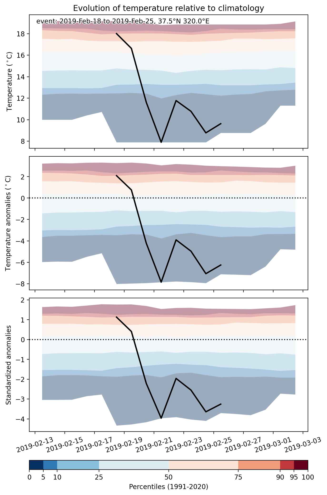
  • Mean temperature anomaly: -6.4 °C
  • Mean temperature: 1.5 °C
  • Minimum temperature anomaly: -11.6 °C
  • Minimum temperature: -20.8 °C

Event center: 37.5°N 320.0°E

Area affected: 2448812 km$^2$


Fig. 1: Map of most extreme temperature anomalies (standardized) experienced during the event. The purple star indicates the center of the extreme event. Green hatching illustrates all areas under the effect of extremes at some time during the event.


Fig. 2: Evolution of temperature at the center of the event. The climatological percentile distribution is illustrated with color shadings.


Fig. 3: Maps illustrating the evolution of standardized temperature anomalies during the event.

Event ID: Cold_spell_2019-Feb-18_to_2019-Feb-25_320.0_37.5

Heat wave occuring from February 17 2019 to February 22 2019 at -24.0°S 148.0°E

Download data: JSON

Event type: Heat wave

Countries affected (identified with ArcGIS Online; provided only for geographical reference):

  • Australia

Duration: 6 days

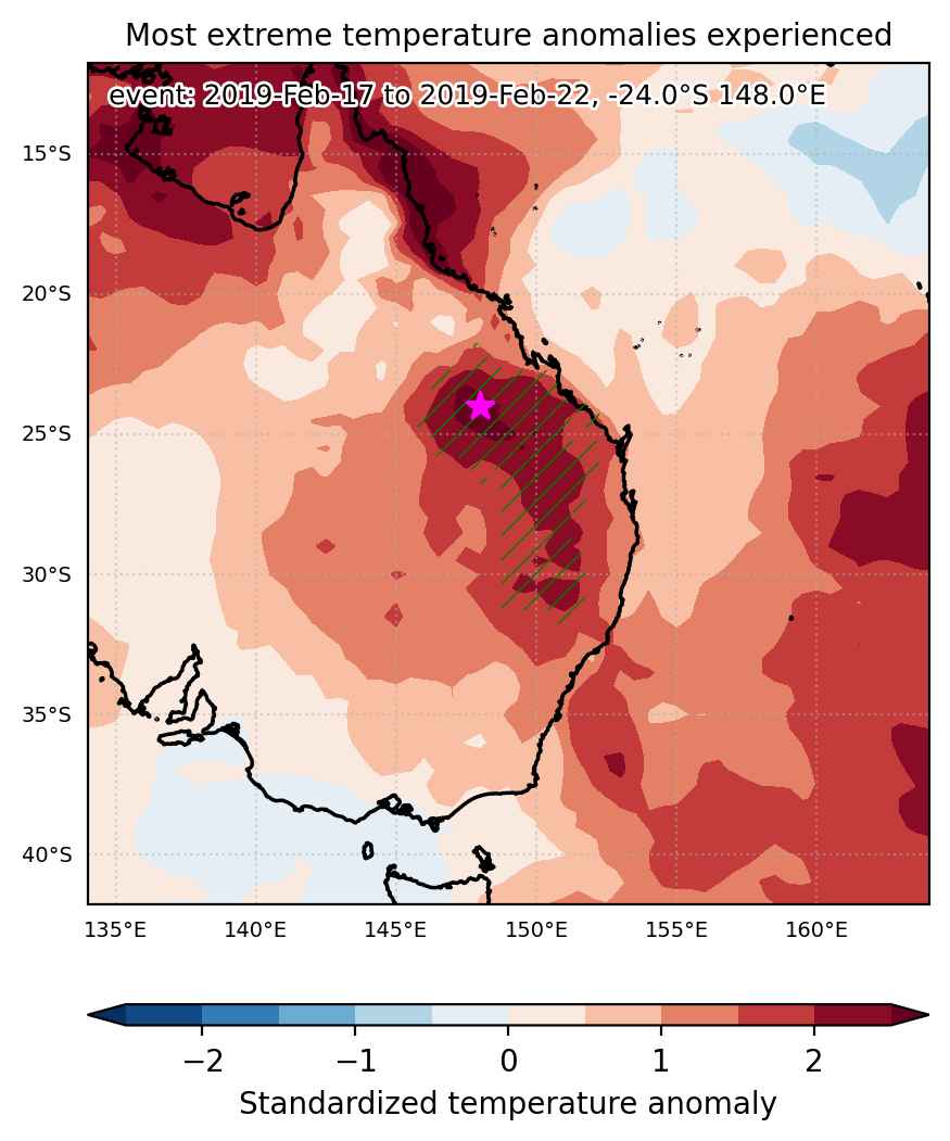
Time span: February 17 2019 to February 22 2019

Statistics over entire affected area:

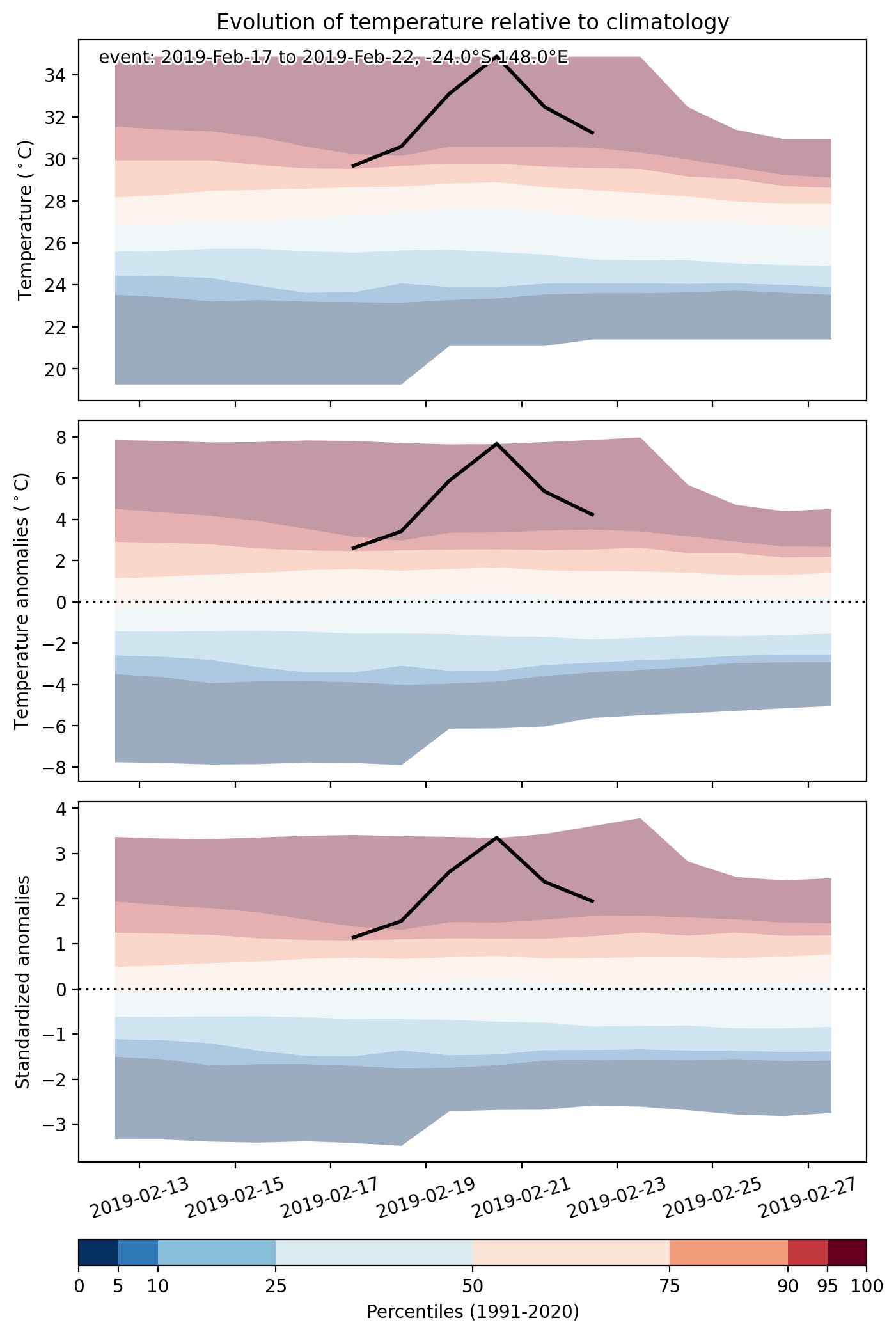
  • Mean temperature anomaly: 4.5 °C
  • Mean temperature: 30.1 °C
  • Maximum temperature anomaly: 7.7 °C
  • Maximum temperature: 34.9 °C

Event center: -24.0°S 148.0°E

Area affected: 376359 km$^2$


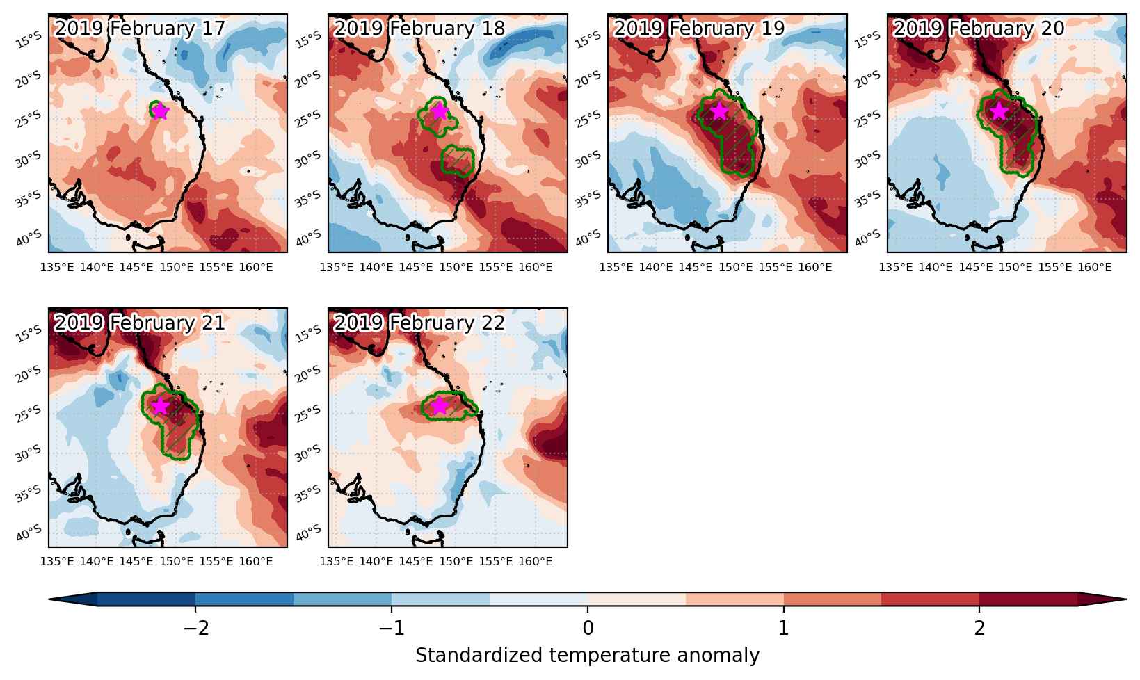
Fig. 1: Map of most extreme temperature anomalies (standardized) experienced during the event. The purple star indicates the center of the extreme event. Green hatching illustrates all areas under the effect of extremes at some time during the event.


Fig. 2: Evolution of temperature at the center of the event. The climatological percentile distribution is illustrated with color shadings.


Fig. 3: Maps illustrating the evolution of standardized temperature anomalies during the event.

Event ID: Heat_wave_2019-Feb-17_to_2019-Feb-22_148.0_-24.0

Cold spell occuring from February 17 2019 to March 01 2019 at 58.0°N 162.5°E

Download data: JSON

Event type: Cold spell

Countries affected (identified with ArcGIS Online; provided only for geographical reference):

  • Russian Federation

Duration: 13 days

Time span: February 17 2019 to March 01 2019

Statistics over entire affected area:

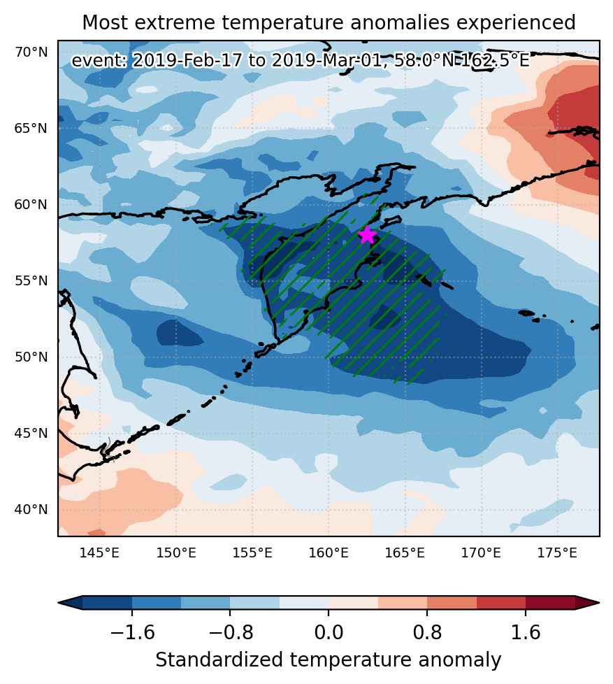
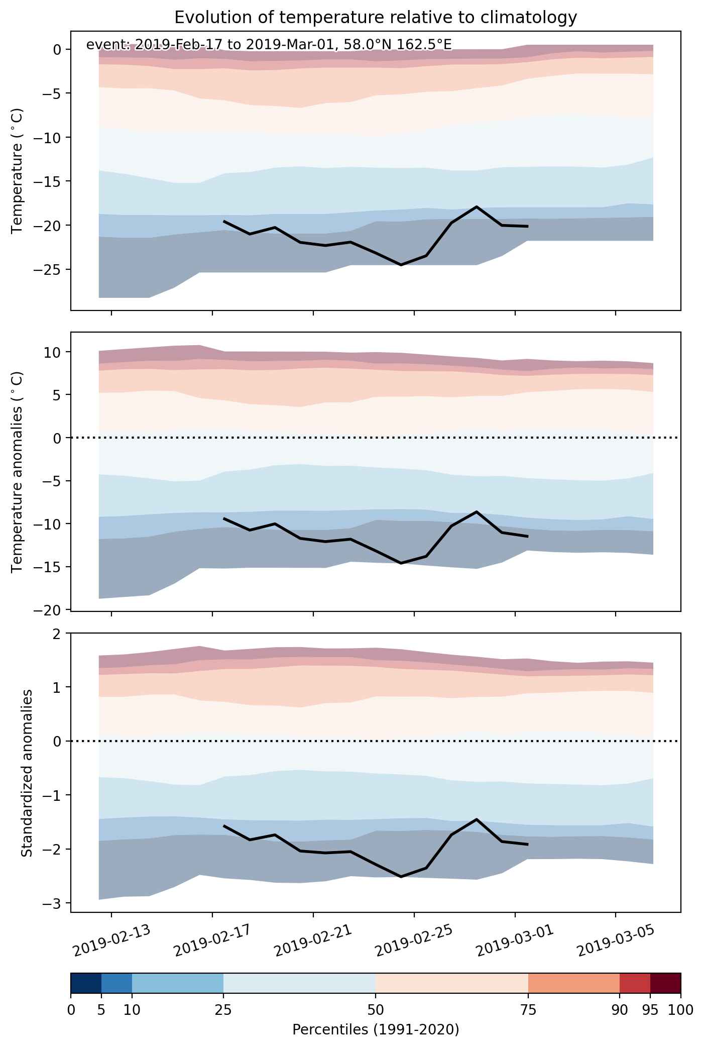
  • Mean temperature anomaly: -6.4 °C
  • Mean temperature: -13.8 °C
  • Minimum temperature anomaly: -16.7 °C
  • Minimum temperature: -33.5 °C

Event center: 58.0°N 162.5°E

Area affected: 714110 km$^2$


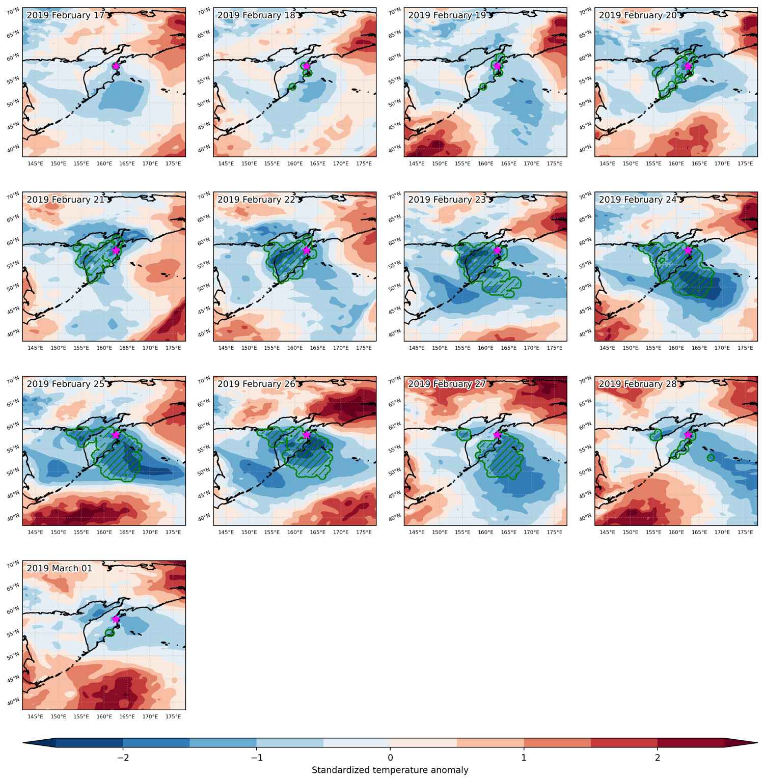
Fig. 1: Map of most extreme temperature anomalies (standardized) experienced during the event. The purple star indicates the center of the extreme event. Green hatching illustrates all areas under the effect of extremes at some time during the event.


Fig. 2: Evolution of temperature at the center of the event. The climatological percentile distribution is illustrated with color shadings.


Fig. 3: Maps illustrating the evolution of standardized temperature anomalies during the event.

Event ID: Cold_spell_2019-Feb-17_to_2019-Mar-01_162.5_58.0

Heat wave occuring from February 16 2019 to March 23 2019 at 14.0°N 266.5°E

Download data: JSON

Event type: Heat wave

Countries affected (identified with ArcGIS Online; provided only for geographical reference):

  • Bahamas
  • Belize
  • Cuba
  • El Salvador
  • Guatemala
  • Honduras
  • Mexico
  • Nicaragua
  • United States

Duration: 36 days

Time span: February 16 2019 to March 23 2019

Statistics over entire affected area:

  • Mean temperature anomaly: 2.6 °C
  • Mean temperature: 24.4 °C
  • Maximum temperature anomaly: 8.5 °C
  • Maximum temperature: 31.6 °C

Event center: 14.0°N 266.5°E

Area affected: 3144891 km$^2$


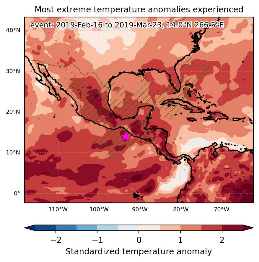
Fig. 1: Map of most extreme temperature anomalies (standardized) experienced during the event. The purple star indicates the center of the extreme event. Green hatching illustrates all areas under the effect of extremes at some time during the event.


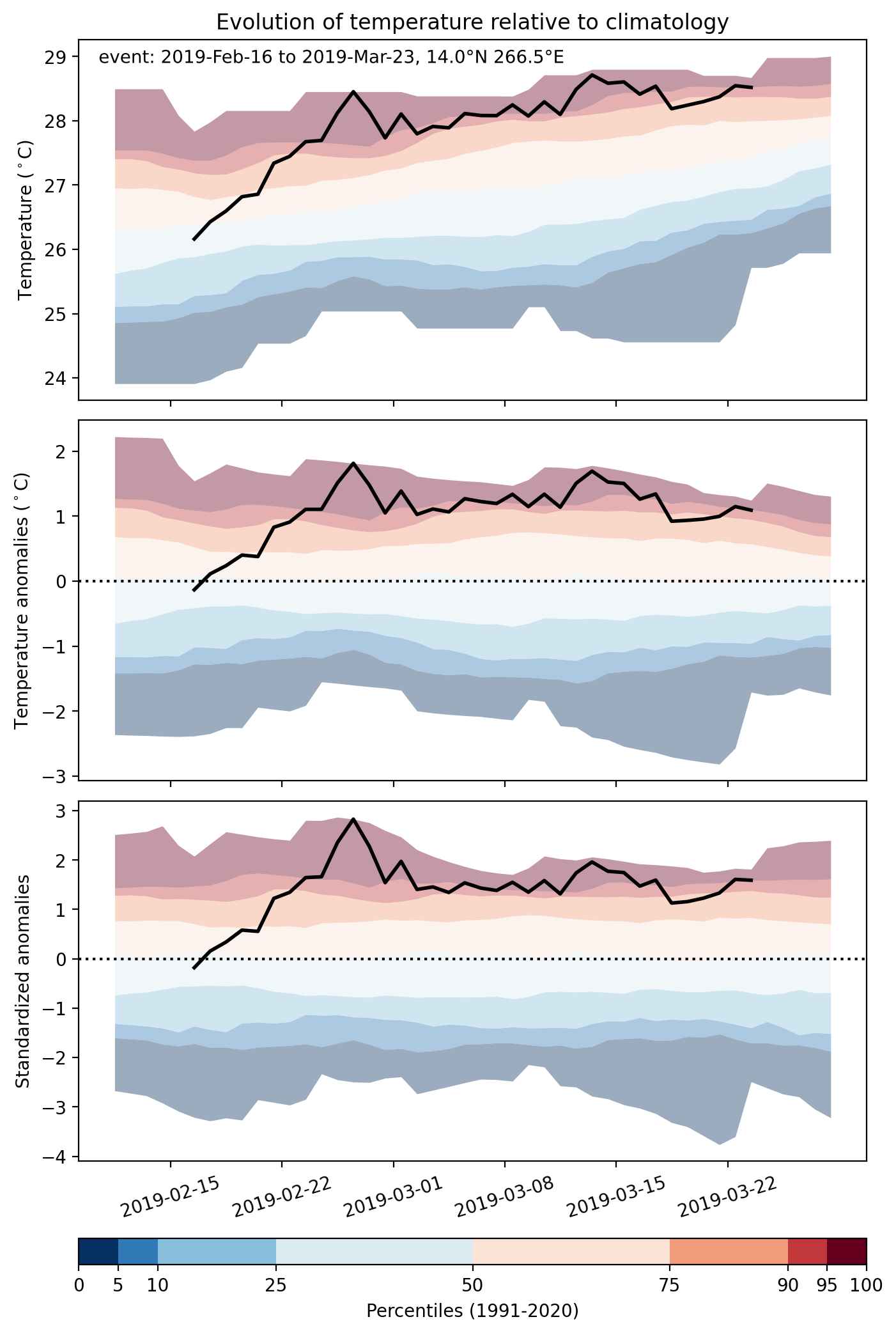
Fig. 2: Evolution of temperature at the center of the event. The climatological percentile distribution is illustrated with color shadings.


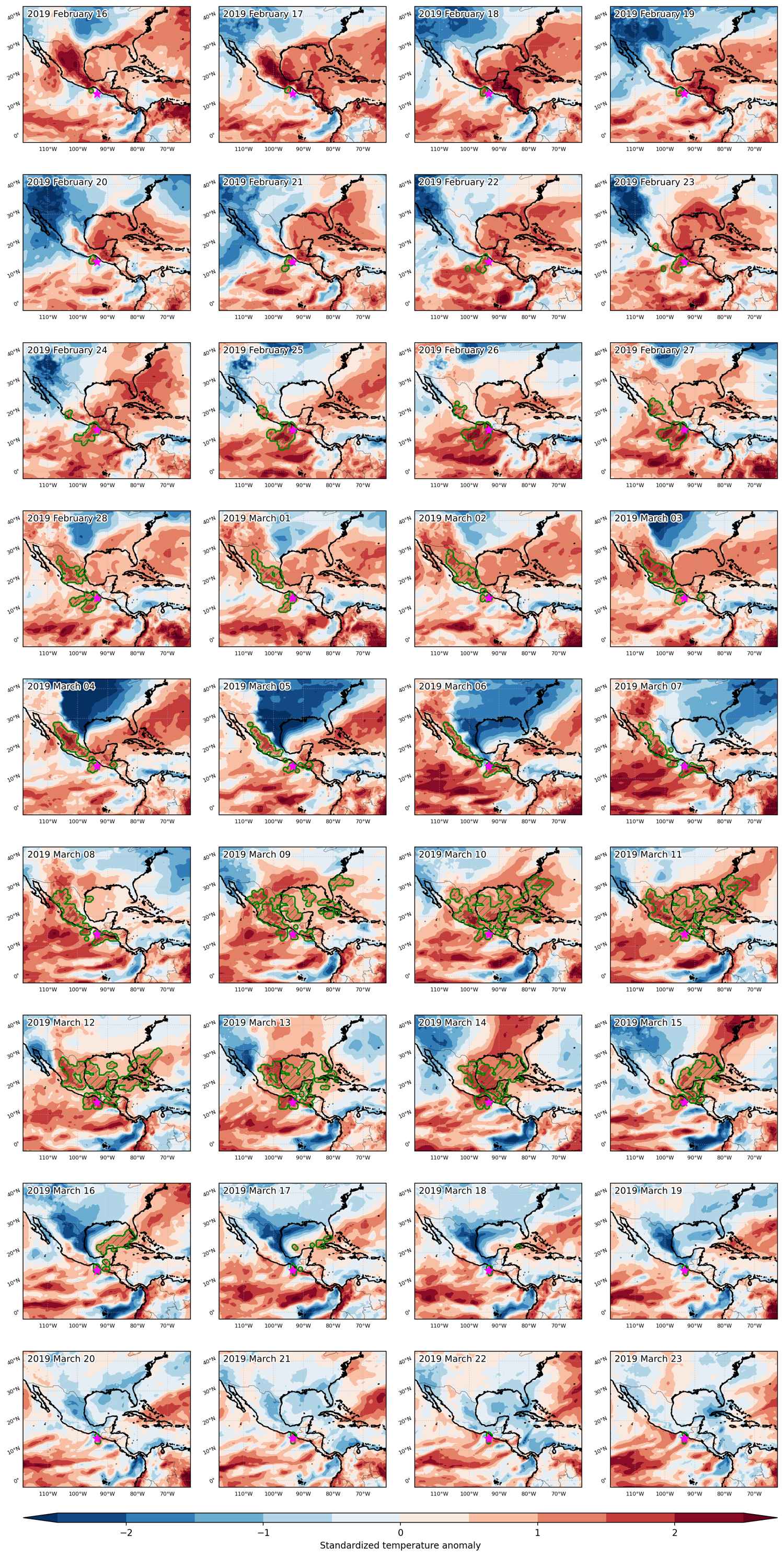
Fig. 3: Maps illustrating the evolution of standardized temperature anomalies during the event.

Event ID: Heat_wave_2019-Feb-16_to_2019-Mar-23_266.5_14.0

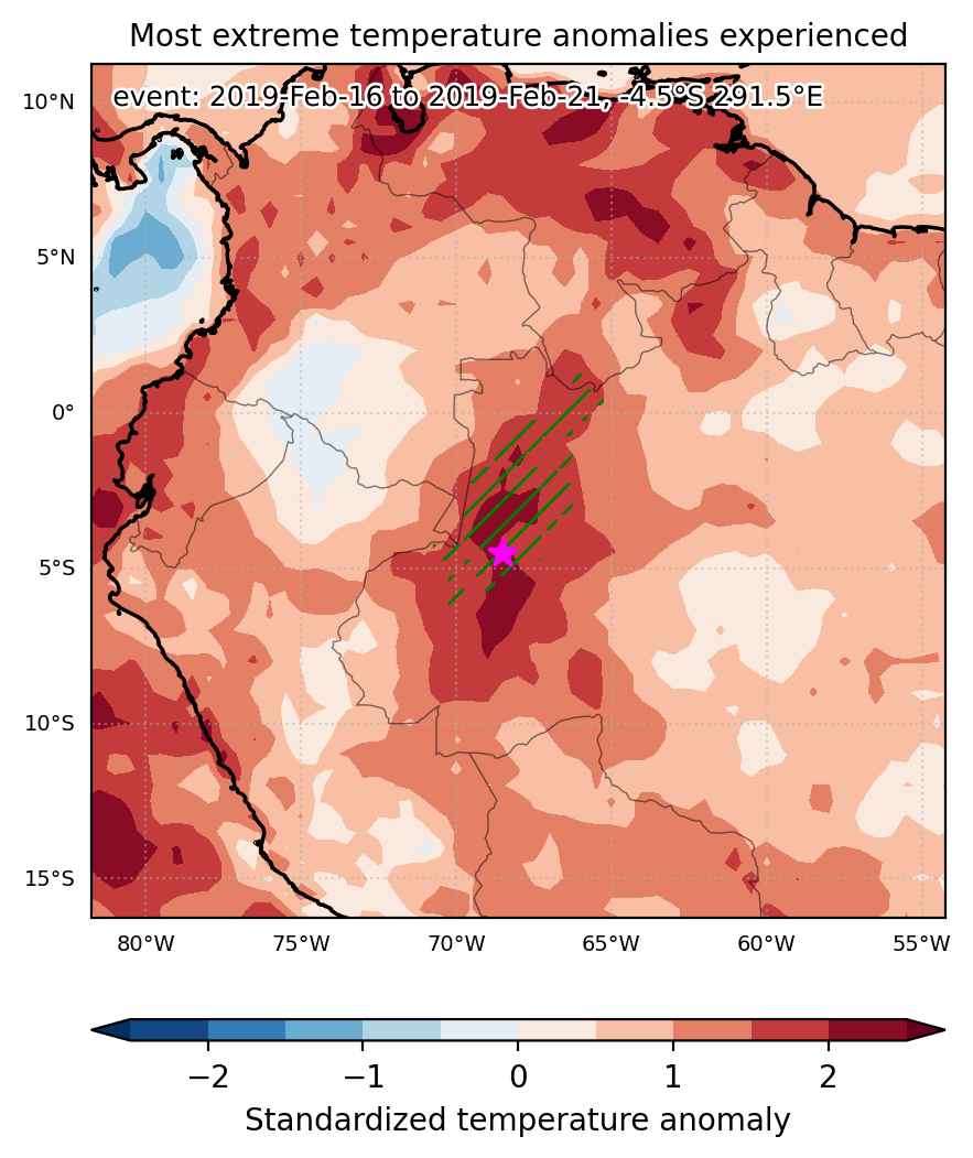
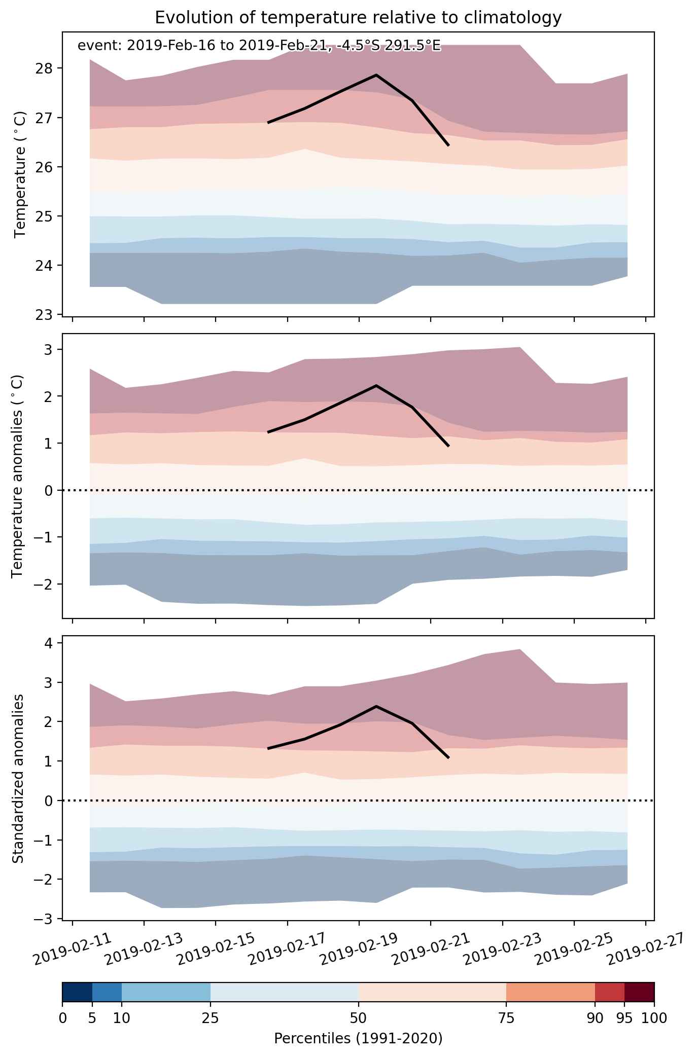
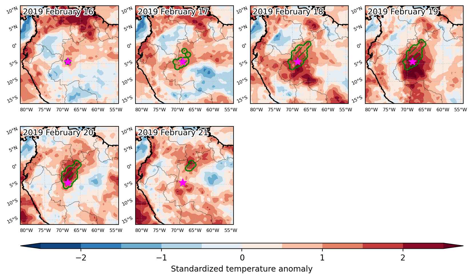
Heat wave occuring from February 16 2019 to February 21 2019 at -4.5°S 291.5°E

Download data: JSON

Event type: Heat wave

Countries affected (identified with ArcGIS Online; provided only for geographical reference):

  • Brazil
  • Venezuela

Duration: 6 days

Time span: February 16 2019 to February 21 2019

Statistics over entire affected area:

  • Mean temperature anomaly: 1.9 °C
  • Mean temperature: 27.7 °C
  • Maximum temperature anomaly: 2.8 °C
  • Maximum temperature: 29.1 °C

Event center: -4.5°S 291.5°E

Area affected: 178996 km$^2$


Fig. 1: Map of most extreme temperature anomalies (standardized) experienced during the event. The purple star indicates the center of the extreme event. Green hatching illustrates all areas under the effect of extremes at some time during the event.


Fig. 2: Evolution of temperature at the center of the event. The climatological percentile distribution is illustrated with color shadings.


Fig. 3: Maps illustrating the evolution of standardized temperature anomalies during the event.

Event ID: Heat_wave_2019-Feb-16_to_2019-Feb-21_291.5_-4.5

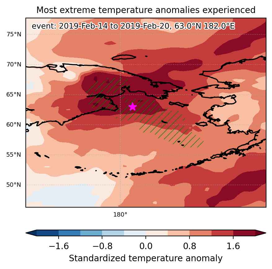
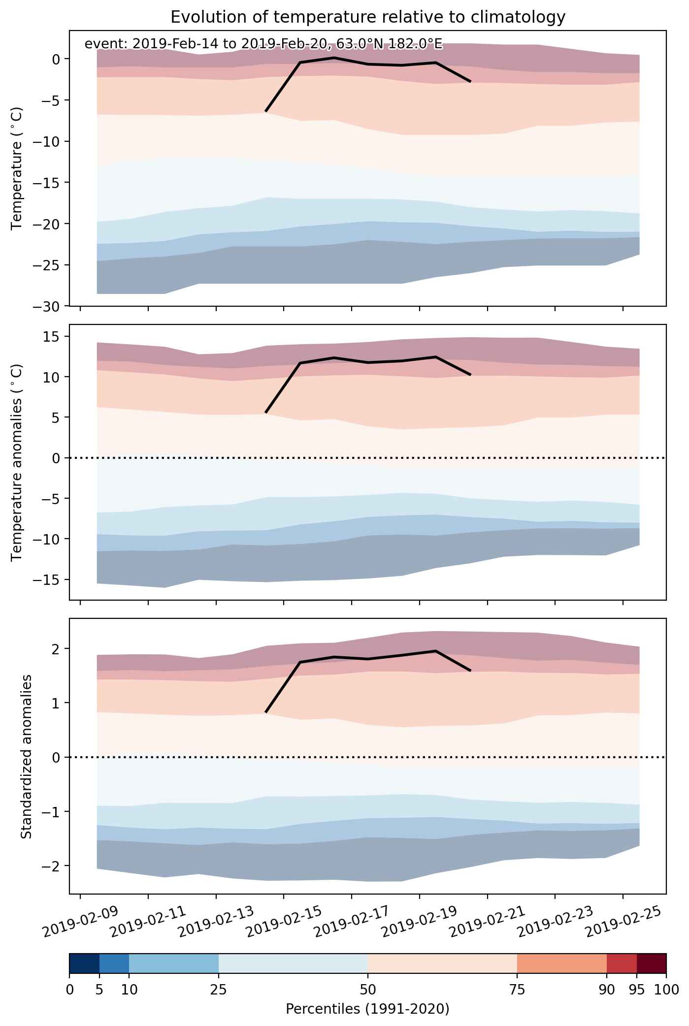
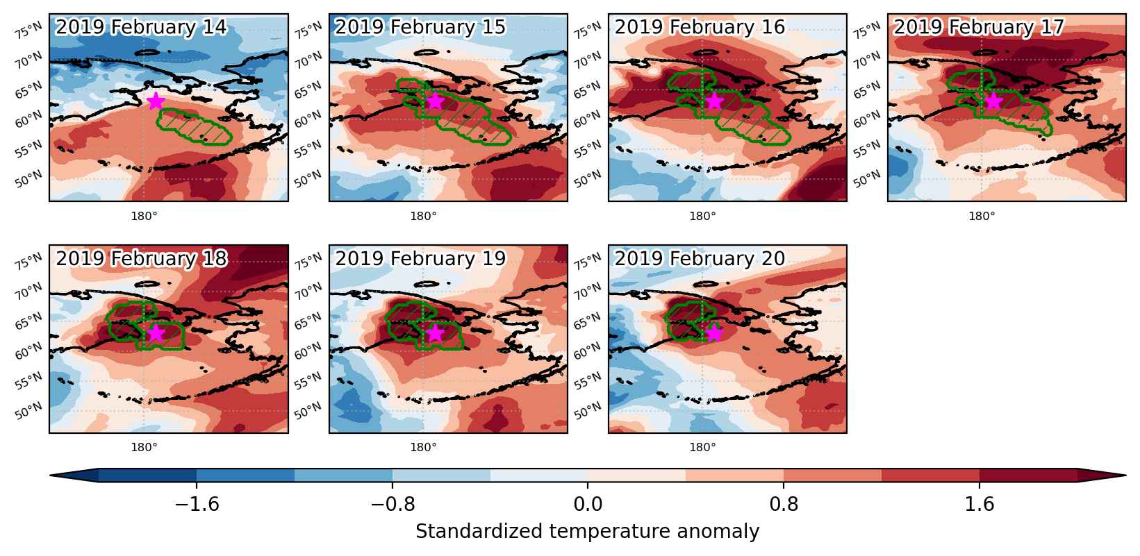
Heat wave occuring from February 14 2019 to February 20 2019 at 63.0°N 182.0°E

Download data: JSON

Event type: Heat wave

Countries affected (identified with ArcGIS Online; provided only for geographical reference):

  • Russian Federation
  • United States

Duration: 7 days

Time span: February 14 2019 to February 20 2019

Statistics over entire affected area:

  • Mean temperature anomaly: 10.8 °C
  • Mean temperature: -1.4 °C
  • Maximum temperature anomaly: 19.0 °C
  • Maximum temperature: 4.0 °C

Event center: 63.0°N 182.0°E

Area affected: 467407 km$^2$


Fig. 1: Map of most extreme temperature anomalies (standardized) experienced during the event. The purple star indicates the center of the extreme event. Green hatching illustrates all areas under the effect of extremes at some time during the event.


Fig. 2: Evolution of temperature at the center of the event. The climatological percentile distribution is illustrated with color shadings.


Fig. 3: Maps illustrating the evolution of standardized temperature anomalies during the event.

Event ID: Heat_wave_2019-Feb-14_to_2019-Feb-20_182.0_63.0