Heat wave occuring from September 21 2018 to October 02 2018 at -15.0°S 185.5°E

Download data: JSON

Event type: Heat wave

Countries affected (identified with ArcGIS Online; provided only for geographical reference):

  • Samoa

Duration: 12 days

Time span: September 21 2018 to October 02 2018

Statistics over entire affected area:

  • Mean temperature anomaly: 1.0 °C
  • Mean temperature: 27.5 °C
  • Maximum temperature anomaly: 1.7 °C
  • Maximum temperature: 28.3 °C

Event center: -15.0°S 185.5°E

Area affected: 421066 km$^2$
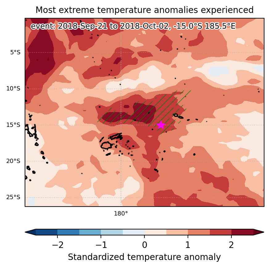

Fig. 1: Map of most extreme temperature anomalies (standardized) experienced during the event. The purple star indicates the center of the extreme event. Green hatching illustrates all areas under the effect of extremes at some time during the event.
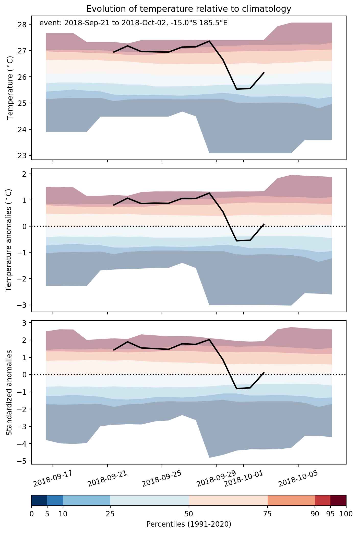


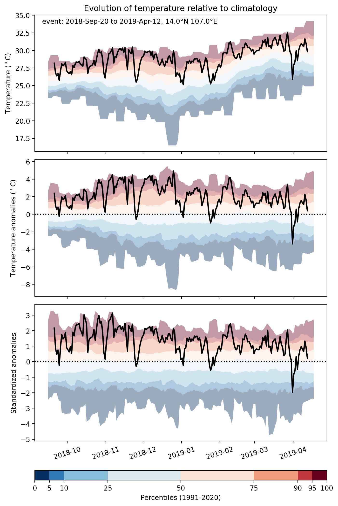
Fig. 2: Evolution of temperature at the center of the event. The climatological percentile distribution is illustrated with color shadings.
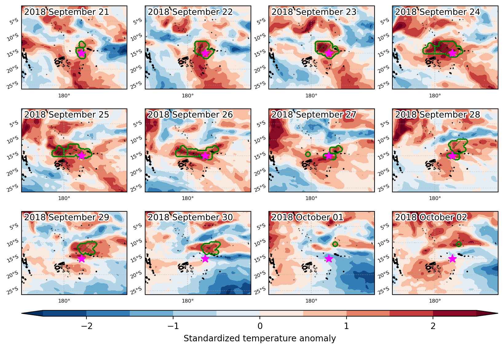


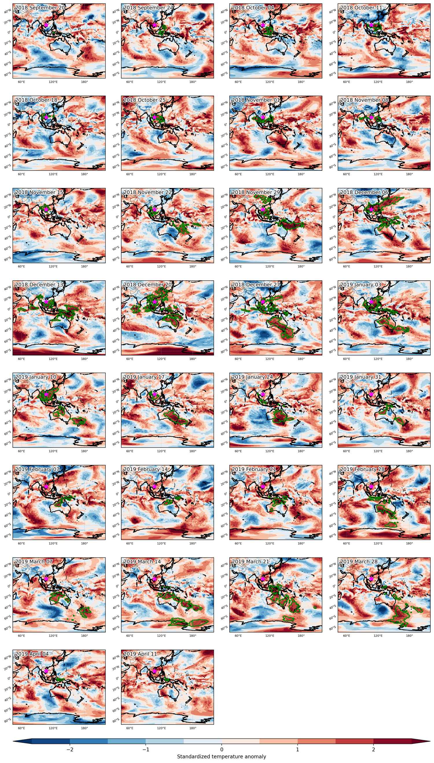
Fig. 3: Maps illustrating the evolution of standardized temperature anomalies during the event.

Event ID: Heat_wave_2018-Sep-21_to_2018-Oct-02_185.5_-15.0
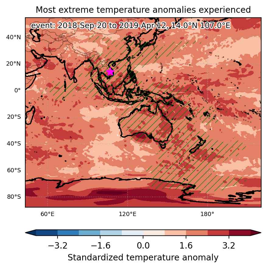
Heat wave occuring from September 20 2018 to April 12 2019 at 14.0°N 107.0°E

Download data: JSON

Event type: Heat wave

Countries affected (identified with ArcGIS Online; provided only for geographical reference):

  • Antarctica
  • Australia
  • Bangladesh
  • Brunei Darussalam
  • Cambodia
  • China
  • Fiji
  • India
  • Indonesia
  • Japan
  • Laos
  • Malaysia
  • Mongolia
  • Myanmar
  • New Caledonia
  • New Zealand
  • Papua New Guinea
  • Philippines
  • Samoa
  • Solomon Islands
  • South Korea
  • Thailand
  • Timor-Leste
  • Vanuatu
  • Vietnam

Duration: 205 days

Time span: September 20 2018 to April 12 2019

Statistics over entire affected area:

  • Mean temperature anomaly: 3.0 °C
  • Mean temperature: 23.1 °C
  • Maximum temperature anomaly: 18.0 °C
  • Maximum temperature: 41.8 °C

Event center: 14.0°N 107.0°E

Area affected: 65225544 km$^2$


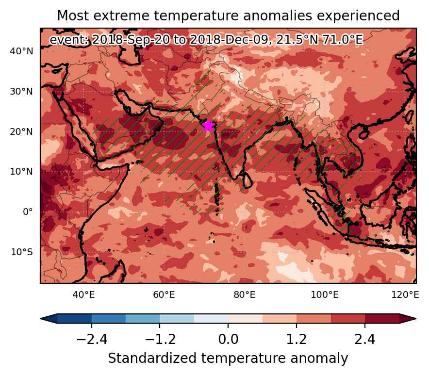
Fig. 1: Map of most extreme temperature anomalies (standardized) experienced during the event. The purple star indicates the center of the extreme event. Green hatching illustrates all areas under the effect of extremes at some time during the event.


Fig. 2: Evolution of temperature at the center of the event. The climatological percentile distribution is illustrated with color shadings.


Fig. 3: Maps illustrating the evolution of standardized temperature anomalies during the event.

Event ID: Heat_wave_2018-Sep-20_to_2019-Apr-12_107.0_14.0

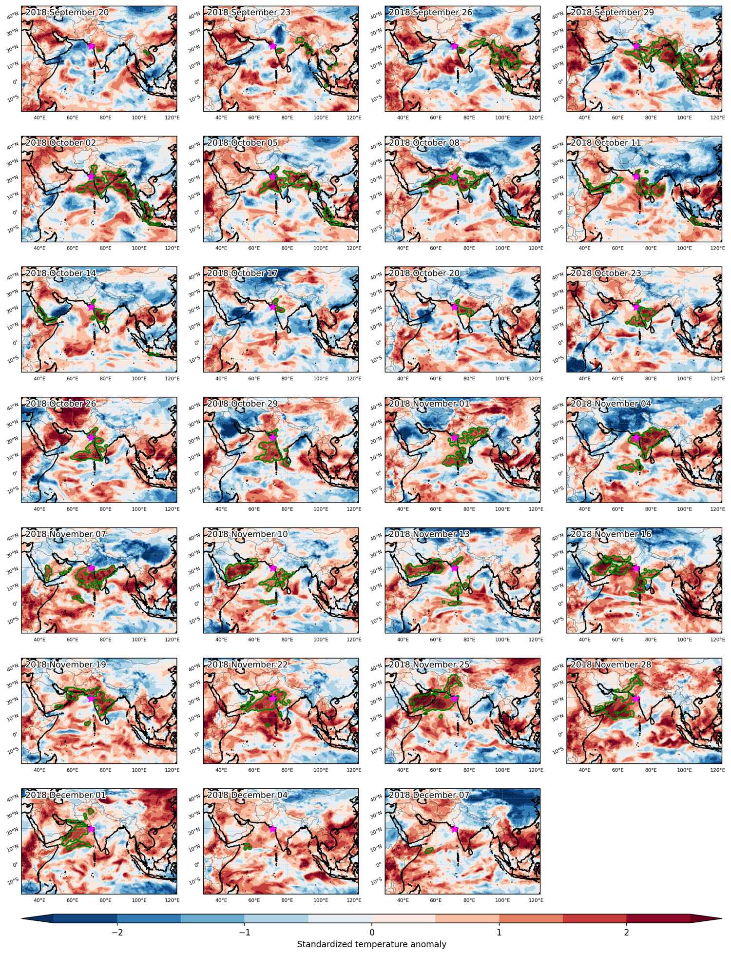
Heat wave occuring from September 20 2018 to December 09 2018 at 21.5°N 71.0°E

Download data: JSON

Event type: Heat wave

Countries affected (identified with ArcGIS Online; provided only for geographical reference):

  • Afghanistan
  • Bangladesh
  • Cambodia
  • India
  • Indonesia
  • Iran
  • Laos
  • Malaysia
  • Myanmar
  • Nepal
  • Oman
  • Pakistan
  • Qatar
  • Saudi Arabia
  • Sri Lanka
  • Thailand
  • United Arab Emirates
  • Vietnam
  • Yemen

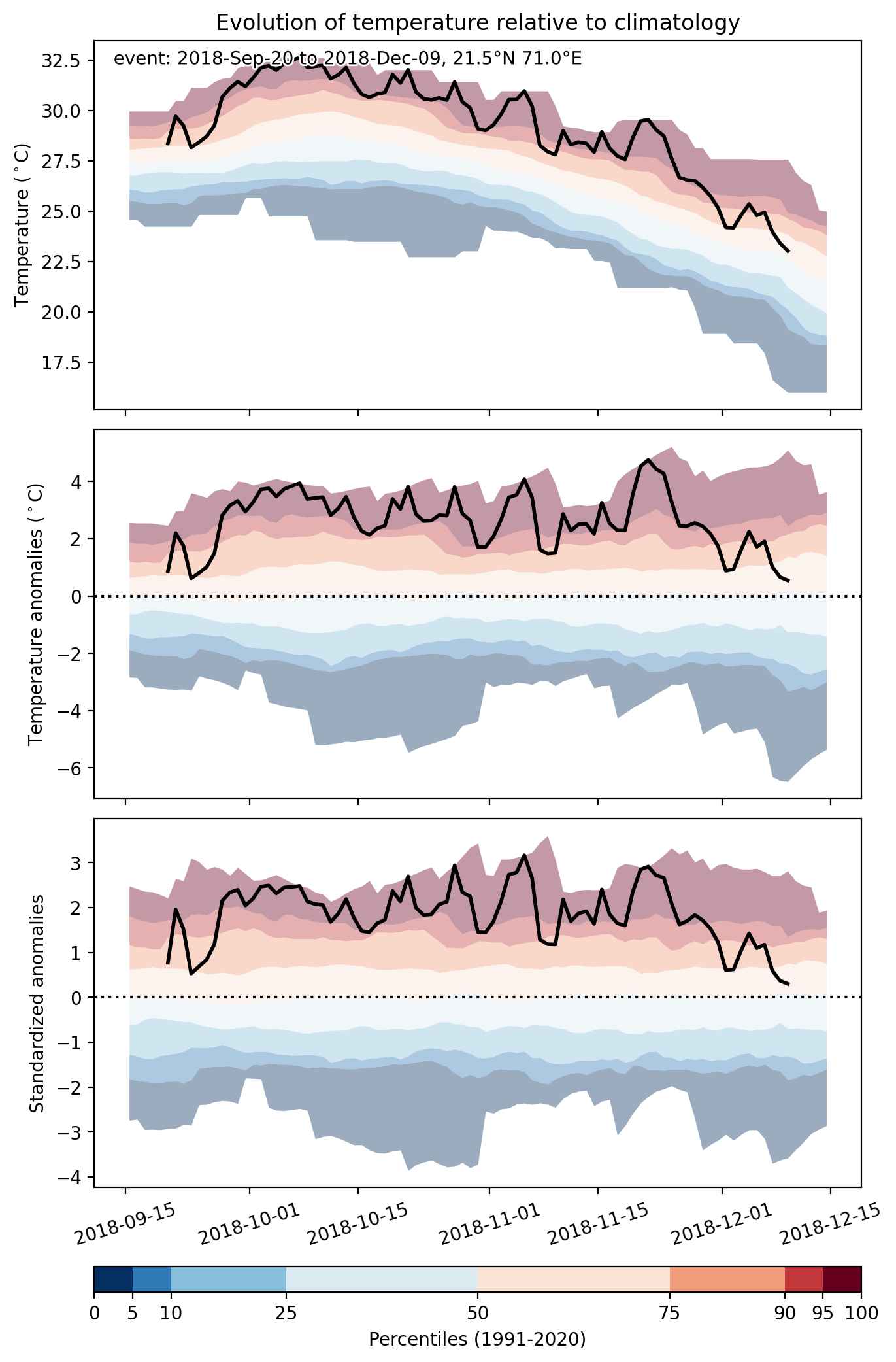
Duration: 81 days

Time span: September 20 2018 to December 09 2018

Statistics over entire affected area:

  • Mean temperature anomaly: 1.9 °C
  • Mean temperature: 27.6 °C
  • Maximum temperature anomaly: 7.9 °C
  • Maximum temperature: 34.6 °C

Event center: 21.5°N 71.0°E

Area affected: 12267725 km$^2$


Fig. 1: Map of most extreme temperature anomalies (standardized) experienced during the event. The purple star indicates the center of the extreme event. Green hatching illustrates all areas under the effect of extremes at some time during the event.


Fig. 2: Evolution of temperature at the center of the event. The climatological percentile distribution is illustrated with color shadings.


Fig. 3: Maps illustrating the evolution of standardized temperature anomalies during the event.

Event ID: Heat_wave_2018-Sep-20_to_2018-Dec-09_71.0_21.5

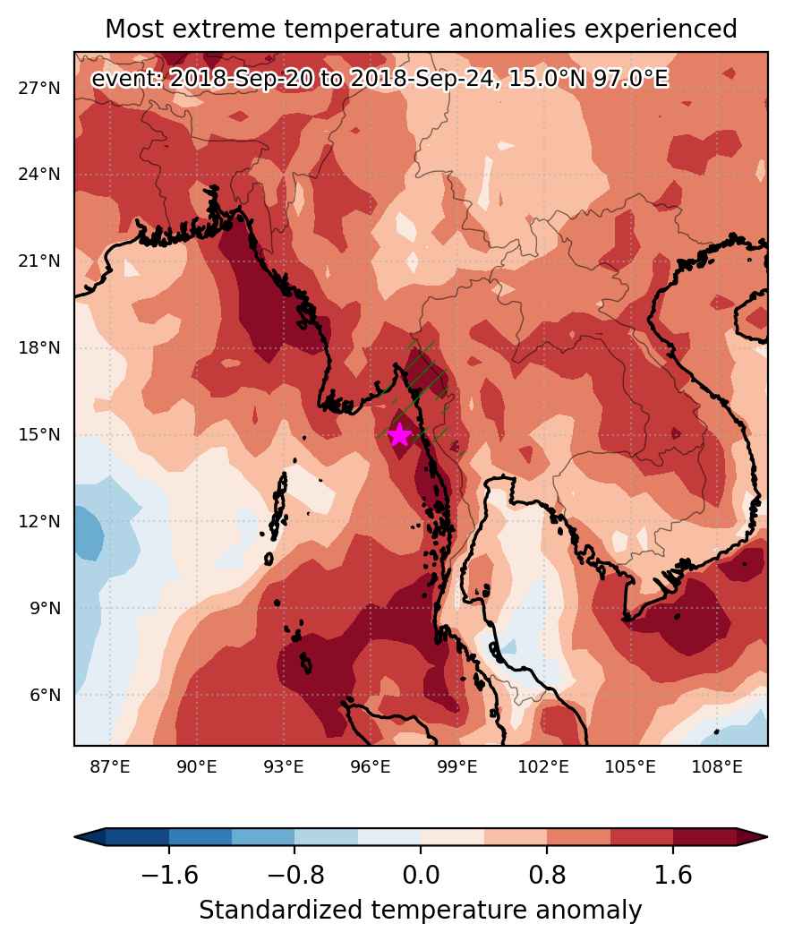
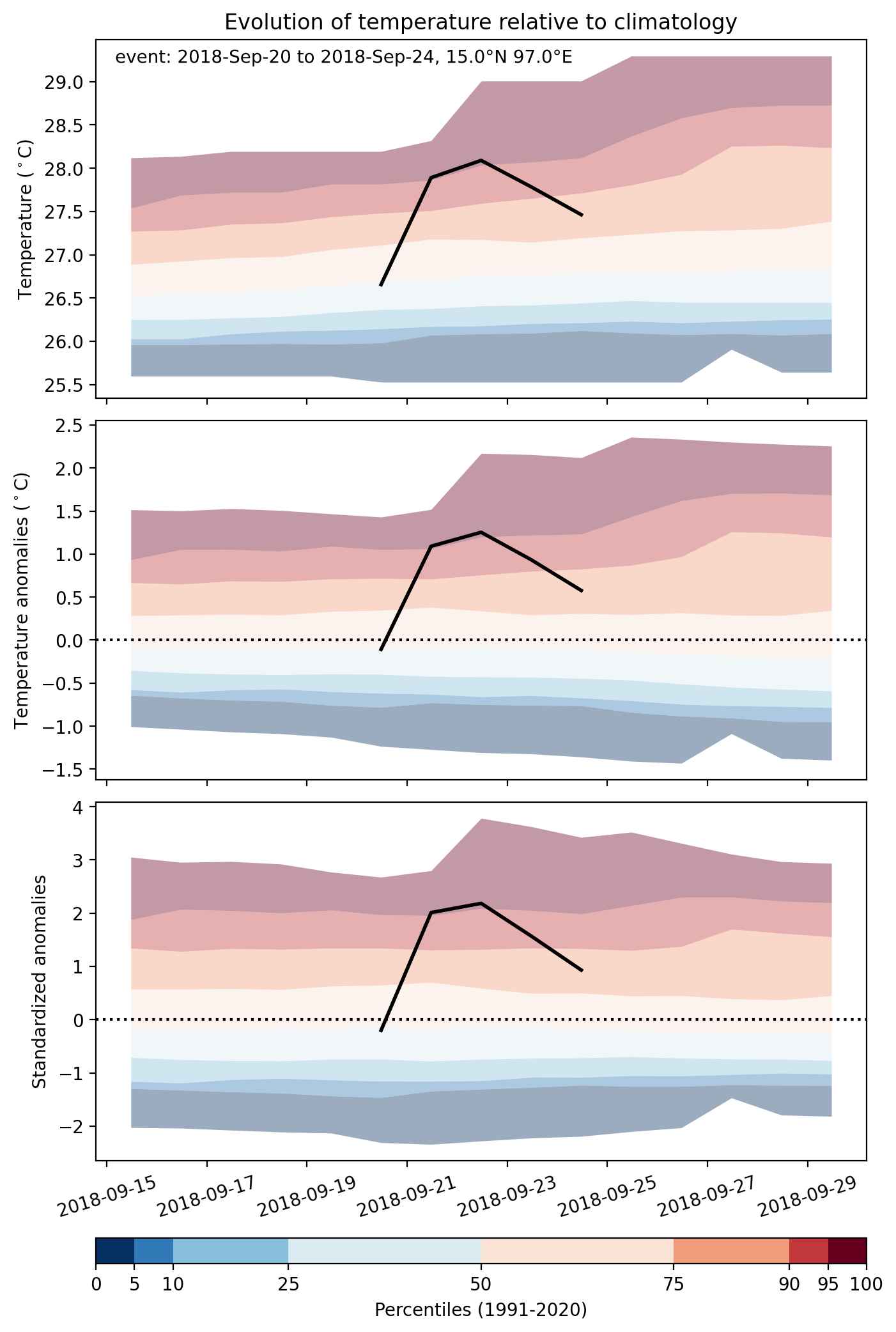
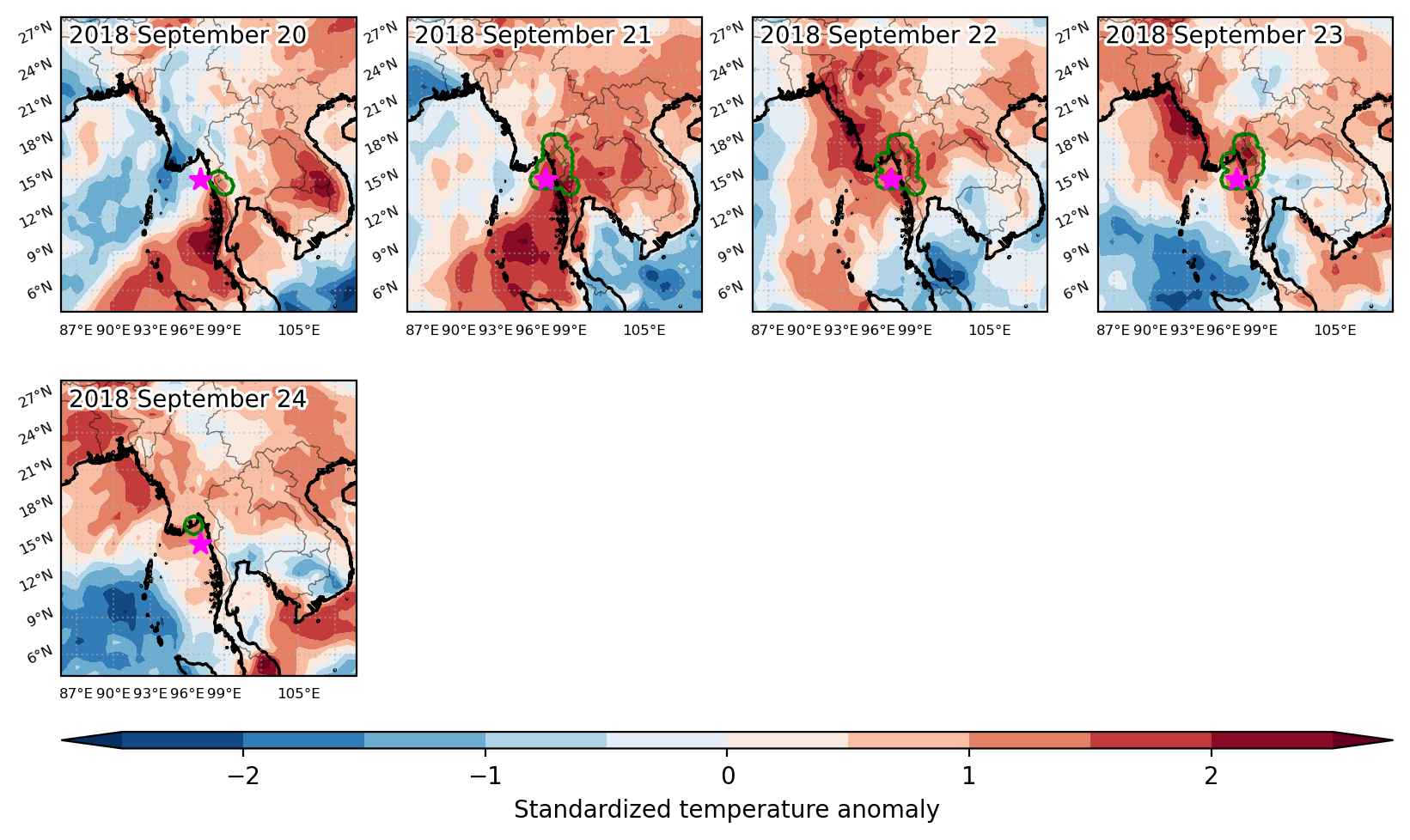
Heat wave occuring from September 20 2018 to September 24 2018 at 15.0°N 97.0°E

Download data: JSON

Event type: Heat wave

Countries affected (identified with ArcGIS Online; provided only for geographical reference):

  • Myanmar
  • Thailand

Duration: 5 days

Time span: September 20 2018 to September 24 2018

Statistics over entire affected area:

  • Mean temperature anomaly: 1.2 °C
  • Mean temperature: 27.4 °C
  • Maximum temperature anomaly: 2.0 °C
  • Maximum temperature: 29.5 °C

Event center: 15.0°N 97.0°E

Area affected: 62312 km$^2$


Fig. 1: Map of most extreme temperature anomalies (standardized) experienced during the event. The purple star indicates the center of the extreme event. Green hatching illustrates all areas under the effect of extremes at some time during the event.


Fig. 2: Evolution of temperature at the center of the event. The climatological percentile distribution is illustrated with color shadings.


Fig. 3: Maps illustrating the evolution of standardized temperature anomalies during the event.

Event ID: Heat_wave_2018-Sep-20_to_2018-Sep-24_97.0_15.0

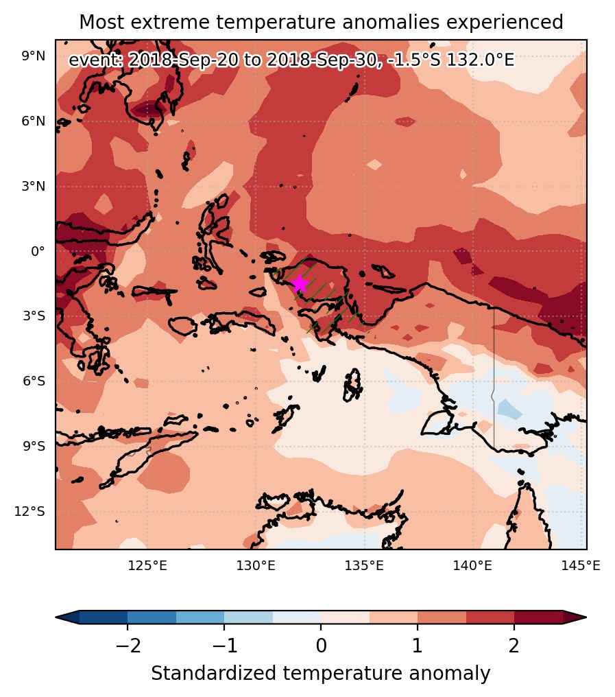
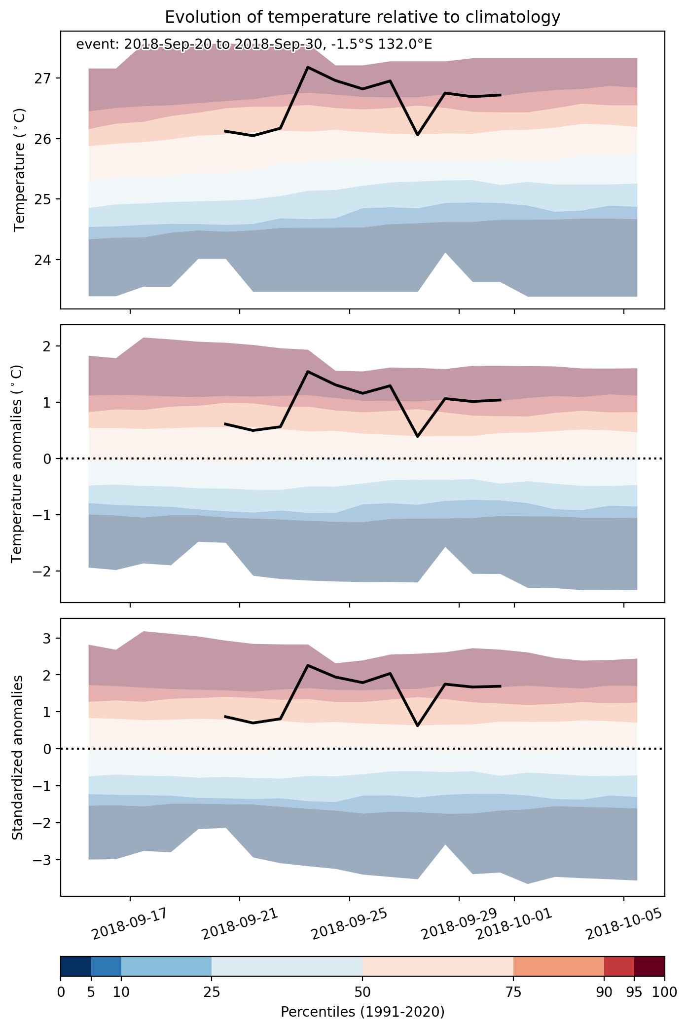
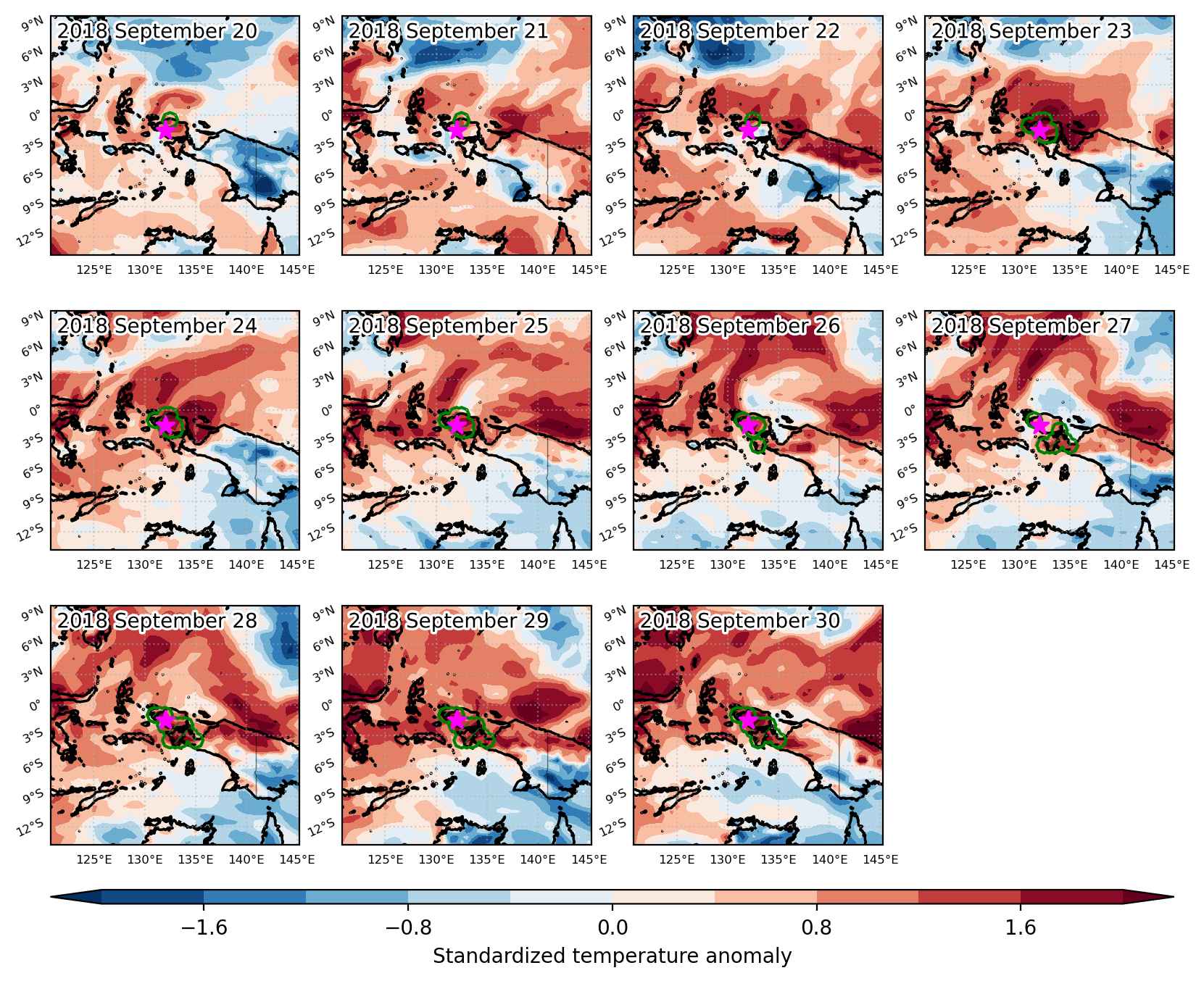
Heat wave occuring from September 20 2018 to September 30 2018 at -1.5°S 132.0°E

Download data: JSON

Event type: Heat wave

Countries affected (identified with ArcGIS Online; provided only for geographical reference):

  • Indonesia

Duration: 11 days

Time span: September 20 2018 to September 30 2018

Statistics over entire affected area:

  • Mean temperature anomaly: 1.2 °C
  • Mean temperature: 26.7 °C
  • Maximum temperature anomaly: 1.9 °C
  • Maximum temperature: 28.0 °C

Event center: -1.5°S 132.0°E

Area affected: 71038 km$^2$


Fig. 1: Map of most extreme temperature anomalies (standardized) experienced during the event. The purple star indicates the center of the extreme event. Green hatching illustrates all areas under the effect of extremes at some time during the event.


Fig. 2: Evolution of temperature at the center of the event. The climatological percentile distribution is illustrated with color shadings.


Fig. 3: Maps illustrating the evolution of standardized temperature anomalies during the event.

Event ID: Heat_wave_2018-Sep-20_to_2018-Sep-30_132.0_-1.5

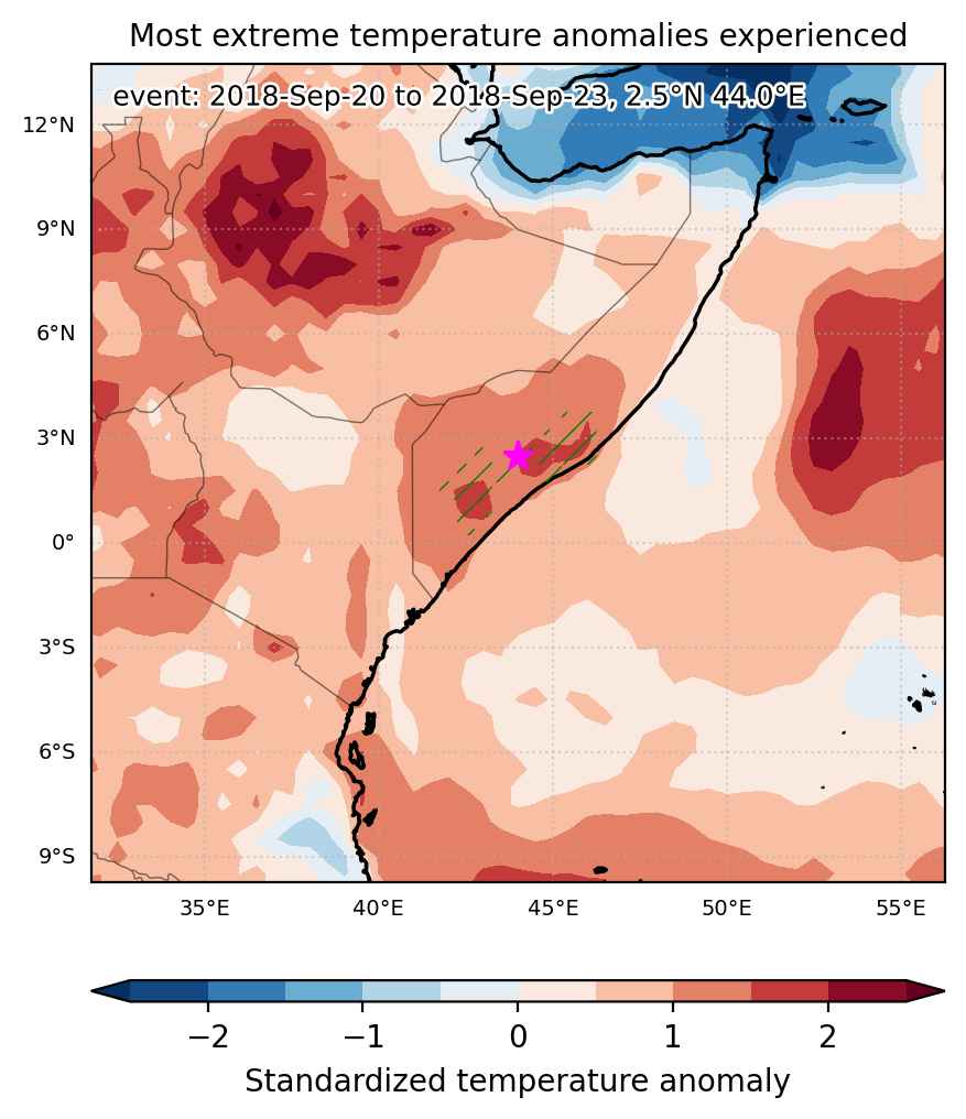
Heat wave occuring from September 20 2018 to September 23 2018 at 2.5°N 44.0°E

Download data: JSON

Event type: Heat wave

Countries affected (identified with ArcGIS Online; provided only for geographical reference):

  • Somalia

Duration: 4 days

Time span: September 20 2018 to September 23 2018

Statistics over entire affected area:

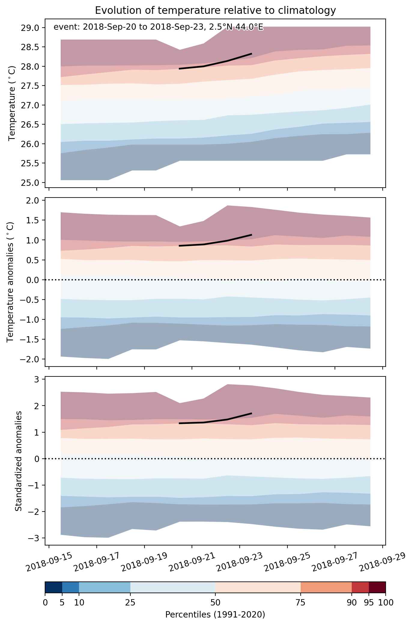
  • Mean temperature anomaly: 0.9 °C
  • Mean temperature: 28.0 °C
  • Maximum temperature anomaly: 1.3 °C
  • Maximum temperature: 29.4 °C

Event center: 2.5°N 44.0°E

Area affected: 64858 km$^2$


Fig. 1: Map of most extreme temperature anomalies (standardized) experienced during the event. The purple star indicates the center of the extreme event. Green hatching illustrates all areas under the effect of extremes at some time during the event.


Fig. 2: Evolution of temperature at the center of the event. The climatological percentile distribution is illustrated with color shadings.


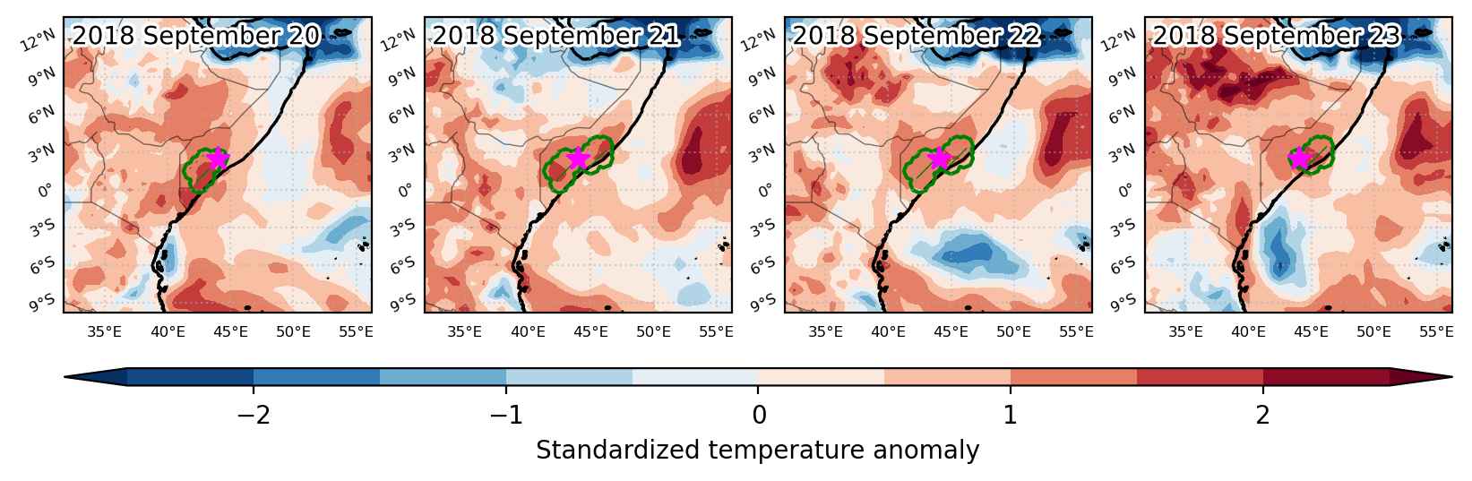
Fig. 3: Maps illustrating the evolution of standardized temperature anomalies during the event.

Event ID: Heat_wave_2018-Sep-20_to_2018-Sep-23_44.0_2.5

Heat wave occuring from September 20 2018 to September 28 2018 at -14.5°S 112.5°E

Download data: JSON

Event type: Heat wave

Countries affected (identified with ArcGIS Online; provided only for geographical reference):

  • Australia

Duration: 9 days

Time span: September 20 2018 to September 28 2018

Statistics over entire affected area:

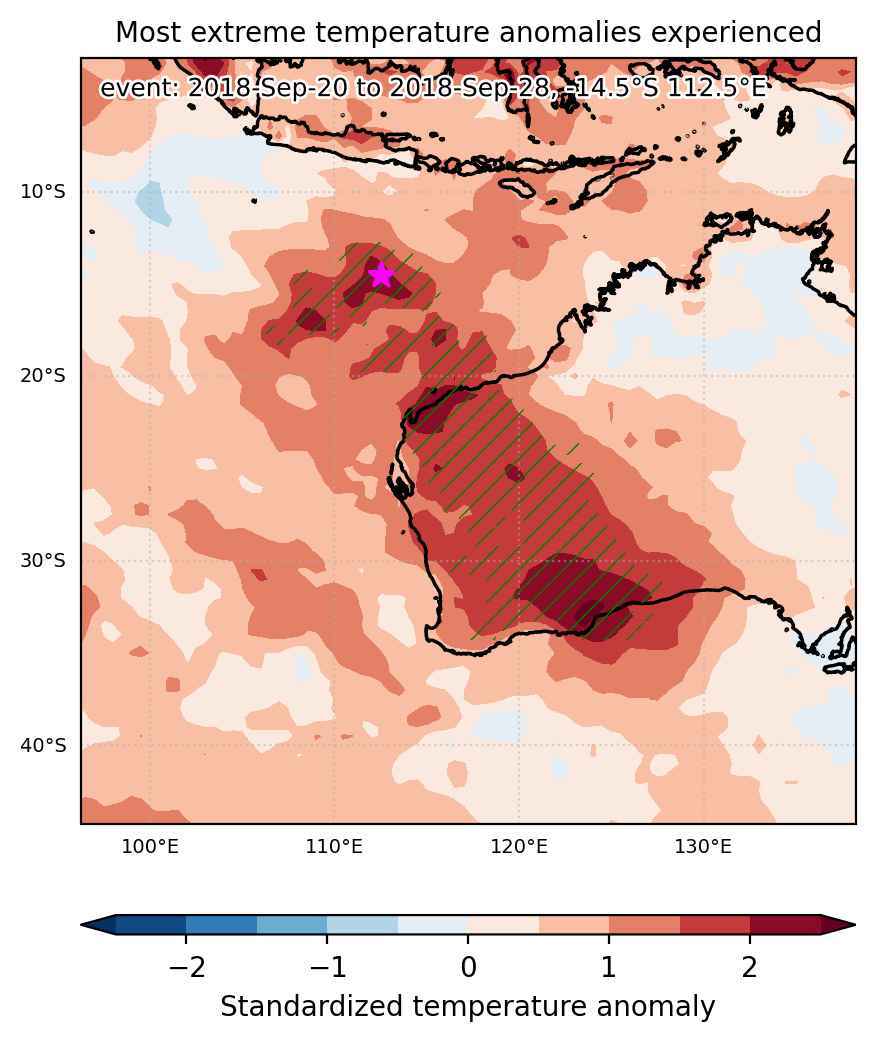
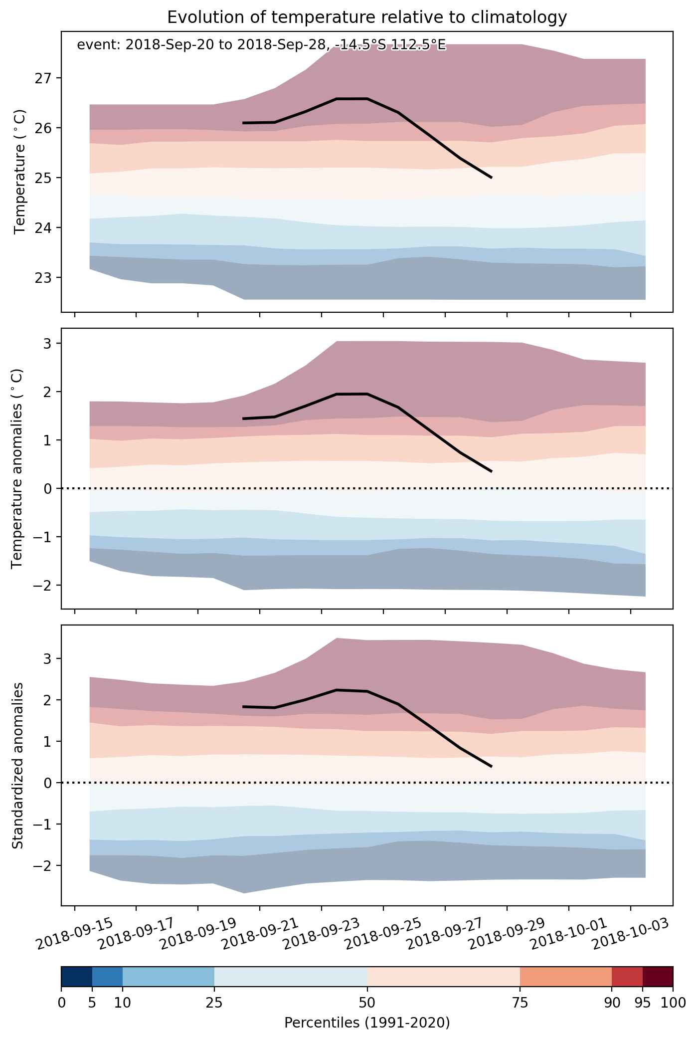
  • Mean temperature anomaly: 4.2 °C
  • Mean temperature: 25.0 °C
  • Maximum temperature anomaly: 10.7 °C
  • Maximum temperature: 30.9 °C

Event center: -14.5°S 112.5°E

Area affected: 1632208 km$^2$


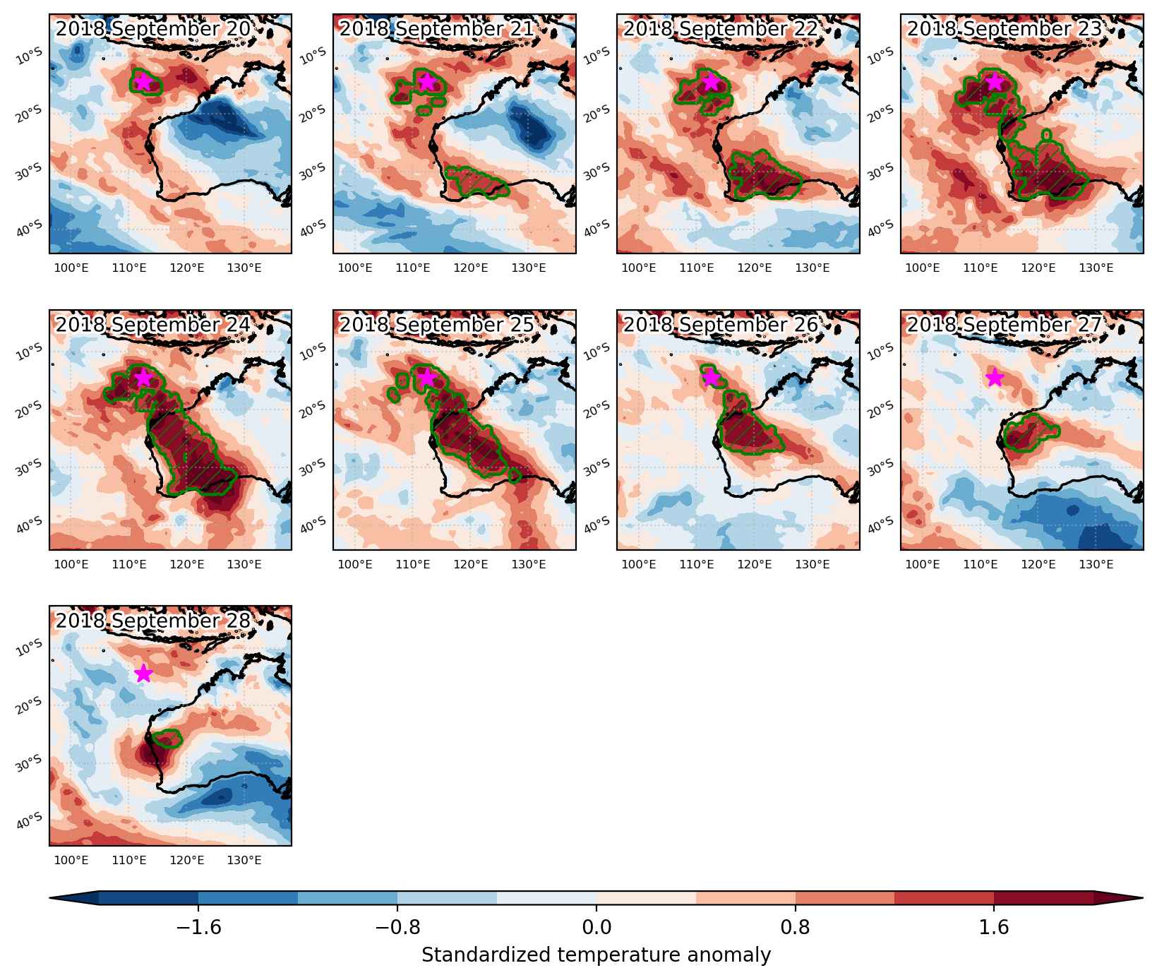
Fig. 1: Map of most extreme temperature anomalies (standardized) experienced during the event. The purple star indicates the center of the extreme event. Green hatching illustrates all areas under the effect of extremes at some time during the event.


Fig. 2: Evolution of temperature at the center of the event. The climatological percentile distribution is illustrated with color shadings.


Fig. 3: Maps illustrating the evolution of standardized temperature anomalies during the event.

Event ID: Heat_wave_2018-Sep-20_to_2018-Sep-28_112.5_-14.5

Cold spell occuring from September 20 2018 to October 04 2018 at 23.5°N 6.0°E

Download data: JSON

Event type: Cold spell

Countries affected (identified with ArcGIS Online; provided only for geographical reference):

  • Algeria
  • Libya

Duration: 15 days

Time span: September 20 2018 to October 04 2018

Statistics over entire affected area:

  • Mean temperature anomaly: -3.9 °C
  • Mean temperature: 24.8 °C
  • Minimum temperature anomaly: -7.8 °C
  • Minimum temperature: 17.0 °C

Event center: 23.5°N 6.0°E

Area affected: 308309 km$^2$


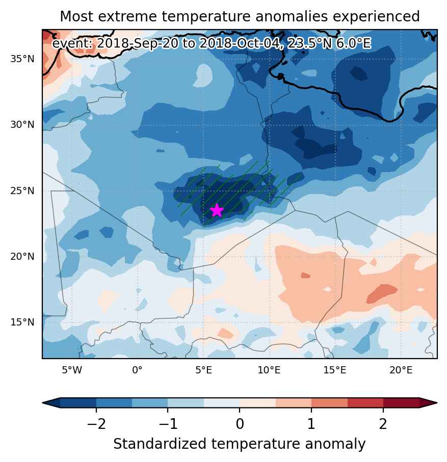
Fig. 1: Map of most extreme temperature anomalies (standardized) experienced during the event. The purple star indicates the center of the extreme event. Green hatching illustrates all areas under the effect of extremes at some time during the event.


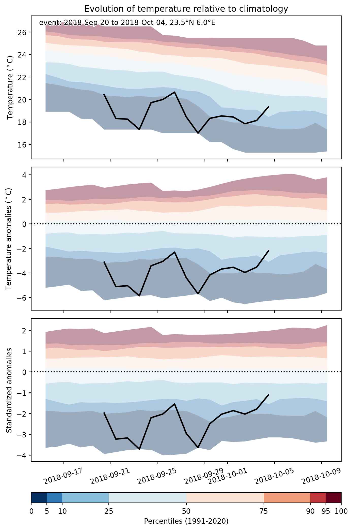
Fig. 2: Evolution of temperature at the center of the event. The climatological percentile distribution is illustrated with color shadings.


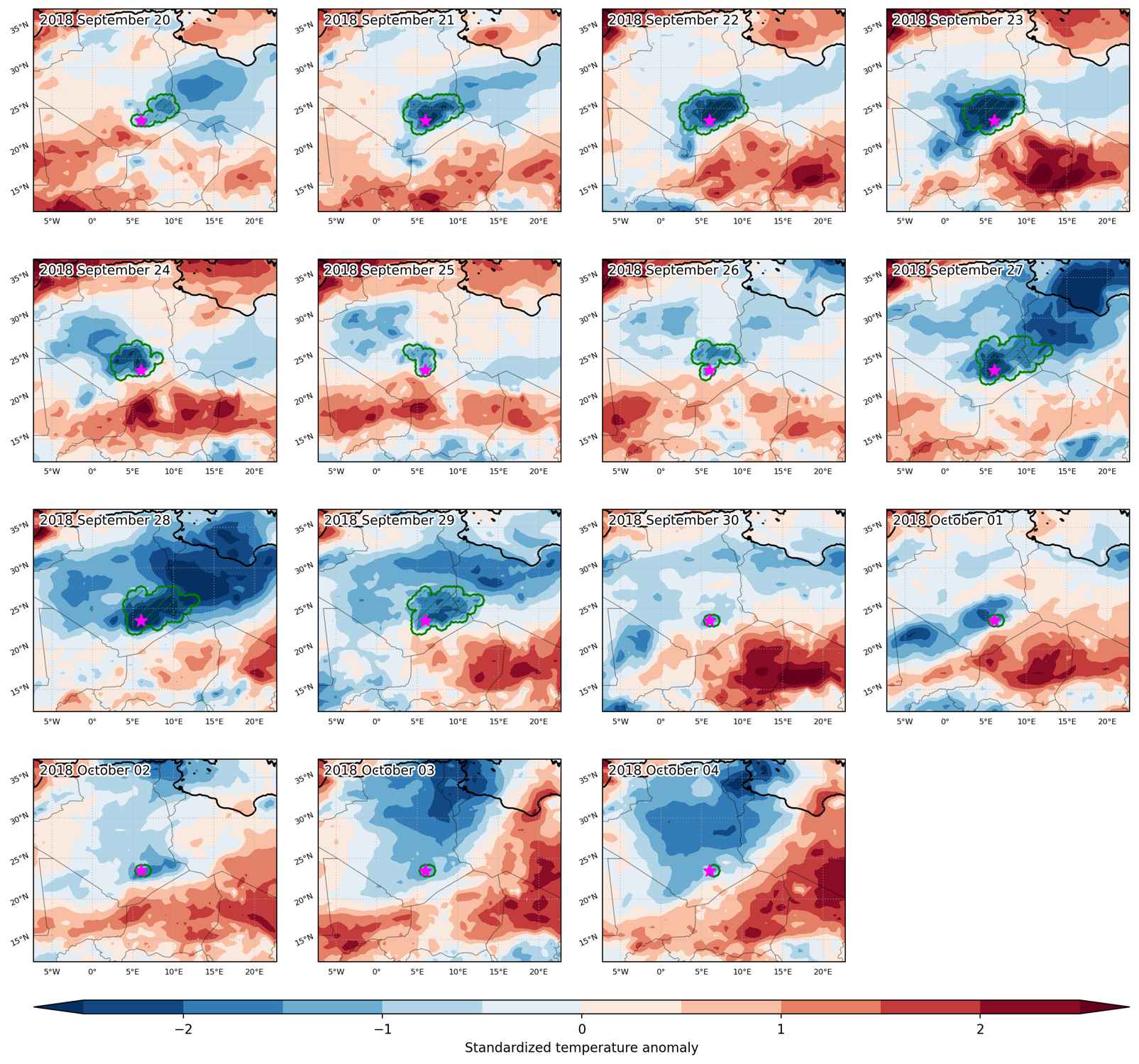
Fig. 3: Maps illustrating the evolution of standardized temperature anomalies during the event.

Event ID: Cold_spell_2018-Sep-20_to_2018-Oct-04_6.0_23.5

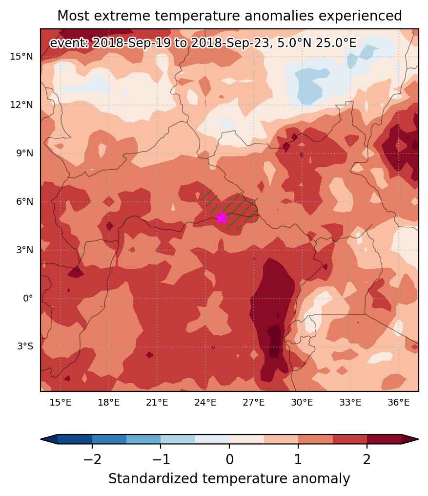
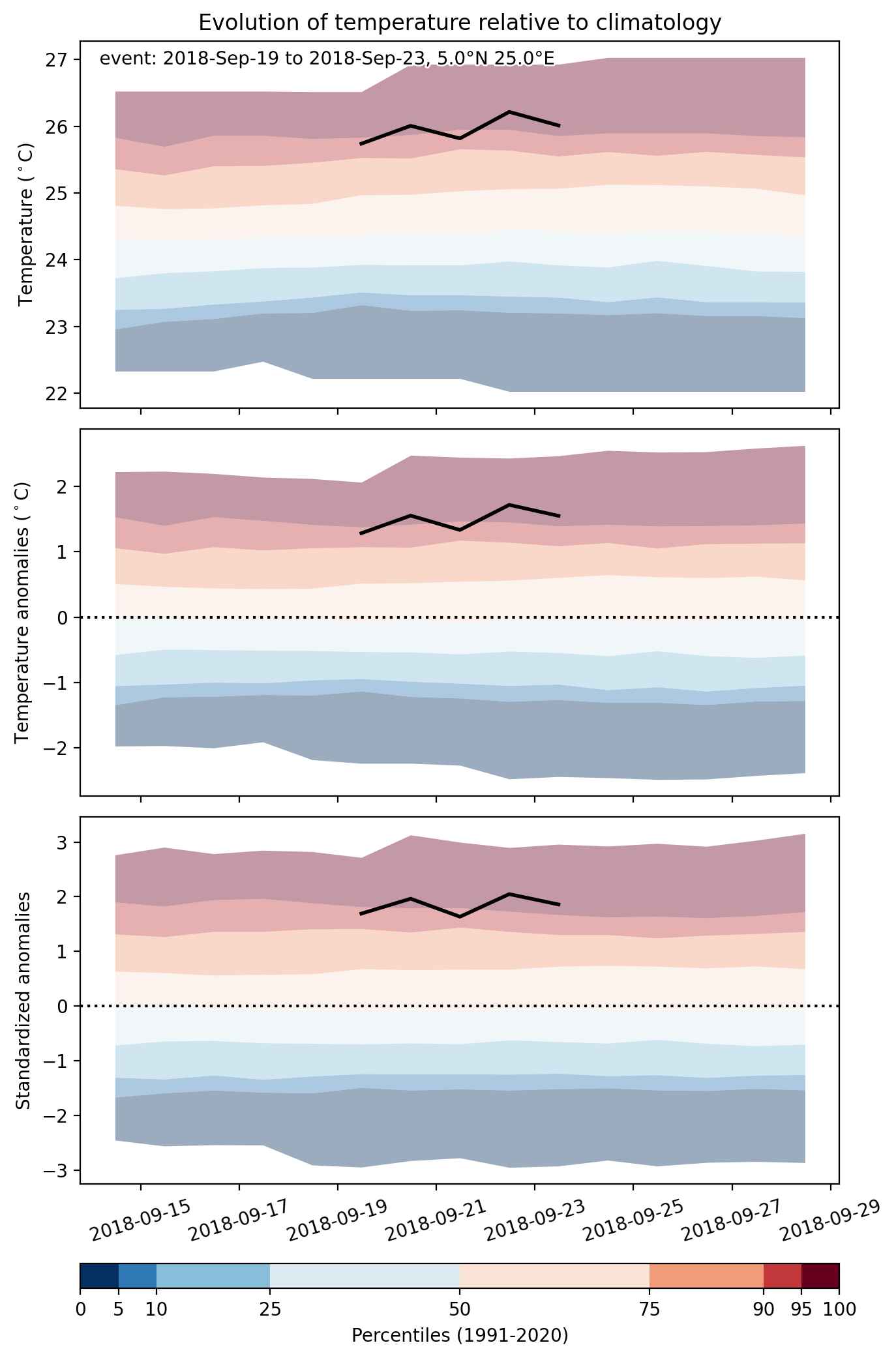
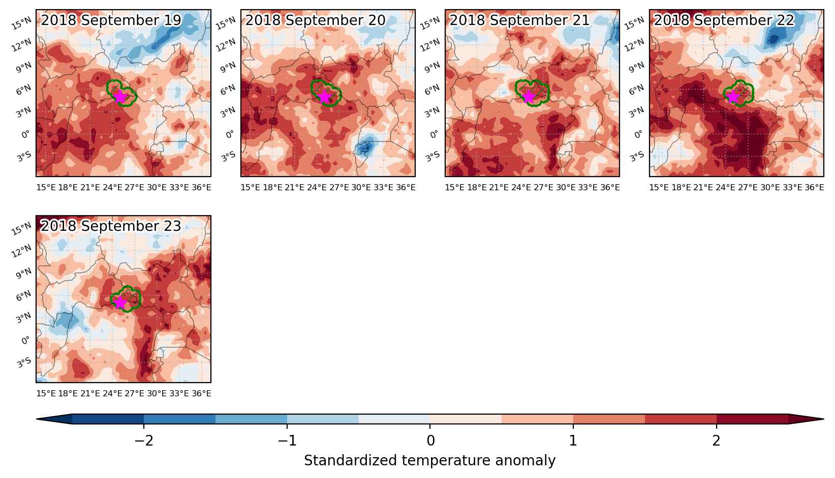
Heat wave occuring from September 19 2018 to September 23 2018 at 5.0°N 25.0°E

Download data: JSON

Event type: Heat wave

Countries affected (identified with ArcGIS Online; provided only for geographical reference):

  • Central African Republic
  • Congo DRC
  • South Sudan

Duration: 5 days

Time span: September 19 2018 to September 23 2018

Statistics over entire affected area:

  • Mean temperature anomaly: 1.3 °C
  • Mean temperature: 25.8 °C
  • Maximum temperature anomaly: 1.7 °C
  • Maximum temperature: 26.3 °C

Event center: 5.0°N 25.0°E

Area affected: 67679 km$^2$


Fig. 1: Map of most extreme temperature anomalies (standardized) experienced during the event. The purple star indicates the center of the extreme event. Green hatching illustrates all areas under the effect of extremes at some time during the event.


Fig. 2: Evolution of temperature at the center of the event. The climatological percentile distribution is illustrated with color shadings.


Fig. 3: Maps illustrating the evolution of standardized temperature anomalies during the event.

Event ID: Heat_wave_2018-Sep-19_to_2018-Sep-23_25.0_5.0

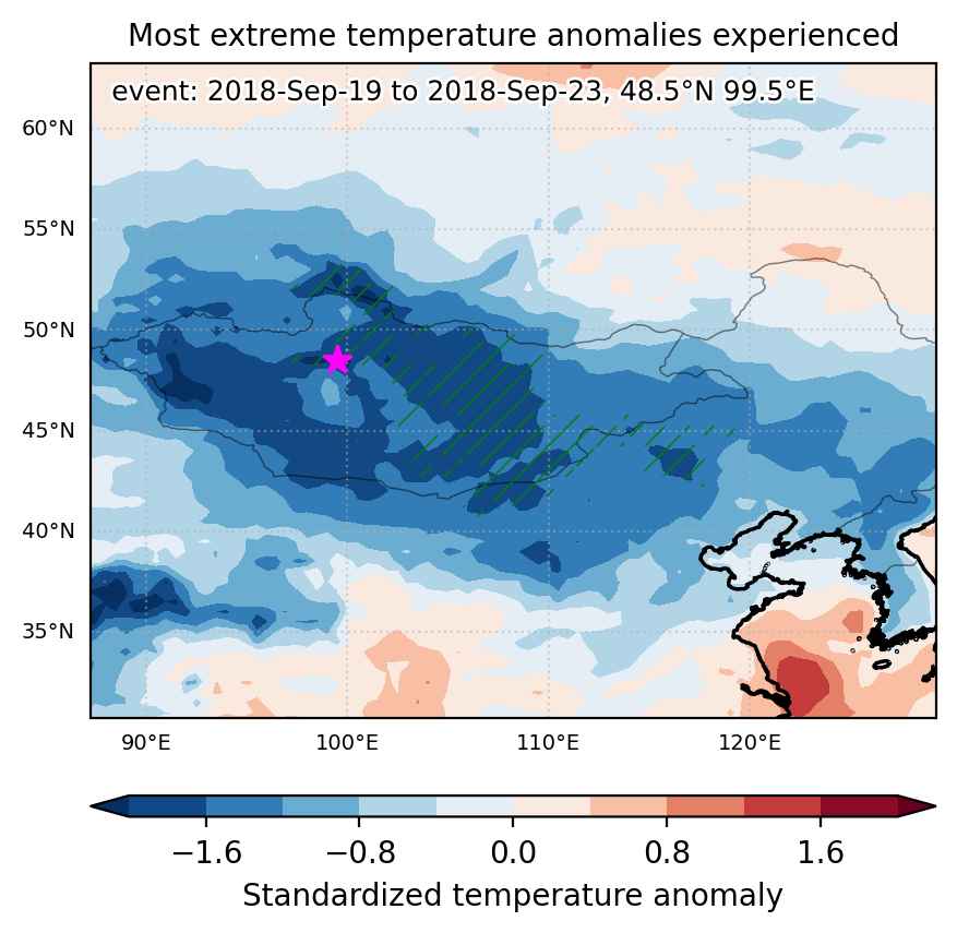
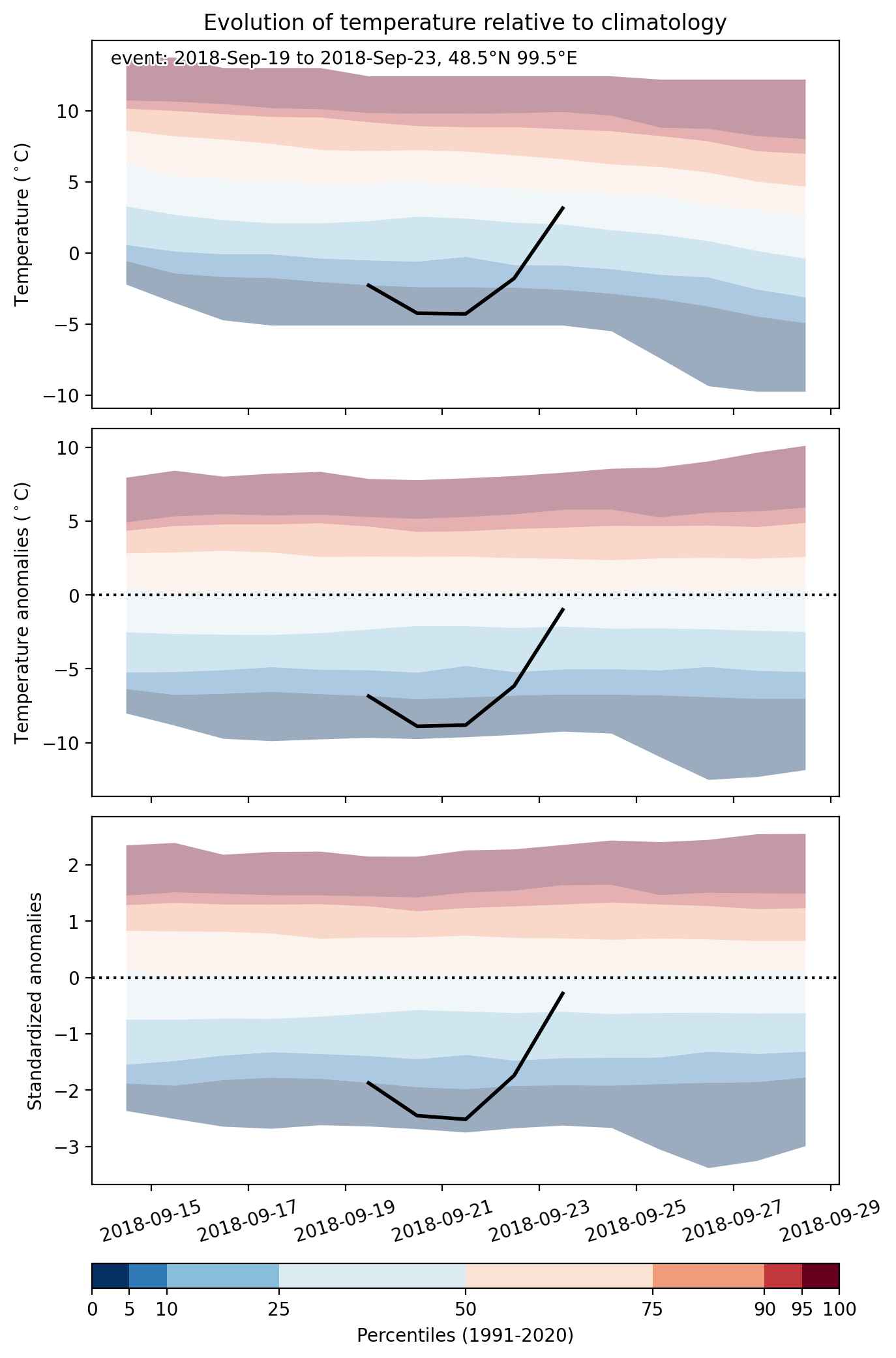
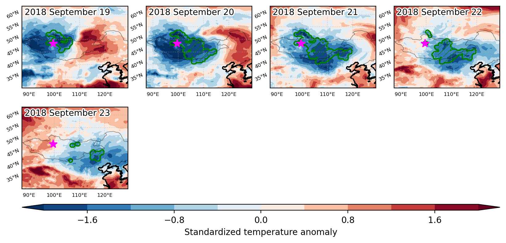
Cold spell occuring from September 19 2018 to September 23 2018 at 48.5°N 99.5°E

Download data: JSON

Event type: Cold spell

Countries affected (identified with ArcGIS Online; provided only for geographical reference):

  • China
  • Mongolia
  • Russian Federation

Duration: 5 days

Time span: September 19 2018 to September 23 2018

Statistics over entire affected area:

  • Mean temperature anomaly: -6.6 °C
  • Mean temperature: 3.6 °C
  • Minimum temperature anomaly: -10.1 °C
  • Minimum temperature: -10.7 °C

Event center: 48.5°N 99.5°E

Area affected: 613801 km$^2$


Fig. 1: Map of most extreme temperature anomalies (standardized) experienced during the event. The purple star indicates the center of the extreme event. Green hatching illustrates all areas under the effect of extremes at some time during the event.


Fig. 2: Evolution of temperature at the center of the event. The climatological percentile distribution is illustrated with color shadings.


Fig. 3: Maps illustrating the evolution of standardized temperature anomalies during the event.

Event ID: Cold_spell_2018-Sep-19_to_2018-Sep-23_99.5_48.5