Heat wave occuring from May 03 2018 to May 10 2018 at 18.0°N 50.5°E

Download data: JSON

Event type: Heat wave

Countries affected (identified with ArcGIS Online; provided only for geographical reference):

  • Oman
  • Saudi Arabia
  • Yemen

Duration: 8 days

Time span: May 03 2018 to May 10 2018

Statistics over entire affected area:

  • Mean temperature anomaly: 2.1 °C
  • Mean temperature: 34.0 °C
  • Maximum temperature anomaly: 3.5 °C
  • Maximum temperature: 37.3 °C

Event center: 18.0°N 50.5°E

Area affected: 281435 km$^2$
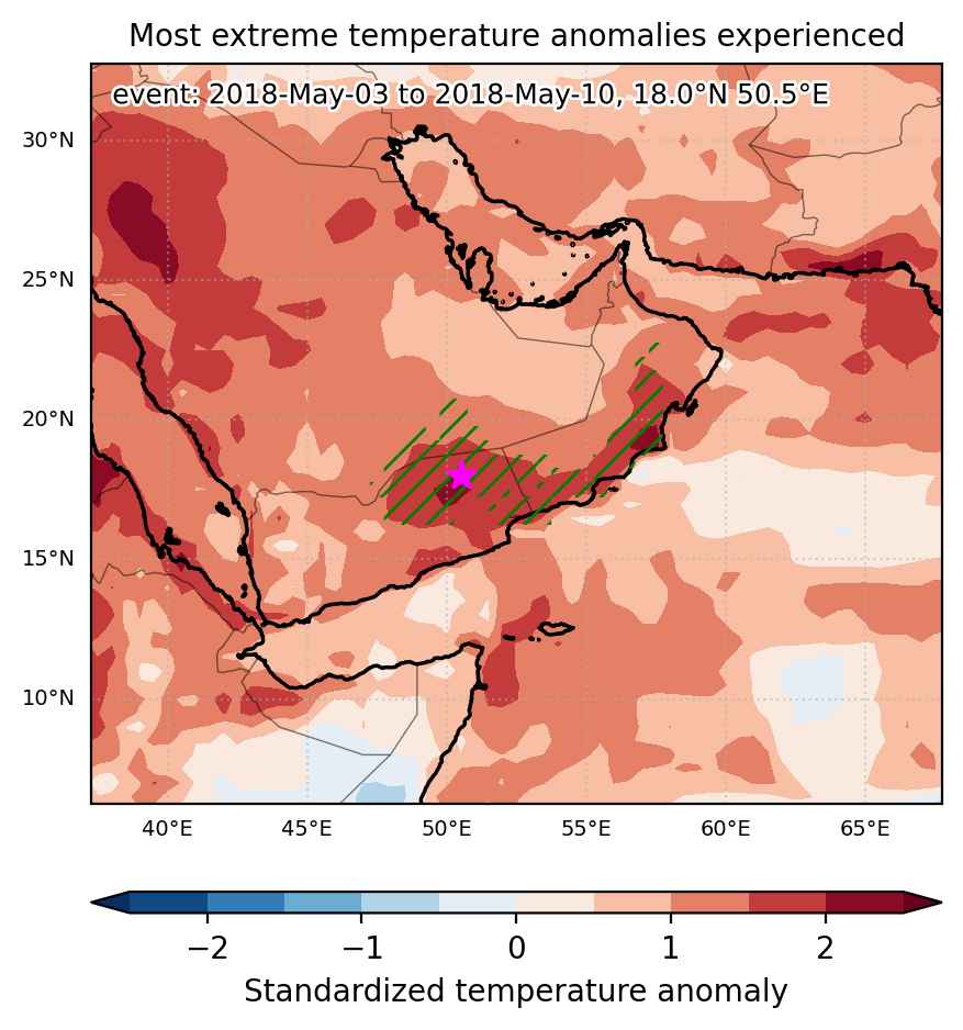

Fig. 1: Map of most extreme temperature anomalies (standardized) experienced during the event. The purple star indicates the center of the extreme event. Green hatching illustrates all areas under the effect of extremes at some time during the event.
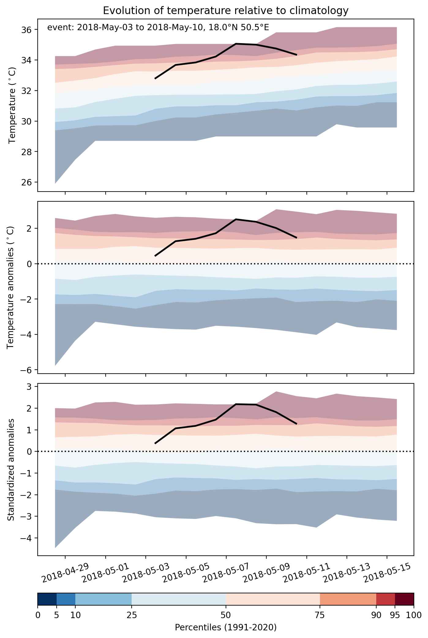


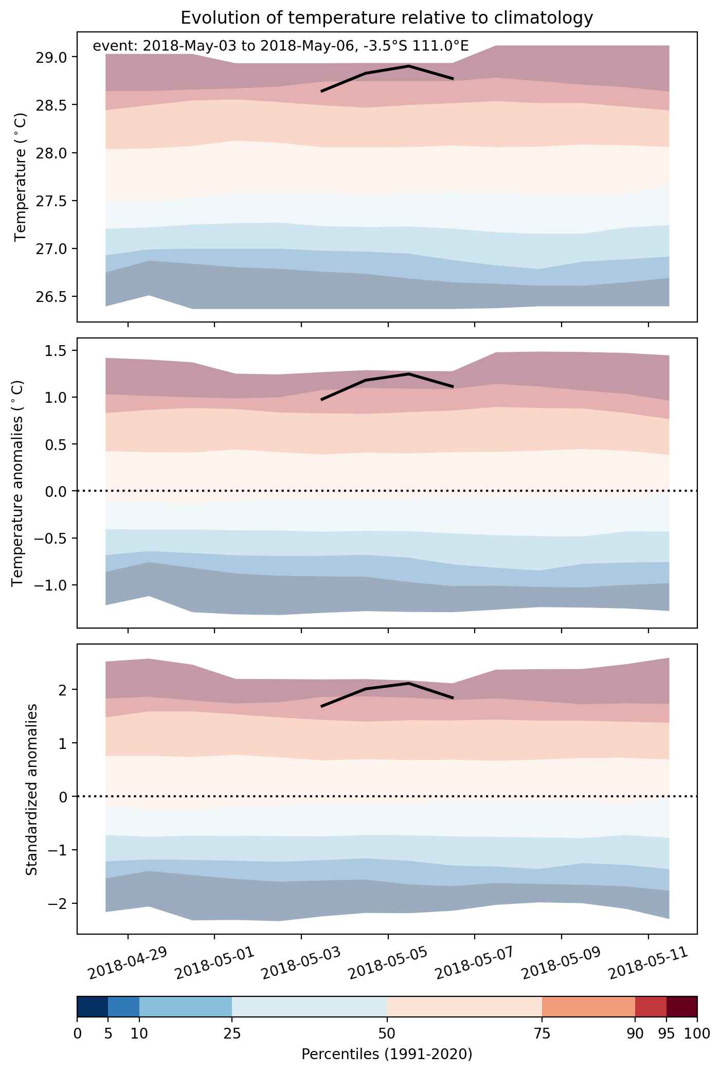
Fig. 2: Evolution of temperature at the center of the event. The climatological percentile distribution is illustrated with color shadings.
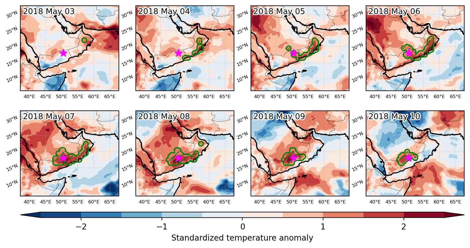


Fig. 3: Maps illustrating the evolution of standardized temperature anomalies during the event.

Event ID: Heat_wave_2018-May-03_to_2018-May-10_50.5_18.0
Heat wave occuring from May 03 2018 to May 06 2018 at -3.5°S 111.0°E

Download data: JSON

Event type: Heat wave

Countries affected (identified with ArcGIS Online; provided only for geographical reference):

  • Indonesia

Duration: 4 days

Time span: May 03 2018 to May 06 2018

Statistics over entire affected area:

  • Mean temperature anomaly: 1.1 °C
  • Mean temperature: 28.7 °C
  • Maximum temperature anomaly: 1.6 °C
  • Maximum temperature: 29.2 °C

Event center: -3.5°S 111.0°E

Area affected: 144983 km$^2$


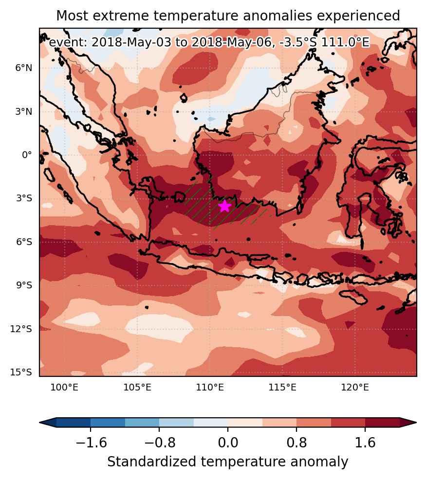
Fig. 1: Map of most extreme temperature anomalies (standardized) experienced during the event. The purple star indicates the center of the extreme event. Green hatching illustrates all areas under the effect of extremes at some time during the event.


Fig. 2: Evolution of temperature at the center of the event. The climatological percentile distribution is illustrated with color shadings.


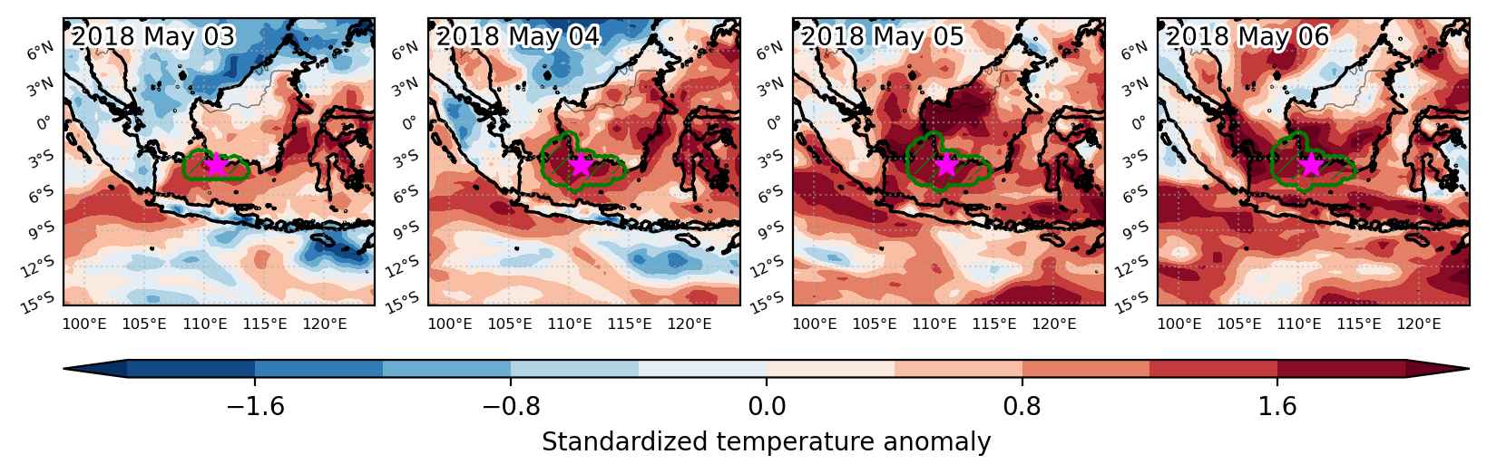
Fig. 3: Maps illustrating the evolution of standardized temperature anomalies during the event.

Event ID: Heat_wave_2018-May-03_to_2018-May-06_111.0_-3.5

Heat wave occuring from May 03 2018 to May 05 2018 at -77.0°S 316.5°E

Download data: JSON

Event type: Heat wave

Countries affected (identified with ArcGIS Online; provided only for geographical reference):

  • Antarctica

Duration: 3 days

Time span: May 03 2018 to May 05 2018

Statistics over entire affected area:

  • Mean temperature anomaly: 10.6 °C
  • Mean temperature: -13.5 °C
  • Maximum temperature anomaly: 16.0 °C
  • Maximum temperature: -9.2 °C

Event center: -77.0°S 316.5°E

Area affected: 55465 km$^2$


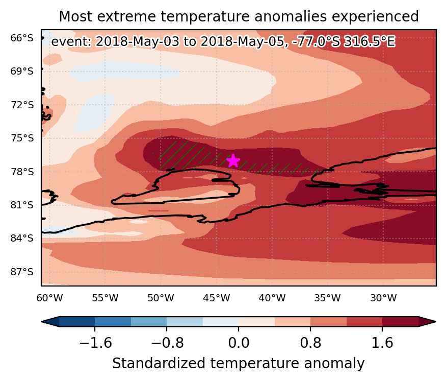
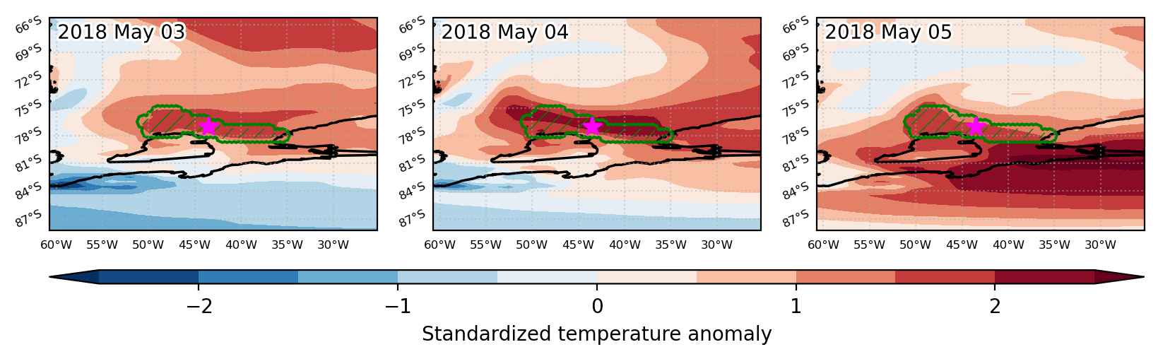
Fig. 1: Map of most extreme temperature anomalies (standardized) experienced during the event. The purple star indicates the center of the extreme event. Green hatching illustrates all areas under the effect of extremes at some time during the event.


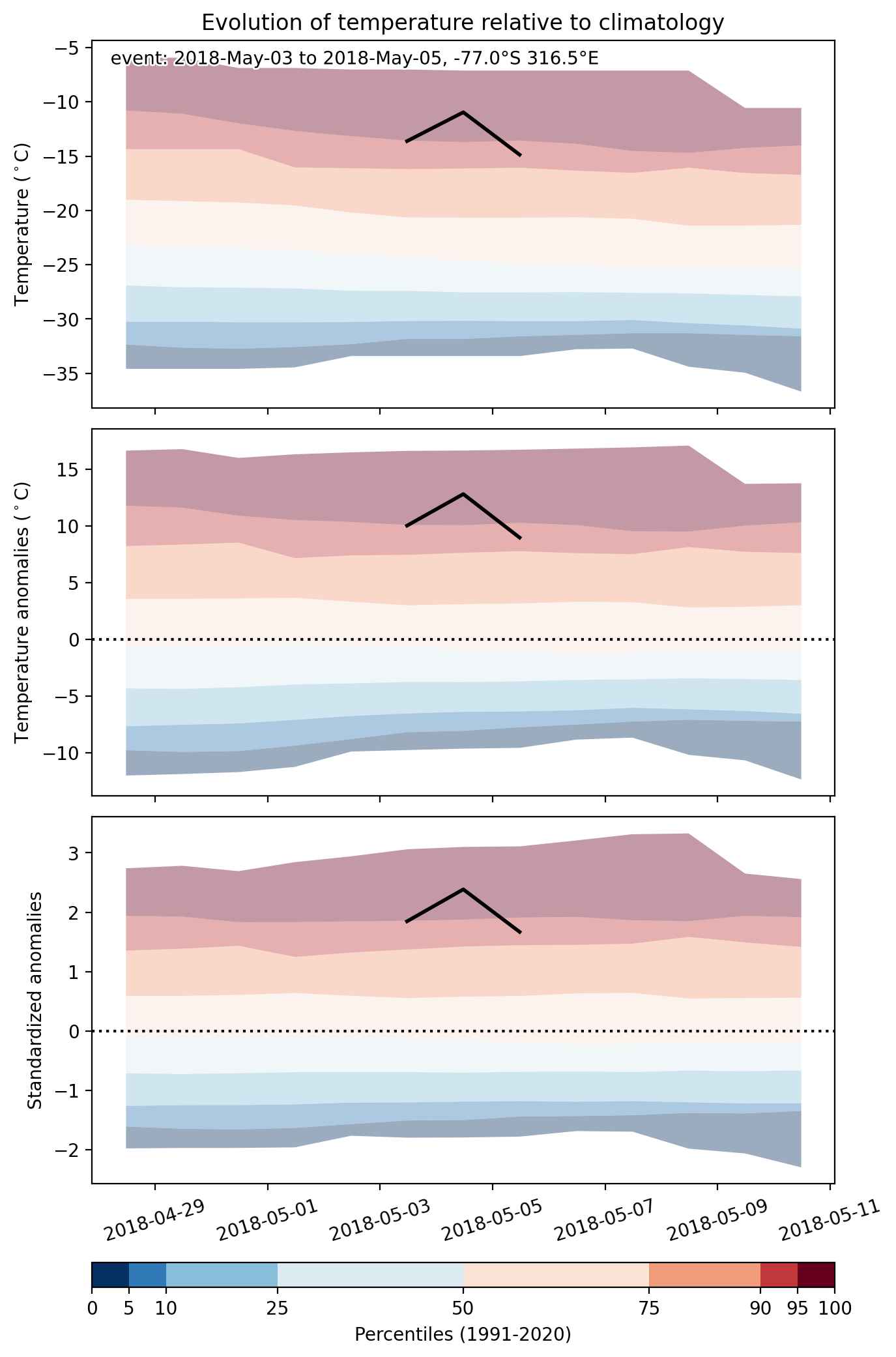
Fig. 2: Evolution of temperature at the center of the event. The climatological percentile distribution is illustrated with color shadings.


Fig. 3: Maps illustrating the evolution of standardized temperature anomalies during the event.

Event ID: Heat_wave_2018-May-03_to_2018-May-05_316.5_-77.0

Cold spell occuring from May 03 2018 to May 11 2018 at 60.0°N 86.0°E

Download data: JSON

Event type: Cold spell

Countries affected (identified with ArcGIS Online; provided only for geographical reference):

  • Russian Federation

Duration: 9 days

Time span: May 03 2018 to May 11 2018

Statistics over entire affected area:

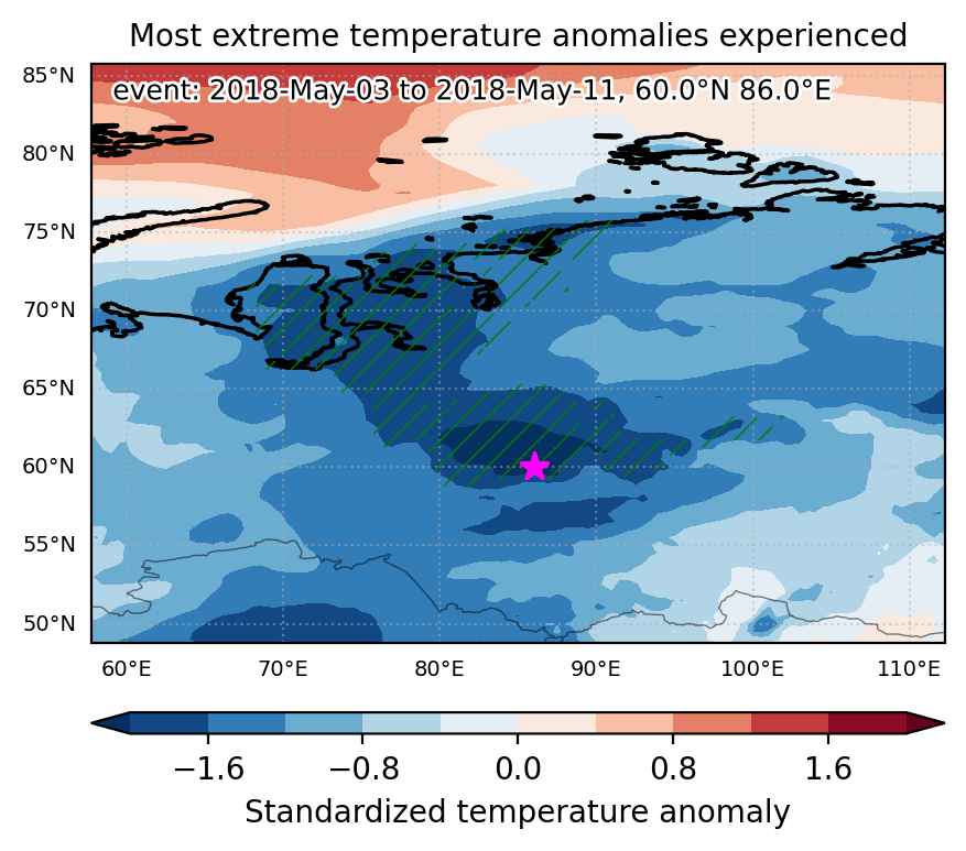
  • Mean temperature anomaly: -7.2 °C
  • Mean temperature: -10.3 °C
  • Minimum temperature anomaly: -12.1 °C
  • Minimum temperature: -18.9 °C

Event center: 60.0°N 86.0°E

Area affected: 1045836 km$^2$


Fig. 1: Map of most extreme temperature anomalies (standardized) experienced during the event. The purple star indicates the center of the extreme event. Green hatching illustrates all areas under the effect of extremes at some time during the event.


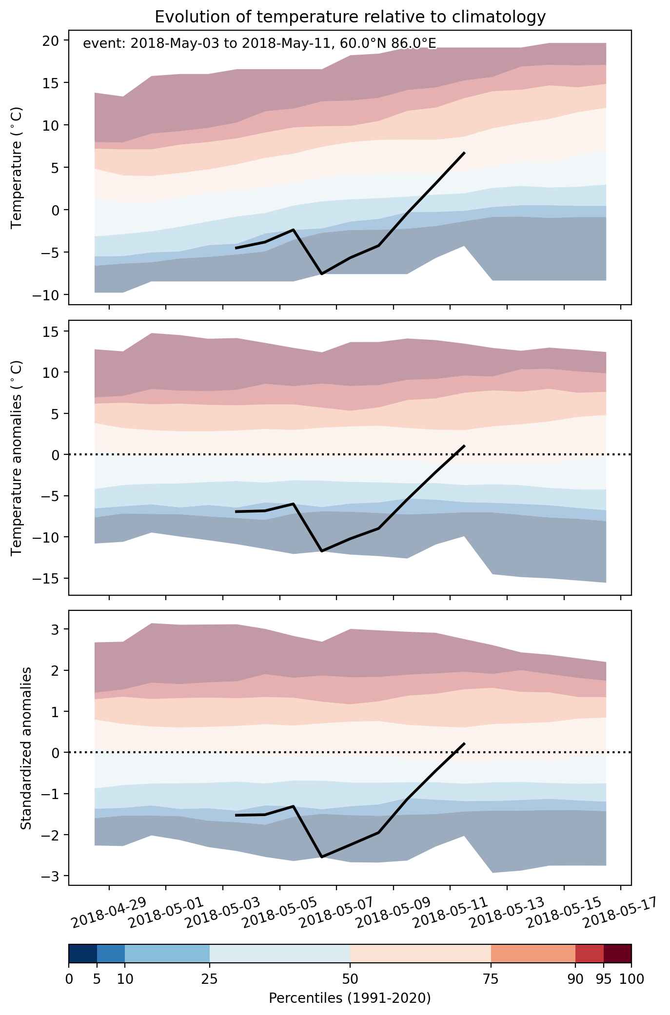
Fig. 2: Evolution of temperature at the center of the event. The climatological percentile distribution is illustrated with color shadings.


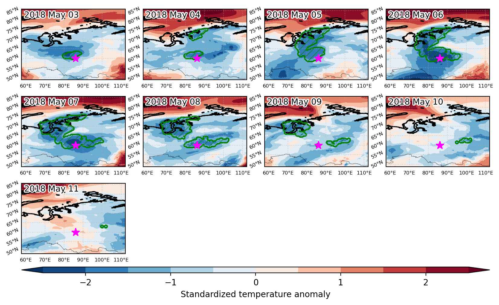
Fig. 3: Maps illustrating the evolution of standardized temperature anomalies during the event.

Event ID: Cold_spell_2018-May-03_to_2018-May-11_86.0_60.0

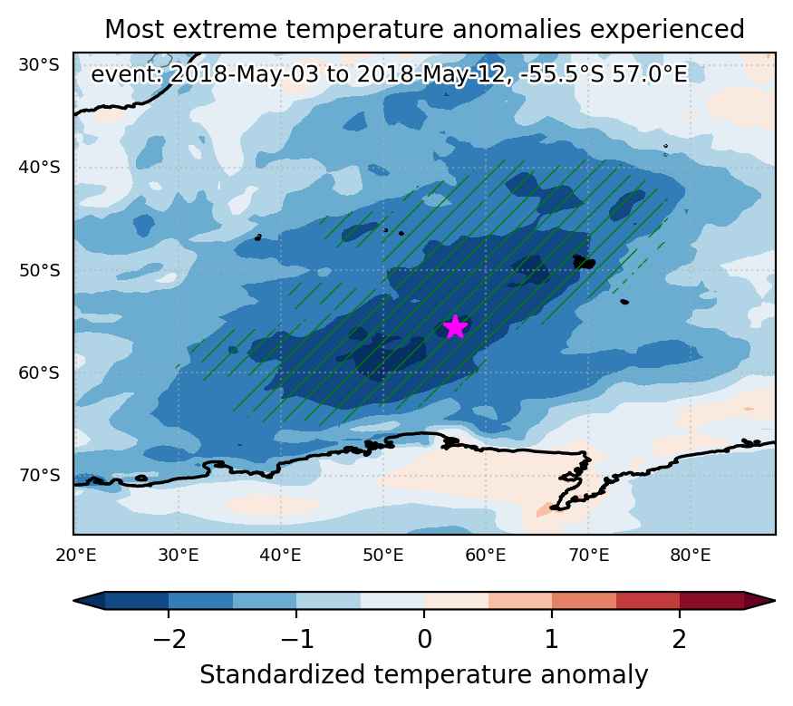
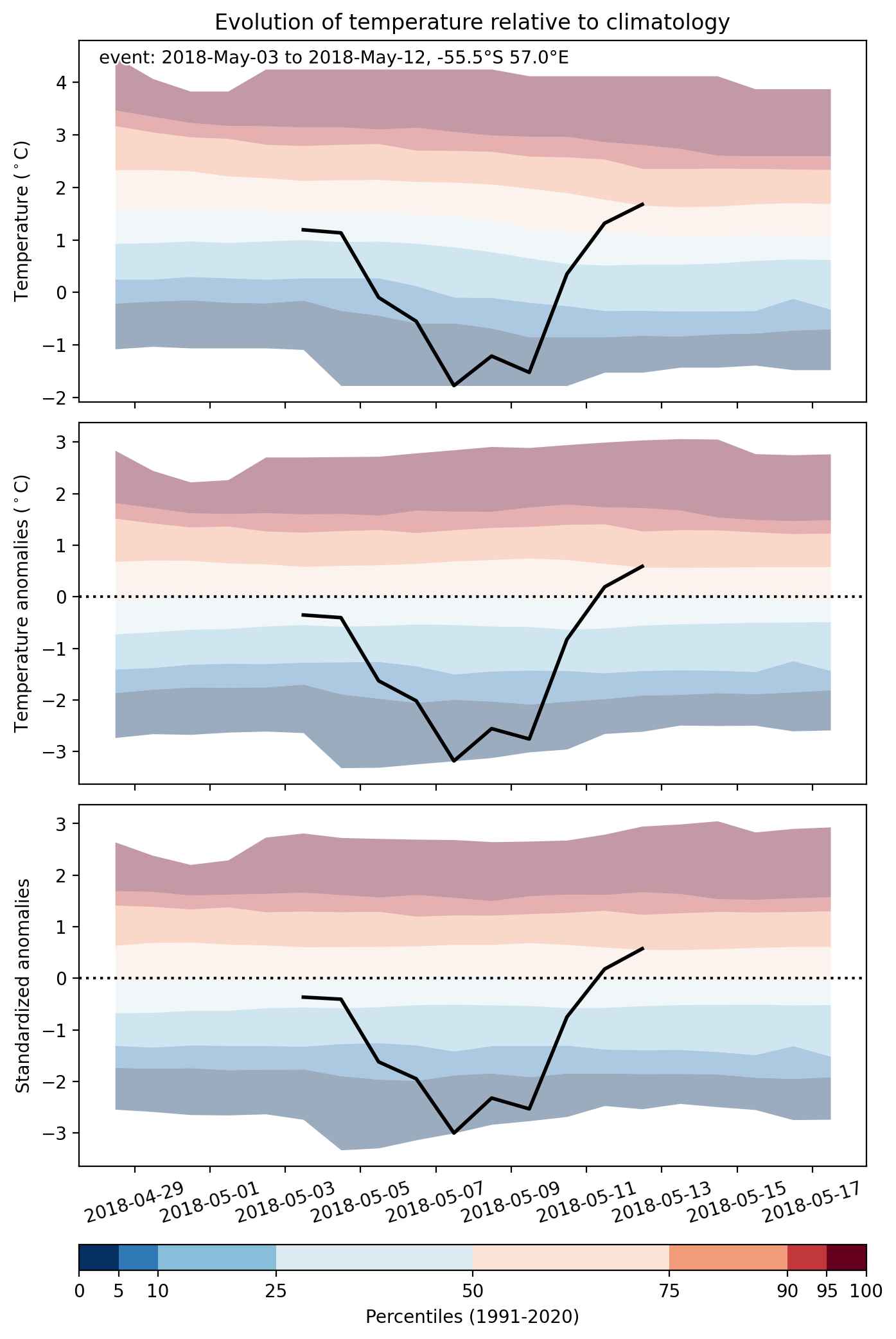
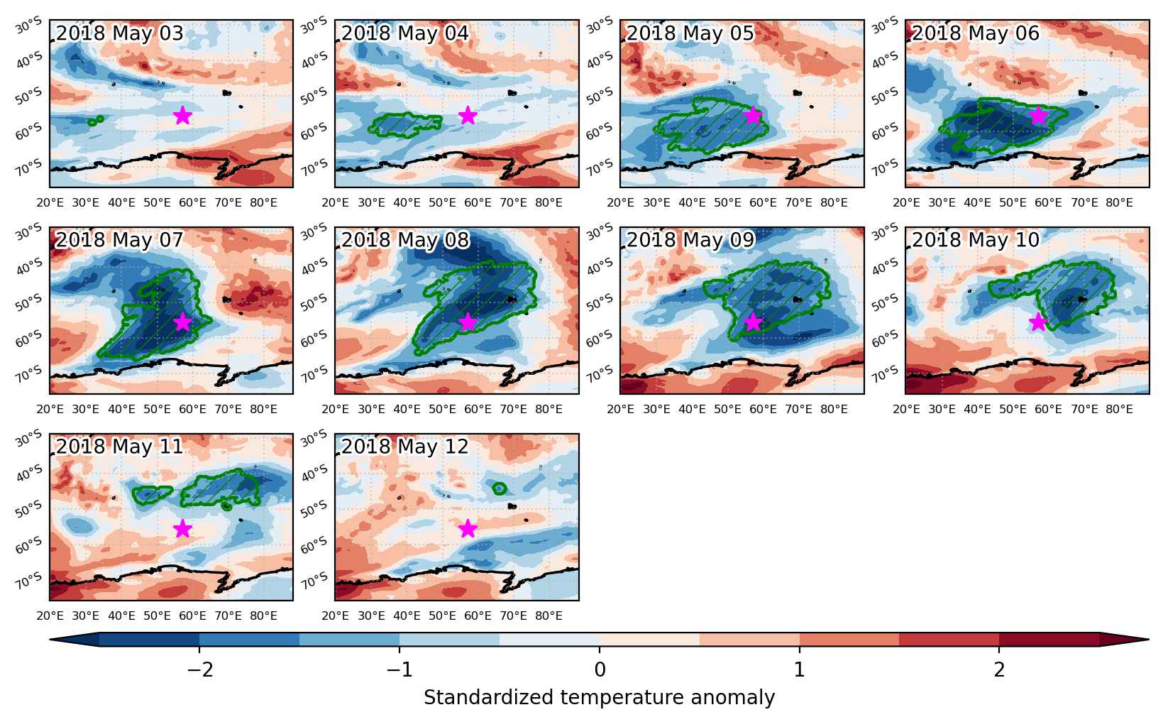
Cold spell occuring from May 03 2018 to May 12 2018 at -55.5°S 57.0°E

Download data: JSON

Event type: Cold spell

Countries affected (identified with ArcGIS Online; provided only for geographical reference):

  • French Southern Territories

Duration: 10 days

Time span: May 03 2018 to May 12 2018

Statistics over entire affected area:

  • Mean temperature anomaly: -2.7 °C
  • Mean temperature: 1.4 °C
  • Minimum temperature anomaly: -6.0 °C
  • Minimum temperature: -8.9 °C

Event center: -55.5°S 57.0°E

Area affected: 4682968 km$^2$


Fig. 1: Map of most extreme temperature anomalies (standardized) experienced during the event. The purple star indicates the center of the extreme event. Green hatching illustrates all areas under the effect of extremes at some time during the event.


Fig. 2: Evolution of temperature at the center of the event. The climatological percentile distribution is illustrated with color shadings.


Fig. 3: Maps illustrating the evolution of standardized temperature anomalies during the event.

Event ID: Cold_spell_2018-May-03_to_2018-May-12_57.0_-55.5

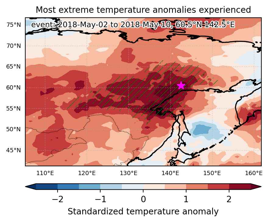
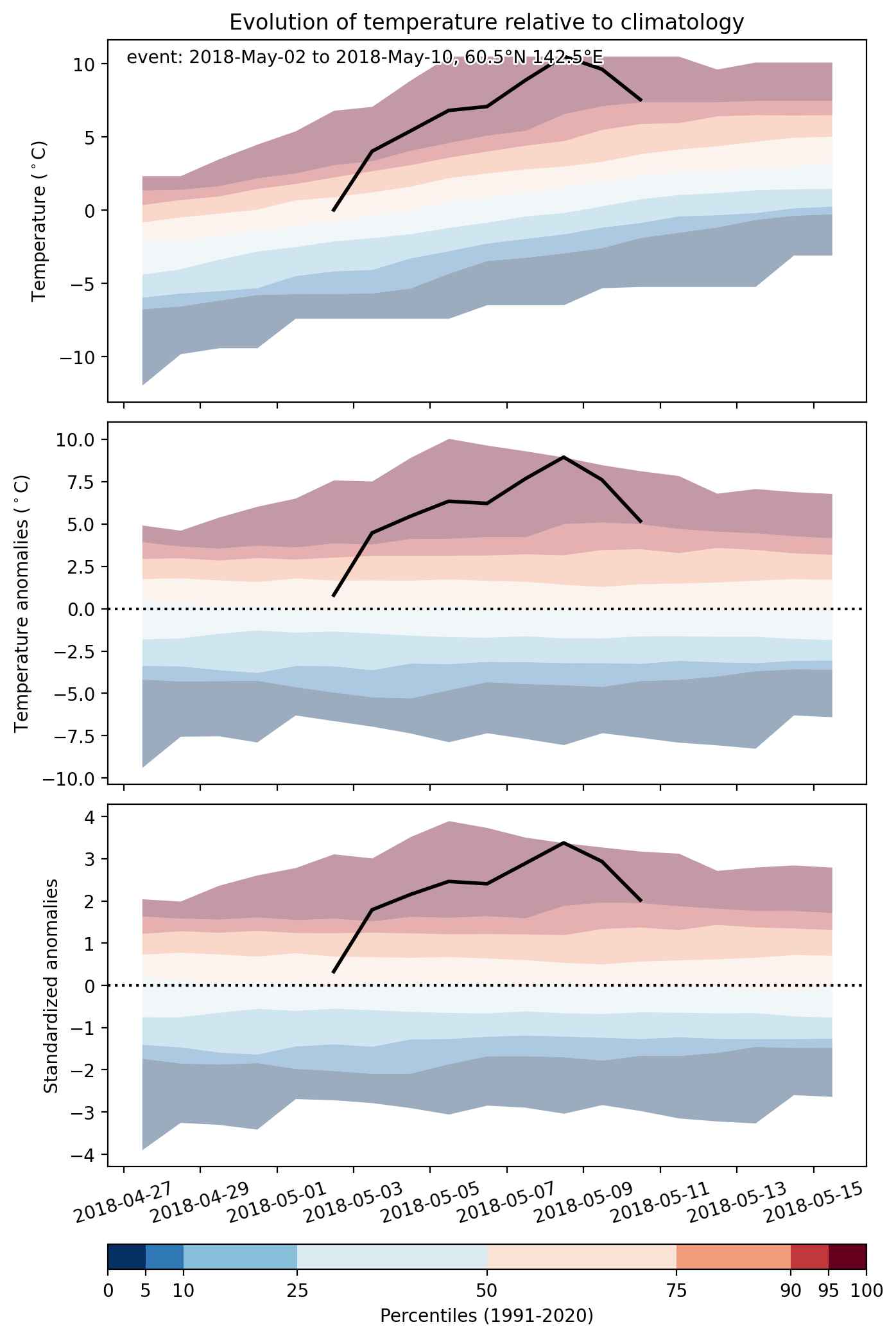
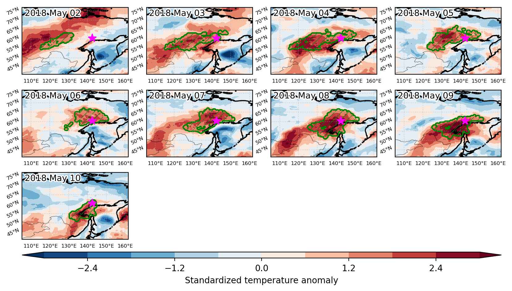
Heat wave occuring from May 02 2018 to May 10 2018 at 60.5°N 142.5°E

Download data: JSON

Event type: Heat wave

Countries affected (identified with ArcGIS Online; provided only for geographical reference):

  • Russian Federation

Duration: 9 days

Time span: May 02 2018 to May 10 2018

Statistics over entire affected area:

  • Mean temperature anomaly: 6.4 °C
  • Mean temperature: 7.1 °C
  • Maximum temperature anomaly: 13.6 °C
  • Maximum temperature: 17.6 °C

Event center: 60.5°N 142.5°E

Area affected: 1400411 km$^2$


Fig. 1: Map of most extreme temperature anomalies (standardized) experienced during the event. The purple star indicates the center of the extreme event. Green hatching illustrates all areas under the effect of extremes at some time during the event.


Fig. 2: Evolution of temperature at the center of the event. The climatological percentile distribution is illustrated with color shadings.


Fig. 3: Maps illustrating the evolution of standardized temperature anomalies during the event.

Event ID: Heat_wave_2018-May-02_to_2018-May-10_142.5_60.5

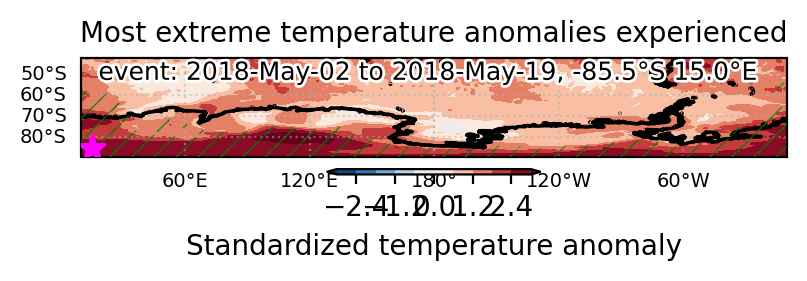
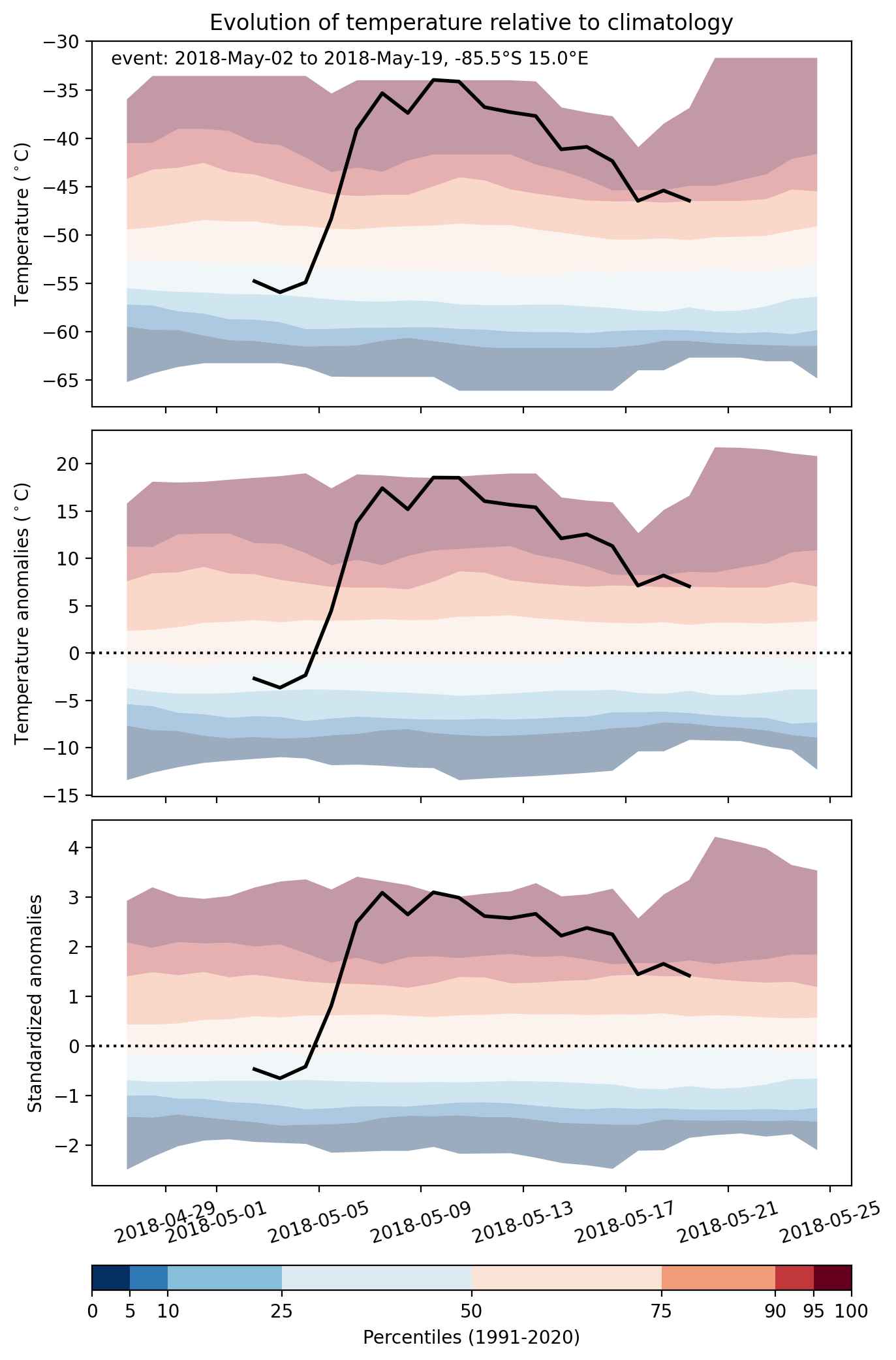
Heat wave occuring from May 02 2018 to May 19 2018 at -85.5°S 15.0°E

Download data: JSON

Event type: Heat wave

Countries affected (identified with ArcGIS Online; provided only for geographical reference):

  • Antarctica

Duration: 18 days

Time span: May 02 2018 to May 19 2018

Statistics over entire affected area:

  • Mean temperature anomaly: 11.7 °C
  • Mean temperature: -33.4 °C
  • Maximum temperature anomaly: 23.7 °C
  • Maximum temperature: 5.6 °C

Event center: -85.5°S 15.0°E

Area affected: 8990483 km$^2$


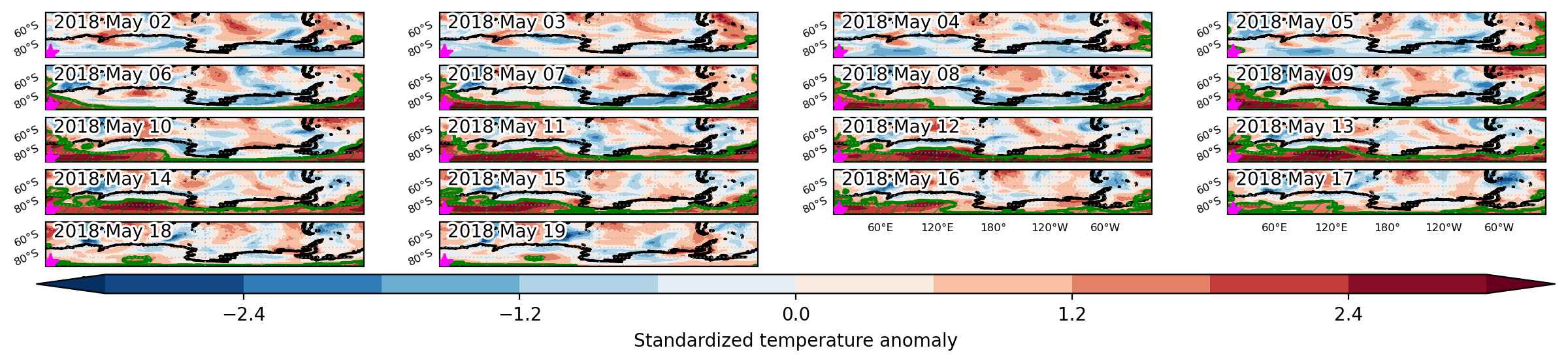
Fig. 1: Map of most extreme temperature anomalies (standardized) experienced during the event. The purple star indicates the center of the extreme event. Green hatching illustrates all areas under the effect of extremes at some time during the event.


Fig. 2: Evolution of temperature at the center of the event. The climatological percentile distribution is illustrated with color shadings.


Fig. 3: Maps illustrating the evolution of standardized temperature anomalies during the event.

Event ID: Heat_wave_2018-May-02_to_2018-May-19_15.0_-85.5

Heat wave occuring from May 01 2018 to May 09 2018 at 26.0°N 39.5°E

Download data: JSON

Event type: Heat wave

Countries affected (identified with ArcGIS Online; provided only for geographical reference):

  • Jordan
  • Saudi Arabia

Duration: 9 days

Time span: May 01 2018 to May 09 2018

Statistics over entire affected area:

  • Mean temperature anomaly: 3.9 °C
  • Mean temperature: 31.9 °C
  • Maximum temperature anomaly: 7.4 °C
  • Maximum temperature: 36.3 °C

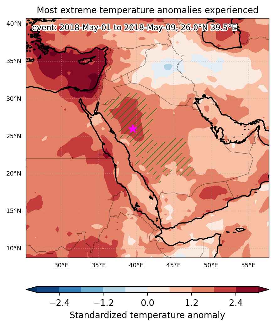
Event center: 26.0°N 39.5°E

Area affected: 614809 km$^2$


Fig. 1: Map of most extreme temperature anomalies (standardized) experienced during the event. The purple star indicates the center of the extreme event. Green hatching illustrates all areas under the effect of extremes at some time during the event.


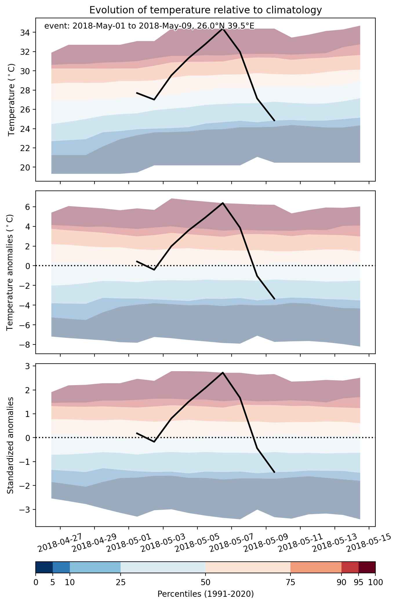
Fig. 2: Evolution of temperature at the center of the event. The climatological percentile distribution is illustrated with color shadings.


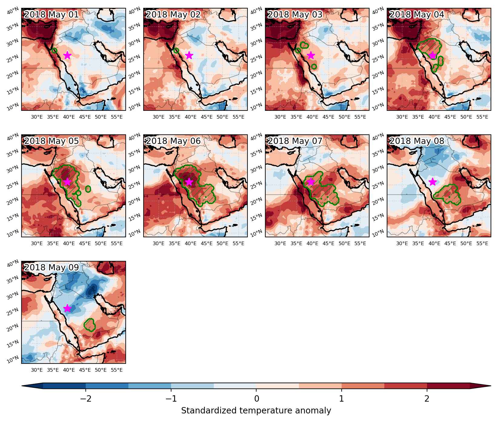
Fig. 3: Maps illustrating the evolution of standardized temperature anomalies during the event.

Event ID: Heat_wave_2018-May-01_to_2018-May-09_39.5_26.0

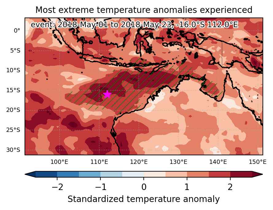
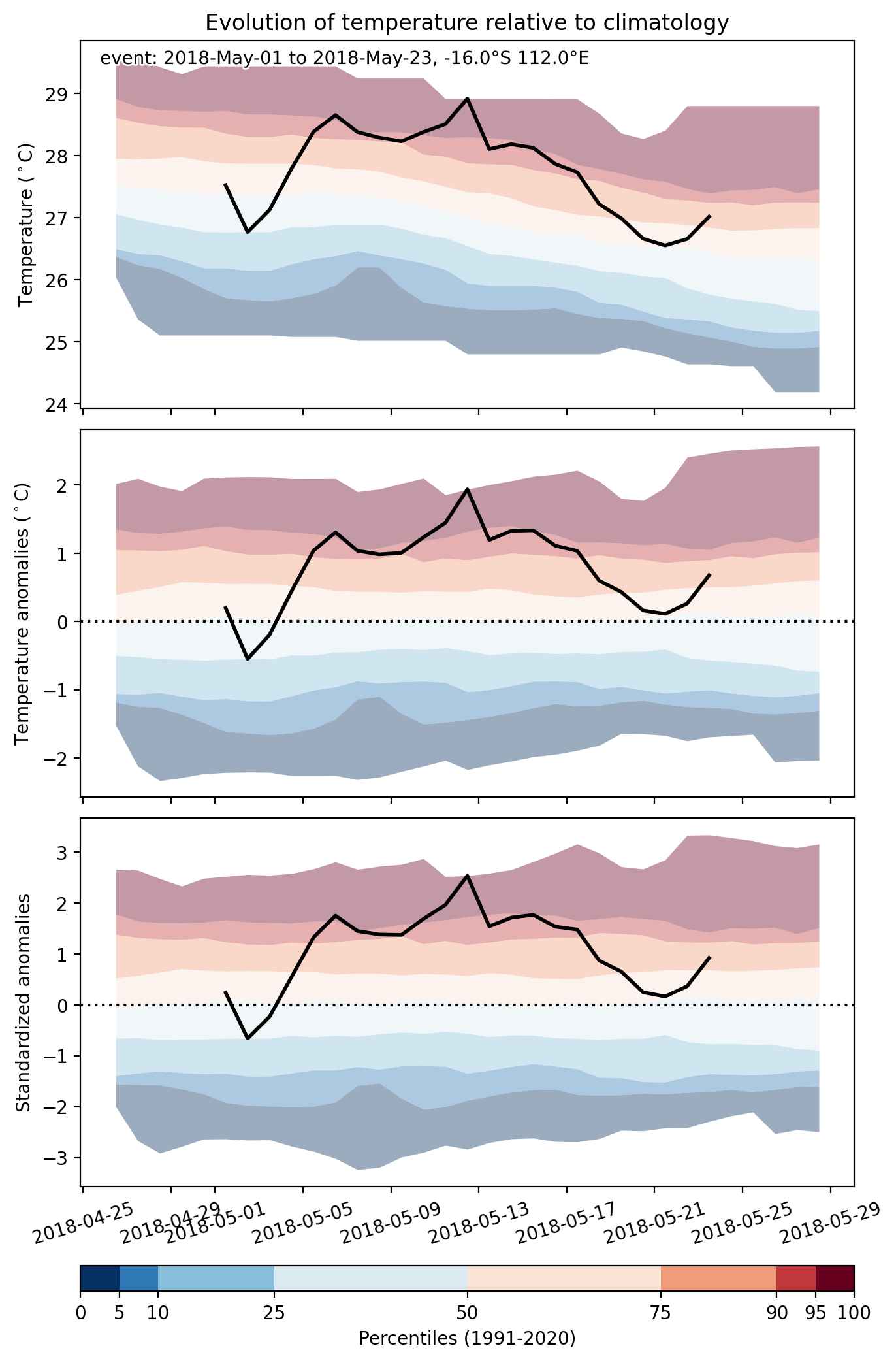
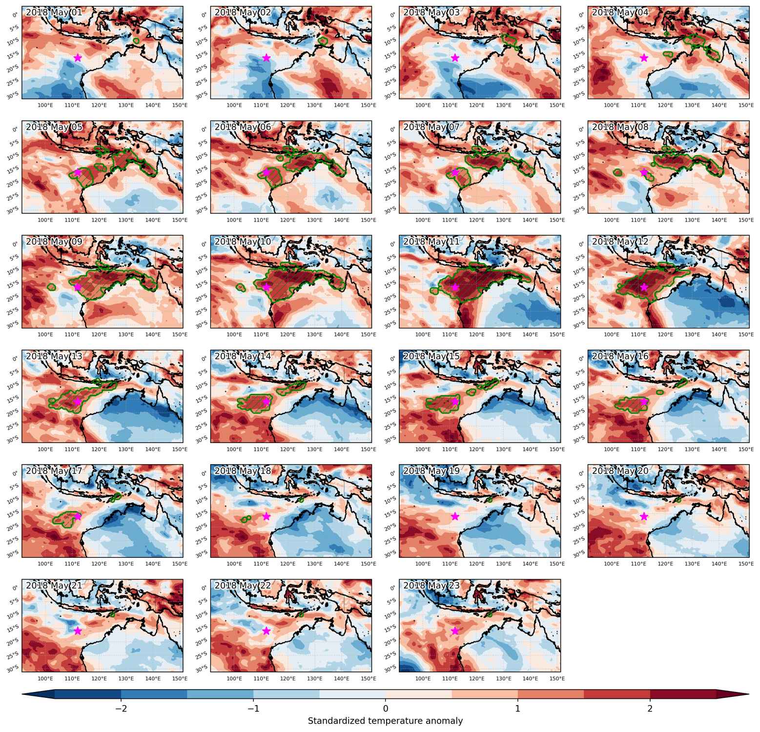
Heat wave occuring from May 01 2018 to May 23 2018 at -16.0°S 112.0°E

Download data: JSON

Event type: Heat wave

Countries affected (identified with ArcGIS Online; provided only for geographical reference):

  • Australia
  • Indonesia

Duration: 23 days

Time span: May 01 2018 to May 23 2018

Statistics over entire affected area:

  • Mean temperature anomaly: 1.3 °C
  • Mean temperature: 28.6 °C
  • Maximum temperature anomaly: 2.5 °C
  • Maximum temperature: 30.3 °C

Event center: -16.0°S 112.0°E

Area affected: 2664471 km$^2$


Fig. 1: Map of most extreme temperature anomalies (standardized) experienced during the event. The purple star indicates the center of the extreme event. Green hatching illustrates all areas under the effect of extremes at some time during the event.


Fig. 2: Evolution of temperature at the center of the event. The climatological percentile distribution is illustrated with color shadings.


Fig. 3: Maps illustrating the evolution of standardized temperature anomalies during the event.

Event ID: Heat_wave_2018-May-01_to_2018-May-23_112.0_-16.0

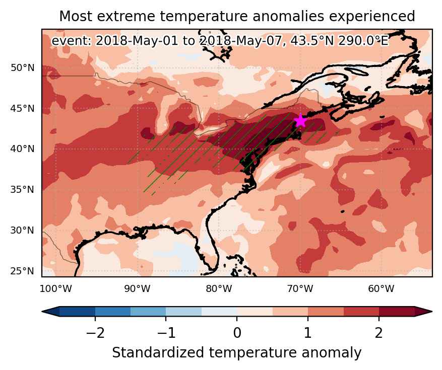
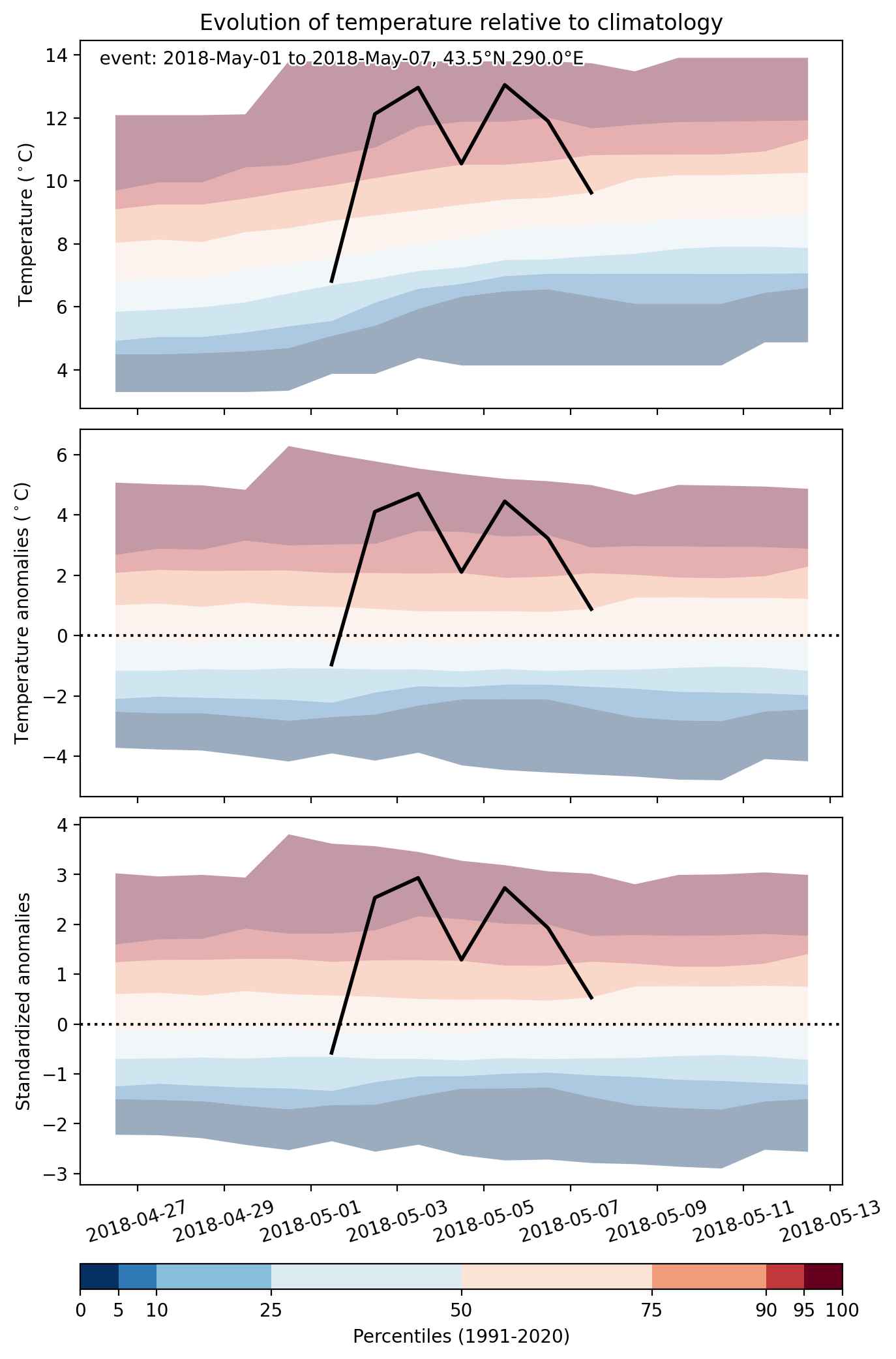
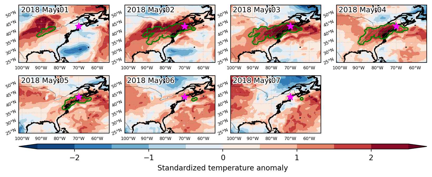
Heat wave occuring from May 01 2018 to May 07 2018 at 43.5°N 290.0°E

Download data: JSON

Event type: Heat wave

Countries affected (identified with ArcGIS Online; provided only for geographical reference):

  • United States

Duration: 7 days

Time span: May 01 2018 to May 07 2018

Statistics over entire affected area:

  • Mean temperature anomaly: 6.9 °C
  • Mean temperature: 20.3 °C
  • Maximum temperature anomaly: 12.1 °C
  • Maximum temperature: 26.3 °C

Event center: 43.5°N 290.0°E

Area affected: 903206 km$^2$


Fig. 1: Map of most extreme temperature anomalies (standardized) experienced during the event. The purple star indicates the center of the extreme event. Green hatching illustrates all areas under the effect of extremes at some time during the event.


Fig. 2: Evolution of temperature at the center of the event. The climatological percentile distribution is illustrated with color shadings.


Fig. 3: Maps illustrating the evolution of standardized temperature anomalies during the event.

Event ID: Heat_wave_2018-May-01_to_2018-May-07_290.0_43.5