Cold spell occuring from January 06 2013 to January 13 2013 at 3.5°N 35.5°E

Download data: JSON

Event type: Cold spell

Countries affected (identified with ArcGIS Online; provided only for geographical reference):

  • Ethiopia
  • Kenya
  • South Sudan
  • Uganda

Duration: 8 days

Time span: January 06 2013 to January 13 2013

Statistics over entire affected area:

  • Mean temperature anomaly: -2.8 °C
  • Mean temperature: 24.6 °C
  • Minimum temperature anomaly: -5.0 °C
  • Minimum temperature: 20.5 °C

Event center: 3.5°N 35.5°E

Area affected: 166603 km$^2$
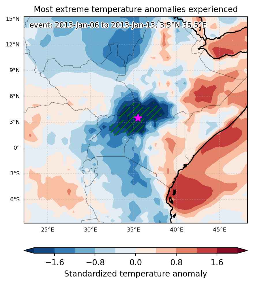

Fig. 1: Map of most extreme temperature anomalies (standardized) experienced during the event. The purple star indicates the center of the extreme event. Green hatching illustrates all areas under the effect of extremes at some time during the event.
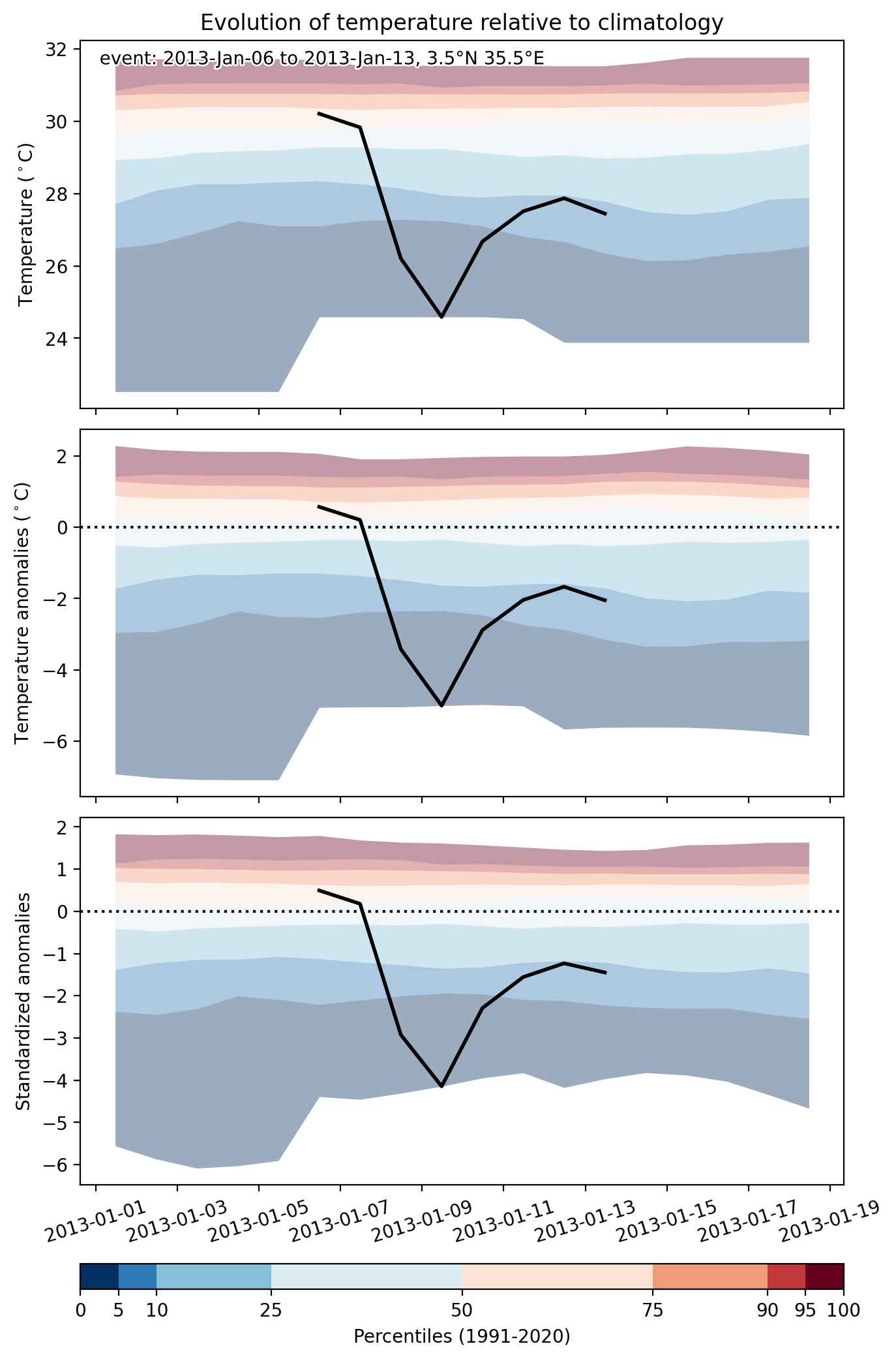


Fig. 2: Evolution of temperature at the center of the event. The climatological percentile distribution is illustrated with color shadings.
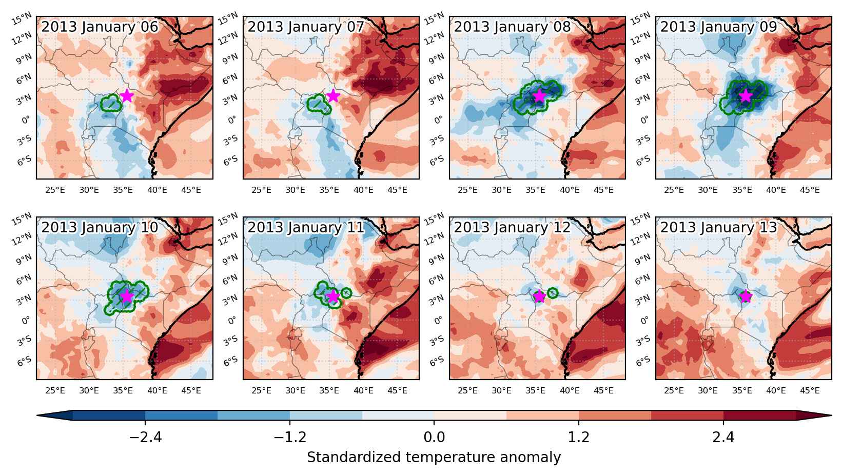


Fig. 3: Maps illustrating the evolution of standardized temperature anomalies during the event.

Event ID: Cold_spell_2013-Jan-06_to_2013-Jan-13_35.5_3.5
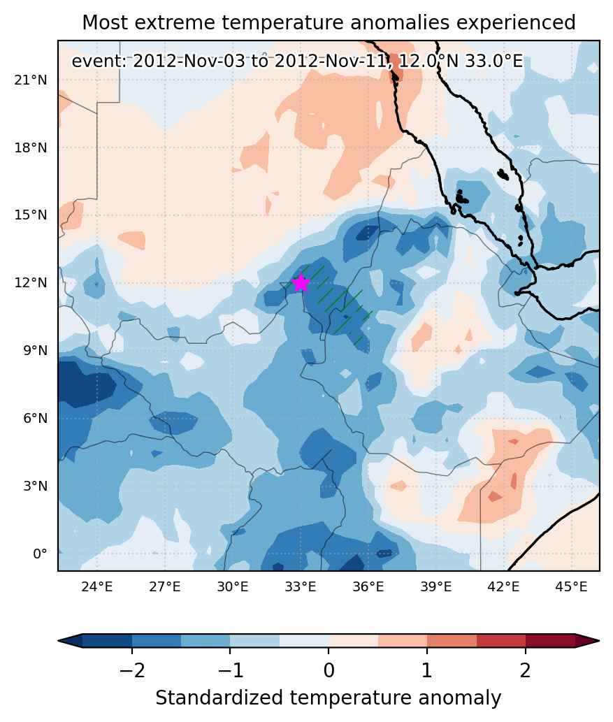
Cold spell occuring from November 03 2012 to November 11 2012 at 12.0°N 33.0°E

Download data: JSON

Event type: Cold spell

Countries affected (identified with ArcGIS Online; provided only for geographical reference):

  • Ethiopia
  • South Sudan
  • Sudan

Duration: 9 days

Time span: November 03 2012 to November 11 2012

Statistics over entire affected area:

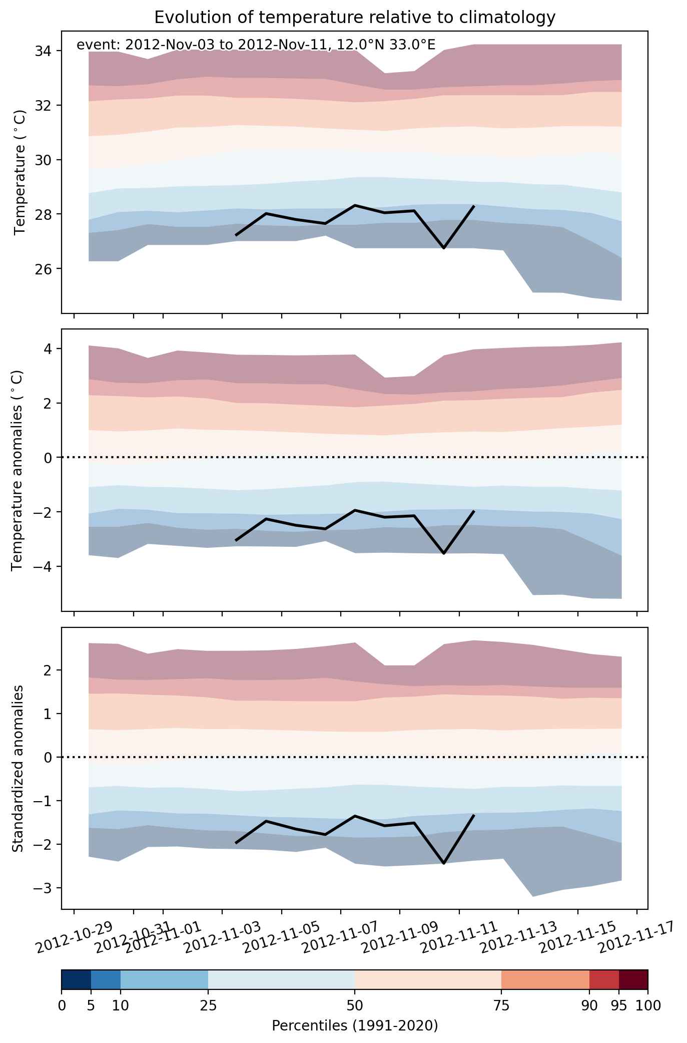
  • Mean temperature anomaly: -2.2 °C
  • Mean temperature: 25.2 °C
  • Minimum temperature anomaly: -3.5 °C
  • Minimum temperature: 18.2 °C

Event center: 12.0°N 33.0°E

Area affected: 60616 km$^2$


Fig. 1: Map of most extreme temperature anomalies (standardized) experienced during the event. The purple star indicates the center of the extreme event. Green hatching illustrates all areas under the effect of extremes at some time during the event.


Fig. 2: Evolution of temperature at the center of the event. The climatological percentile distribution is illustrated with color shadings.


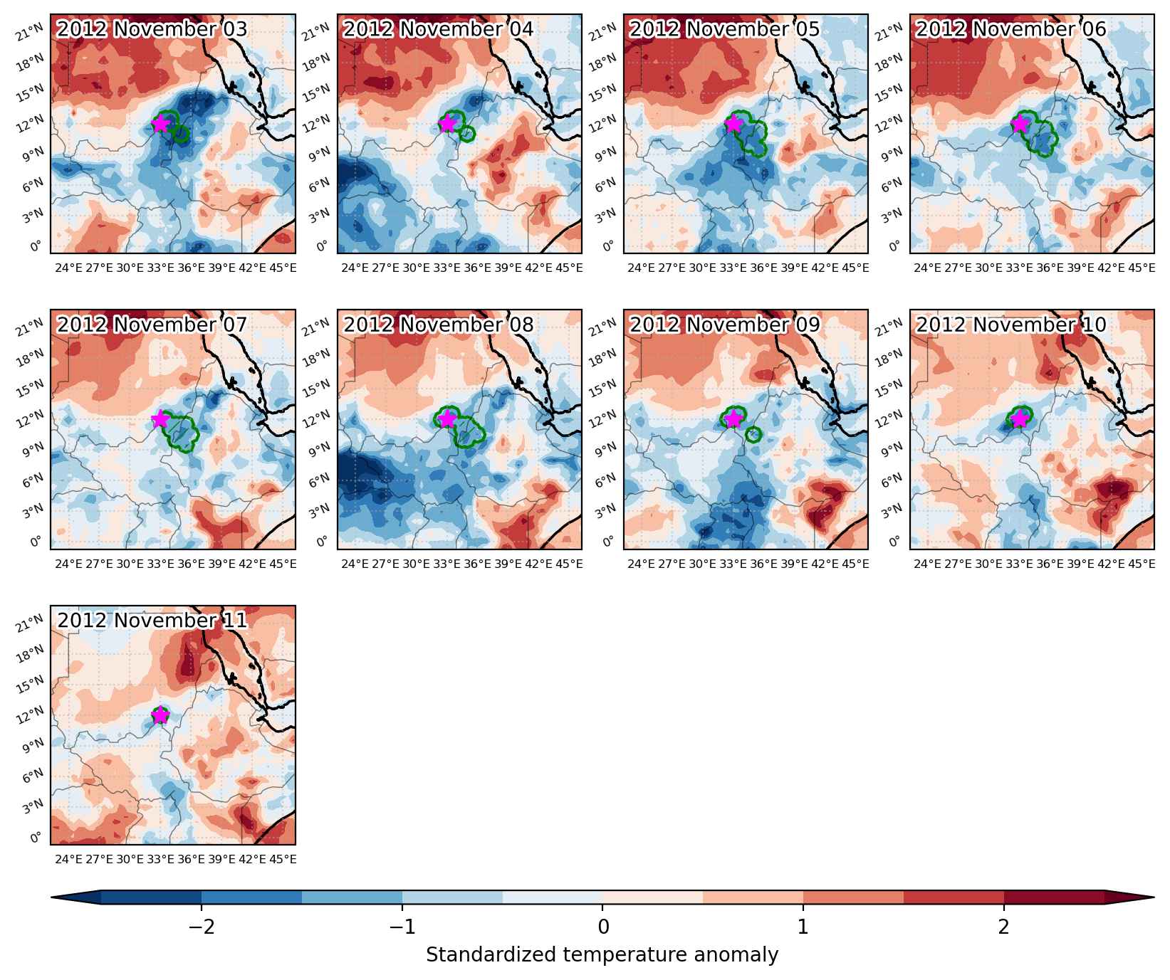
Fig. 3: Maps illustrating the evolution of standardized temperature anomalies during the event.

Event ID: Cold_spell_2012-Nov-03_to_2012-Nov-11_33.0_12.0

Cold spell occuring from October 27 2012 to November 09 2012 at -6.5°S 35.0°E

Download data: JSON

Event type: Cold spell

Countries affected (identified with ArcGIS Online; provided only for geographical reference):

  • Angola
  • Burundi
  • Congo DRC
  • Eswatini
  • Kenya
  • Lesotho
  • Madagascar
  • Malawi
  • Mozambique
  • South Africa
  • South Sudan
  • Tanzania
  • Uganda
  • Zambia
  • Zimbabwe

Duration: 14 days

Time span: October 27 2012 to November 09 2012

Statistics over entire affected area:

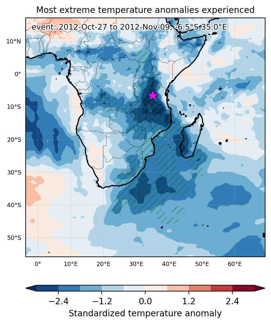
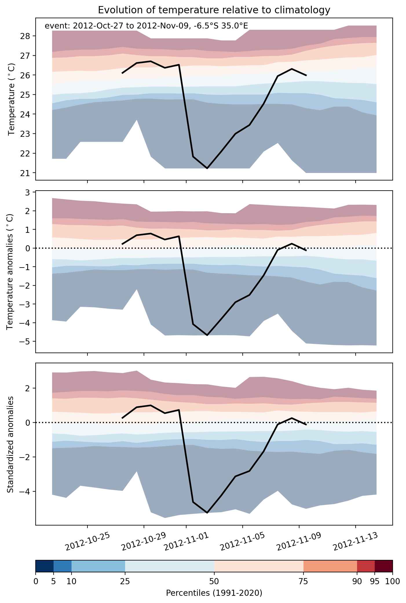
  • Mean temperature anomaly: -3.4 °C
  • Mean temperature: 18.5 °C
  • Minimum temperature anomaly: -8.5 °C
  • Minimum temperature: 3.6 °C

Event center: -6.5°S 35.0°E

Area affected: 7901794 km$^2$


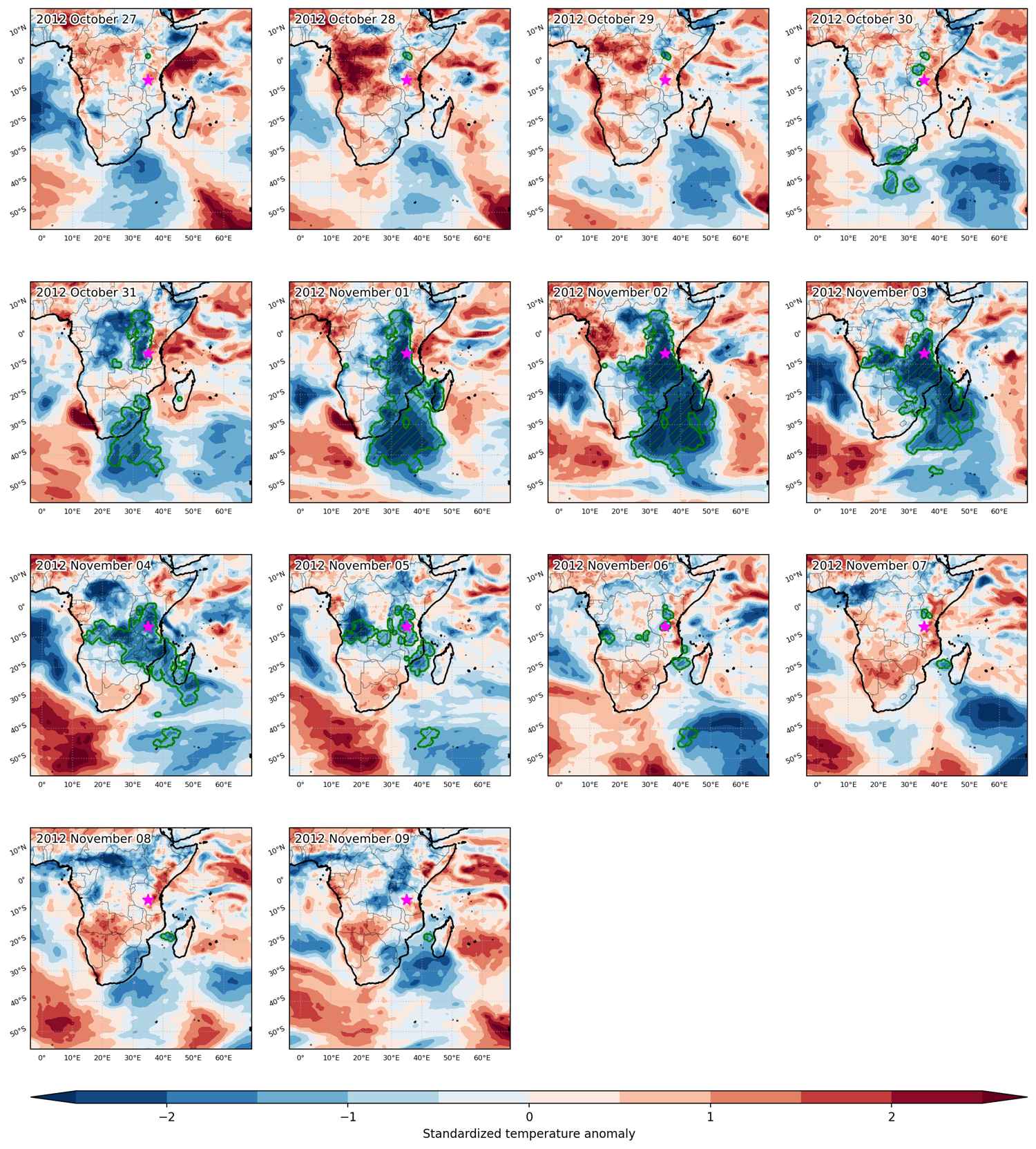
Fig. 1: Map of most extreme temperature anomalies (standardized) experienced during the event. The purple star indicates the center of the extreme event. Green hatching illustrates all areas under the effect of extremes at some time during the event.


Fig. 2: Evolution of temperature at the center of the event. The climatological percentile distribution is illustrated with color shadings.


Fig. 3: Maps illustrating the evolution of standardized temperature anomalies during the event.

Event ID: Cold_spell_2012-Oct-27_to_2012-Nov-09_35.0_-6.5

Cold spell occuring from October 12 2012 to October 15 2012 at 4.0°N 34.5°E

Download data: JSON

Event type: Cold spell

Countries affected (identified with ArcGIS Online; provided only for geographical reference):

  • Ethiopia
  • Kenya
  • South Sudan
  • Uganda

Duration: 4 days

Time span: October 12 2012 to October 15 2012

Statistics over entire affected area:

  • Mean temperature anomaly: -3.0 °C
  • Mean temperature: 24.0 °C
  • Minimum temperature anomaly: -5.1 °C
  • Minimum temperature: 16.1 °C

Event center: 4.0°N 34.5°E

Area affected: 145097 km$^2$


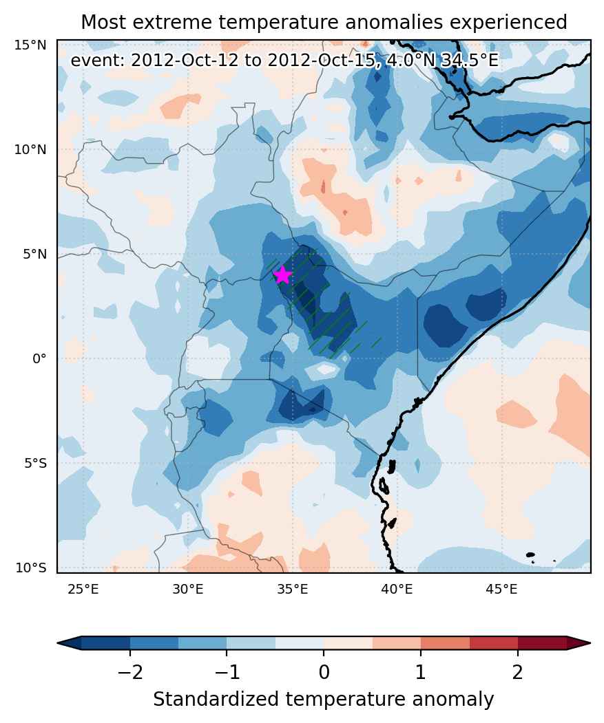
Fig. 1: Map of most extreme temperature anomalies (standardized) experienced during the event. The purple star indicates the center of the extreme event. Green hatching illustrates all areas under the effect of extremes at some time during the event.


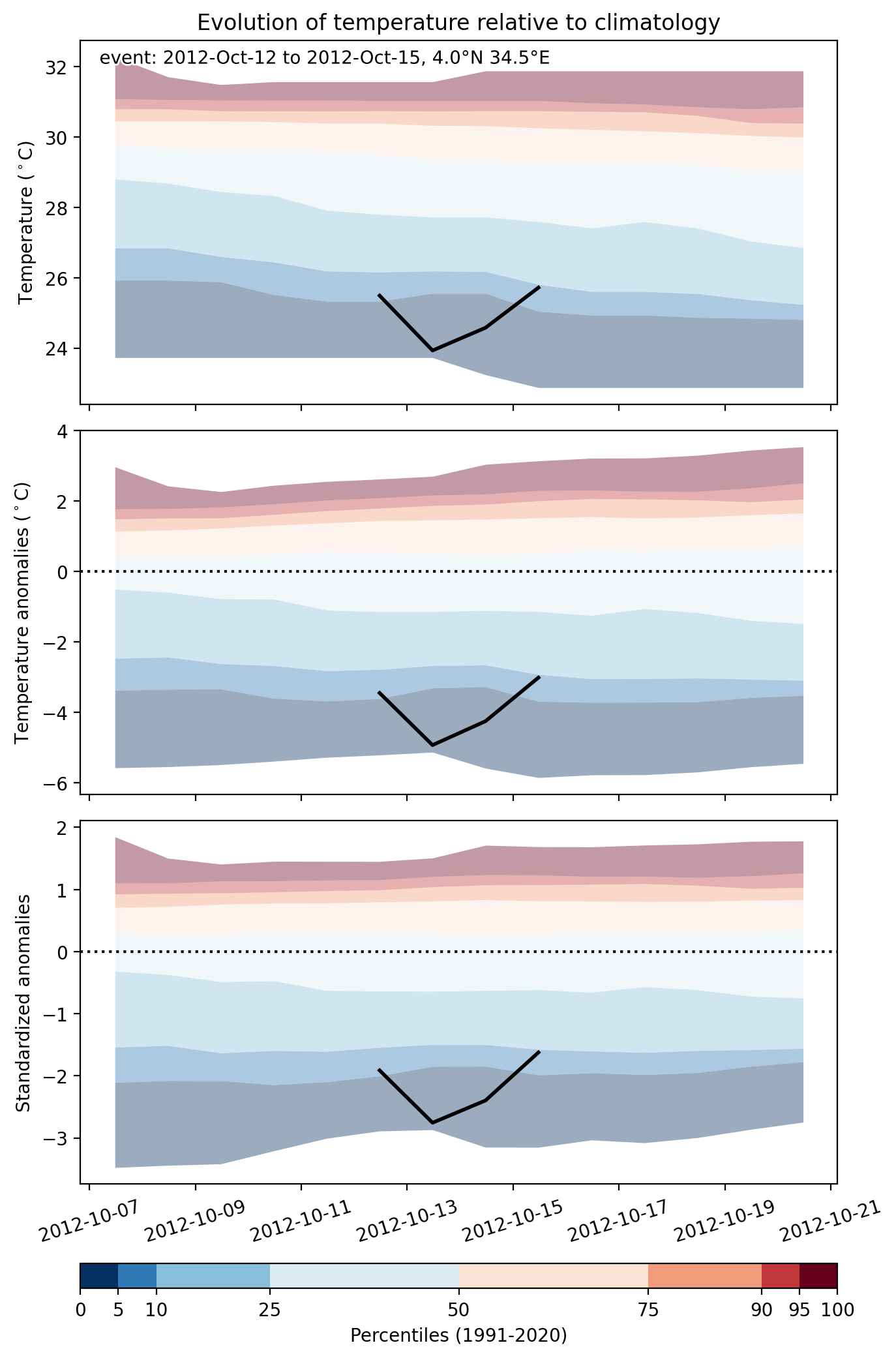
Fig. 2: Evolution of temperature at the center of the event. The climatological percentile distribution is illustrated with color shadings.


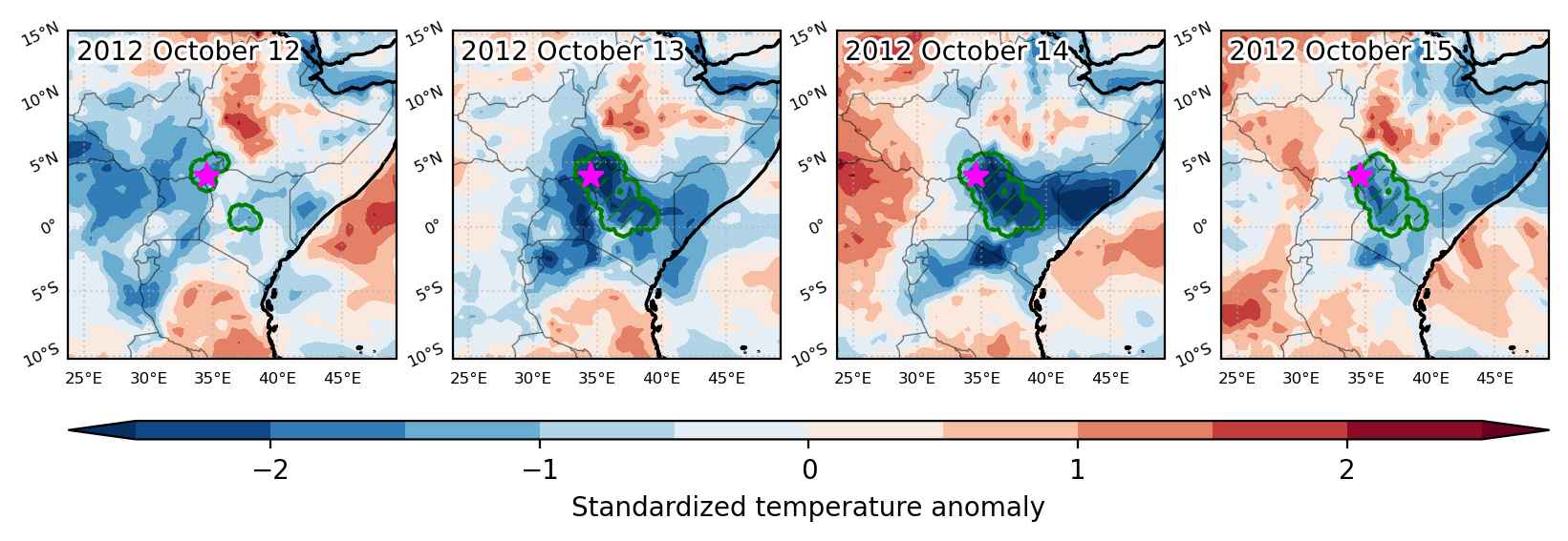
Fig. 3: Maps illustrating the evolution of standardized temperature anomalies during the event.

Event ID: Cold_spell_2012-Oct-12_to_2012-Oct-15_34.5_4.0

Cold spell occuring from September 05 2012 to September 19 2012 at 4.5°N 35.0°E

Download data: JSON

Event type: Cold spell

Countries affected (identified with ArcGIS Online; provided only for geographical reference):

  • Ethiopia
  • Kenya
  • South Sudan

Duration: 15 days

Time span: September 05 2012 to September 19 2012

Statistics over entire affected area:

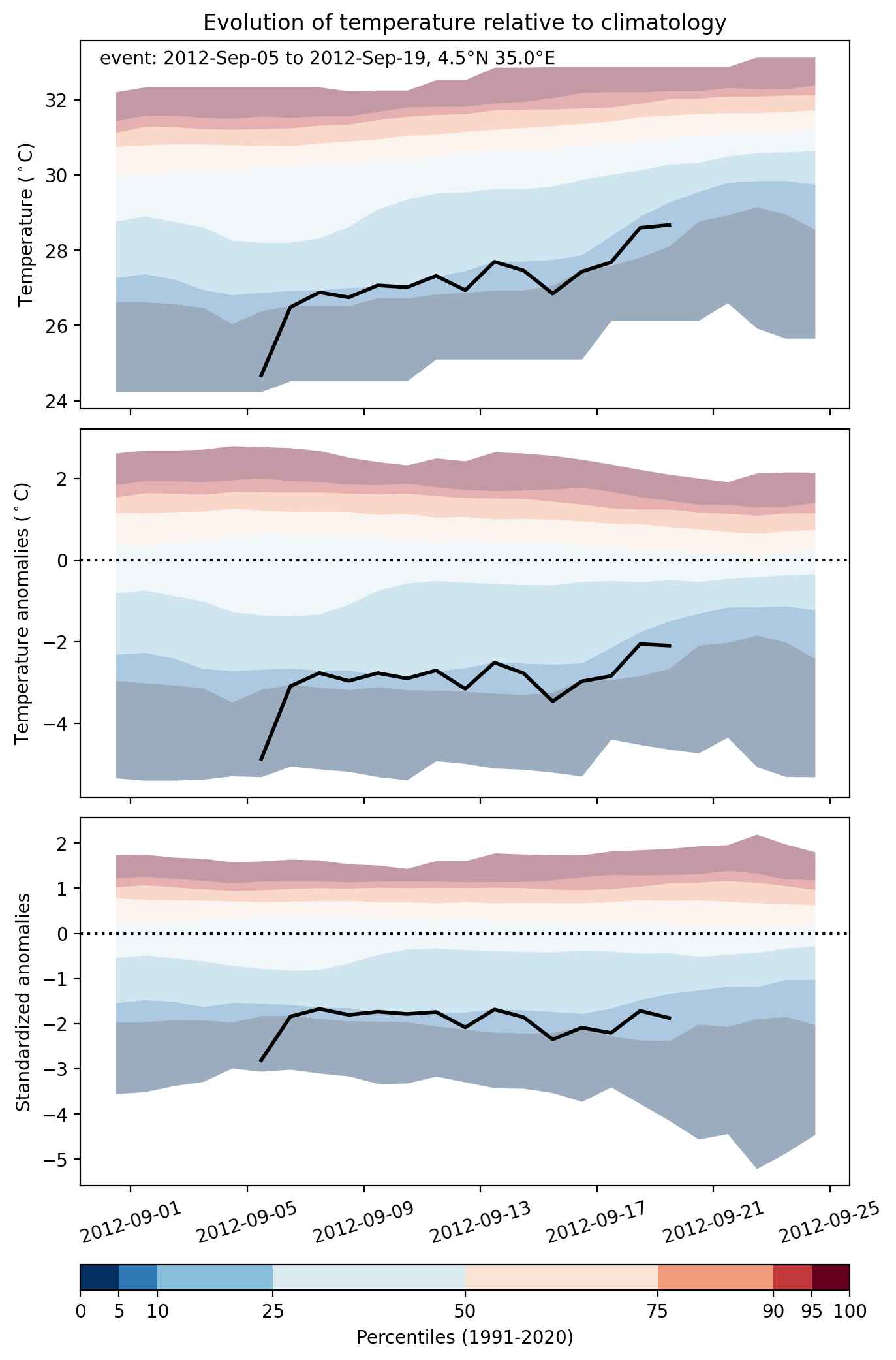
  • Mean temperature anomaly: -2.8 °C
  • Mean temperature: 25.8 °C
  • Minimum temperature anomaly: -4.9 °C
  • Minimum temperature: 21.3 °C

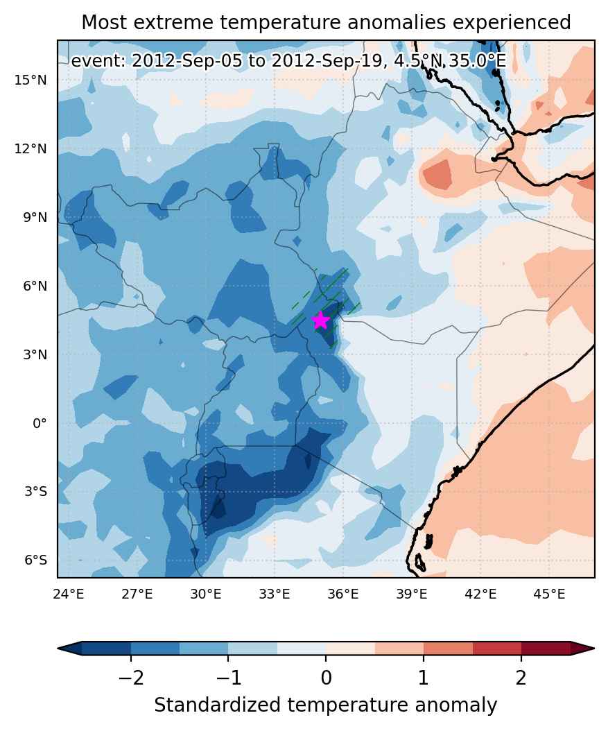
Event center: 4.5°N 35.0°E

Area affected: 55417 km$^2$


Fig. 1: Map of most extreme temperature anomalies (standardized) experienced during the event. The purple star indicates the center of the extreme event. Green hatching illustrates all areas under the effect of extremes at some time during the event.


Fig. 2: Evolution of temperature at the center of the event. The climatological percentile distribution is illustrated with color shadings.


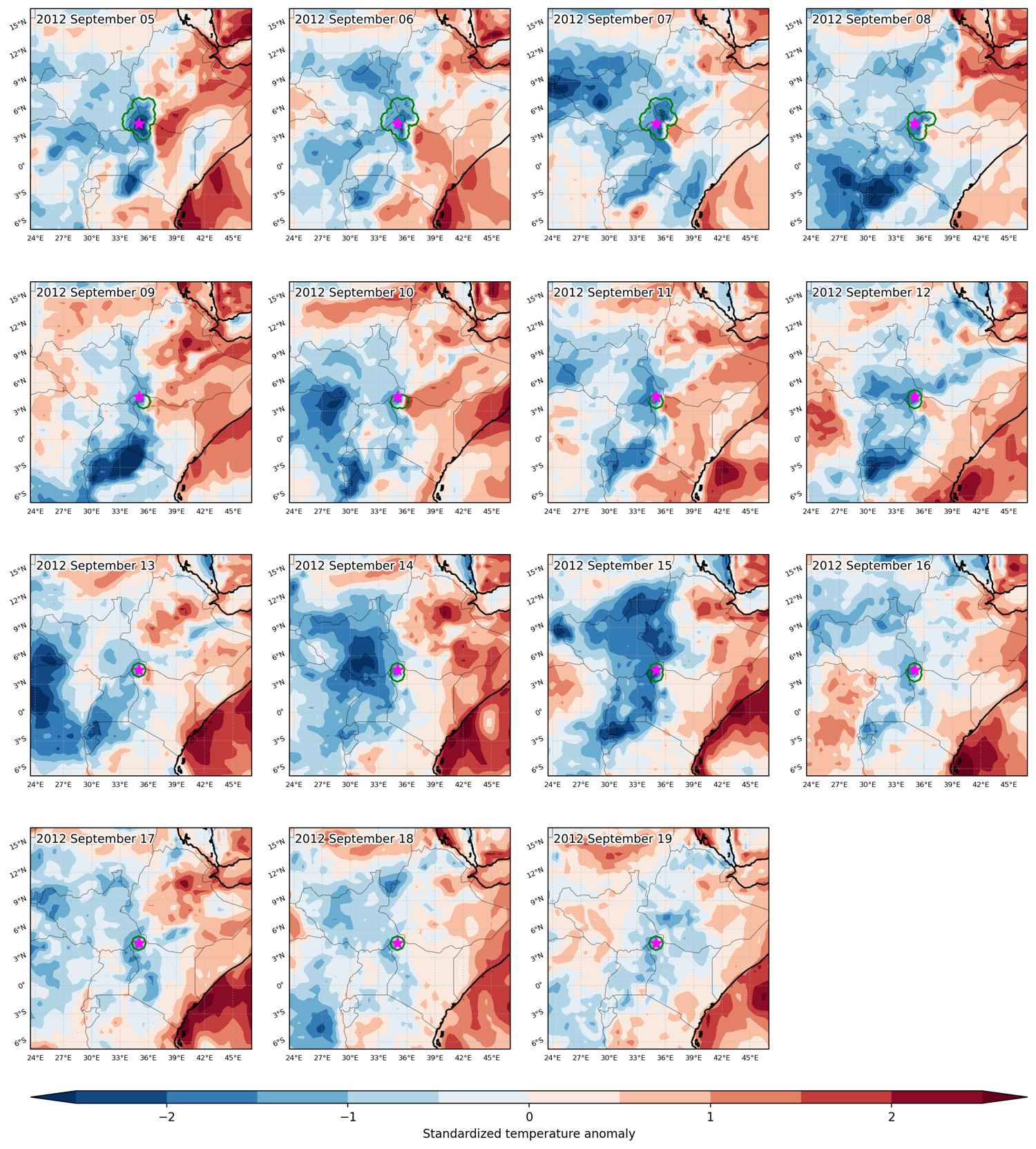
Fig. 3: Maps illustrating the evolution of standardized temperature anomalies during the event.

Event ID: Cold_spell_2012-Sep-05_to_2012-Sep-19_35.0_4.5

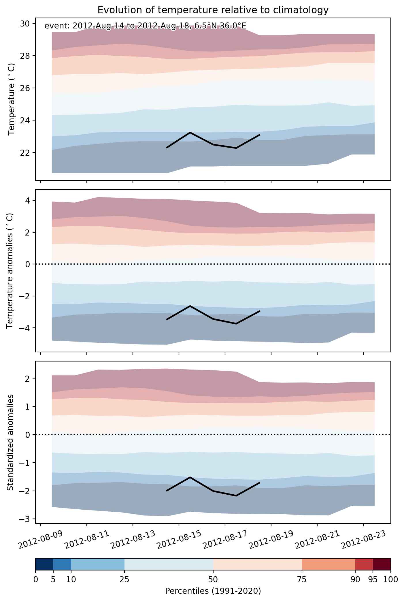
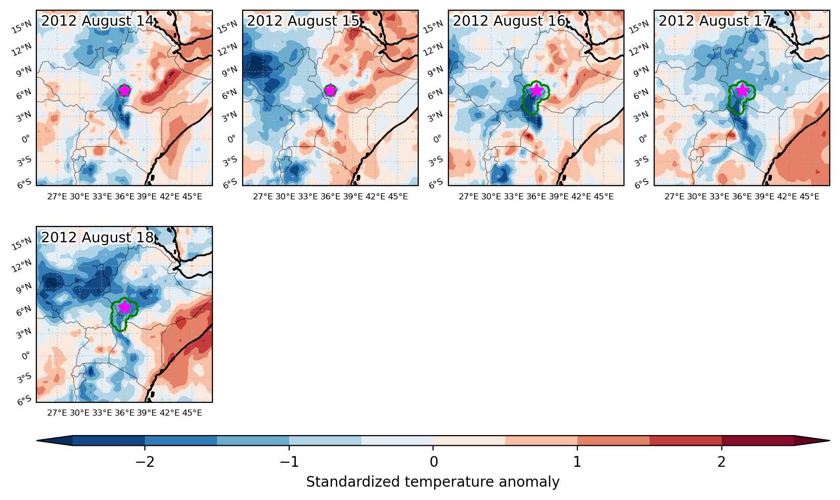
Cold spell occuring from August 14 2012 to August 18 2012 at 6.5°N 36.0°E

Download data: JSON

Event type: Cold spell

Countries affected (identified with ArcGIS Online; provided only for geographical reference):

  • Ethiopia
  • Kenya
  • South Sudan

Duration: 5 days

Time span: August 14 2012 to August 18 2012

Statistics over entire affected area:

  • Mean temperature anomaly: -2.6 °C
  • Mean temperature: 23.3 °C
  • Minimum temperature anomaly: -3.7 °C
  • Minimum temperature: 18.3 °C

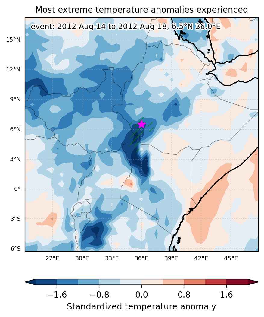
Event center: 6.5°N 36.0°E

Area affected: 52282 km$^2$


Fig. 1: Map of most extreme temperature anomalies (standardized) experienced during the event. The purple star indicates the center of the extreme event. Green hatching illustrates all areas under the effect of extremes at some time during the event.


Fig. 2: Evolution of temperature at the center of the event. The climatological percentile distribution is illustrated with color shadings.


Fig. 3: Maps illustrating the evolution of standardized temperature anomalies during the event.

Event ID: Cold_spell_2012-Aug-14_to_2012-Aug-18_36.0_6.5

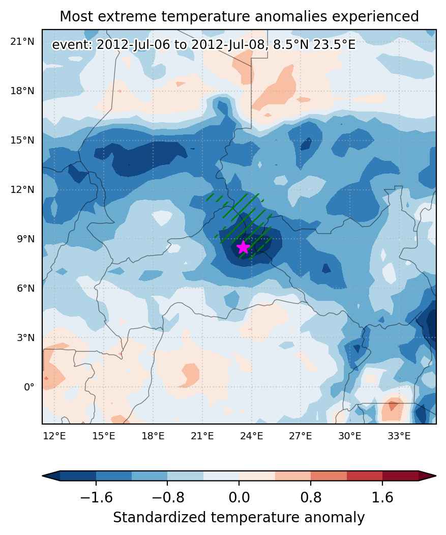
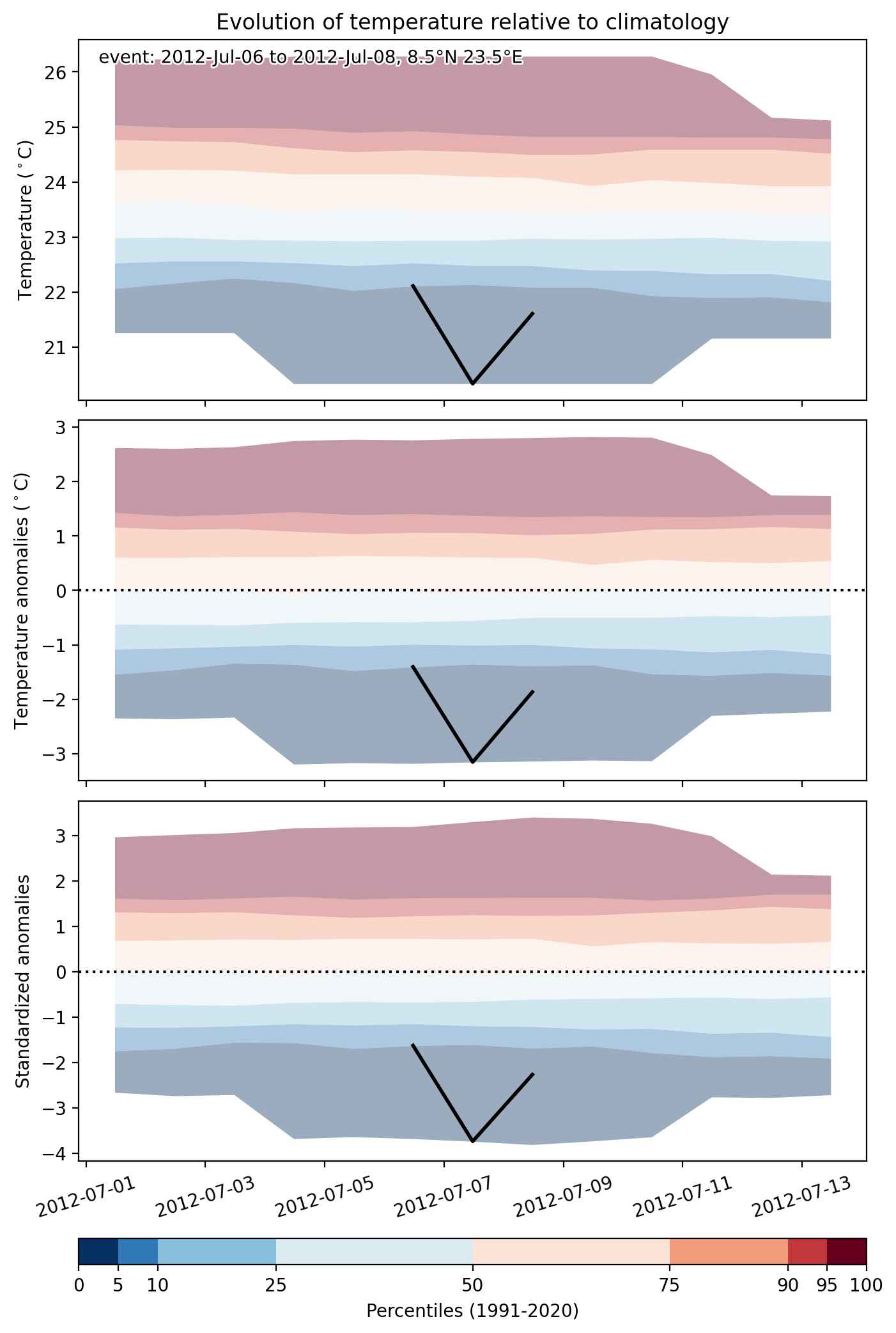
Cold spell occuring from July 06 2012 to July 08 2012 at 8.5°N 23.5°E

Download data: JSON

Event type: Cold spell

Countries affected (identified with ArcGIS Online; provided only for geographical reference):

  • Central African Republic
  • Chad
  • South Sudan
  • Sudan

Duration: 3 days

Time span: July 06 2012 to July 08 2012

Statistics over entire affected area:

  • Mean temperature anomaly: -1.9 °C
  • Mean temperature: 23.4 °C
  • Minimum temperature anomaly: -3.2 °C
  • Minimum temperature: 20.3 °C

Event center: 8.5°N 23.5°E

Area affected: 112651 km$^2$


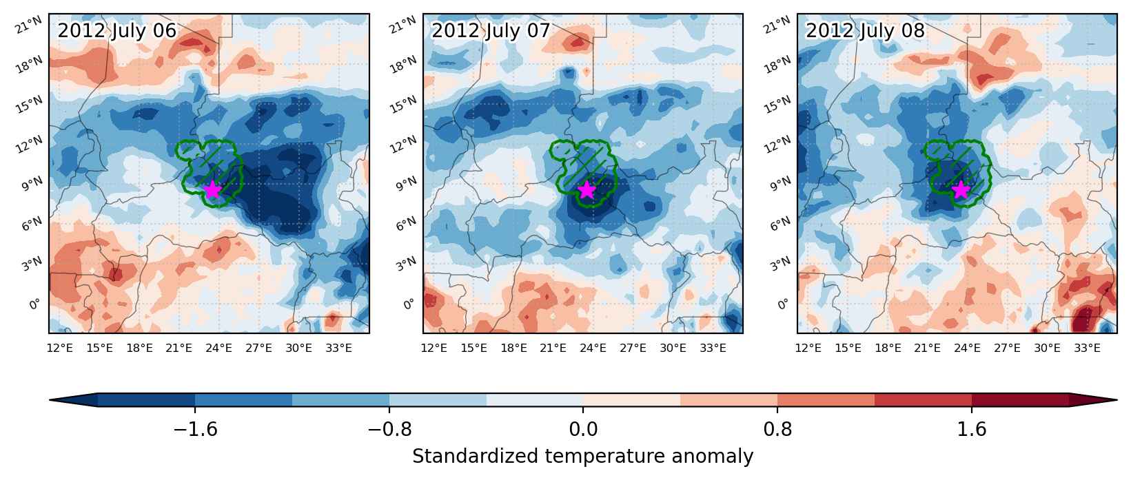
Fig. 1: Map of most extreme temperature anomalies (standardized) experienced during the event. The purple star indicates the center of the extreme event. Green hatching illustrates all areas under the effect of extremes at some time during the event.


Fig. 2: Evolution of temperature at the center of the event. The climatological percentile distribution is illustrated with color shadings.


Fig. 3: Maps illustrating the evolution of standardized temperature anomalies during the event.

Event ID: Cold_spell_2012-Jul-06_to_2012-Jul-08_23.5_8.5

Cold spell occuring from May 05 2012 to May 09 2012 at 5.0°N 39.0°E

Download data: JSON

Event type: Cold spell

Countries affected (identified with ArcGIS Online; provided only for geographical reference):

  • Ethiopia
  • Kenya
  • South Sudan
  • Uganda

Duration: 5 days

Time span: May 05 2012 to May 09 2012

Statistics over entire affected area:

  • Mean temperature anomaly: -2.1 °C
  • Mean temperature: 20.9 °C
  • Minimum temperature anomaly: -4.0 °C
  • Minimum temperature: 12.4 °C

Event center: 5.0°N 39.0°E

Area affected: 175217 km$^2$


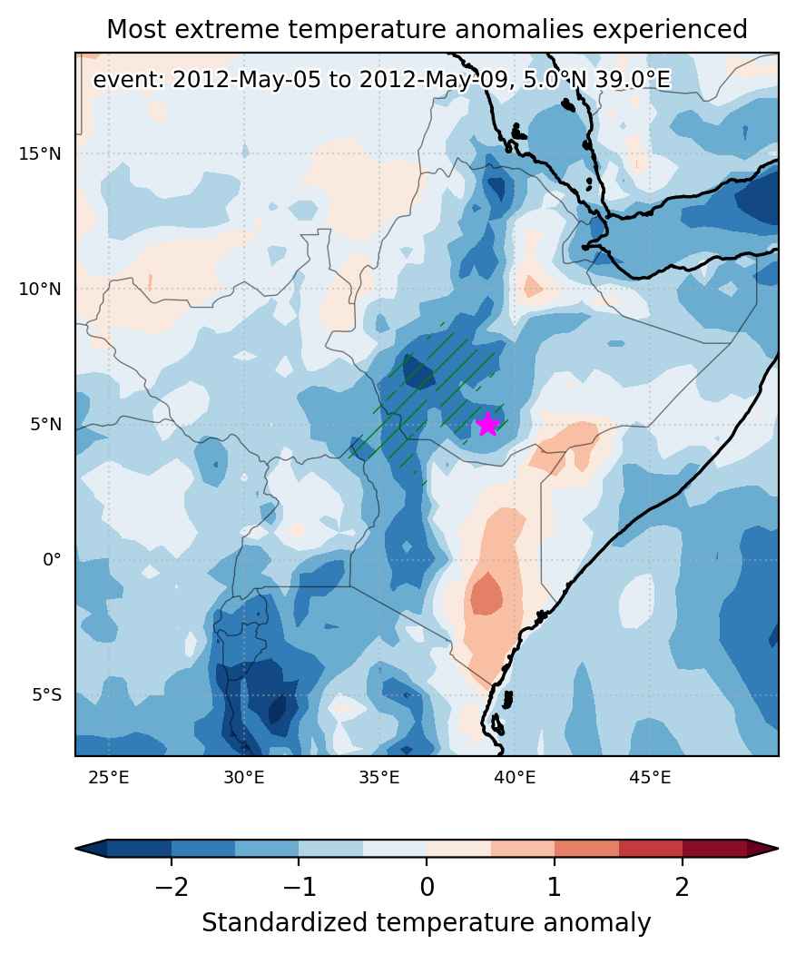
Fig. 1: Map of most extreme temperature anomalies (standardized) experienced during the event. The purple star indicates the center of the extreme event. Green hatching illustrates all areas under the effect of extremes at some time during the event.


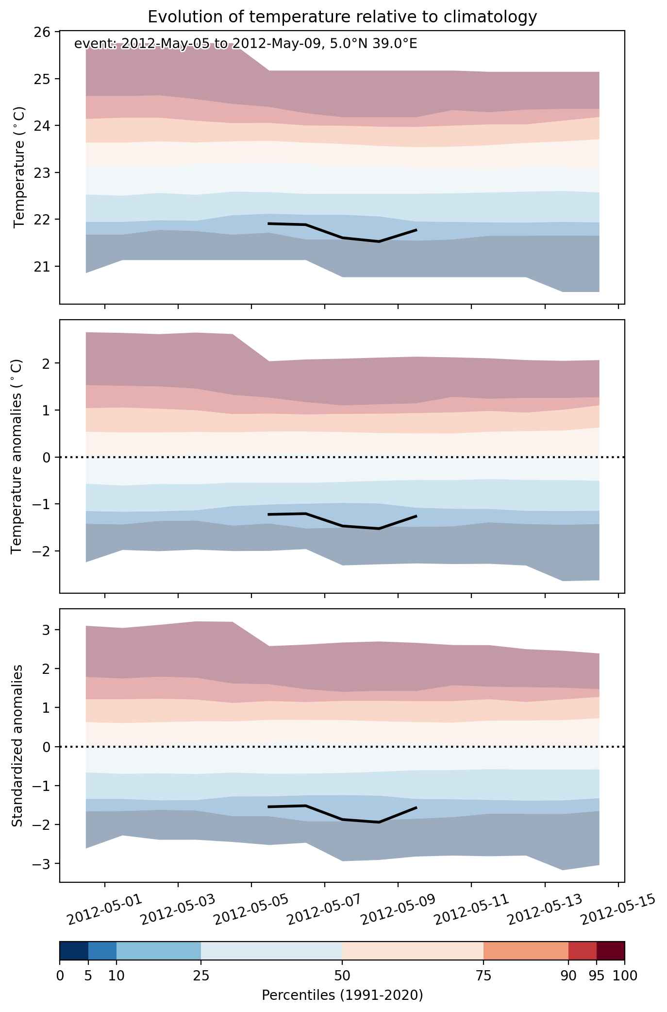
Fig. 2: Evolution of temperature at the center of the event. The climatological percentile distribution is illustrated with color shadings.


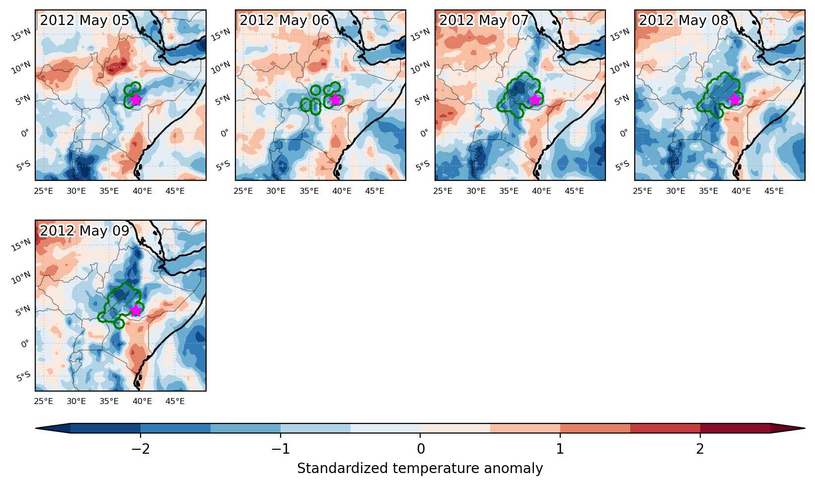
Fig. 3: Maps illustrating the evolution of standardized temperature anomalies during the event.

Event ID: Cold_spell_2012-May-05_to_2012-May-09_39.0_5.0

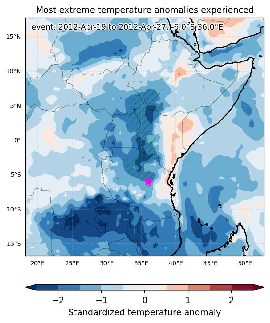
Cold spell occuring from April 19 2012 to April 27 2012 at -6.0°S 36.0°E

Download data: JSON

Event type: Cold spell

Countries affected (identified with ArcGIS Online; provided only for geographical reference):

  • Ethiopia
  • Kenya
  • South Sudan
  • Tanzania
  • Uganda

Duration: 9 days

Time span: April 19 2012 to April 27 2012

Statistics over entire affected area:

  • Mean temperature anomaly: -2.5 °C
  • Mean temperature: 20.9 °C
  • Minimum temperature anomaly: -5.0 °C
  • Minimum temperature: 13.1 °C

Event center: -6.0°S 36.0°E

Area affected: 465541 km$^2$


Fig. 1: Map of most extreme temperature anomalies (standardized) experienced during the event. The purple star indicates the center of the extreme event. Green hatching illustrates all areas under the effect of extremes at some time during the event.


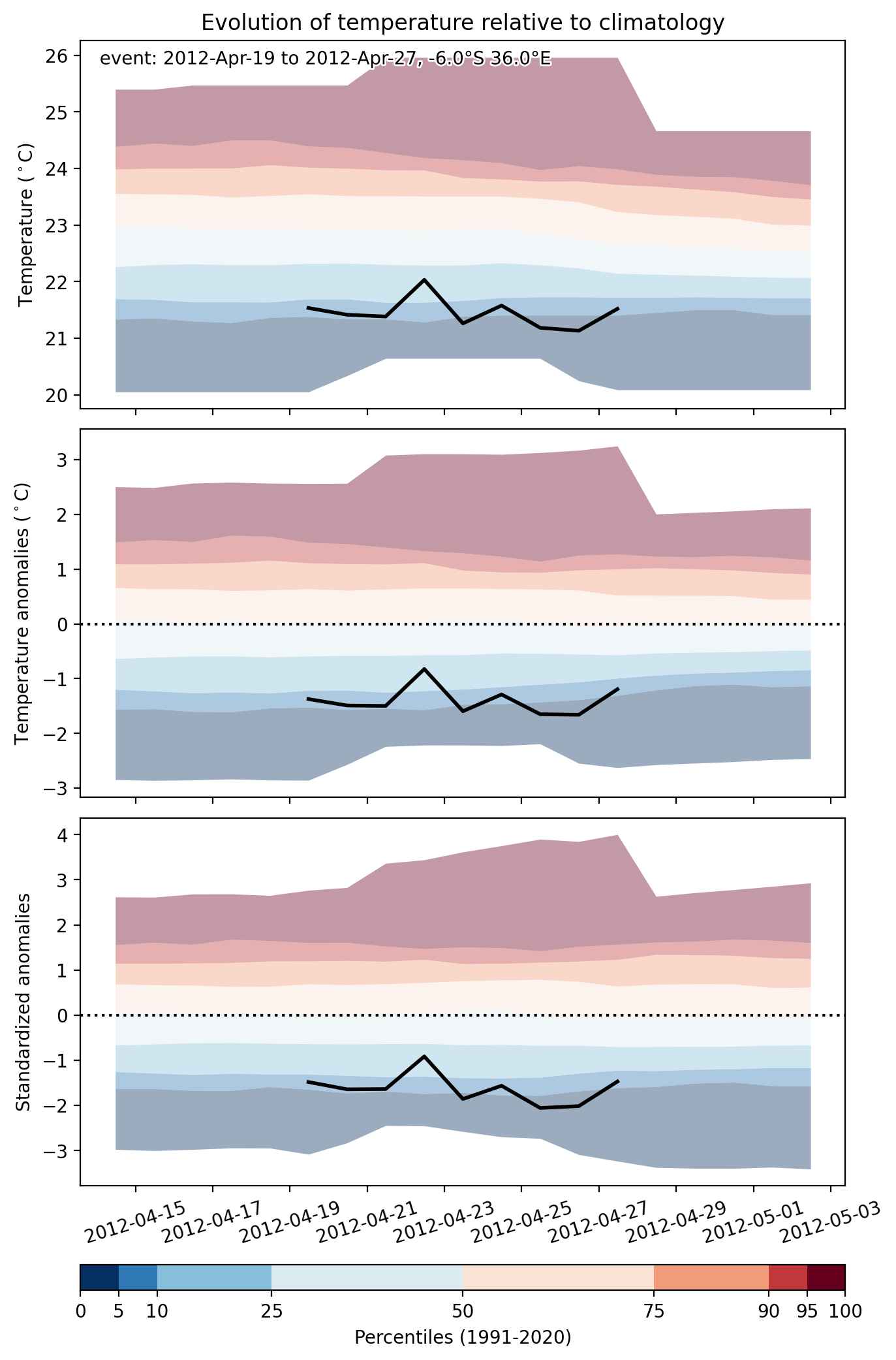
Fig. 2: Evolution of temperature at the center of the event. The climatological percentile distribution is illustrated with color shadings.


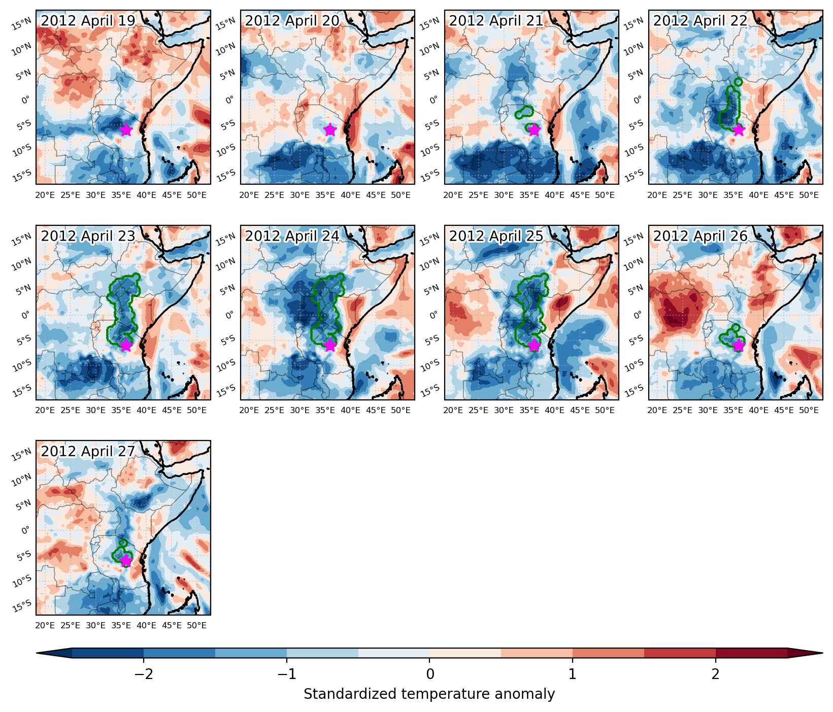
Fig. 3: Maps illustrating the evolution of standardized temperature anomalies during the event.

Event ID: Cold_spell_2012-Apr-19_to_2012-Apr-27_36.0_-6.0

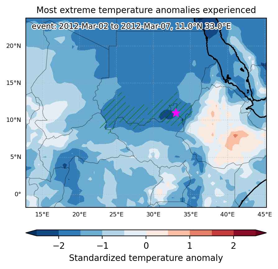
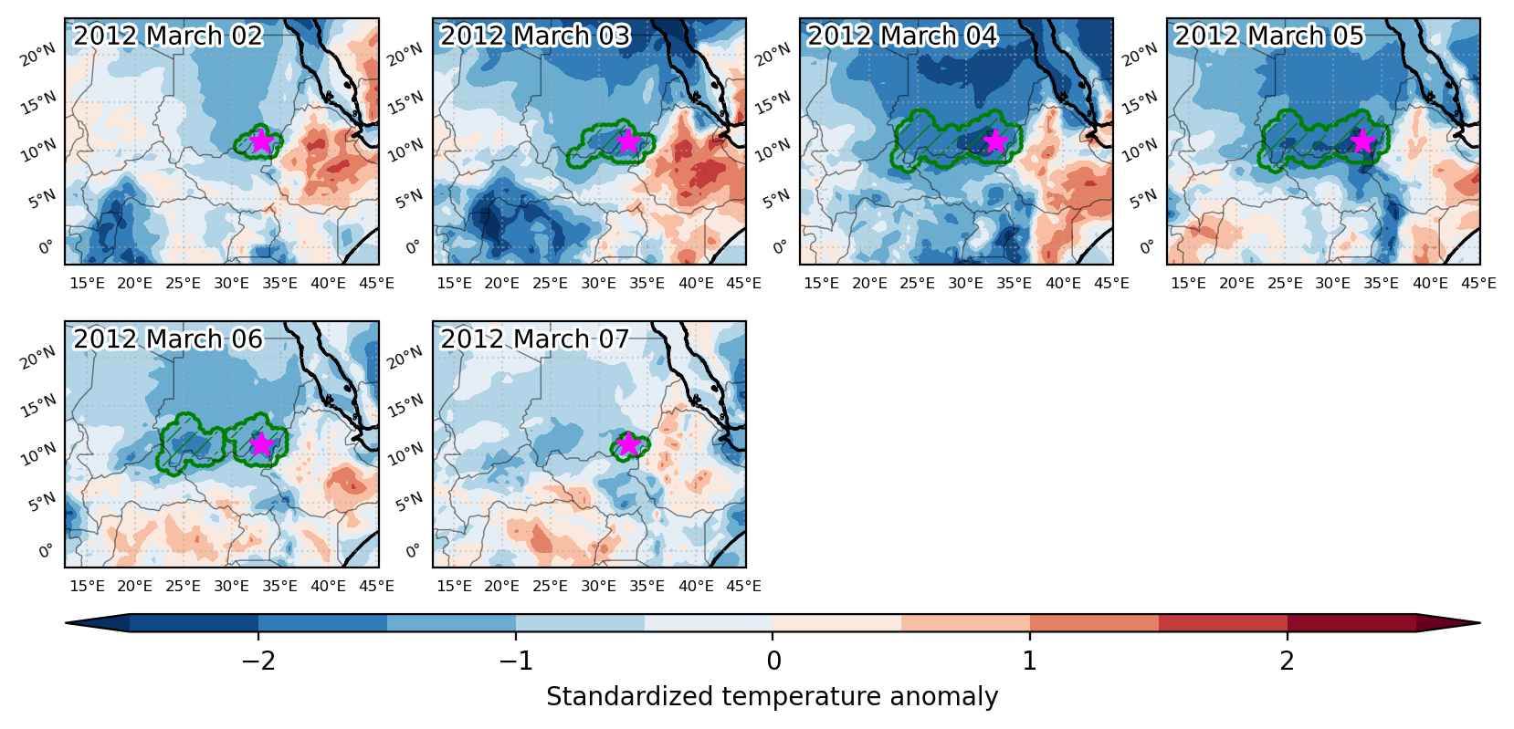
Cold spell occuring from March 02 2012 to March 07 2012 at 11.0°N 33.0°E

Download data: JSON

Event type: Cold spell

Countries affected (identified with ArcGIS Online; provided only for geographical reference):

  • Central African Republic
  • Ethiopia
  • South Sudan
  • Sudan

Duration: 6 days

Time span: March 02 2012 to March 07 2012

Statistics over entire affected area:

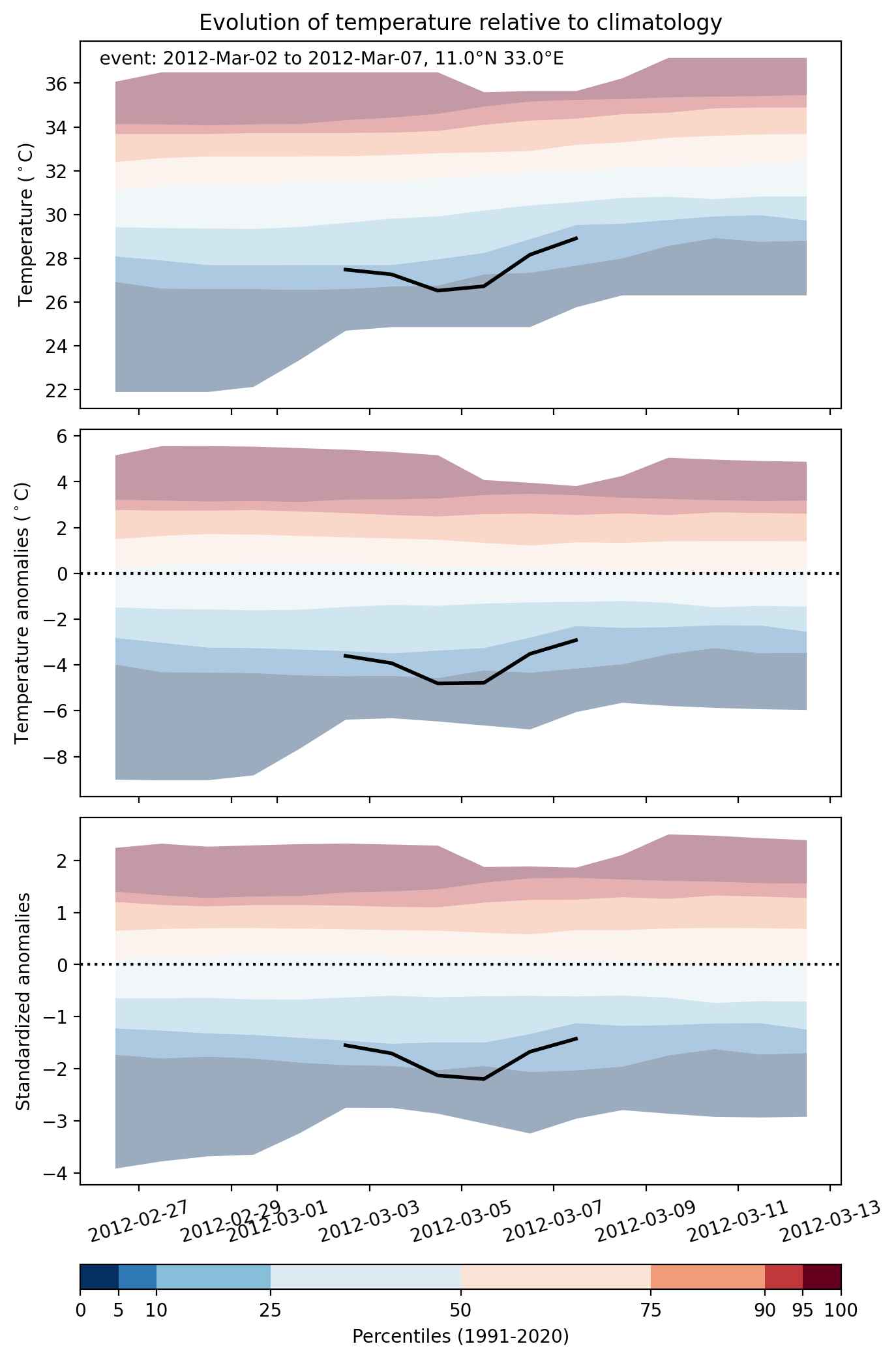
  • Mean temperature anomaly: -4.0 °C
  • Mean temperature: 26.0 °C
  • Minimum temperature anomaly: -5.8 °C
  • Minimum temperature: 19.3 °C

Event center: 11.0°N 33.0°E

Area affected: 439877 km$^2$


Fig. 1: Map of most extreme temperature anomalies (standardized) experienced during the event. The purple star indicates the center of the extreme event. Green hatching illustrates all areas under the effect of extremes at some time during the event.


Fig. 2: Evolution of temperature at the center of the event. The climatological percentile distribution is illustrated with color shadings.


Fig. 3: Maps illustrating the evolution of standardized temperature anomalies during the event.

Event ID: Cold_spell_2012-Mar-02_to_2012-Mar-07_33.0_11.0