Heat wave occuring from January 24 2012 to January 29 2012 at -10.0°S 120.0°E

Download data: JSON

Event type: Heat wave

Countries affected (identified with ArcGIS Online; provided only for geographical reference):

  • Indonesia

Duration: 6 days

Time span: January 24 2012 to January 29 2012

Statistics over entire affected area:

  • Mean temperature anomaly: 1.1 °C
  • Mean temperature: 28.2 °C
  • Maximum temperature anomaly: 1.9 °C
  • Maximum temperature: 28.9 °C

Event center: -10.0°S 120.0°E

Area affected: 79170 km$^2$
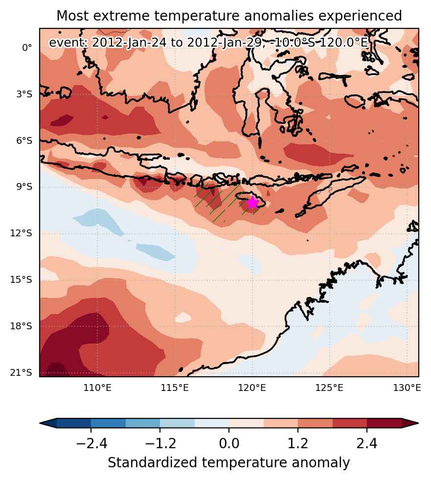

Fig. 1: Map of most extreme temperature anomalies (standardized) experienced during the event. The purple star indicates the center of the extreme event. Green hatching illustrates all areas under the effect of extremes at some time during the event.
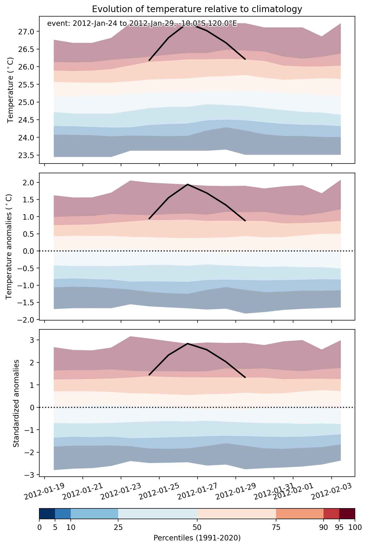


Fig. 2: Evolution of temperature at the center of the event. The climatological percentile distribution is illustrated with color shadings.
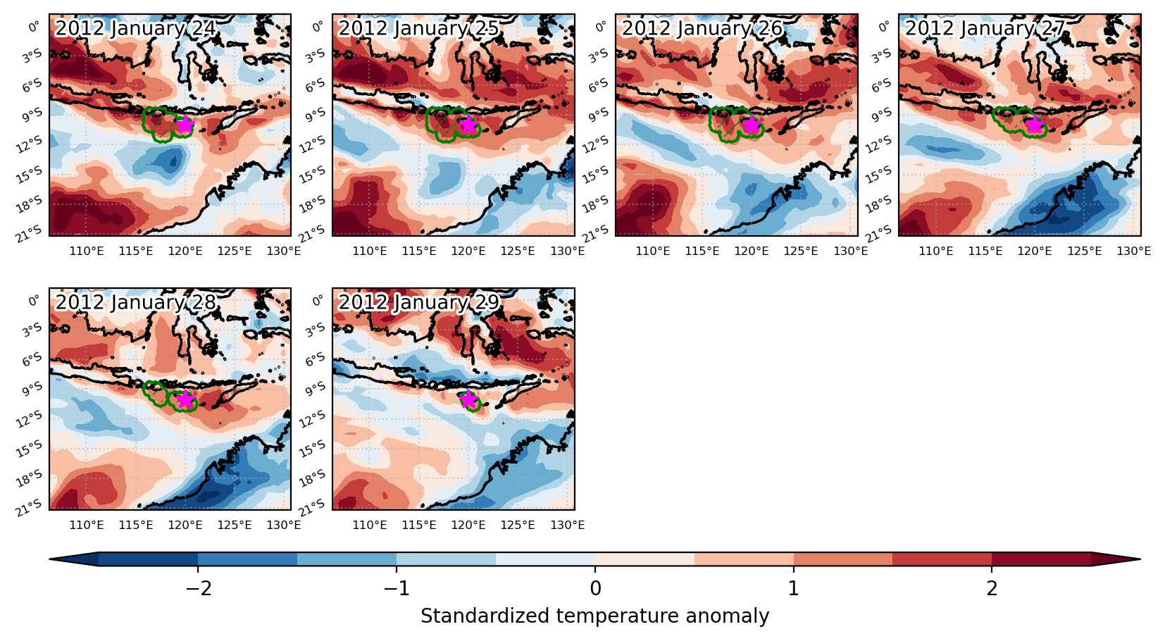


Fig. 3: Maps illustrating the evolution of standardized temperature anomalies during the event.

Event ID: Heat_wave_2012-Jan-24_to_2012-Jan-29_120.0_-10.0
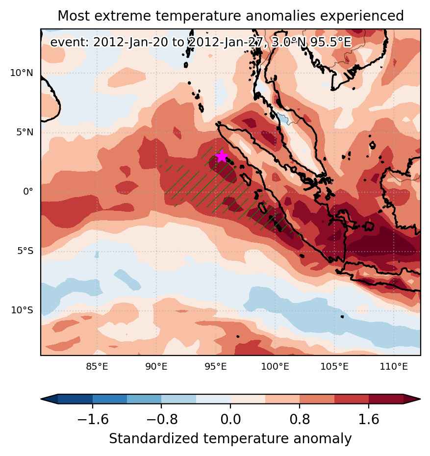
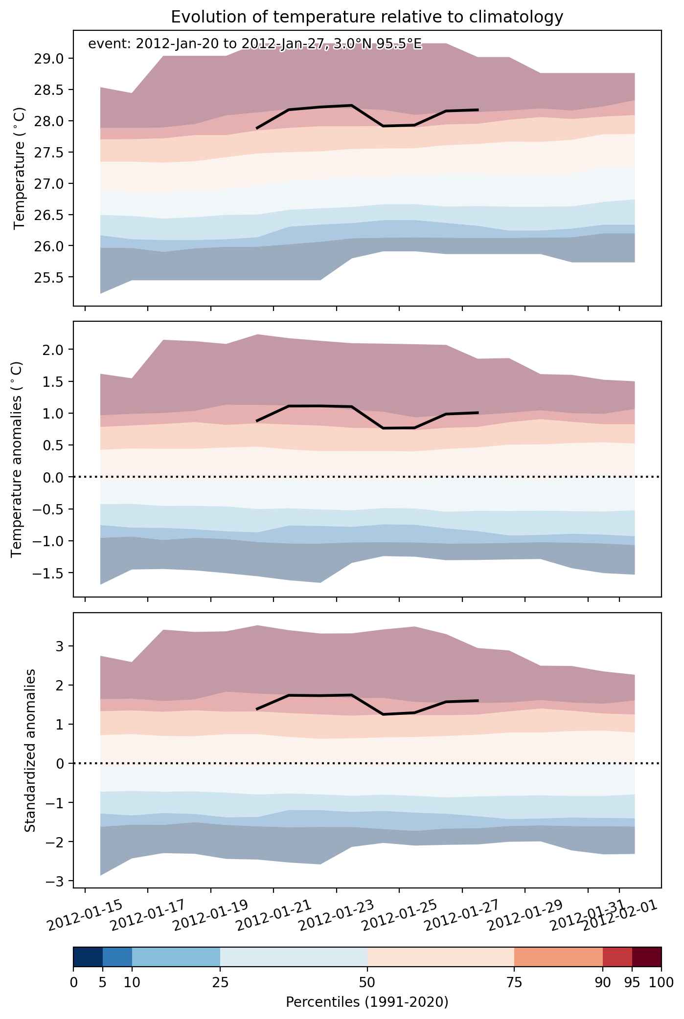
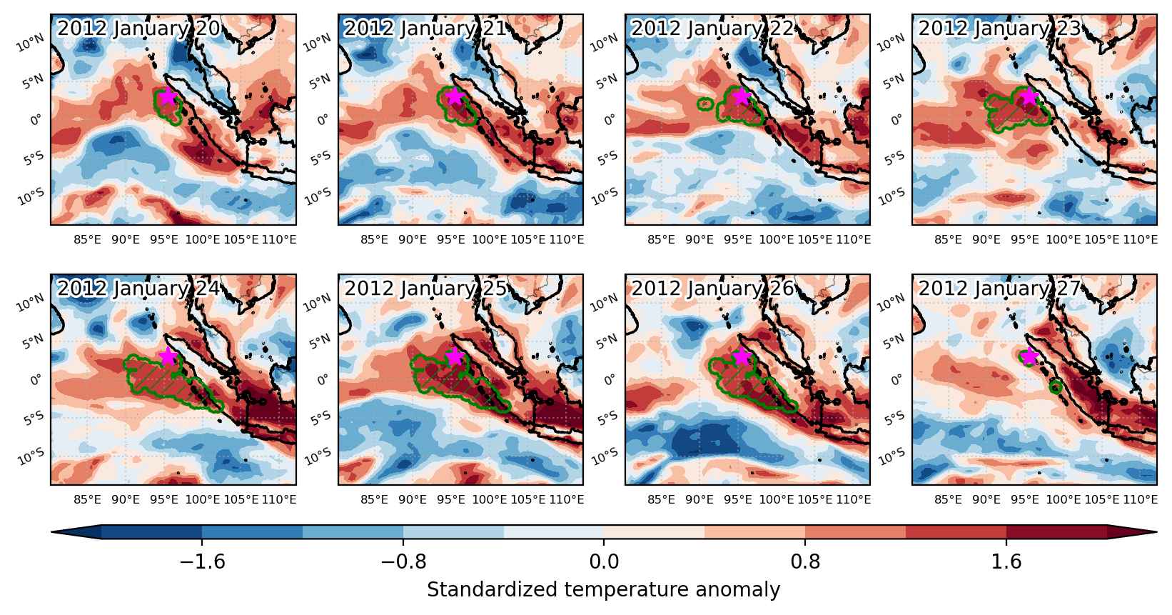
Heat wave occuring from January 20 2012 to January 27 2012 at 3.0°N 95.5°E

Download data: JSON

Event type: Heat wave

Countries affected (identified with ArcGIS Online; provided only for geographical reference):

  • Indonesia

Duration: 8 days

Time span: January 20 2012 to January 27 2012

Statistics over entire affected area:

  • Mean temperature anomaly: 1.0 °C
  • Mean temperature: 28.1 °C
  • Maximum temperature anomaly: 1.9 °C
  • Maximum temperature: 28.8 °C

Event center: 3.0°N 95.5°E

Area affected: 398573 km$^2$


Fig. 1: Map of most extreme temperature anomalies (standardized) experienced during the event. The purple star indicates the center of the extreme event. Green hatching illustrates all areas under the effect of extremes at some time during the event.


Fig. 2: Evolution of temperature at the center of the event. The climatological percentile distribution is illustrated with color shadings.


Fig. 3: Maps illustrating the evolution of standardized temperature anomalies during the event.

Event ID: Heat_wave_2012-Jan-20_to_2012-Jan-27_95.5_3.0

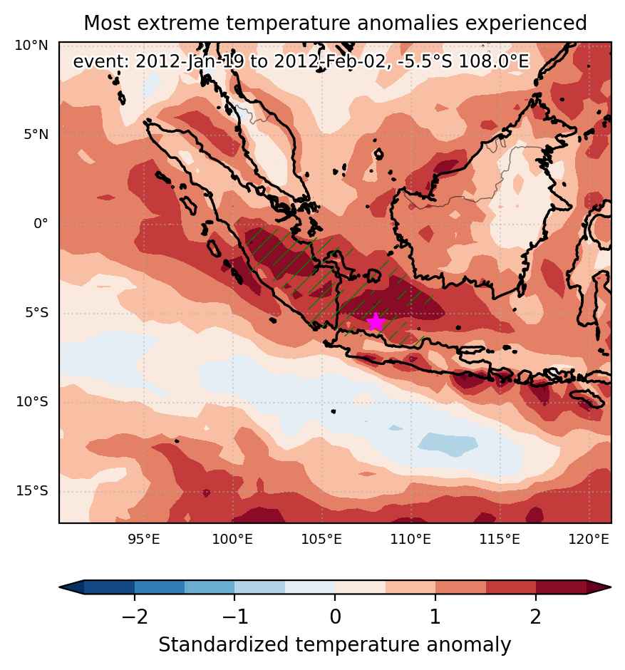
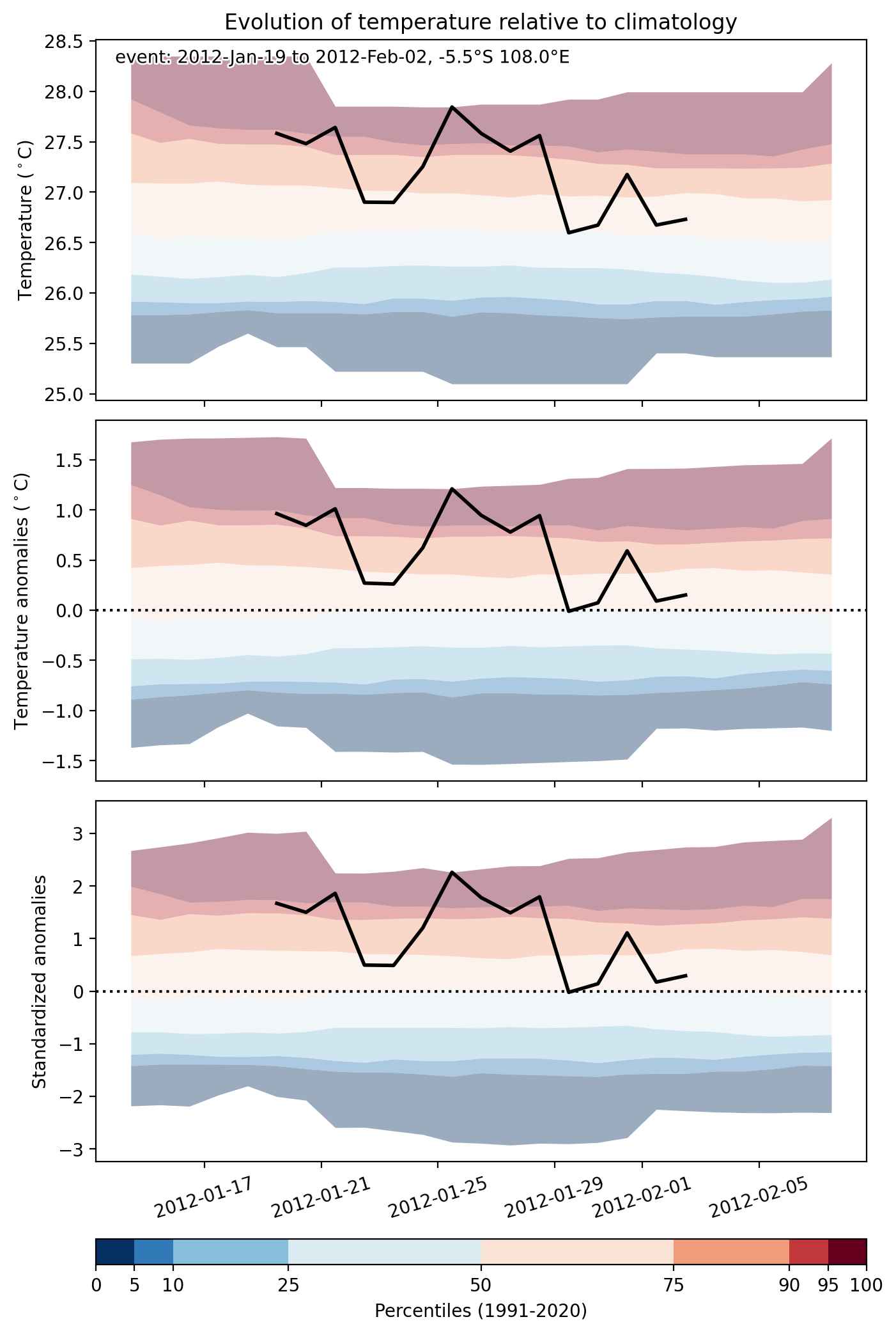
Heat wave occuring from January 19 2012 to February 02 2012 at -5.5°S 108.0°E

Download data: JSON

Event type: Heat wave

Countries affected (identified with ArcGIS Online; provided only for geographical reference):

  • Indonesia

Duration: 15 days

Time span: January 19 2012 to February 02 2012

Statistics over entire affected area:

  • Mean temperature anomaly: 1.3 °C
  • Mean temperature: 27.3 °C
  • Maximum temperature anomaly: 2.9 °C
  • Maximum temperature: 28.6 °C

Event center: -5.5°S 108.0°E

Area affected: 357801 km$^2$


Fig. 1: Map of most extreme temperature anomalies (standardized) experienced during the event. The purple star indicates the center of the extreme event. Green hatching illustrates all areas under the effect of extremes at some time during the event.


Fig. 2: Evolution of temperature at the center of the event. The climatological percentile distribution is illustrated with color shadings.


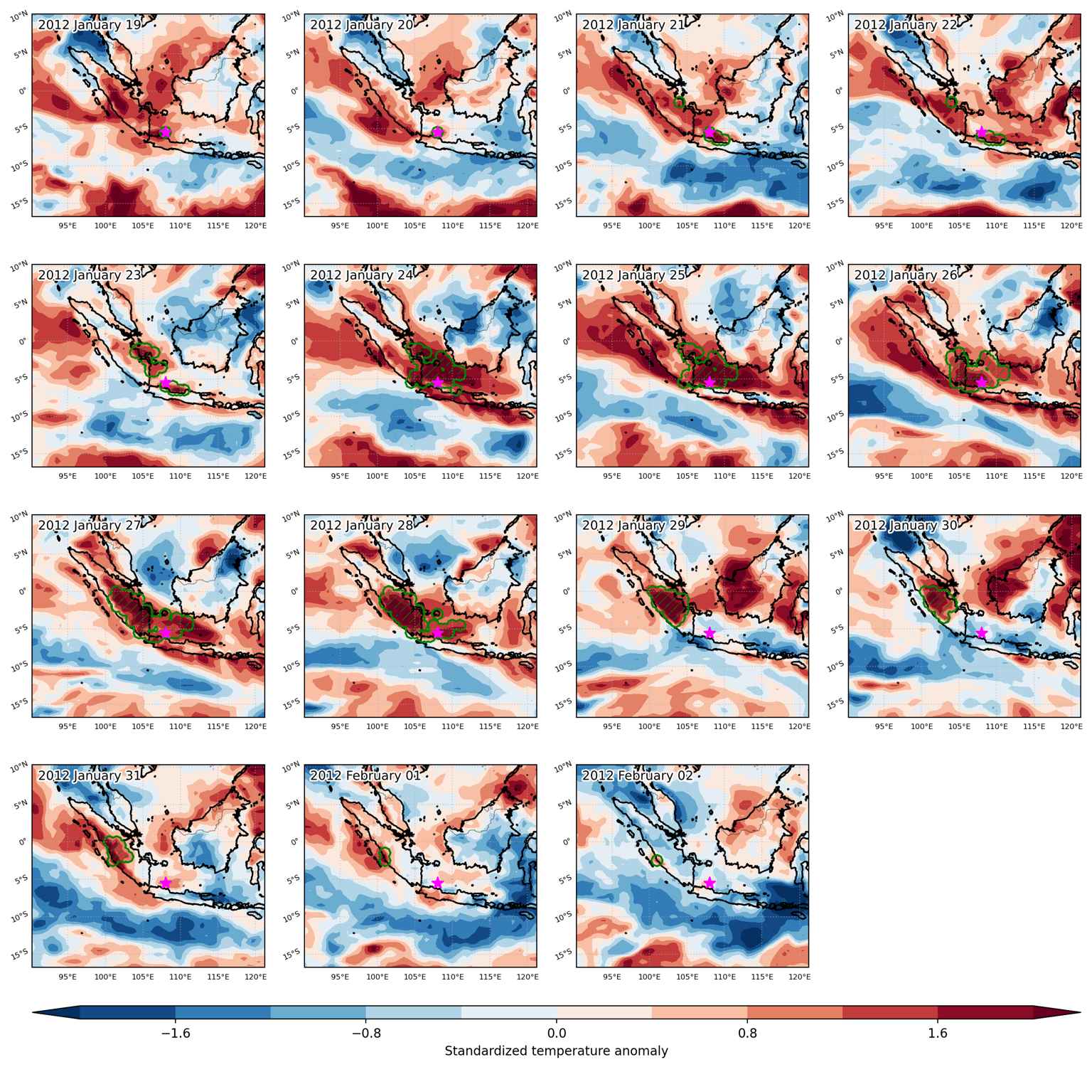
Fig. 3: Maps illustrating the evolution of standardized temperature anomalies during the event.

Event ID: Heat_wave_2012-Jan-19_to_2012-Feb-02_108.0_-5.5

Heat wave occuring from January 13 2012 to January 21 2012 at 3.5°N 113.0°E

Download data: JSON

Event type: Heat wave

Countries affected (identified with ArcGIS Online; provided only for geographical reference):

  • Indonesia
  • Malaysia

Duration: 9 days

Time span: January 13 2012 to January 21 2012

Statistics over entire affected area:

  • Mean temperature anomaly: 1.3 °C
  • Mean temperature: 27.6 °C
  • Maximum temperature anomaly: 2.1 °C
  • Maximum temperature: 28.2 °C

Event center: 3.5°N 113.0°E

Area affected: 249862 km$^2$


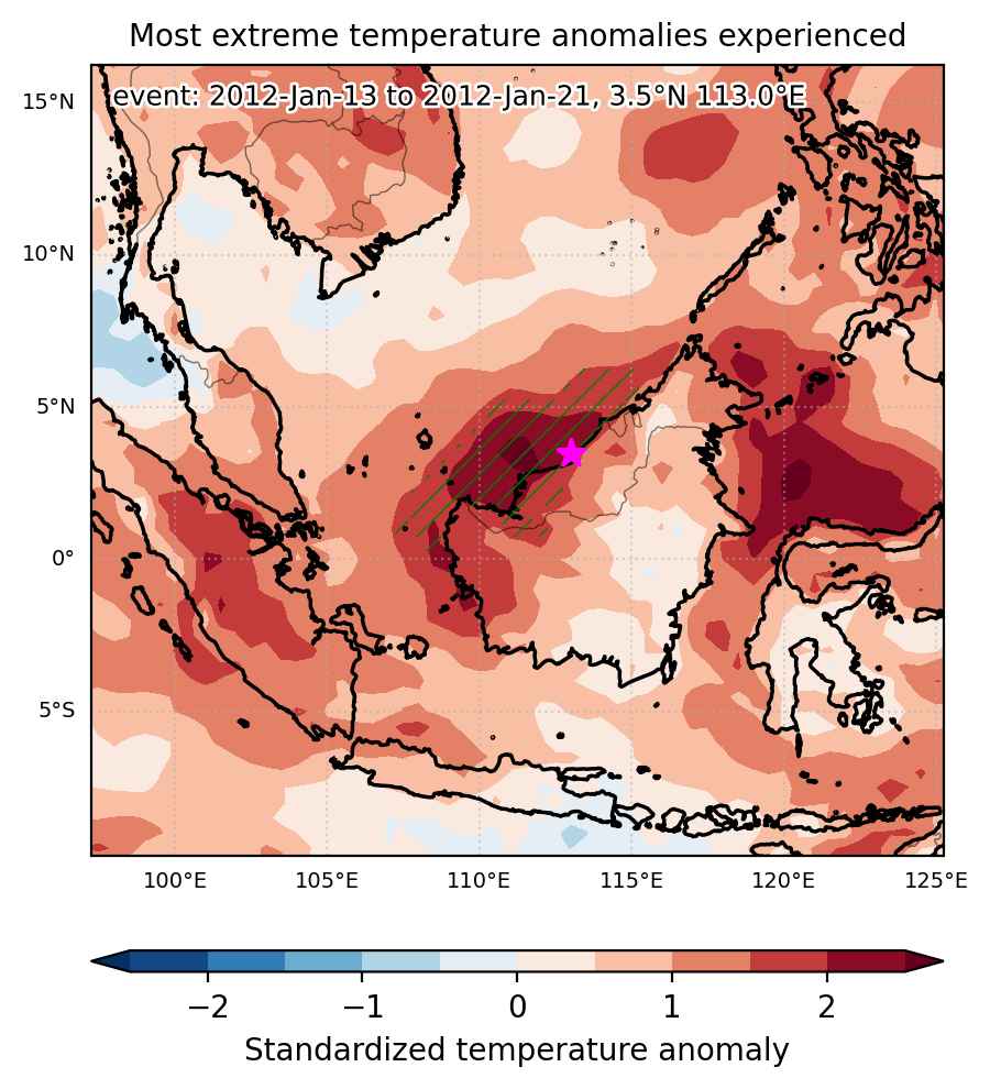
Fig. 1: Map of most extreme temperature anomalies (standardized) experienced during the event. The purple star indicates the center of the extreme event. Green hatching illustrates all areas under the effect of extremes at some time during the event.


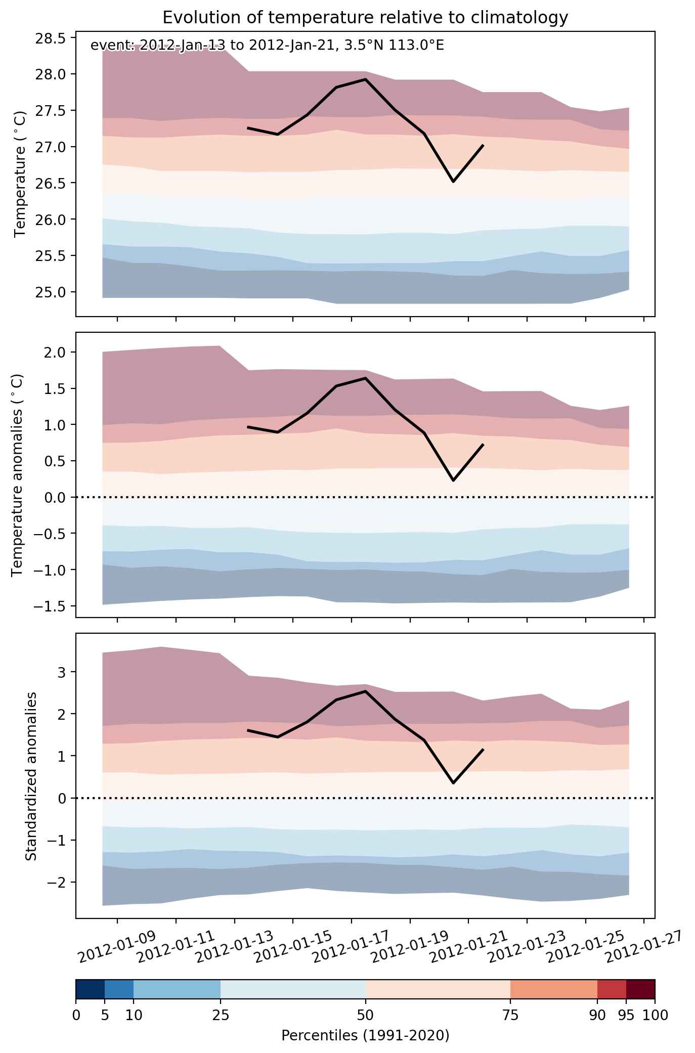
Fig. 2: Evolution of temperature at the center of the event. The climatological percentile distribution is illustrated with color shadings.


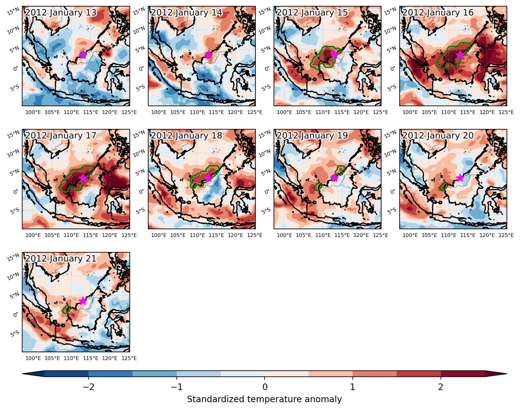
Fig. 3: Maps illustrating the evolution of standardized temperature anomalies during the event.

Event ID: Heat_wave_2012-Jan-13_to_2012-Jan-21_113.0_3.5

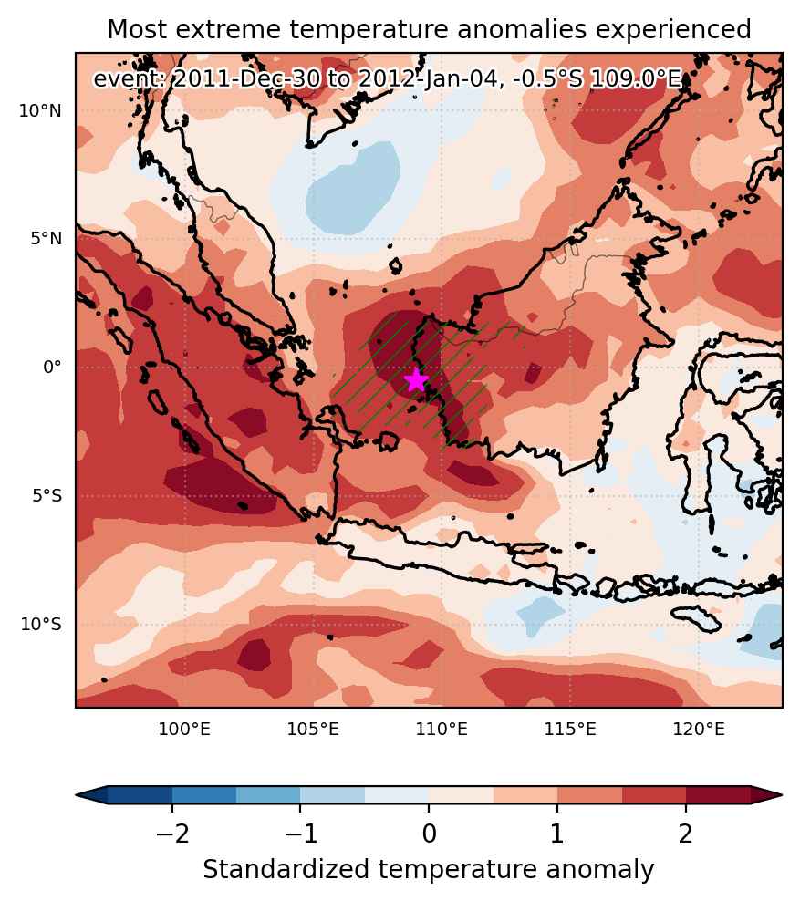
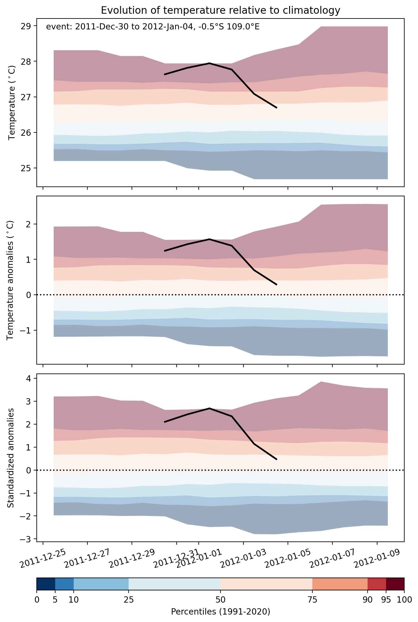
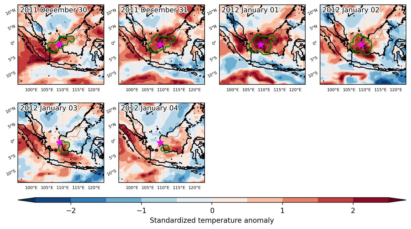
Heat wave occuring from December 30 2011 to January 04 2012 at -0.5°S 109.0°E

Download data: JSON

Event type: Heat wave

Countries affected (identified with ArcGIS Online; provided only for geographical reference):

  • Indonesia
  • Malaysia

Duration: 6 days

Time span: December 30 2011 to January 04 2012

Statistics over entire affected area:

  • Mean temperature anomaly: 1.1 °C
  • Mean temperature: 27.2 °C
  • Maximum temperature anomaly: 1.9 °C
  • Maximum temperature: 28.1 °C

Event center: -0.5°S 109.0°E

Area affected: 290478 km$^2$


Fig. 1: Map of most extreme temperature anomalies (standardized) experienced during the event. The purple star indicates the center of the extreme event. Green hatching illustrates all areas under the effect of extremes at some time during the event.


Fig. 2: Evolution of temperature at the center of the event. The climatological percentile distribution is illustrated with color shadings.


Fig. 3: Maps illustrating the evolution of standardized temperature anomalies during the event.

Event ID: Heat_wave_2011-Dec-30_to_2012-Jan-04_109.0_-0.5

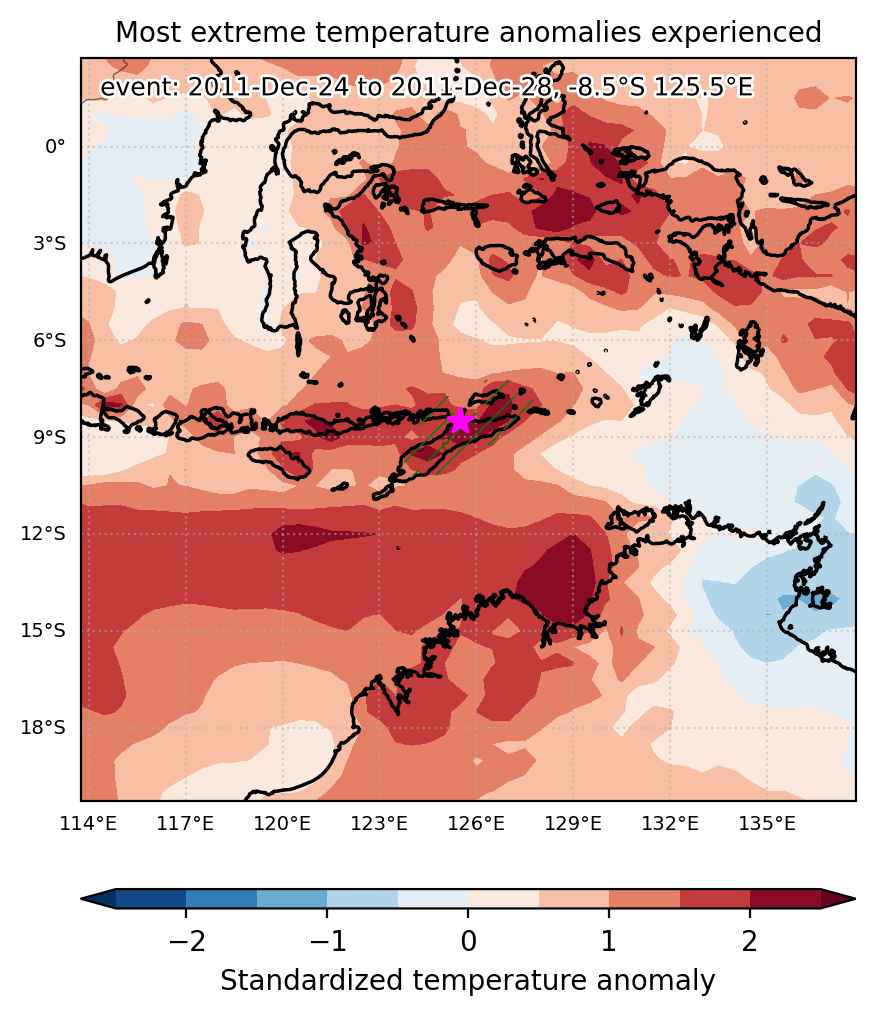
Heat wave occuring from December 24 2011 to December 28 2011 at -8.5°S 125.5°E

Download data: JSON

Event type: Heat wave

Countries affected (identified with ArcGIS Online; provided only for geographical reference):

  • Indonesia
  • Timor-Leste

Duration: 5 days

Time span: December 24 2011 to December 28 2011

Statistics over entire affected area:

  • Mean temperature anomaly: 1.2 °C
  • Mean temperature: 27.8 °C
  • Maximum temperature anomaly: 2.4 °C
  • Maximum temperature: 29.6 °C

Event center: -8.5°S 125.5°E

Area affected: 70264 km$^2$


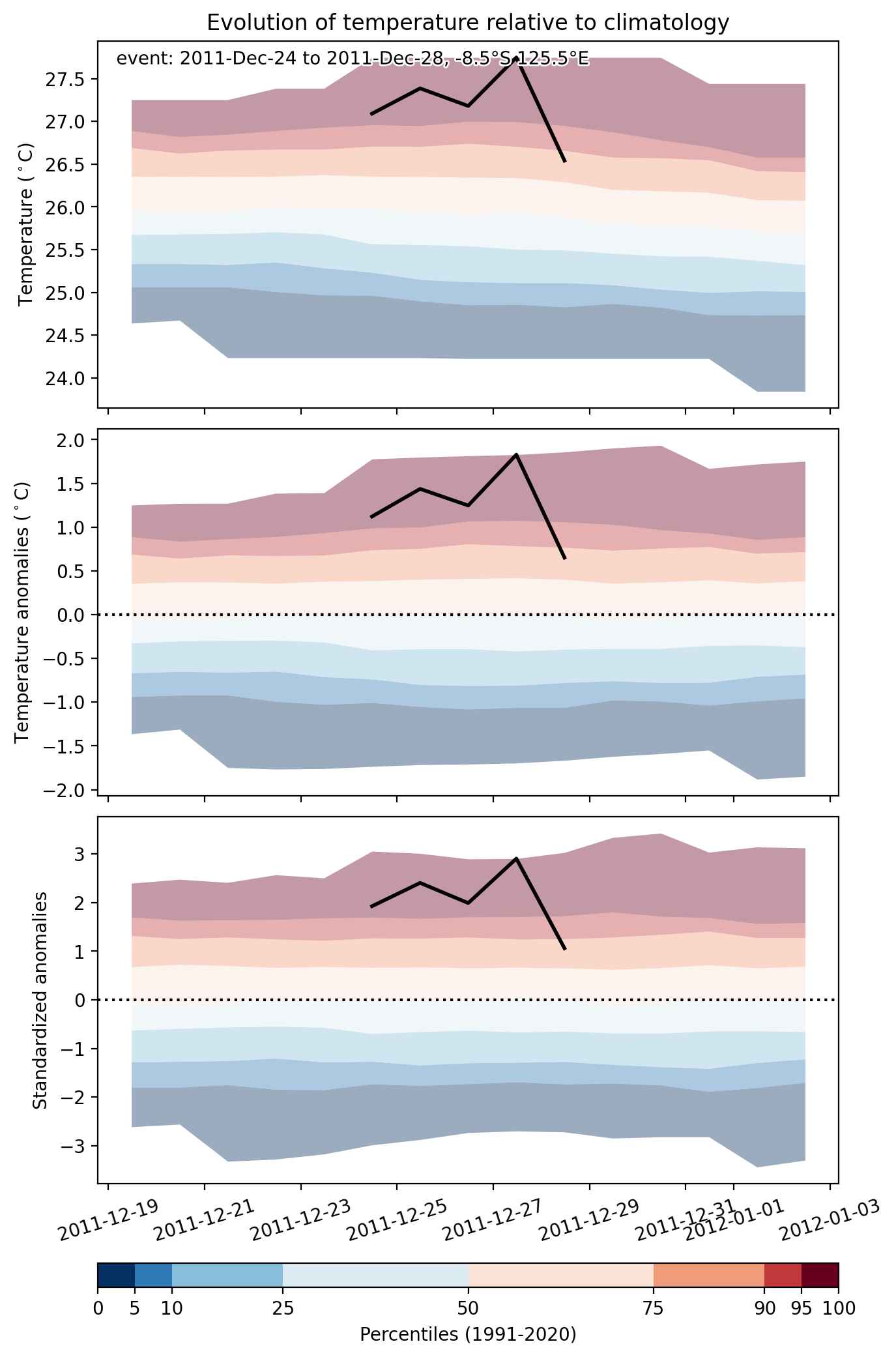
Fig. 1: Map of most extreme temperature anomalies (standardized) experienced during the event. The purple star indicates the center of the extreme event. Green hatching illustrates all areas under the effect of extremes at some time during the event.


Fig. 2: Evolution of temperature at the center of the event. The climatological percentile distribution is illustrated with color shadings.


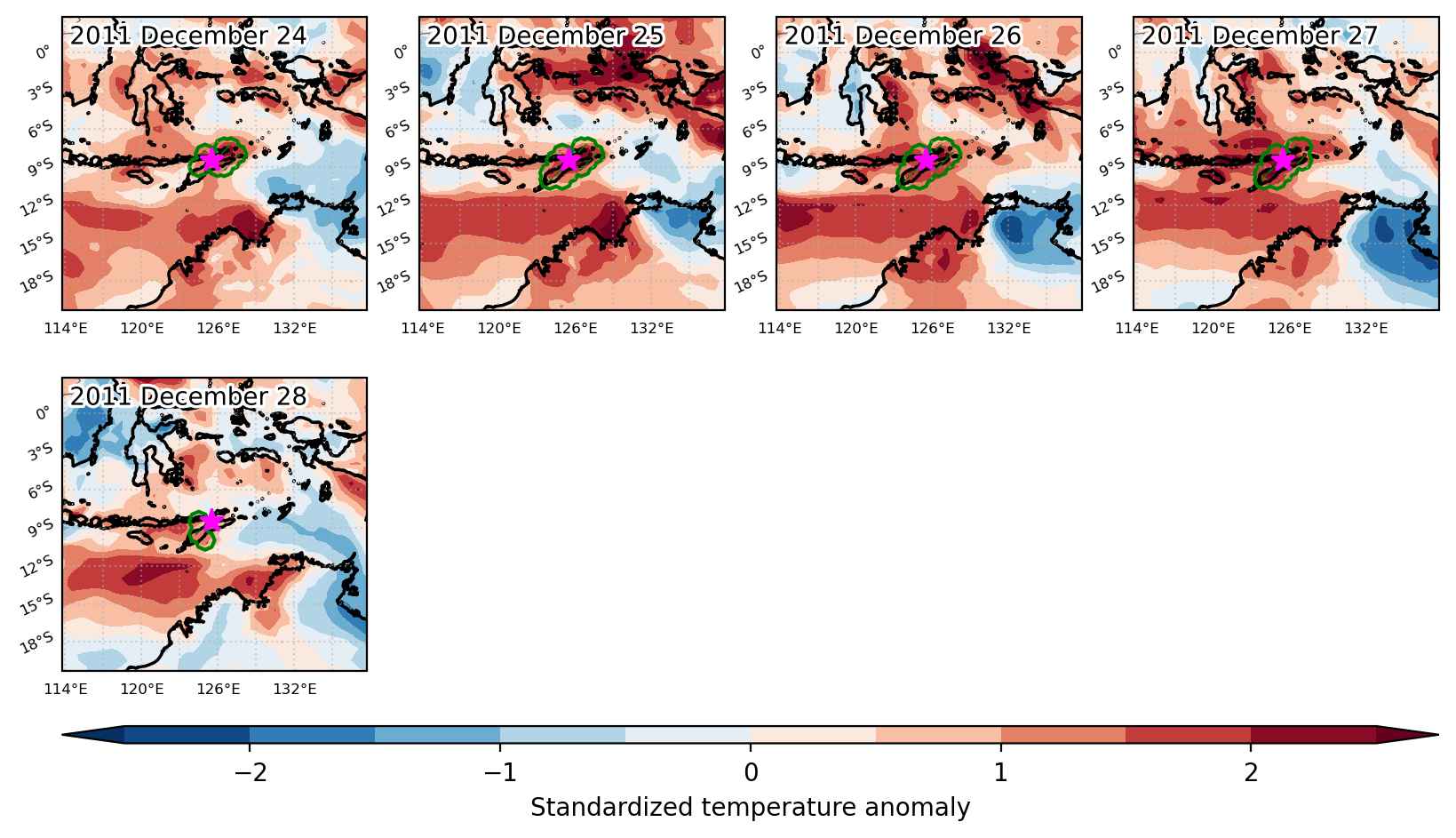
Fig. 3: Maps illustrating the evolution of standardized temperature anomalies during the event.

Event ID: Heat_wave_2011-Dec-24_to_2011-Dec-28_125.5_-8.5

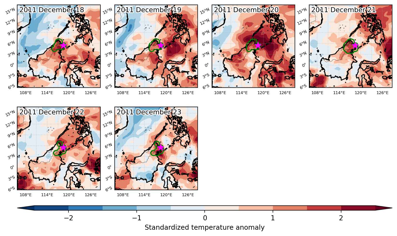
Heat wave occuring from December 18 2011 to December 23 2011 at 5.5°N 118.5°E

Download data: JSON

Event type: Heat wave

Countries affected (identified with ArcGIS Online; provided only for geographical reference):

  • Indonesia
  • Malaysia

Duration: 6 days

Time span: December 18 2011 to December 23 2011

Statistics over entire affected area:

  • Mean temperature anomaly: 1.3 °C
  • Mean temperature: 26.4 °C
  • Maximum temperature anomaly: 1.8 °C
  • Maximum temperature: 28.3 °C

Event center: 5.5°N 118.5°E

Area affected: 61561 km$^2$


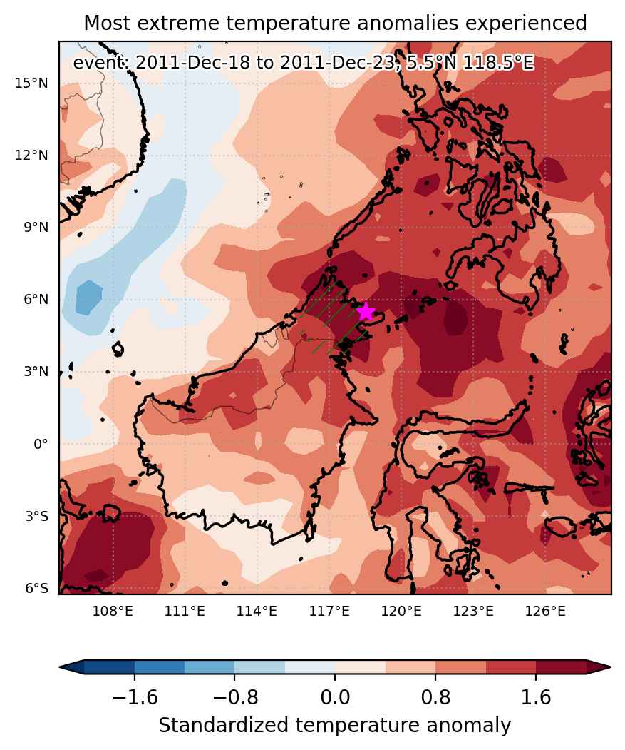
Fig. 1: Map of most extreme temperature anomalies (standardized) experienced during the event. The purple star indicates the center of the extreme event. Green hatching illustrates all areas under the effect of extremes at some time during the event.


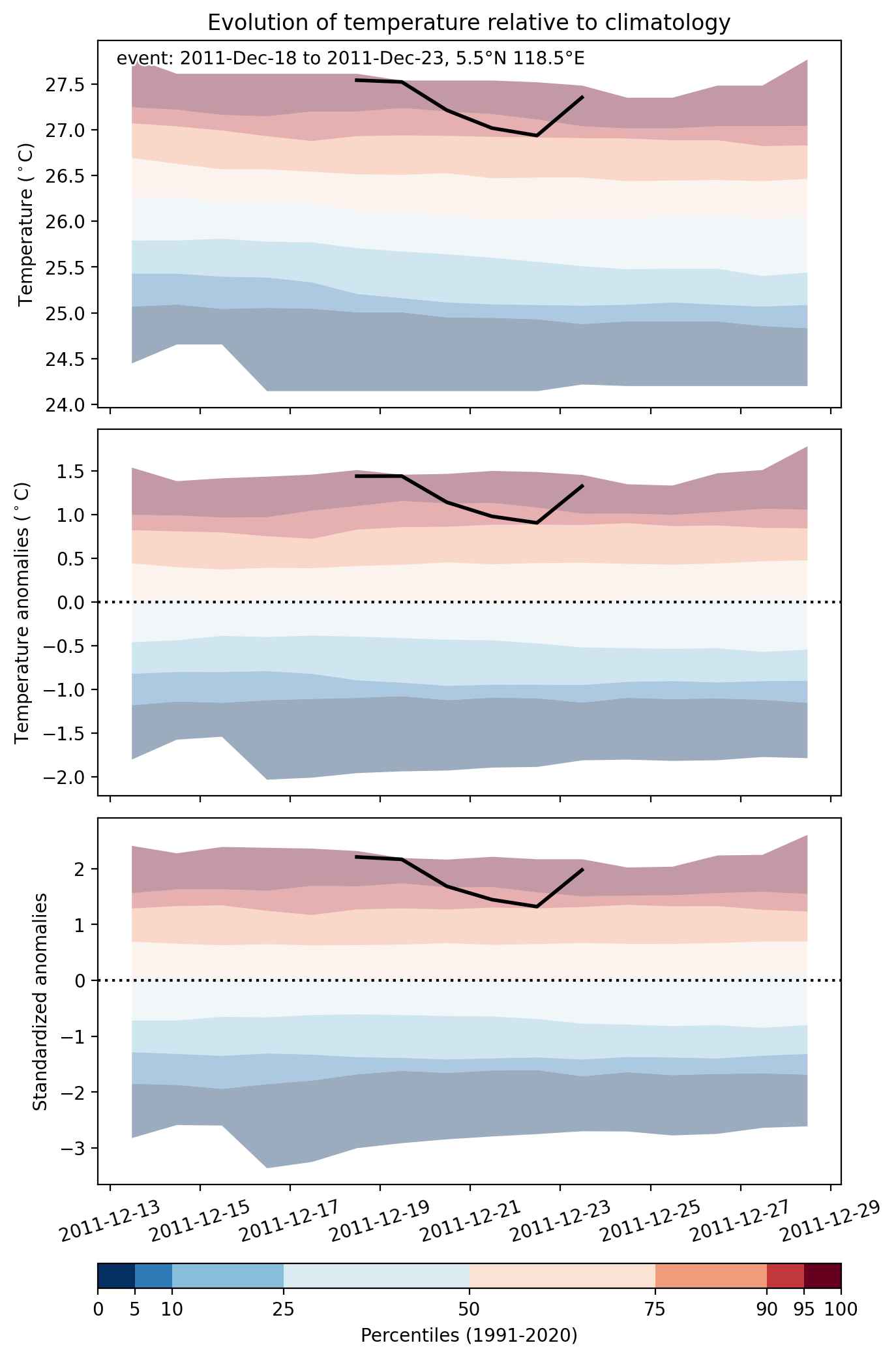
Fig. 2: Evolution of temperature at the center of the event. The climatological percentile distribution is illustrated with color shadings.


Fig. 3: Maps illustrating the evolution of standardized temperature anomalies during the event.

Event ID: Heat_wave_2011-Dec-18_to_2011-Dec-23_118.5_5.5

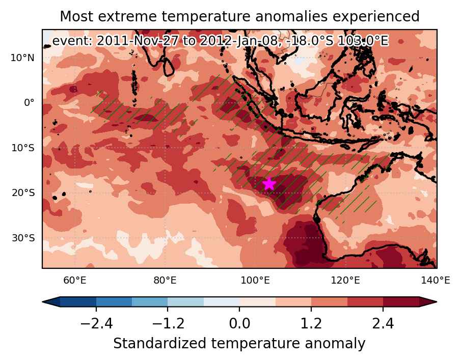
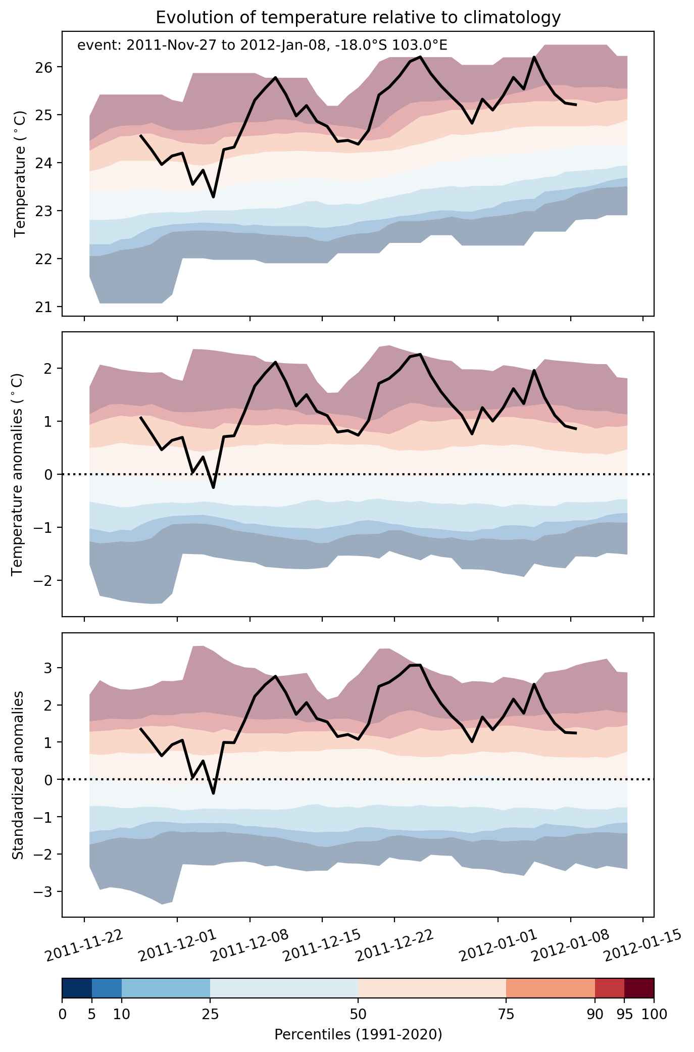
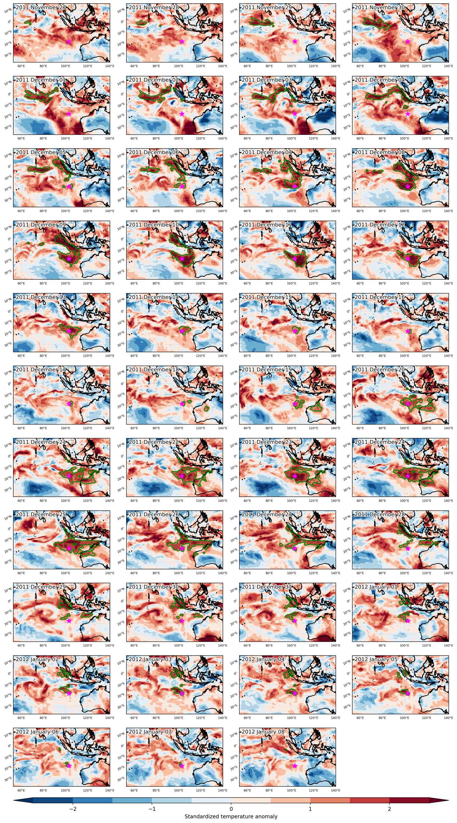
Heat wave occuring from November 27 2011 to January 08 2012 at -18.0°S 103.0°E

Download data: JSON

Event type: Heat wave

Countries affected (identified with ArcGIS Online; provided only for geographical reference):

  • Australia
  • Indonesia

Duration: 43 days

Time span: November 27 2011 to January 08 2012

Statistics over entire affected area:

  • Mean temperature anomaly: 1.6 °C
  • Mean temperature: 27.7 °C
  • Maximum temperature anomaly: 8.9 °C
  • Maximum temperature: 40.3 °C

Event center: -18.0°S 103.0°E

Area affected: 7023520 km$^2$


Fig. 1: Map of most extreme temperature anomalies (standardized) experienced during the event. The purple star indicates the center of the extreme event. Green hatching illustrates all areas under the effect of extremes at some time during the event.


Fig. 2: Evolution of temperature at the center of the event. The climatological percentile distribution is illustrated with color shadings.


Fig. 3: Maps illustrating the evolution of standardized temperature anomalies during the event.

Event ID: Heat_wave_2011-Nov-27_to_2012-Jan-08_103.0_-18.0

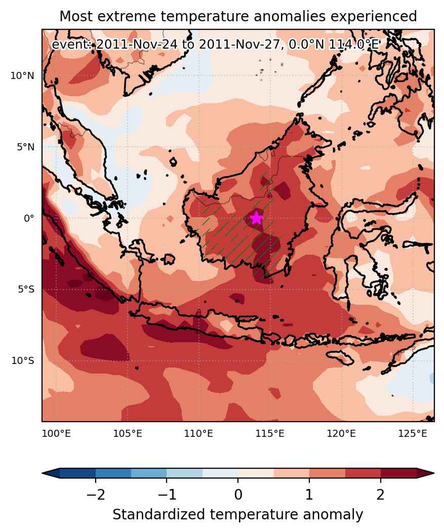
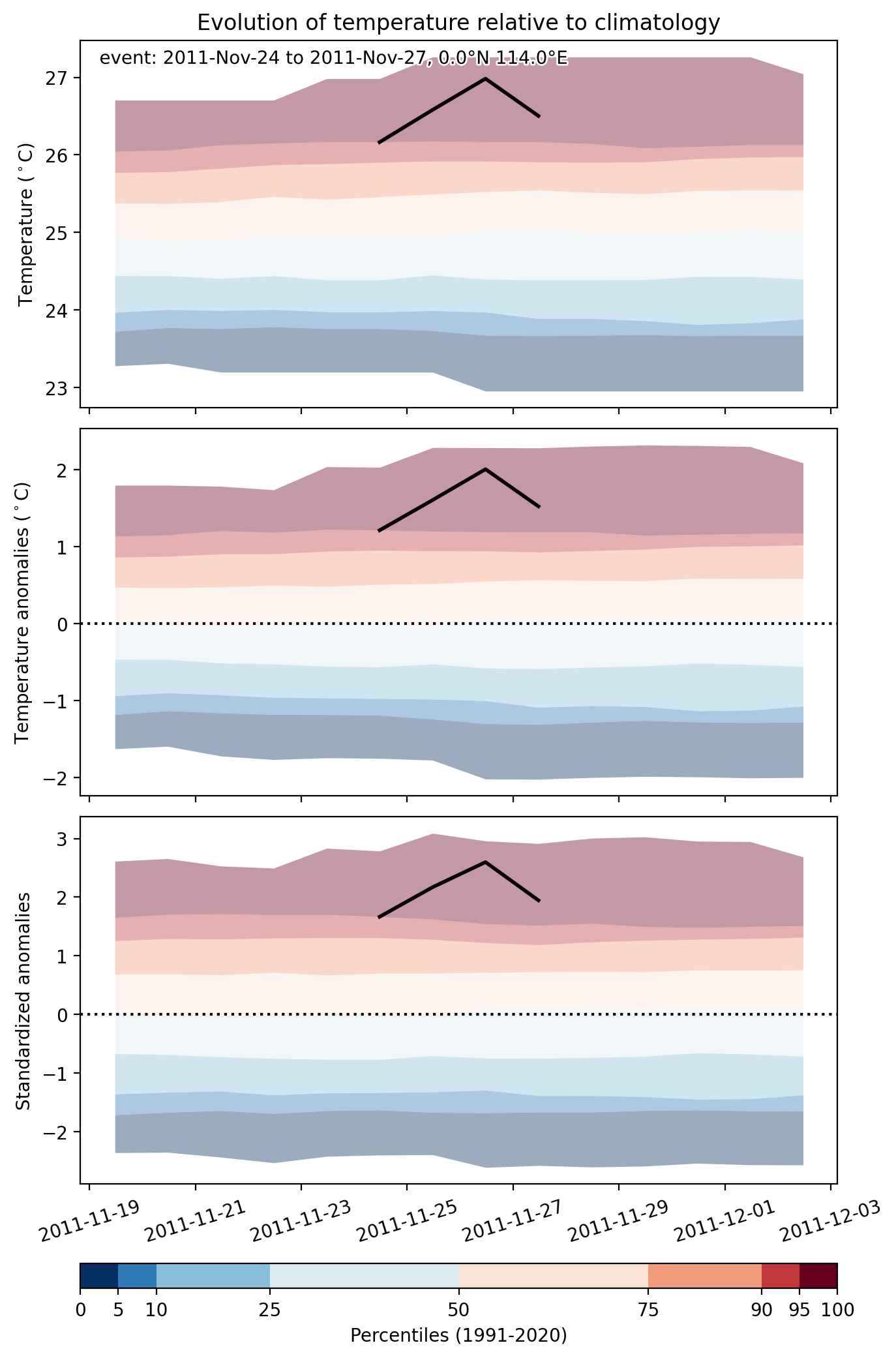
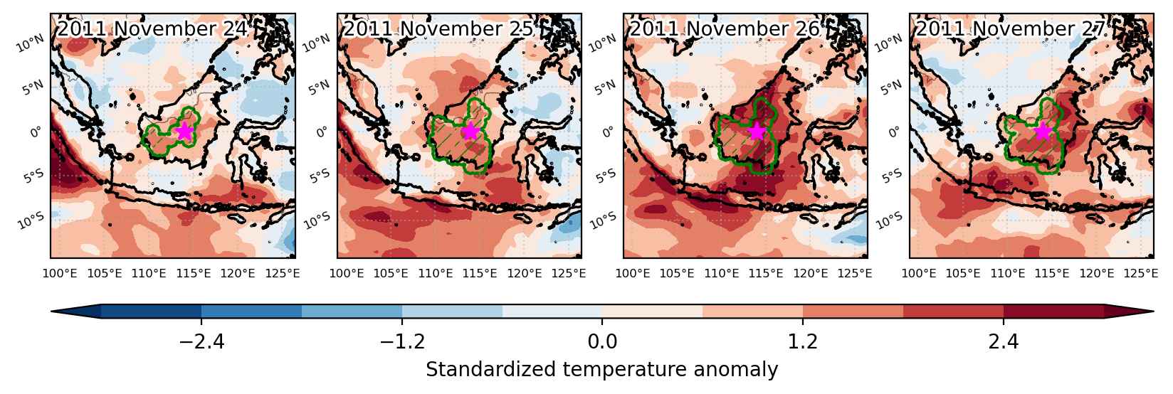
Heat wave occuring from November 24 2011 to November 27 2011 at 0.0°N 114.0°E

Download data: JSON

Event type: Heat wave

Countries affected (identified with ArcGIS Online; provided only for geographical reference):

  • Indonesia
  • Malaysia

Duration: 4 days

Time span: November 24 2011 to November 27 2011

Statistics over entire affected area:

  • Mean temperature anomaly: 1.3 °C
  • Mean temperature: 26.8 °C
  • Maximum temperature anomaly: 2.5 °C
  • Maximum temperature: 29.2 °C

Event center: 0.0°N 114.0°E

Area affected: 250227 km$^2$


Fig. 1: Map of most extreme temperature anomalies (standardized) experienced during the event. The purple star indicates the center of the extreme event. Green hatching illustrates all areas under the effect of extremes at some time during the event.


Fig. 2: Evolution of temperature at the center of the event. The climatological percentile distribution is illustrated with color shadings.


Fig. 3: Maps illustrating the evolution of standardized temperature anomalies during the event.

Event ID: Heat_wave_2011-Nov-24_to_2011-Nov-27_114.0_0.0

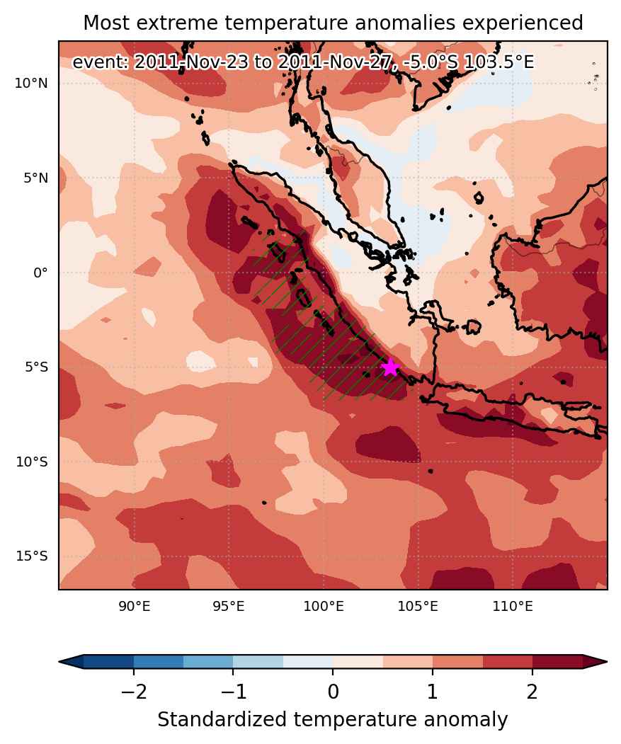
Heat wave occuring from November 23 2011 to November 27 2011 at -5.0°S 103.5°E

Download data: JSON

Event type: Heat wave

Countries affected (identified with ArcGIS Online; provided only for geographical reference):

  • Indonesia

Duration: 5 days

Time span: November 23 2011 to November 27 2011

Statistics over entire affected area:

  • Mean temperature anomaly: 1.2 °C
  • Mean temperature: 27.3 °C
  • Maximum temperature anomaly: 2.7 °C
  • Maximum temperature: 29.0 °C

Event center: -5.0°S 103.5°E

Area affected: 400890 km$^2$


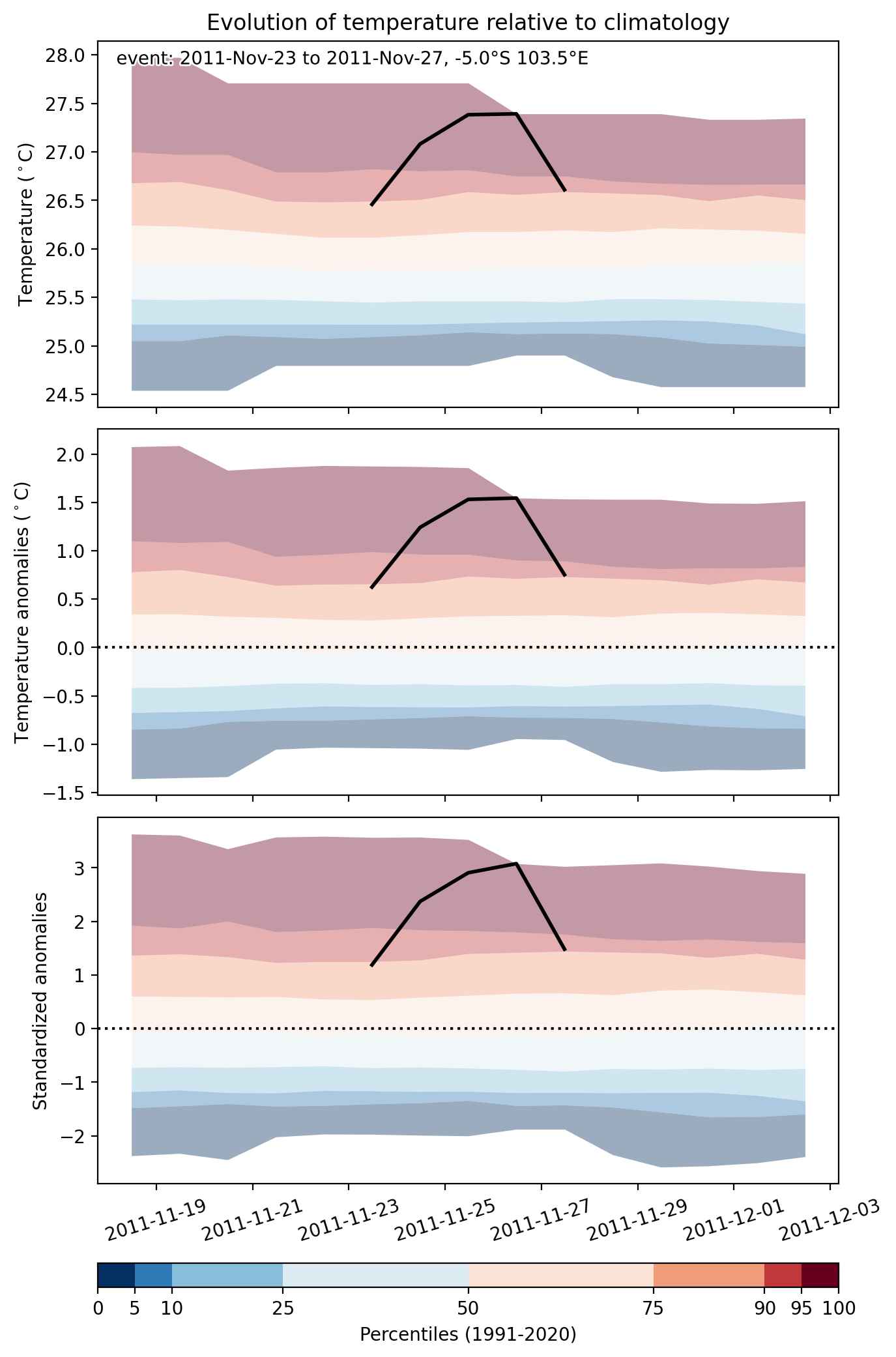
Fig. 1: Map of most extreme temperature anomalies (standardized) experienced during the event. The purple star indicates the center of the extreme event. Green hatching illustrates all areas under the effect of extremes at some time during the event.


Fig. 2: Evolution of temperature at the center of the event. The climatological percentile distribution is illustrated with color shadings.


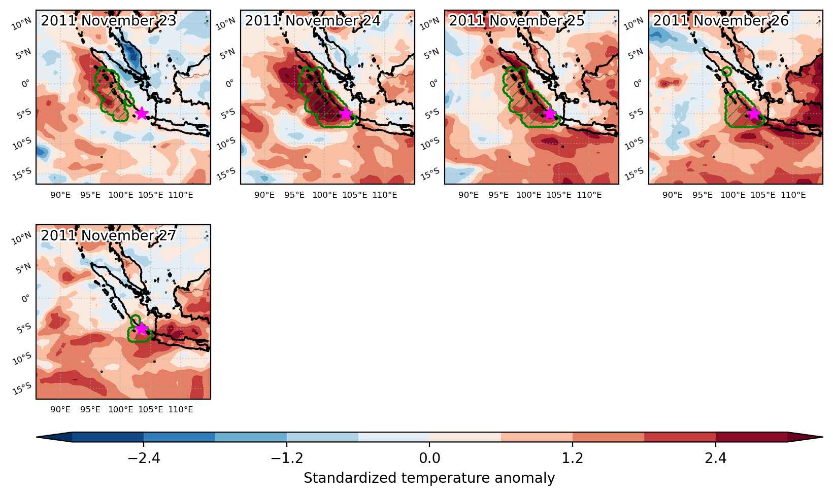
Fig. 3: Maps illustrating the evolution of standardized temperature anomalies during the event.

Event ID: Heat_wave_2011-Nov-23_to_2011-Nov-27_103.5_-5.0