Heat wave occuring from October 30 2019 to November 02 2019 at 39.5°N 115.5°E

Download data: JSON

Event type: Heat wave

Countries affected (identified with ArcGIS Online; provided only for geographical reference):

  • China

Duration: 4 days

Time span: October 30 2019 to November 02 2019

Statistics over entire affected area:

  • Mean temperature anomaly: 4.8 °C
  • Mean temperature: 9.9 °C
  • Maximum temperature anomaly: 7.4 °C
  • Maximum temperature: 16.1 °C

Event center: 39.5°N 115.5°E

Area affected: 122554 km$^2$
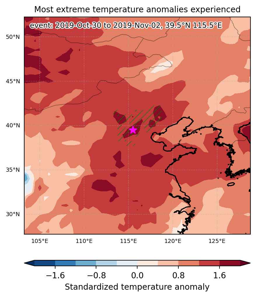

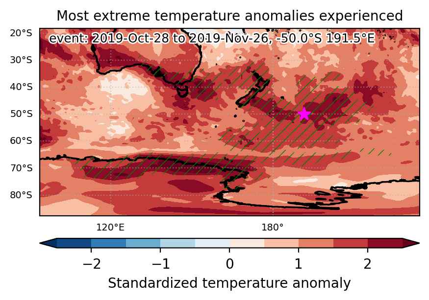
Fig. 1: Map of most extreme temperature anomalies (standardized) experienced during the event. The purple star indicates the center of the extreme event. Green hatching illustrates all areas under the effect of extremes at some time during the event.
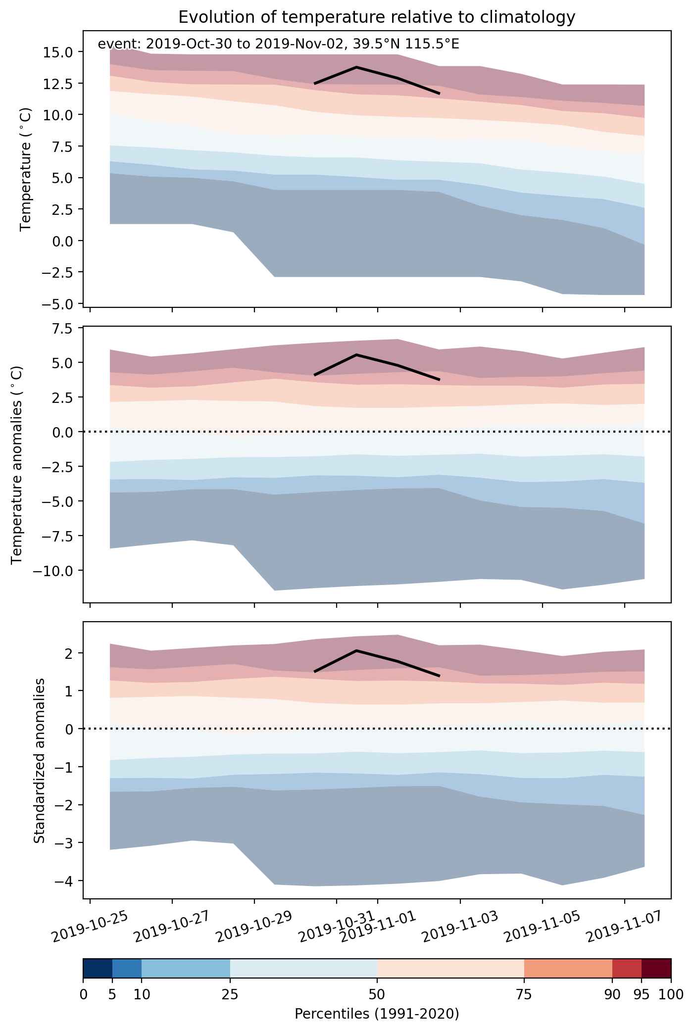


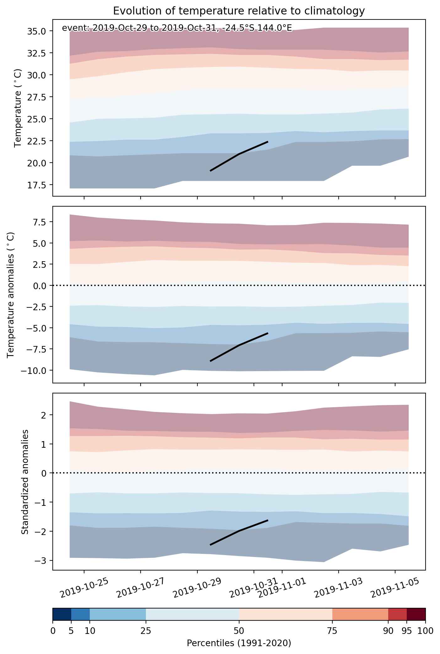
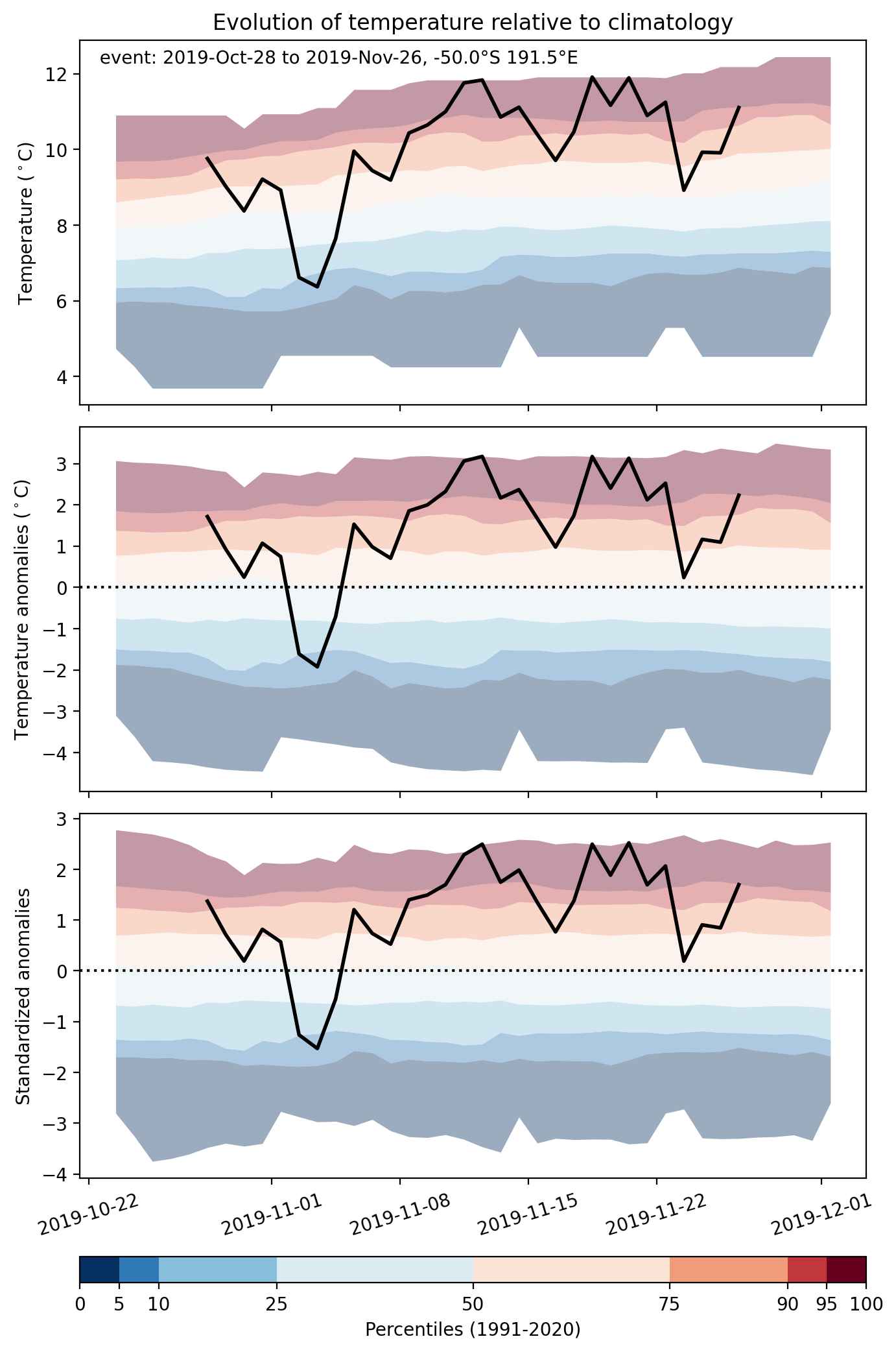
Fig. 2: Evolution of temperature at the center of the event. The climatological percentile distribution is illustrated with color shadings.
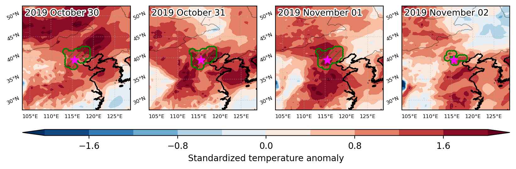


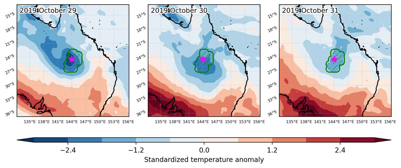
Fig. 3: Maps illustrating the evolution of standardized temperature anomalies during the event.

Event ID: Heat_wave_2019-Oct-30_to_2019-Nov-02_115.5_39.5
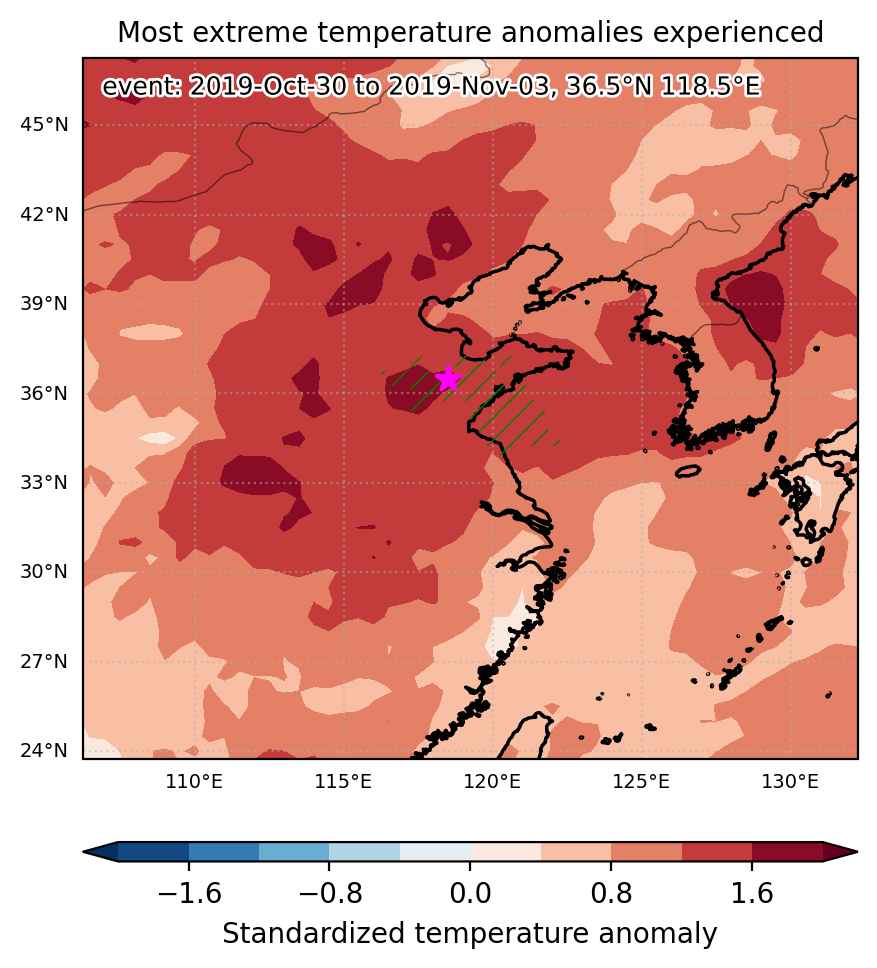
Heat wave occuring from October 30 2019 to November 03 2019 at 36.5°N 118.5°E

Download data: JSON

Event type: Heat wave

Countries affected (identified with ArcGIS Online; provided only for geographical reference):

  • China

Duration: 5 days

Time span: October 30 2019 to November 03 2019

Statistics over entire affected area:

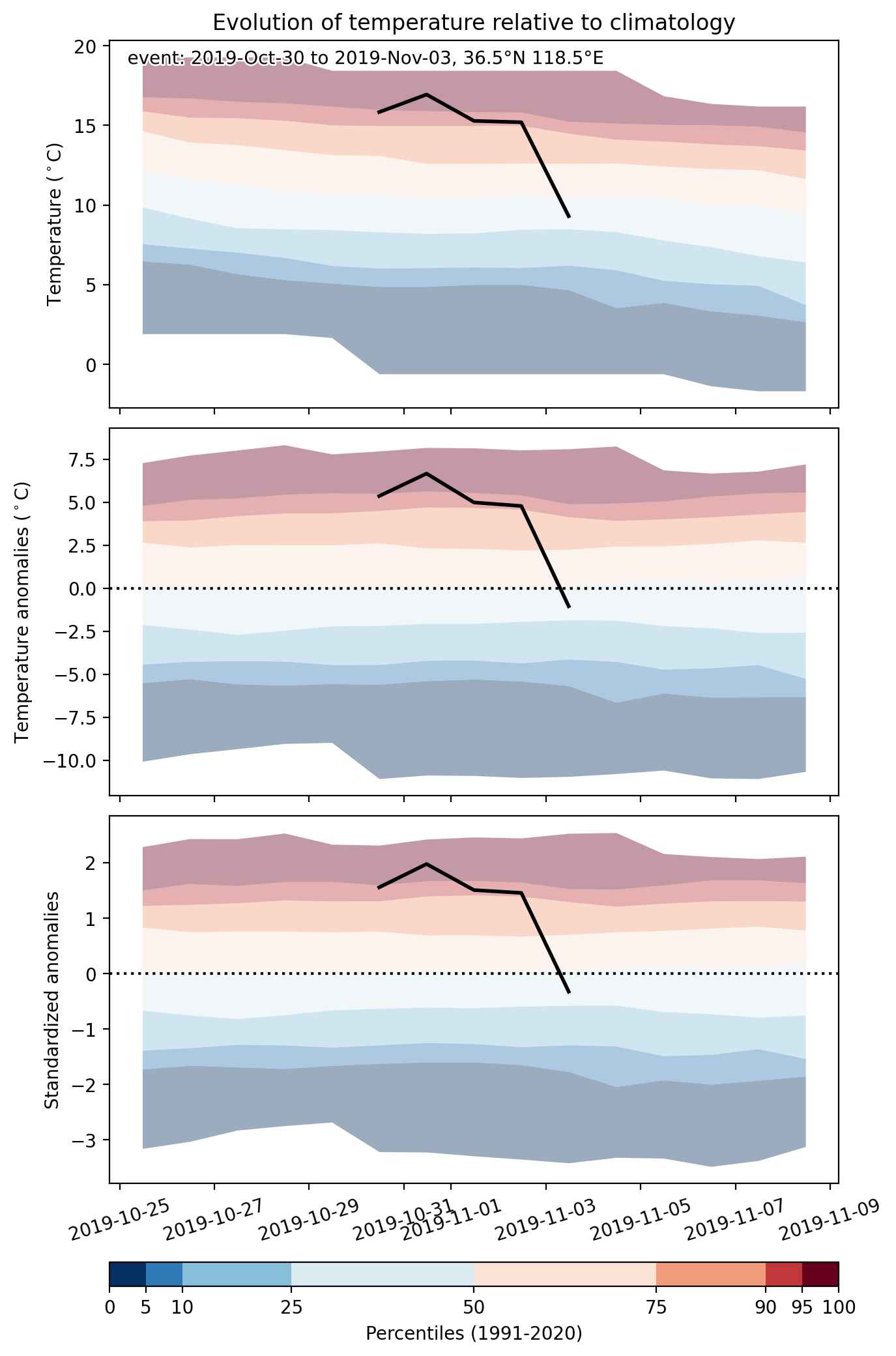
  • Mean temperature anomaly: 4.1 °C
  • Mean temperature: 17.2 °C
  • Maximum temperature anomaly: 6.7 °C
  • Maximum temperature: 19.6 °C

Event center: 36.5°N 118.5°E

Area affected: 92817 km$^2$


Fig. 1: Map of most extreme temperature anomalies (standardized) experienced during the event. The purple star indicates the center of the extreme event. Green hatching illustrates all areas under the effect of extremes at some time during the event.


Fig. 2: Evolution of temperature at the center of the event. The climatological percentile distribution is illustrated with color shadings.


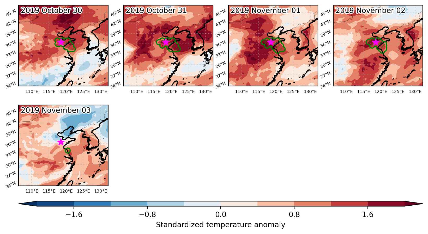
Fig. 3: Maps illustrating the evolution of standardized temperature anomalies during the event.

Event ID: Heat_wave_2019-Oct-30_to_2019-Nov-03_118.5_36.5

Heat wave occuring from October 30 2019 to November 03 2019 at 33.0°N 112.5°E

Download data: JSON

Event type: Heat wave

Countries affected (identified with ArcGIS Online; provided only for geographical reference):

  • China

Duration: 5 days

Time span: October 30 2019 to November 03 2019

Statistics over entire affected area:

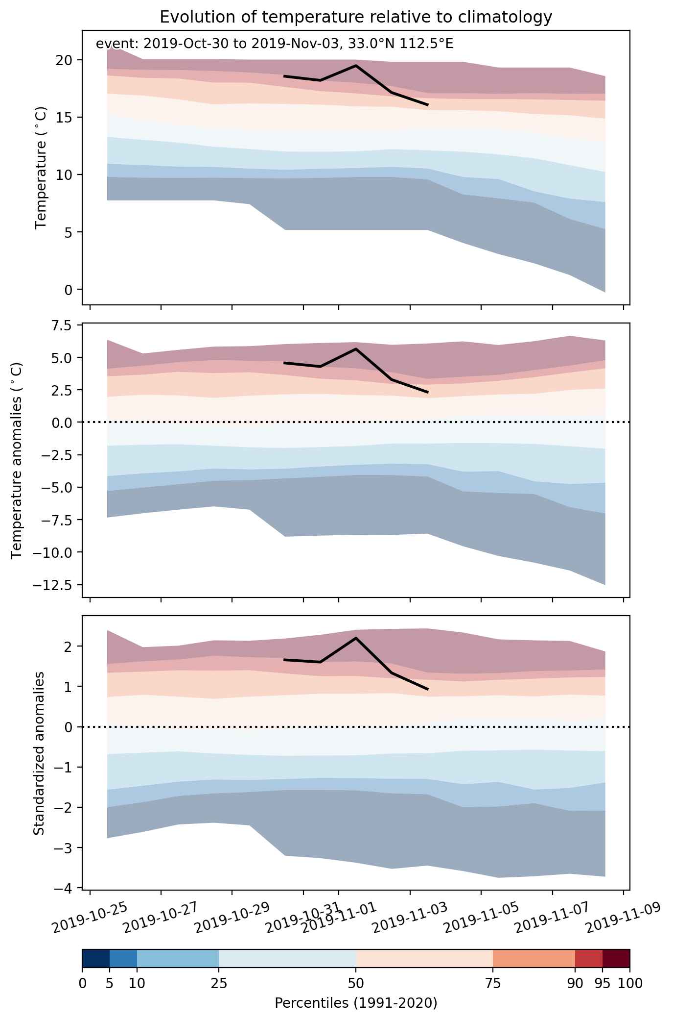
  • Mean temperature anomaly: 4.3 °C
  • Mean temperature: 17.0 °C
  • Maximum temperature anomaly: 6.1 °C
  • Maximum temperature: 20.5 °C

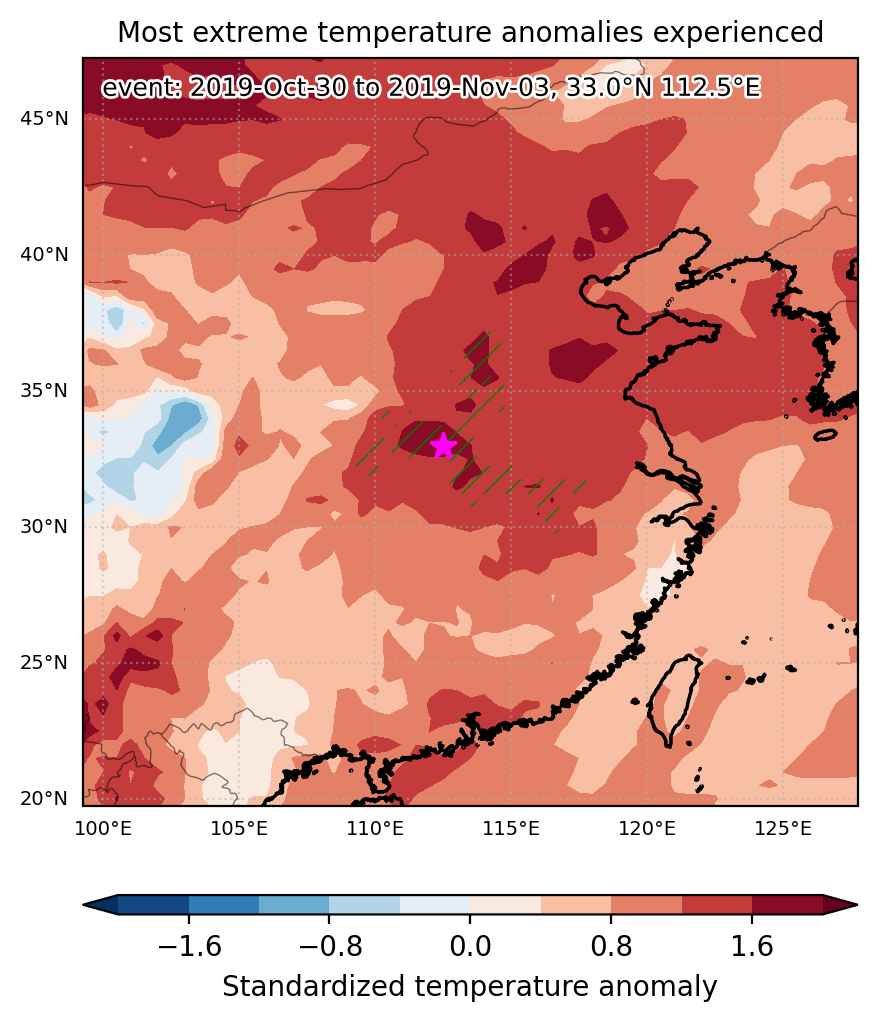
Event center: 33.0°N 112.5°E

Area affected: 139749 km$^2$


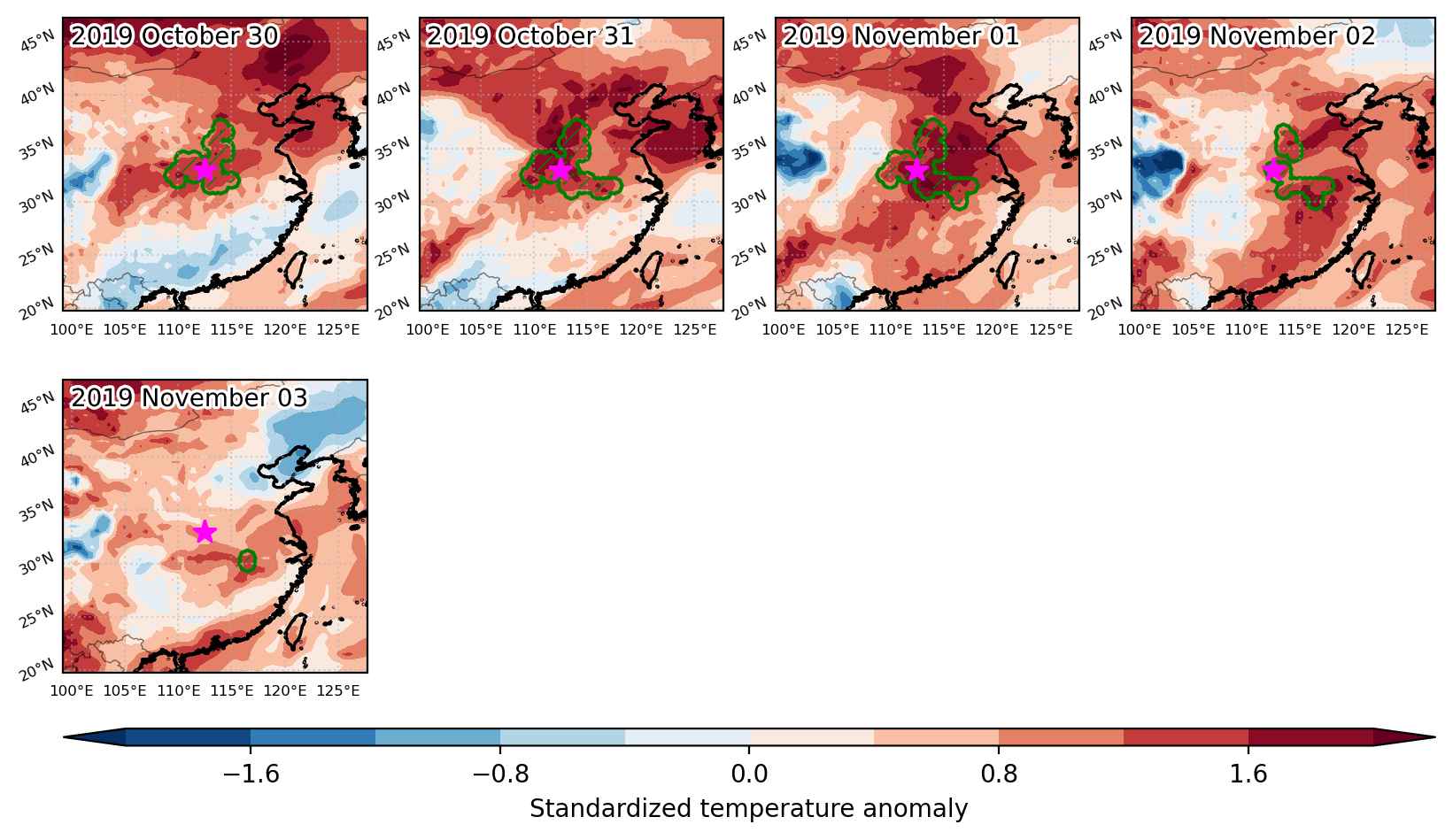
Fig. 1: Map of most extreme temperature anomalies (standardized) experienced during the event. The purple star indicates the center of the extreme event. Green hatching illustrates all areas under the effect of extremes at some time during the event.


Fig. 2: Evolution of temperature at the center of the event. The climatological percentile distribution is illustrated with color shadings.


Fig. 3: Maps illustrating the evolution of standardized temperature anomalies during the event.

Event ID: Heat_wave_2019-Oct-30_to_2019-Nov-03_112.5_33.0

Heat wave occuring from October 29 2019 to November 04 2019 at 4.0°N 108.0°E

Download data: JSON

Event type: Heat wave

Countries affected (identified with ArcGIS Online; provided only for geographical reference):

  • Indonesia

Duration: 7 days

Time span: October 29 2019 to November 04 2019

Statistics over entire affected area:

  • Mean temperature anomaly: 1.0 °C
  • Mean temperature: 27.9 °C
  • Maximum temperature anomaly: 1.5 °C
  • Maximum temperature: 28.3 °C

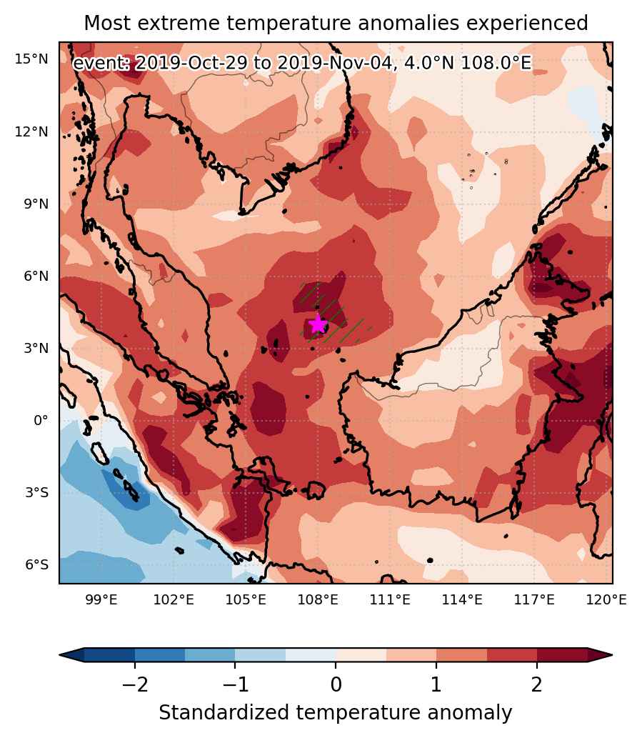
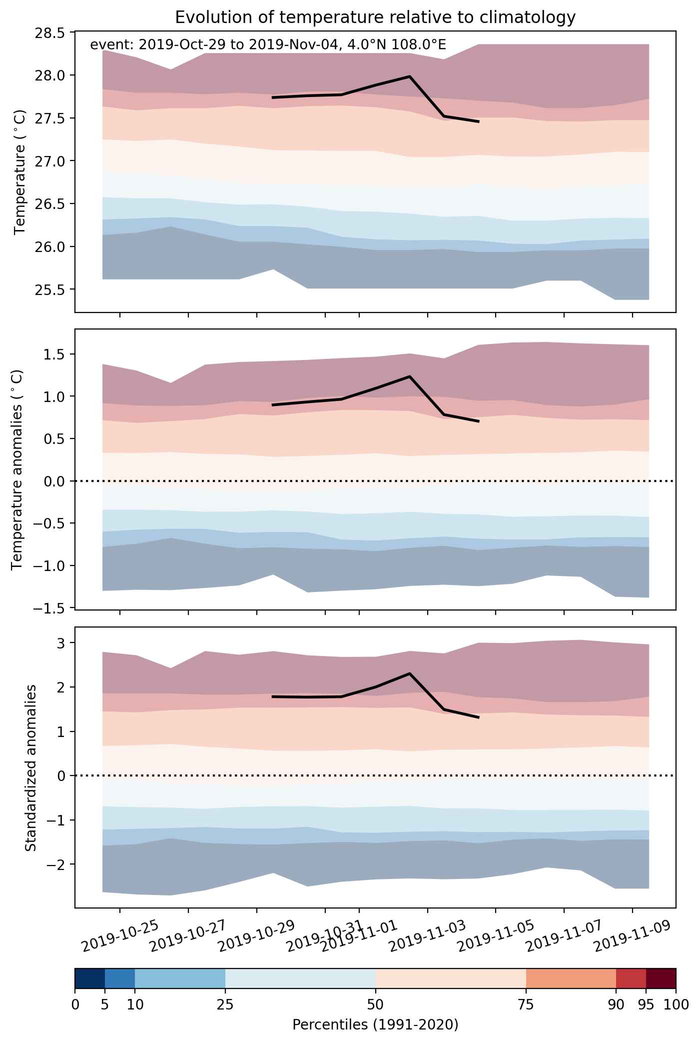
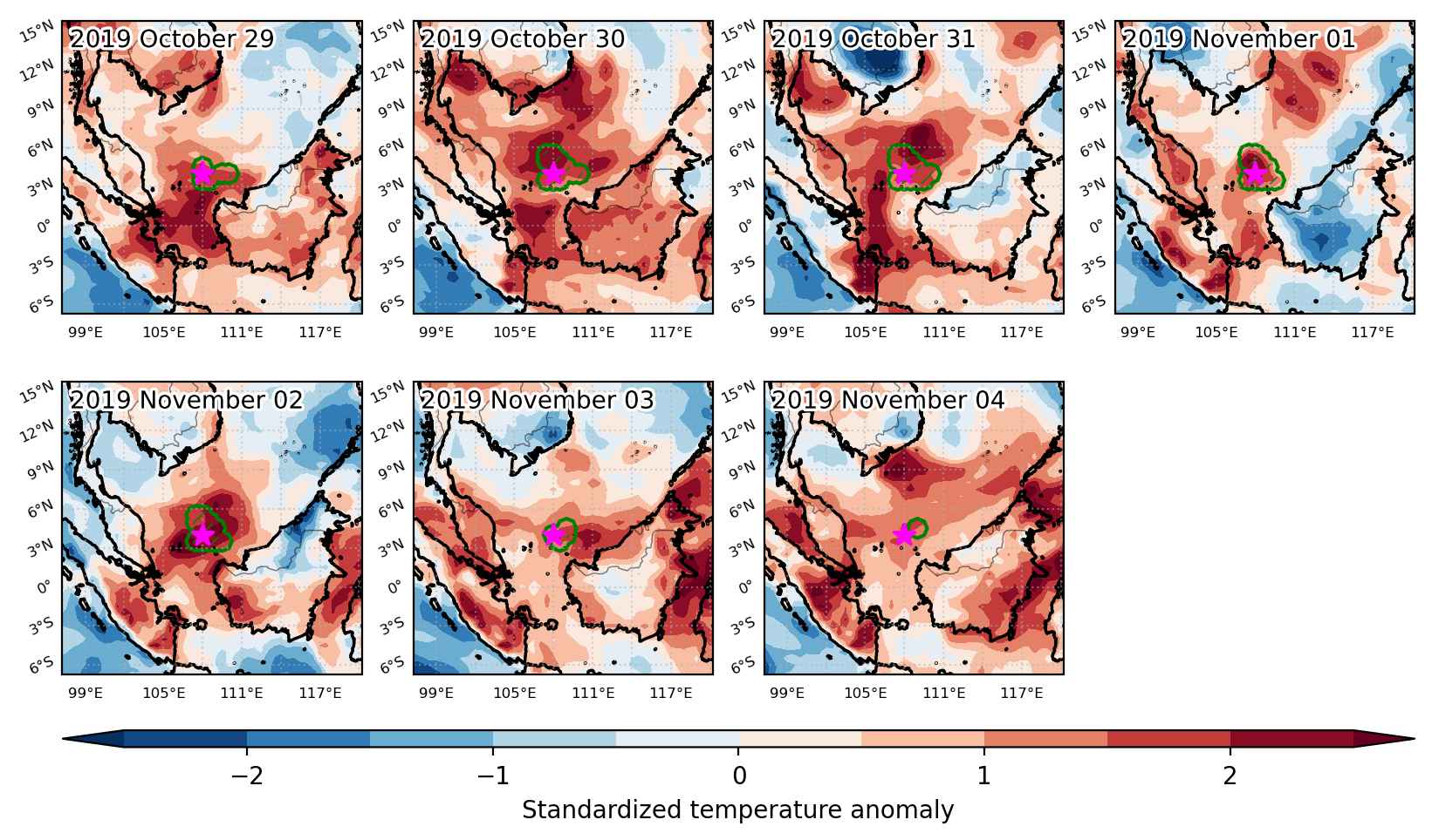
Event center: 4.0°N 108.0°E

Area affected: 55480 km$^2$


Fig. 1: Map of most extreme temperature anomalies (standardized) experienced during the event. The purple star indicates the center of the extreme event. Green hatching illustrates all areas under the effect of extremes at some time during the event.


Fig. 2: Evolution of temperature at the center of the event. The climatological percentile distribution is illustrated with color shadings.


Fig. 3: Maps illustrating the evolution of standardized temperature anomalies during the event.

Event ID: Heat_wave_2019-Oct-29_to_2019-Nov-04_108.0_4.0

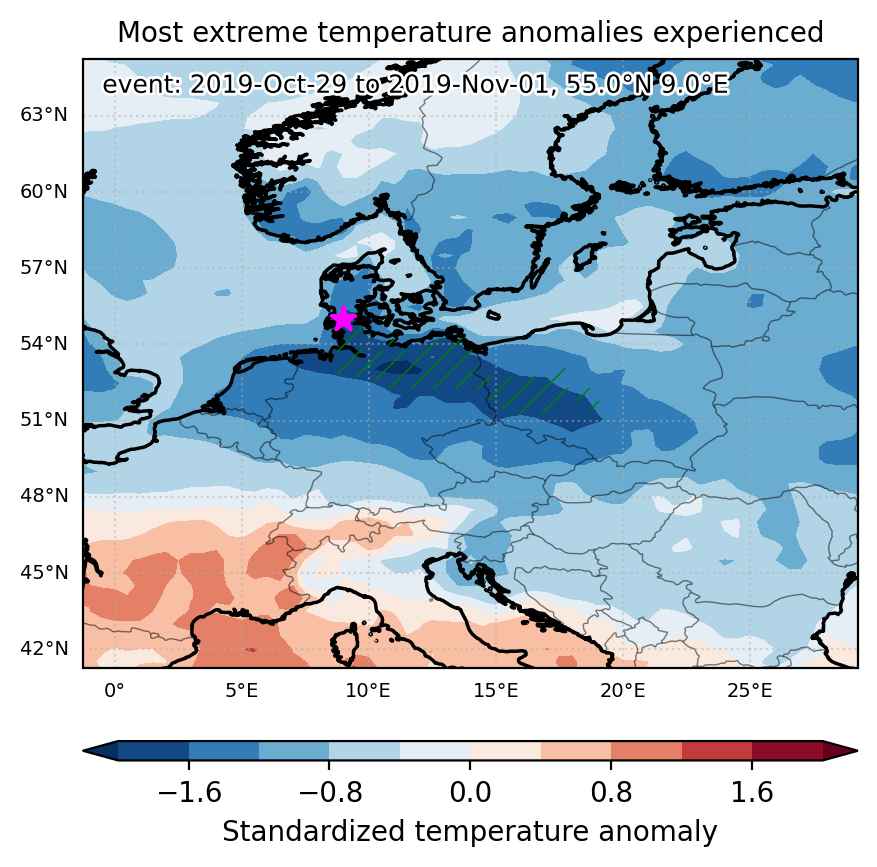
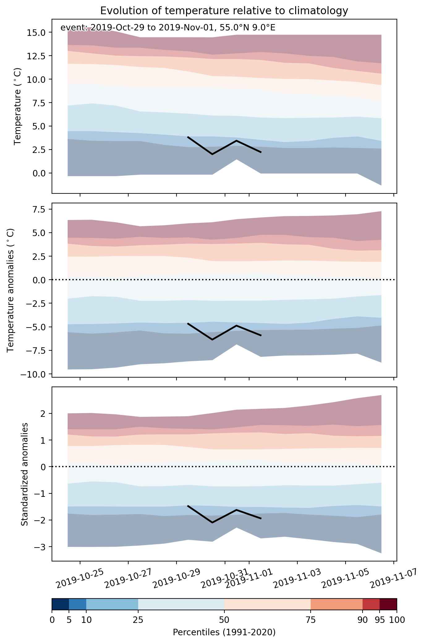
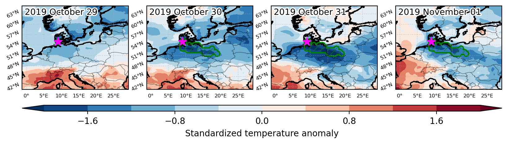
Cold spell occuring from October 29 2019 to November 01 2019 at 55.0°N 9.0°E

Download data: JSON

Event type: Cold spell

Countries affected (identified with ArcGIS Online; provided only for geographical reference):

  • Denmark
  • Germany
  • Poland

Duration: 4 days

Time span: October 29 2019 to November 01 2019

Statistics over entire affected area:

  • Mean temperature anomaly: -6.2 °C
  • Mean temperature: 1.3 °C
  • Minimum temperature anomaly: -8.3 °C
  • Minimum temperature: -0.9 °C

Event center: 55.0°N 9.0°E

Area affected: 113657 km$^2$


Fig. 1: Map of most extreme temperature anomalies (standardized) experienced during the event. The purple star indicates the center of the extreme event. Green hatching illustrates all areas under the effect of extremes at some time during the event.


Fig. 2: Evolution of temperature at the center of the event. The climatological percentile distribution is illustrated with color shadings.


Fig. 3: Maps illustrating the evolution of standardized temperature anomalies during the event.

Event ID: Cold_spell_2019-Oct-29_to_2019-Nov-01_9.0_55.0

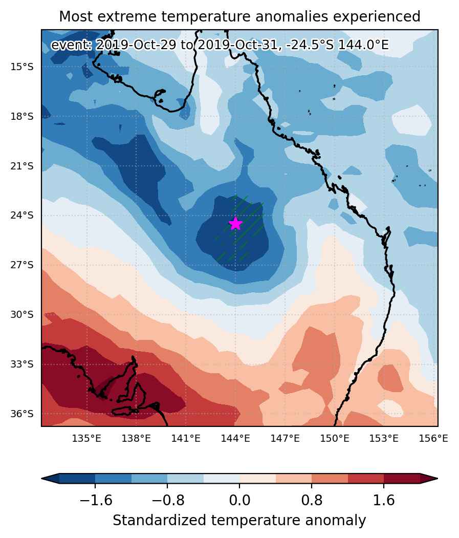
Cold spell occuring from October 29 2019 to October 31 2019 at -24.5°S 144.0°E

Download data: JSON

Event type: Cold spell

Countries affected (identified with ArcGIS Online; provided only for geographical reference):

  • Australia

Duration: 3 days

Time span: October 29 2019 to October 31 2019

Statistics over entire affected area:

  • Mean temperature anomaly: -6.3 °C
  • Mean temperature: 20.7 °C
  • Minimum temperature anomaly: -9.2 °C
  • Minimum temperature: 17.5 °C

Event center: -24.5°S 144.0°E

Area affected: 78609 km$^2$


Fig. 1: Map of most extreme temperature anomalies (standardized) experienced during the event. The purple star indicates the center of the extreme event. Green hatching illustrates all areas under the effect of extremes at some time during the event.


Fig. 2: Evolution of temperature at the center of the event. The climatological percentile distribution is illustrated with color shadings.


Fig. 3: Maps illustrating the evolution of standardized temperature anomalies during the event.

Event ID: Cold_spell_2019-Oct-29_to_2019-Oct-31_144.0_-24.5

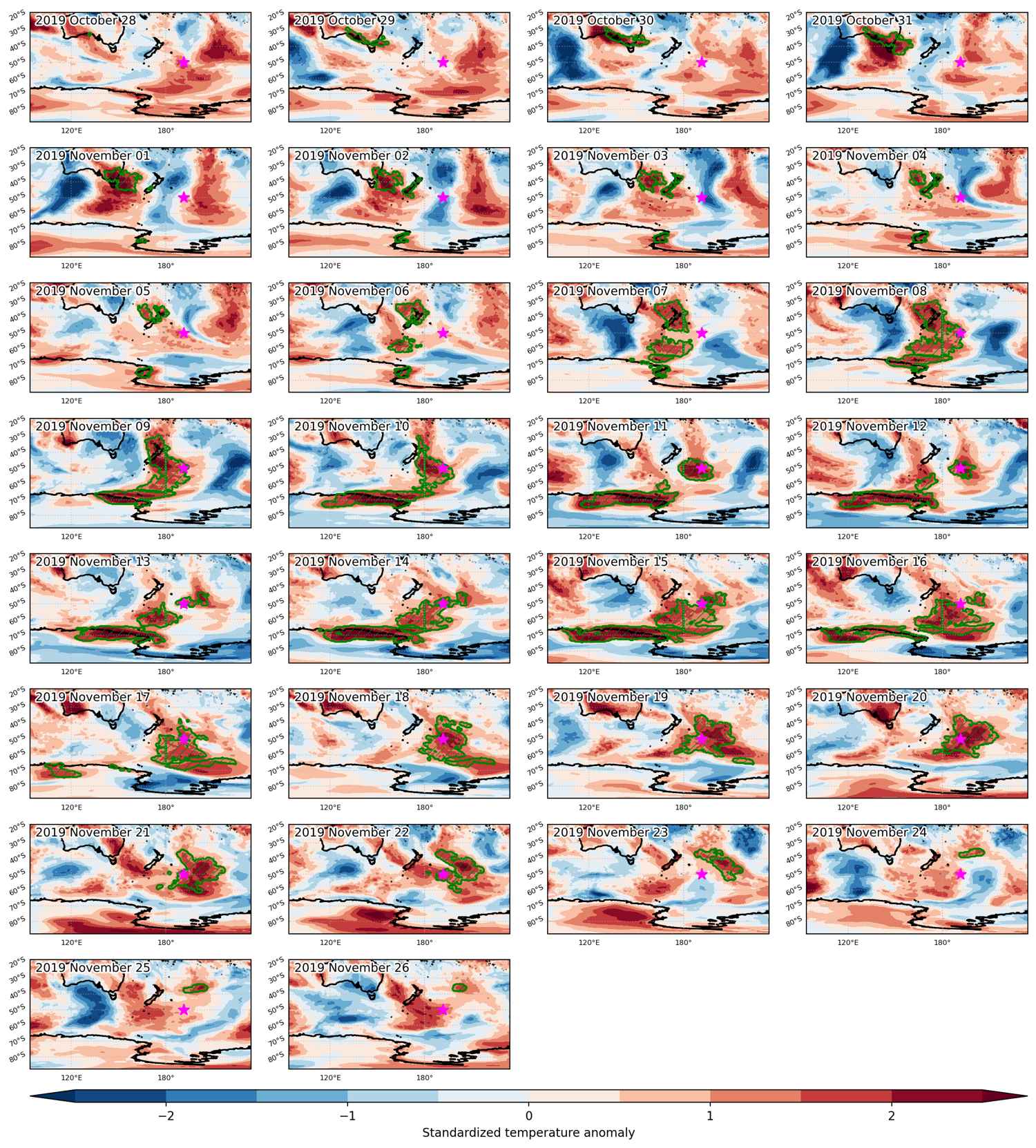
Heat wave occuring from October 28 2019 to November 26 2019 at -50.0°S 191.5°E

Download data: JSON

Event type: Heat wave

Countries affected (identified with ArcGIS Online; provided only for geographical reference):

  • Antarctica
  • Australia
  • New Zealand

Duration: 30 days

Time span: October 28 2019 to November 26 2019

Statistics over entire affected area:

  • Mean temperature anomaly: 4.1 °C
  • Mean temperature: 3.4 °C
  • Maximum temperature anomaly: 14.1 °C
  • Maximum temperature: 33.2 °C

Event center: -50.0°S 191.5°E

Area affected: 13289083 km$^2$


Fig. 1: Map of most extreme temperature anomalies (standardized) experienced during the event. The purple star indicates the center of the extreme event. Green hatching illustrates all areas under the effect of extremes at some time during the event.


Fig. 2: Evolution of temperature at the center of the event. The climatological percentile distribution is illustrated with color shadings.


Fig. 3: Maps illustrating the evolution of standardized temperature anomalies during the event.

Event ID: Heat_wave_2019-Oct-28_to_2019-Nov-26_191.5_-50.0

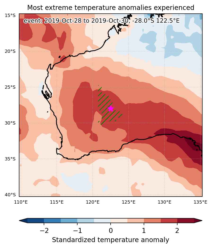
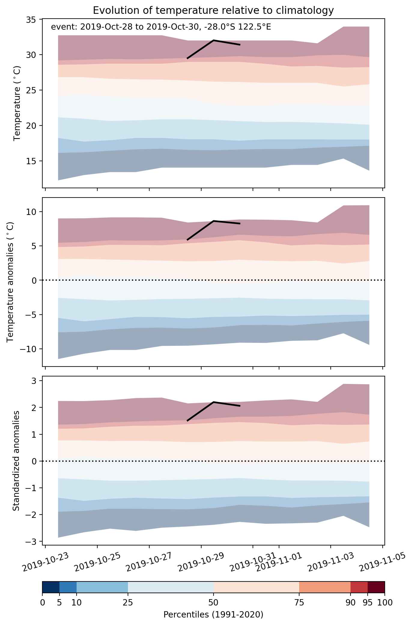
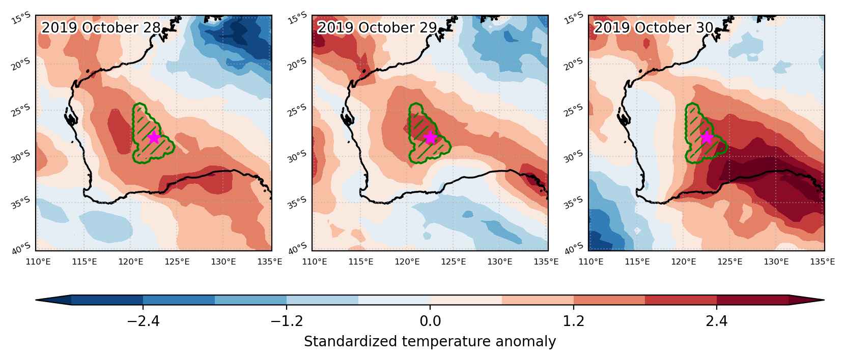
Heat wave occuring from October 28 2019 to October 30 2019 at -28.0°S 122.5°E

Download data: JSON

Event type: Heat wave

Countries affected (identified with ArcGIS Online; provided only for geographical reference):

  • Australia

Duration: 3 days

Time span: October 28 2019 to October 30 2019

Statistics over entire affected area:

  • Mean temperature anomaly: 6.6 °C
  • Mean temperature: 30.3 °C
  • Maximum temperature anomaly: 10.4 °C
  • Maximum temperature: 33.2 °C

Event center: -28.0°S 122.5°E

Area affected: 98266 km$^2$


Fig. 1: Map of most extreme temperature anomalies (standardized) experienced during the event. The purple star indicates the center of the extreme event. Green hatching illustrates all areas under the effect of extremes at some time during the event.


Fig. 2: Evolution of temperature at the center of the event. The climatological percentile distribution is illustrated with color shadings.


Fig. 3: Maps illustrating the evolution of standardized temperature anomalies during the event.

Event ID: Heat_wave_2019-Oct-28_to_2019-Oct-30_122.5_-28.0

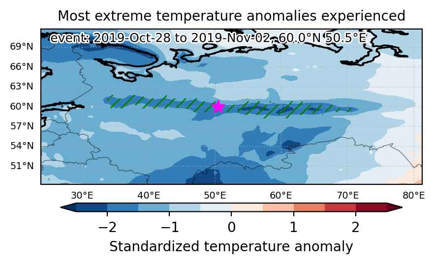
Cold spell occuring from October 28 2019 to November 02 2019 at 60.0°N 50.5°E

Download data: JSON

Event type: Cold spell

Countries affected (identified with ArcGIS Online; provided only for geographical reference):

  • Russian Federation

Duration: 6 days

Time span: October 28 2019 to November 02 2019

Statistics over entire affected area:

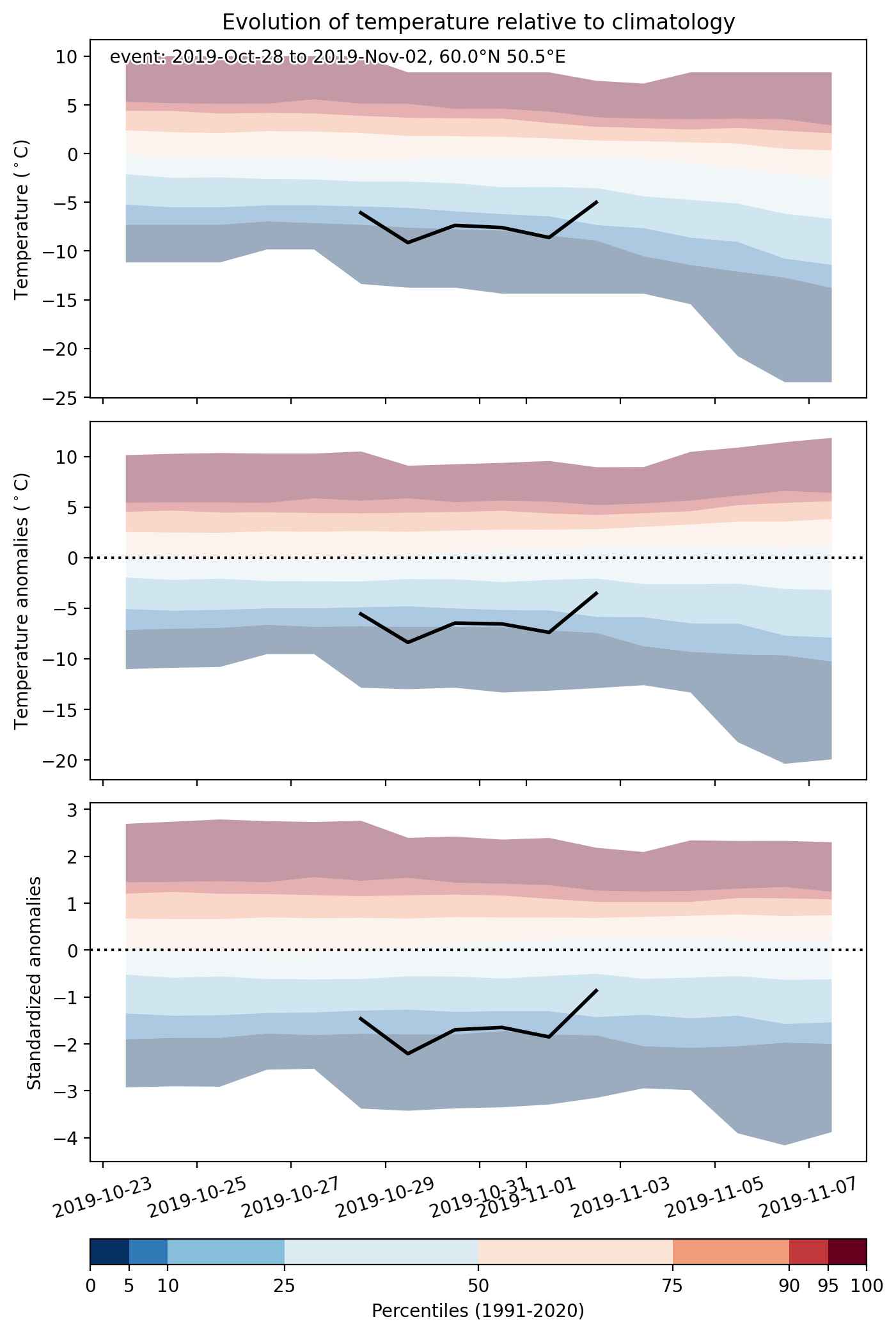
  • Mean temperature anomaly: -7.0 °C
  • Mean temperature: -7.8 °C
  • Minimum temperature anomaly: -12.0 °C
  • Minimum temperature: -14.2 °C

Event center: 60.0°N 50.5°E

Area affected: 351983 km$^2$


Fig. 1: Map of most extreme temperature anomalies (standardized) experienced during the event. The purple star indicates the center of the extreme event. Green hatching illustrates all areas under the effect of extremes at some time during the event.


Fig. 2: Evolution of temperature at the center of the event. The climatological percentile distribution is illustrated with color shadings.


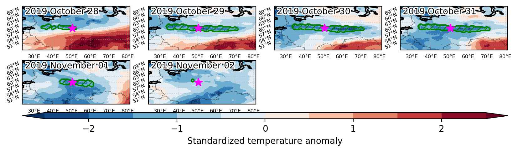
Fig. 3: Maps illustrating the evolution of standardized temperature anomalies during the event.

Event ID: Cold_spell_2019-Oct-28_to_2019-Nov-02_50.5_60.0

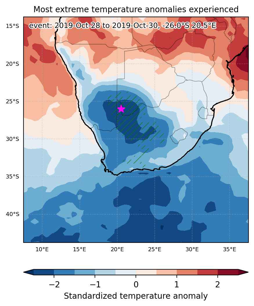
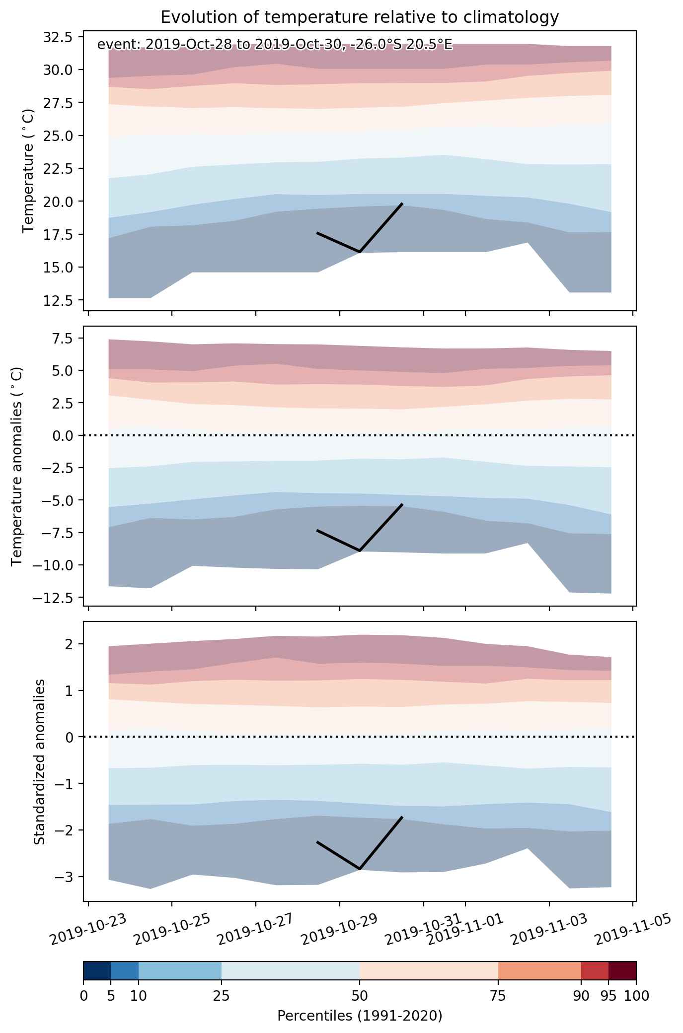
Cold spell occuring from October 28 2019 to October 30 2019 at -26.0°S 20.5°E

Download data: JSON

Event type: Cold spell

Countries affected (identified with ArcGIS Online; provided only for geographical reference):

  • Botswana
  • Namibia
  • South Africa

Duration: 3 days

Time span: October 28 2019 to October 30 2019

Statistics over entire affected area:

  • Mean temperature anomaly: -6.5 °C
  • Mean temperature: 16.7 °C
  • Minimum temperature anomaly: -9.8 °C
  • Minimum temperature: 10.1 °C

Event center: -26.0°S 20.5°E

Area affected: 335943 km$^2$


Fig. 1: Map of most extreme temperature anomalies (standardized) experienced during the event. The purple star indicates the center of the extreme event. Green hatching illustrates all areas under the effect of extremes at some time during the event.


Fig. 2: Evolution of temperature at the center of the event. The climatological percentile distribution is illustrated with color shadings.


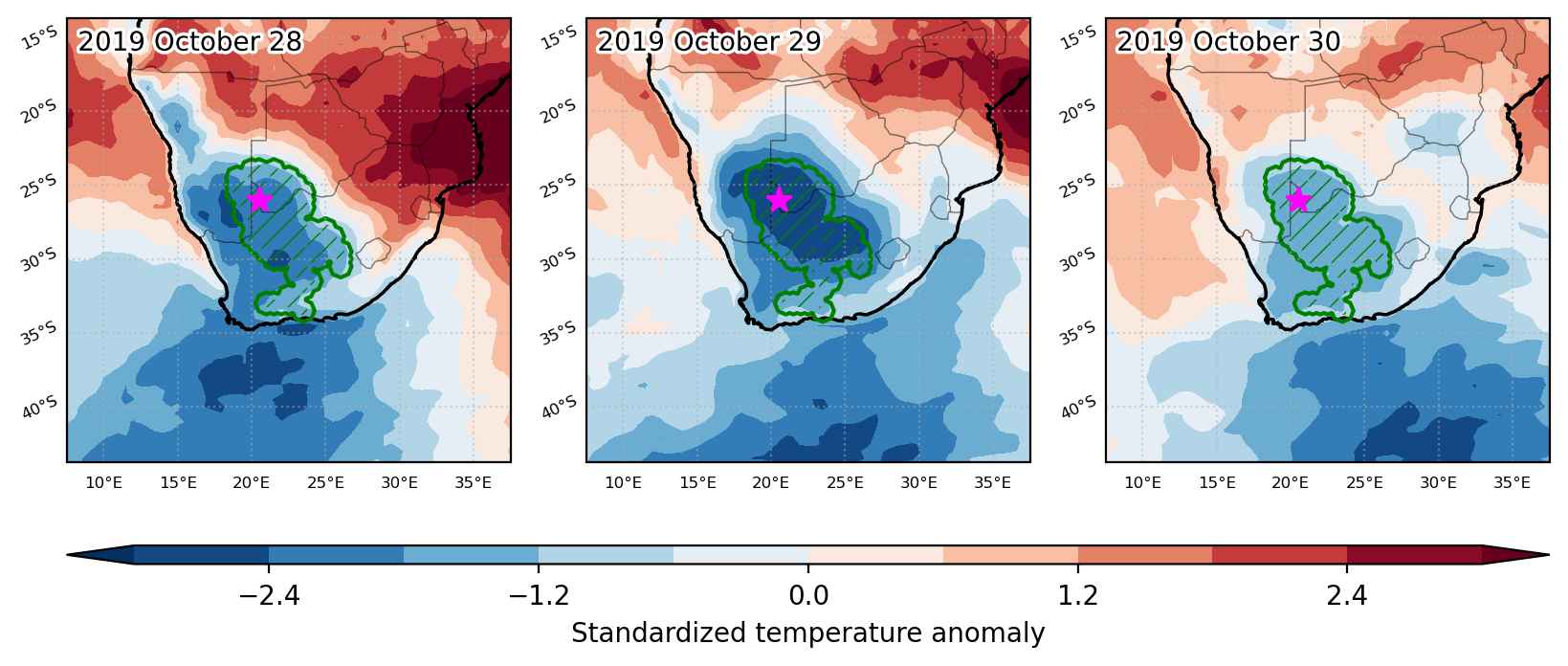
Fig. 3: Maps illustrating the evolution of standardized temperature anomalies during the event.

Event ID: Cold_spell_2019-Oct-28_to_2019-Oct-30_20.5_-26.0