Cold spell occuring from March 21 2012 to March 30 2012 at 14.5°N 346.0°E

Download data: JSON

Event type: Cold spell

Countries affected (identified with ArcGIS Online; provided only for geographical reference):

  • Gambia
  • Guinea-Bissau
  • Mauritania
  • Senegal

Duration: 10 days

Time span: March 21 2012 to March 30 2012

Statistics over entire affected area:

  • Mean temperature anomaly: -3.4 °C
  • Mean temperature: 23.2 °C
  • Minimum temperature anomaly: -8.8 °C
  • Minimum temperature: 17.4 °C

Event center: 14.5°N 346.0°E

Area affected: 283625 km$^2$
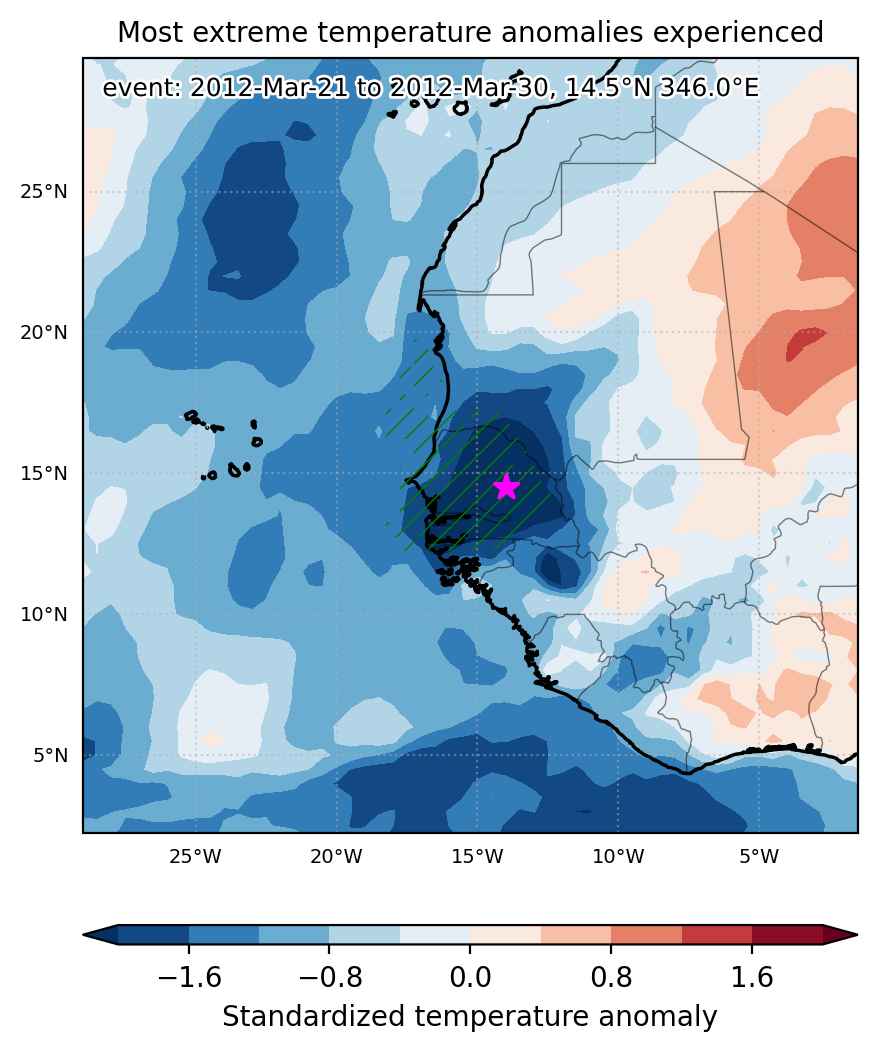

Fig. 1: Map of most extreme temperature anomalies (standardized) experienced during the event. The purple star indicates the center of the extreme event. Green hatching illustrates all areas under the effect of extremes at some time during the event.
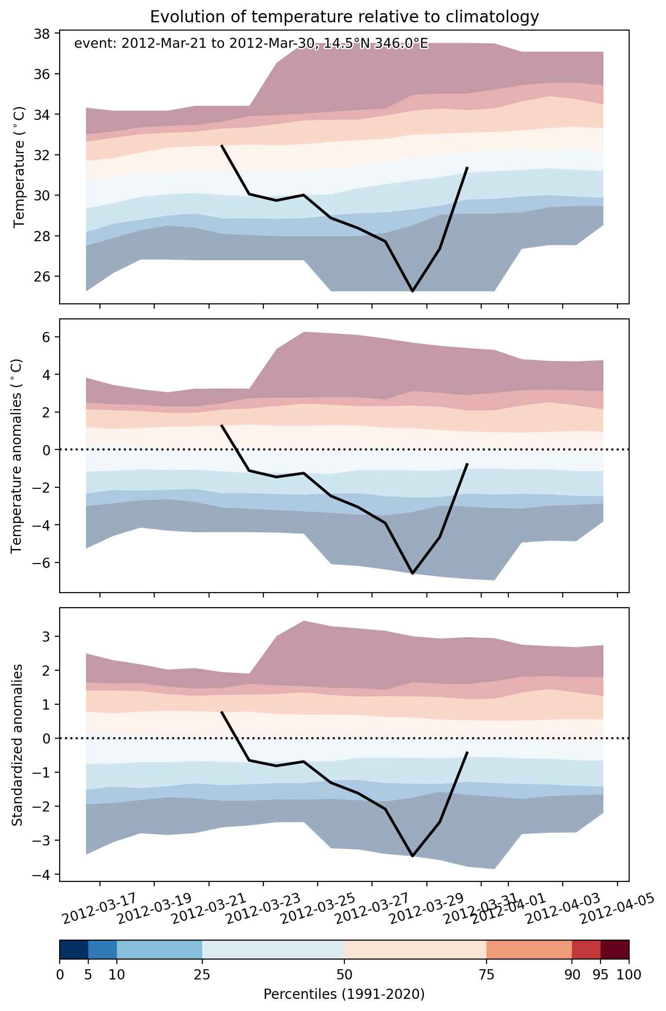


Fig. 2: Evolution of temperature at the center of the event. The climatological percentile distribution is illustrated with color shadings.
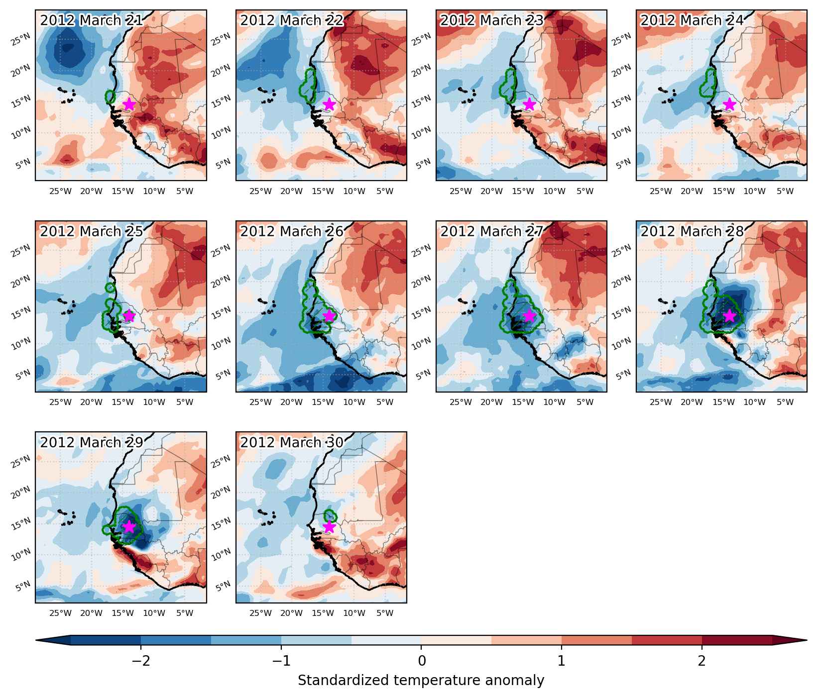


Fig. 3: Maps illustrating the evolution of standardized temperature anomalies during the event.

Event ID: Cold_spell_2012-Mar-21_to_2012-Mar-30_346.0_14.5
Cold spell occuring from January 18 2012 to January 30 2012 at 21.0°N 336.0°E

Download data: JSON

Event type: Cold spell

Countries affected (identified with ArcGIS Online; provided only for geographical reference):

  • Algeria
  • Burkina Faso
  • Cabo Verde
  • Côte d’Ivoire
  • Gambia
  • Guinea
  • Guinea-Bissau
  • Mali
  • Mauritania
  • Morocco
  • Senegal

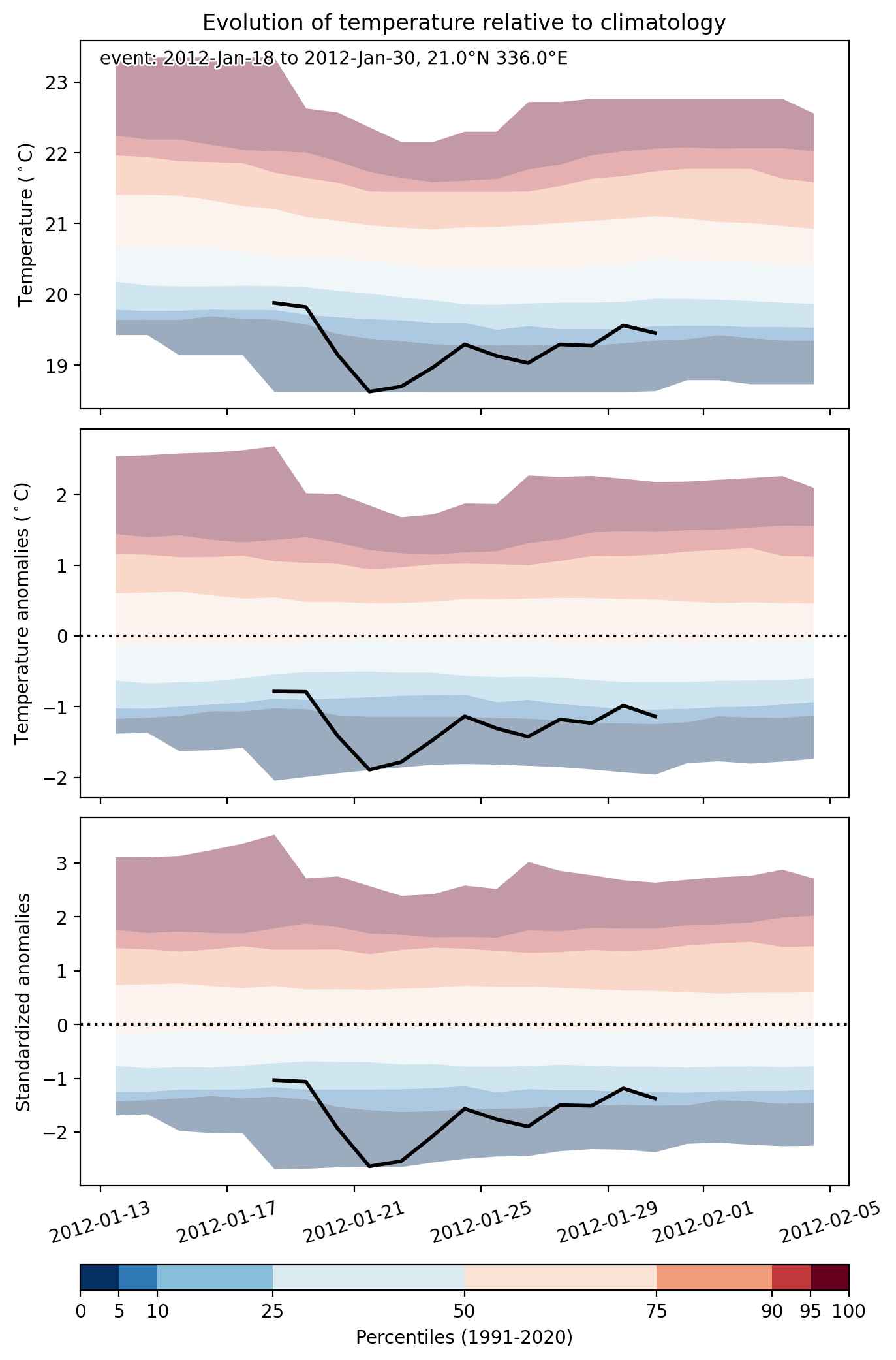
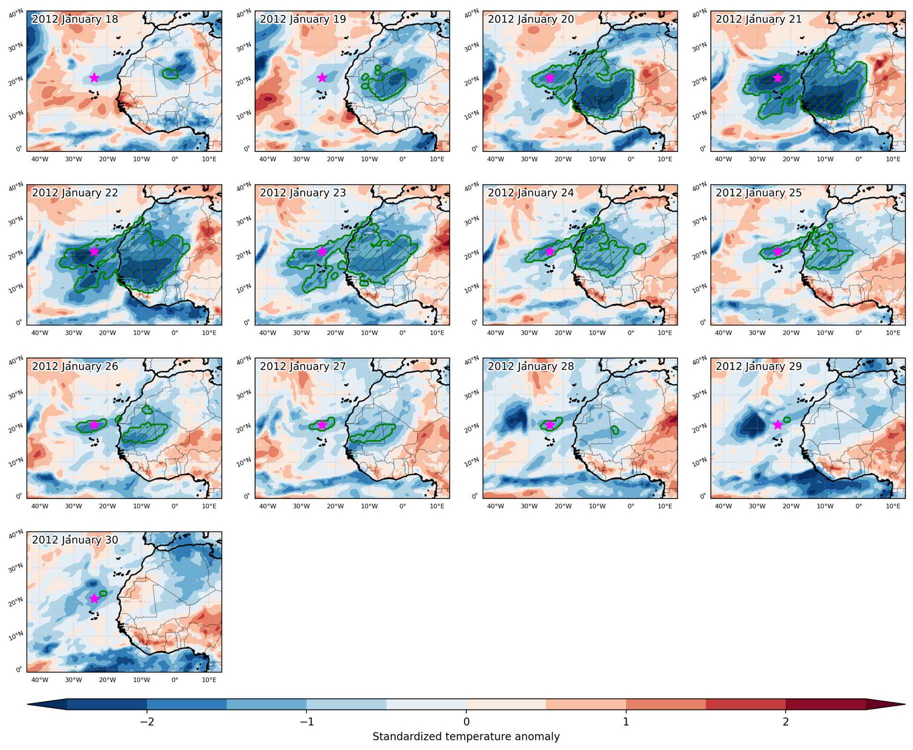
Duration: 13 days

Time span: January 18 2012 to January 30 2012

Statistics over entire affected area:

  • Mean temperature anomaly: -3.4 °C
  • Mean temperature: 16.6 °C
  • Minimum temperature anomaly: -7.4 °C
  • Minimum temperature: 9.7 °C

Event center: 21.0°N 336.0°E

Area affected: 4250412 km$^2$


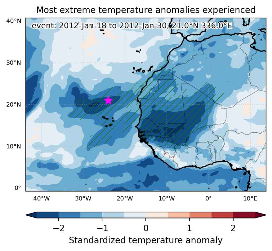
Fig. 1: Map of most extreme temperature anomalies (standardized) experienced during the event. The purple star indicates the center of the extreme event. Green hatching illustrates all areas under the effect of extremes at some time during the event.


Fig. 2: Evolution of temperature at the center of the event. The climatological percentile distribution is illustrated with color shadings.


Fig. 3: Maps illustrating the evolution of standardized temperature anomalies during the event.

Event ID: Cold_spell_2012-Jan-18_to_2012-Jan-30_336.0_21.0

Cold spell occuring from January 15 2012 to March 19 2012 at 21.0°N 336.0°E

Download data: JSON

Event type: Cold spell

Countries affected (identified with ArcGIS Online; provided only for geographical reference):

  • Afghanistan
  • Albania
  • Algeria
  • Andorra
  • Armenia
  • Austria
  • Azerbaijan
  • Bangladesh
  • Belarus
  • Belgium
  • Bosnia and Herzegovina
  • Bulgaria
  • Burkina Faso
  • Cabo Verde
  • Canarias
  • China
  • Croatia
  • Czech Republic
  • Côte d’Ivoire
  • Denmark
  • Egypt
  • Estonia
  • Finland
  • France
  • Gambia
  • Georgia
  • Germany
  • Ghana
  • Greece
  • Guinea
  • Guinea-Bissau
  • Hungary
  • India
  • Iran
  • Ireland
  • Italy
  • Japan
  • Kazakhstan
  • Kyrgyzstan
  • Latvia
  • Libya
  • Lithuania
  • Luxembourg
  • Madeira
  • Mali
  • Mauritania
  • Moldova
  • Mongolia
  • Montenegro
  • Morocco
  • Nepal
  • Netherlands
  • Niger
  • North Korea
  • North Macedonia
  • Norway
  • Oman
  • Pakistan
  • Poland
  • Portugal
  • Romania
  • Russian Federation
  • Senegal
  • Serbia
  • Sierra Leone
  • Slovakia
  • Slovenia
  • South Korea
  • Spain
  • Sweden
  • Switzerland
  • Tajikistan
  • Tunisia
  • Turkiye
  • Turkmenistan
  • Ukraine
  • United Kingdom
  • Uzbekistan

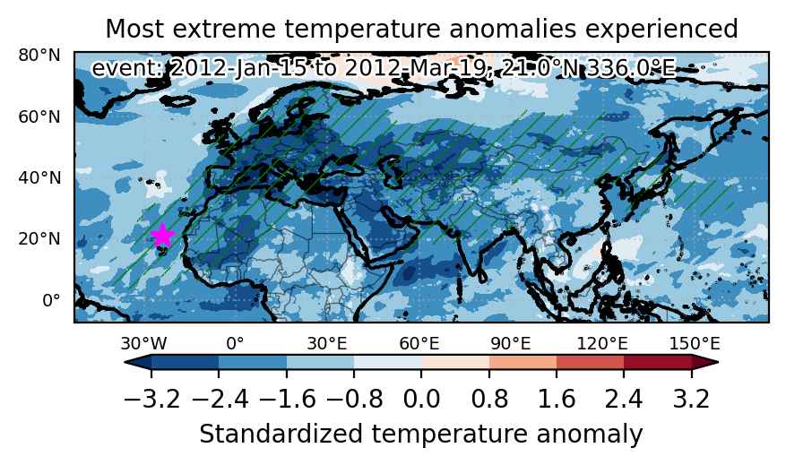
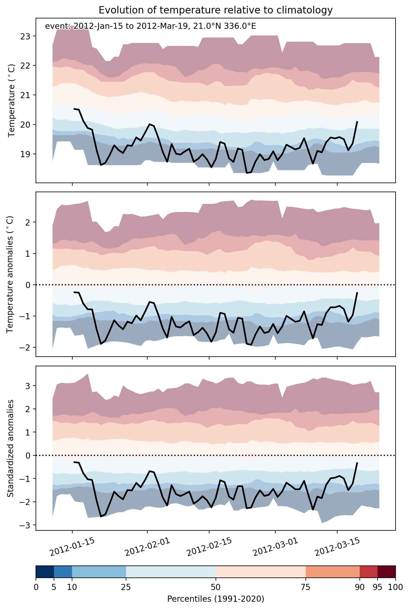
Duration: 65 days

Time span: January 15 2012 to March 19 2012

Statistics over entire affected area:

  • Mean temperature anomaly: -8.3 °C
  • Mean temperature: -6.9 °C
  • Minimum temperature anomaly: -25.5 °C
  • Minimum temperature: -47.7 °C

Event center: 21.0°N 24.0°W

Area affected: 47897737 km$^2$


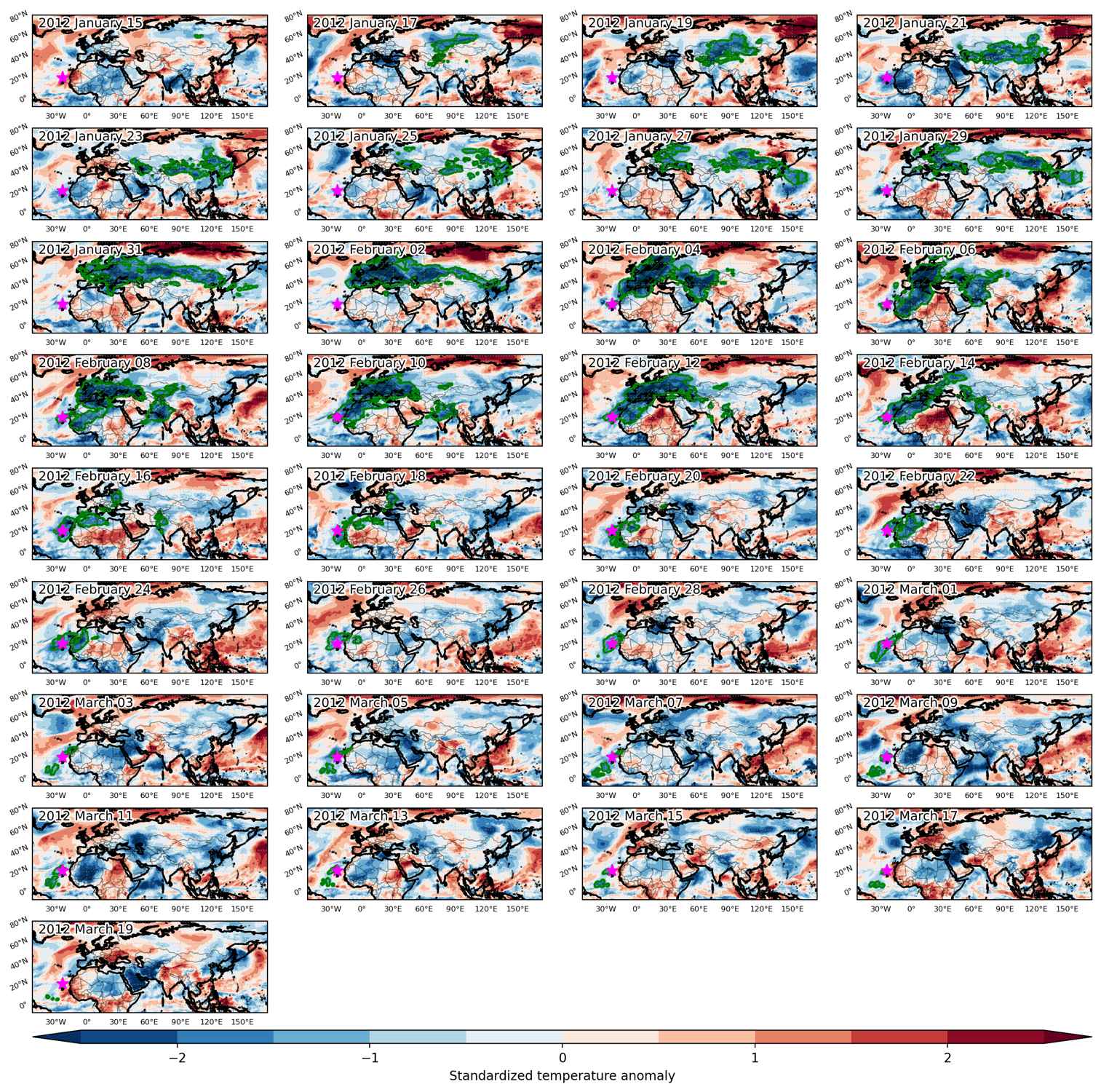
Fig. 1: Map of most extreme temperature anomalies (standardized) experienced during the event. The purple star indicates the center of the extreme event. Green hatching illustrates all areas under the effect of extremes at some time during the event.


Fig. 2: Evolution of temperature at the center of the event. The climatological percentile distribution is illustrated with color shadings.


Fig. 3: Maps illustrating the evolution of standardized temperature anomalies during the event.

Event ID: Cold_spell_2012-Jan-15_to_2012-Mar-19_336.0_21.0

Cold spell occuring from December 17 2011 to December 20 2011 at 12.5°N 344.5°E

Download data: JSON

Event type: Cold spell

Countries affected (identified with ArcGIS Online; provided only for geographical reference):

  • Gambia
  • Guinea
  • Guinea-Bissau
  • Senegal

Duration: 4 days

Time span: December 17 2011 to December 20 2011

Statistics over entire affected area:

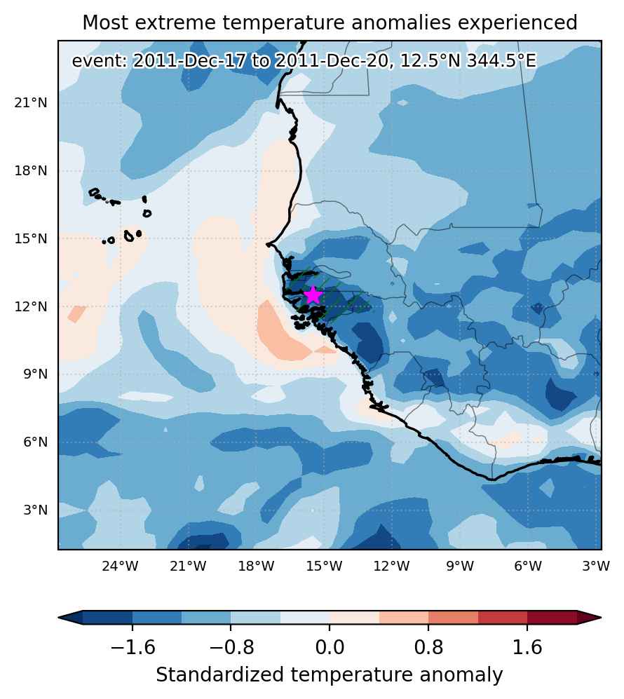
  • Mean temperature anomaly: -2.0 °C
  • Mean temperature: 23.7 °C
  • Minimum temperature anomaly: -2.8 °C
  • Minimum temperature: 22.6 °C

Event center: 12.5°N 344.5°E

Area affected: 54329 km$^2$


Fig. 1: Map of most extreme temperature anomalies (standardized) experienced during the event. The purple star indicates the center of the extreme event. Green hatching illustrates all areas under the effect of extremes at some time during the event.


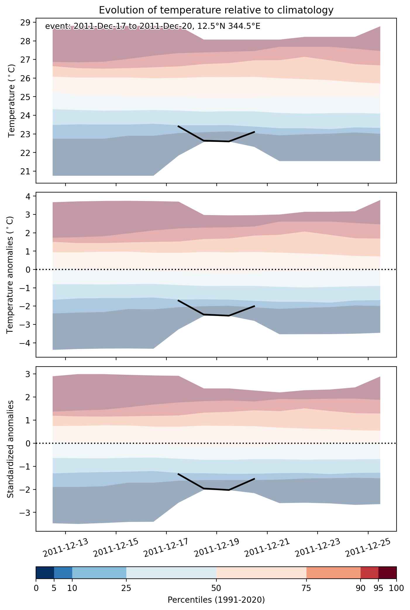
Fig. 2: Evolution of temperature at the center of the event. The climatological percentile distribution is illustrated with color shadings.


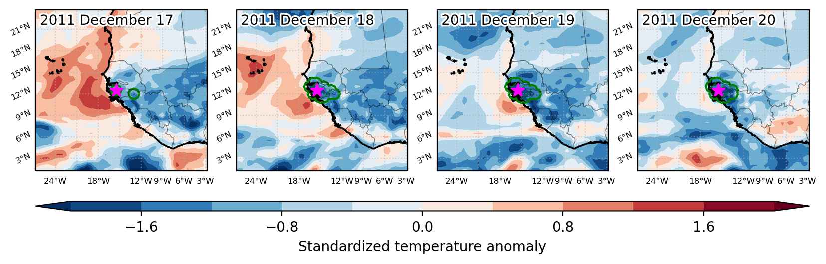
Fig. 3: Maps illustrating the evolution of standardized temperature anomalies during the event.

Event ID: Cold_spell_2011-Dec-17_to_2011-Dec-20_344.5_12.5

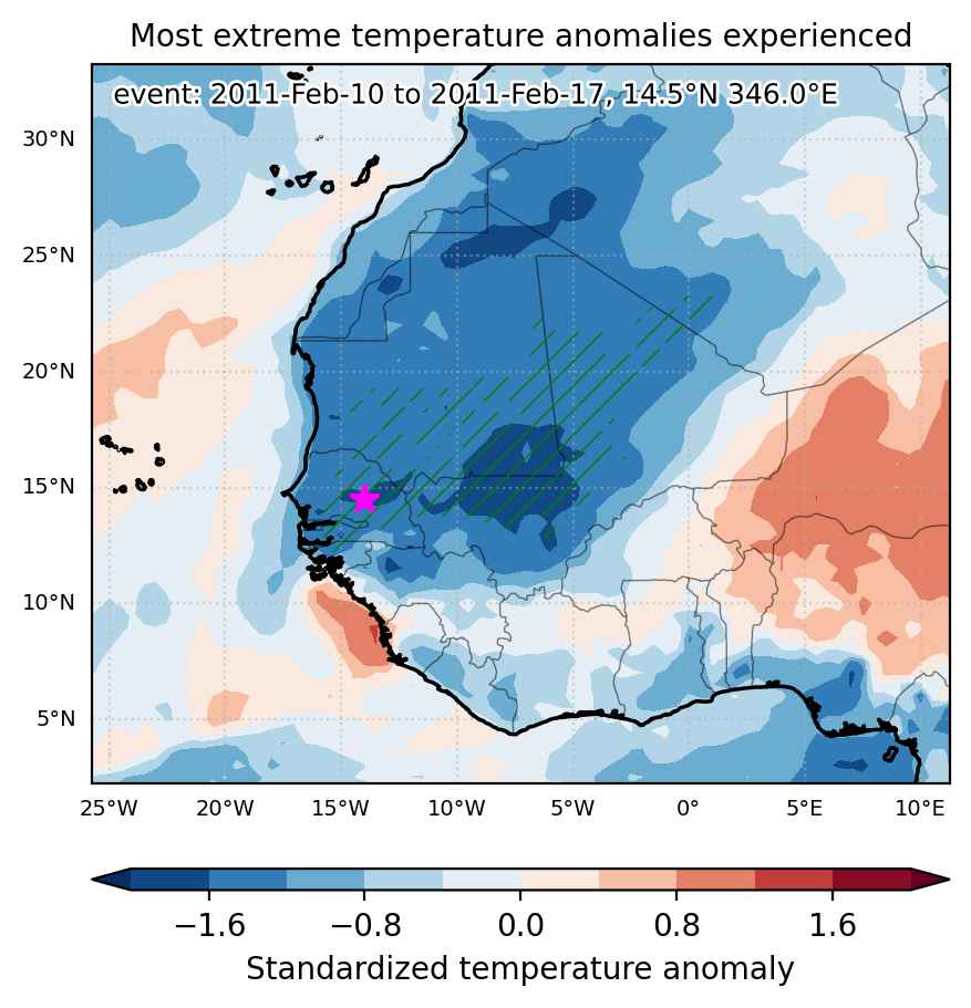
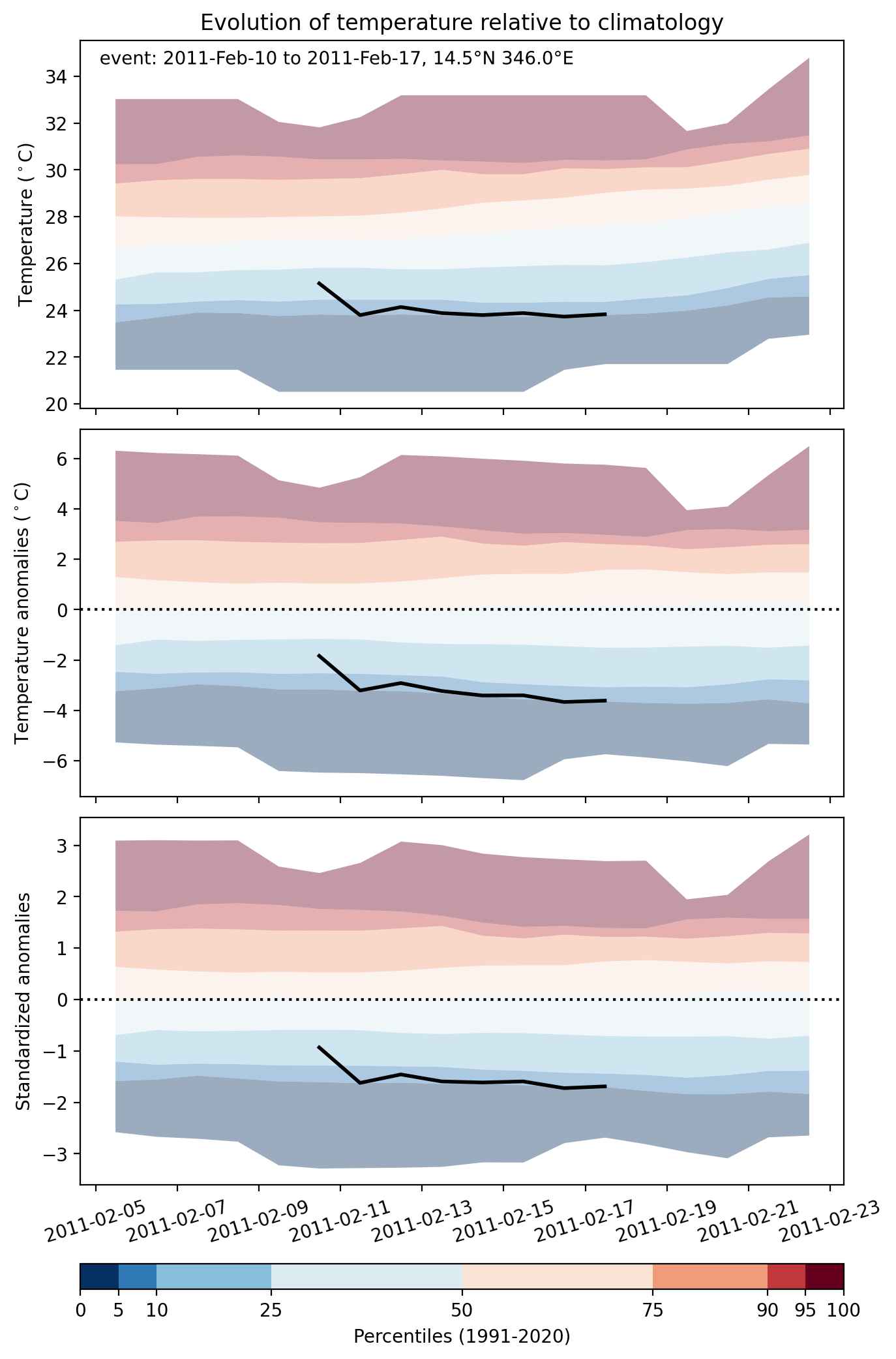
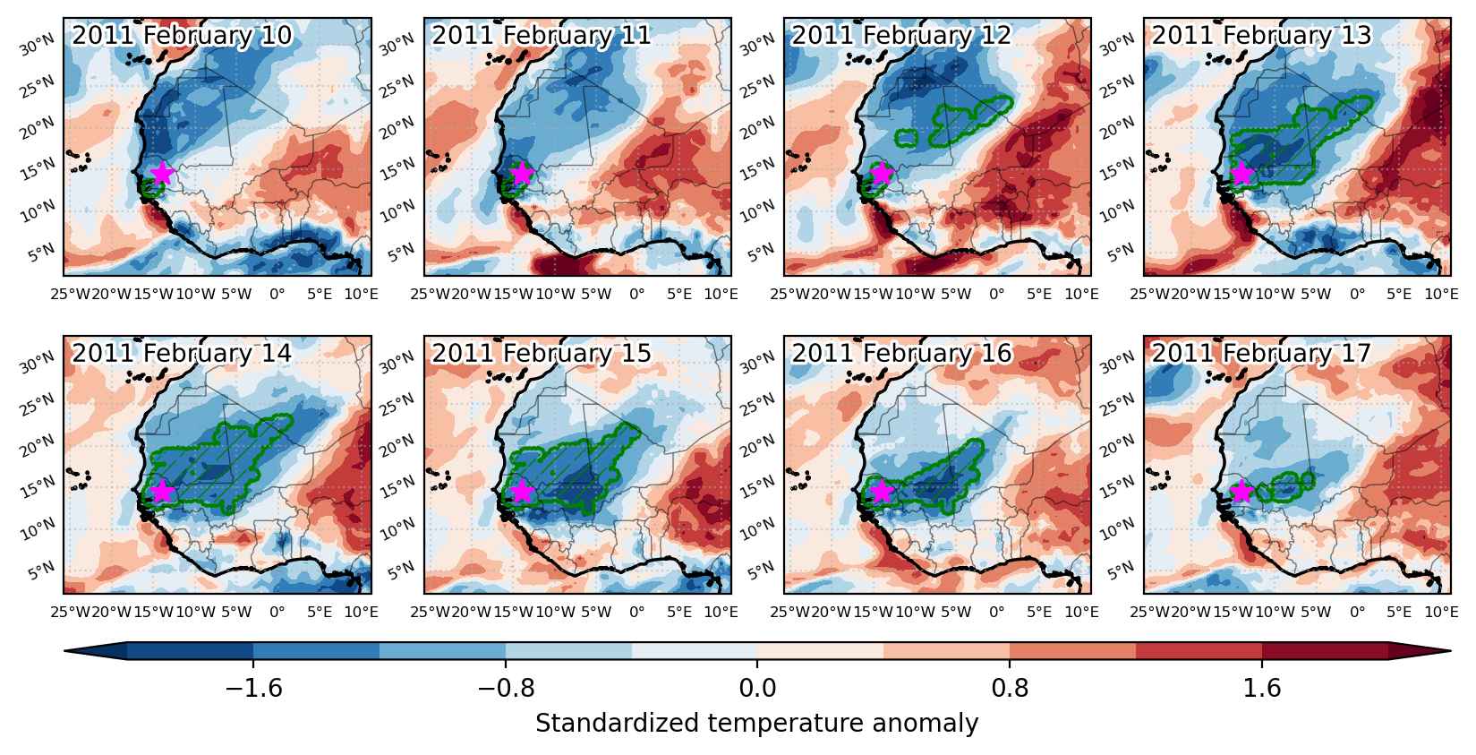
Cold spell occuring from February 10 2011 to February 17 2011 at 14.5°N 346.0°E

Download data: JSON

Event type: Cold spell

Countries affected (identified with ArcGIS Online; provided only for geographical reference):

  • Algeria
  • Gambia
  • Guinea-Bissau
  • Mali
  • Mauritania
  • Senegal

Duration: 8 days

Time span: February 10 2011 to February 17 2011

Statistics over entire affected area:

  • Mean temperature anomaly: -3.9 °C
  • Mean temperature: 20.4 °C
  • Minimum temperature anomaly: -5.3 °C
  • Minimum temperature: 13.9 °C

Event center: 14.5°N 346.0°E

Area affected: 852610 km$^2$


Fig. 1: Map of most extreme temperature anomalies (standardized) experienced during the event. The purple star indicates the center of the extreme event. Green hatching illustrates all areas under the effect of extremes at some time during the event.


Fig. 2: Evolution of temperature at the center of the event. The climatological percentile distribution is illustrated with color shadings.


Fig. 3: Maps illustrating the evolution of standardized temperature anomalies during the event.

Event ID: Cold_spell_2011-Feb-10_to_2011-Feb-17_346.0_14.5

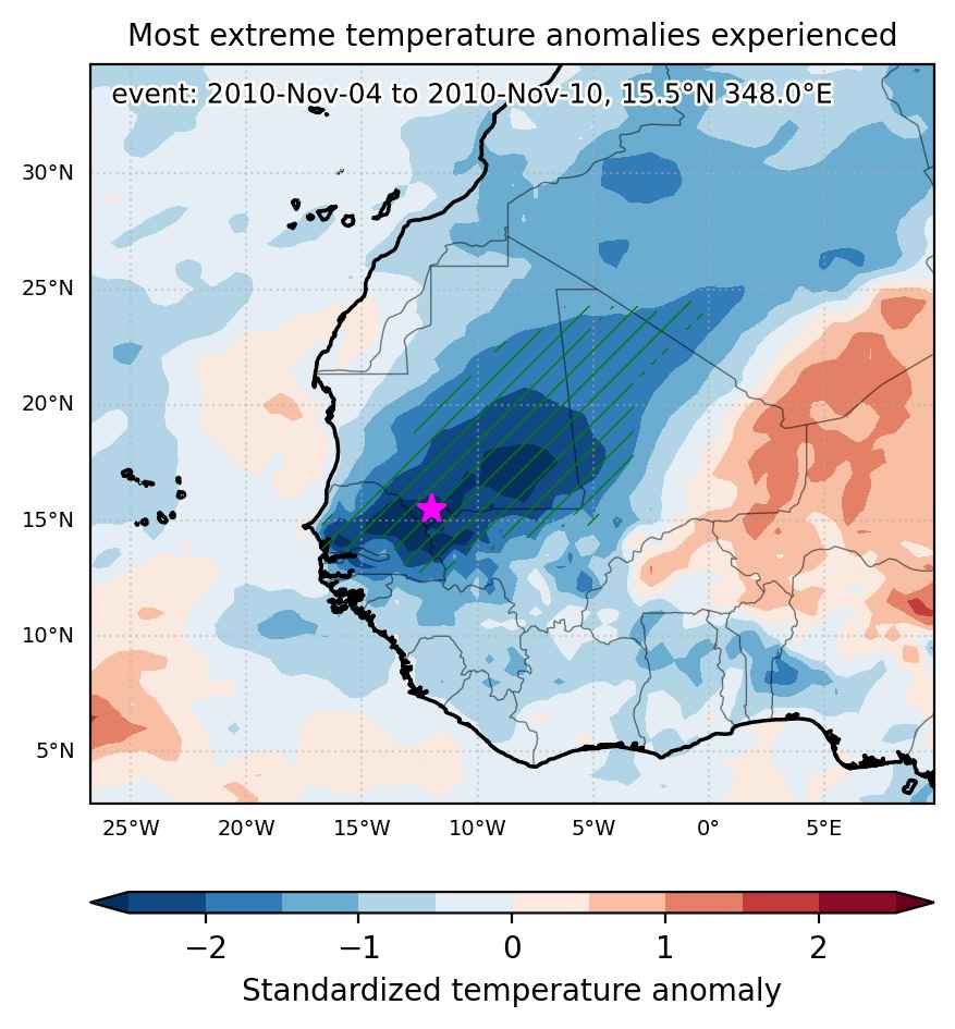
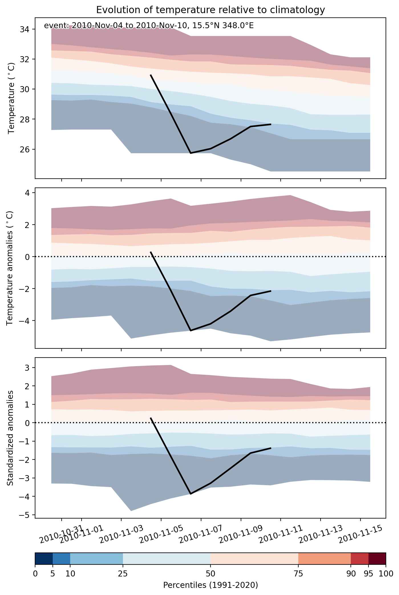
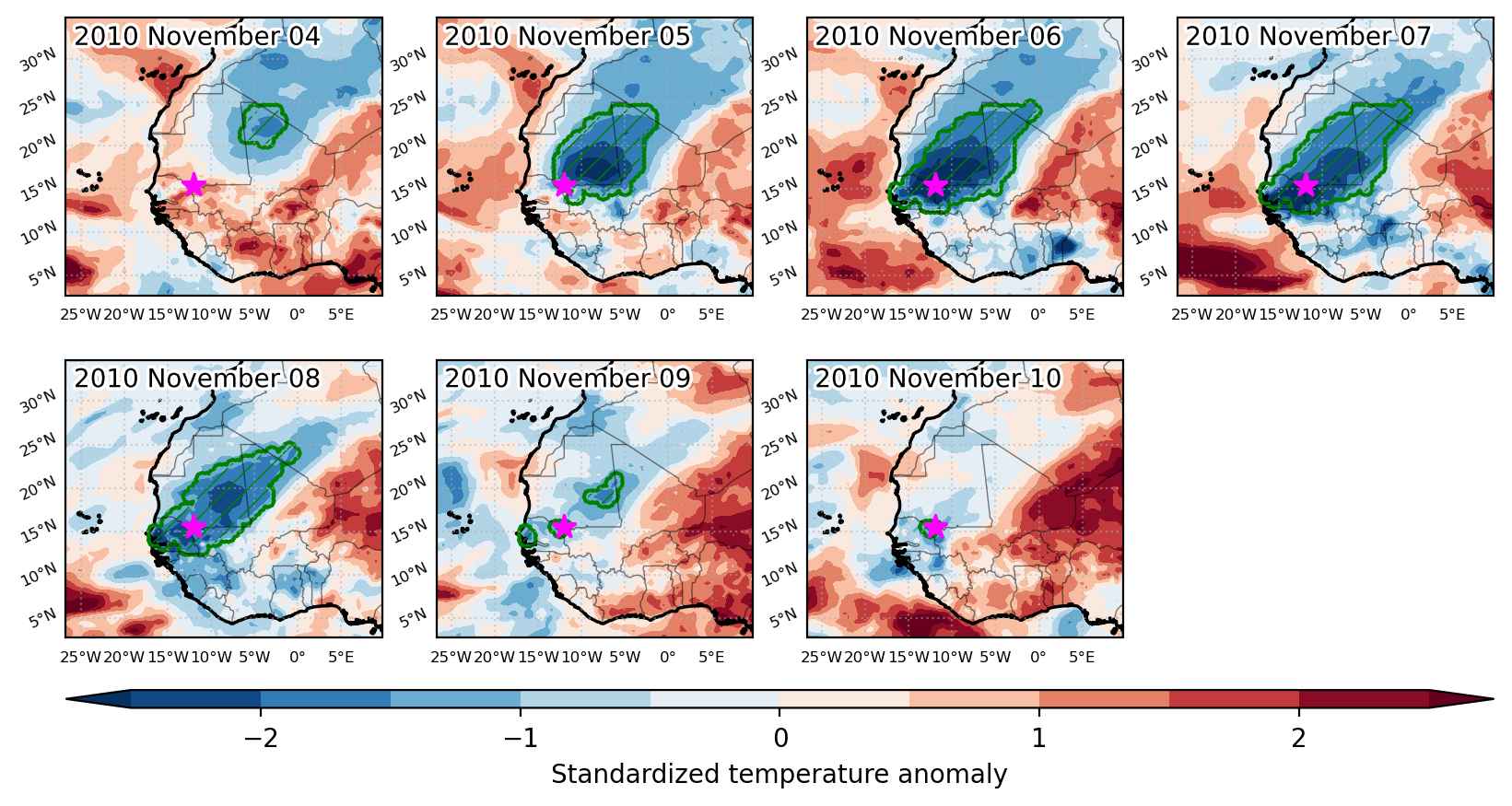
Cold spell occuring from November 04 2010 to November 10 2010 at 15.5°N 348.0°E

Download data: JSON

Event type: Cold spell

Countries affected (identified with ArcGIS Online; provided only for geographical reference):

  • Algeria
  • Gambia
  • Mali
  • Mauritania
  • Senegal

Duration: 7 days

Time span: November 04 2010 to November 10 2010

Statistics over entire affected area:

  • Mean temperature anomaly: -3.9 °C
  • Mean temperature: 22.5 °C
  • Minimum temperature anomaly: -5.7 °C
  • Minimum temperature: 17.8 °C

Event center: 15.5°N 348.0°E

Area affected: 1077883 km$^2$


Fig. 1: Map of most extreme temperature anomalies (standardized) experienced during the event. The purple star indicates the center of the extreme event. Green hatching illustrates all areas under the effect of extremes at some time during the event.


Fig. 2: Evolution of temperature at the center of the event. The climatological percentile distribution is illustrated with color shadings.


Fig. 3: Maps illustrating the evolution of standardized temperature anomalies during the event.

Event ID: Cold_spell_2010-Nov-04_to_2010-Nov-10_348.0_15.5