Cold spell occuring from May 20 2019 to May 30 2019 at 12.0°N 274.0°E

Download data: JSON

Event type: Cold spell

Countries affected (identified with ArcGIS Online; provided only for geographical reference):

  • Honduras
  • Nicaragua

Duration: 11 days

Time span: May 20 2019 to May 30 2019

Statistics over entire affected area:

  • Mean temperature anomaly: -1.6 °C
  • Mean temperature: 24.6 °C
  • Minimum temperature anomaly: -3.0 °C
  • Minimum temperature: 20.9 °C

Event center: 12.0°N 274.0°E

Area affected: 194824 km$^2$
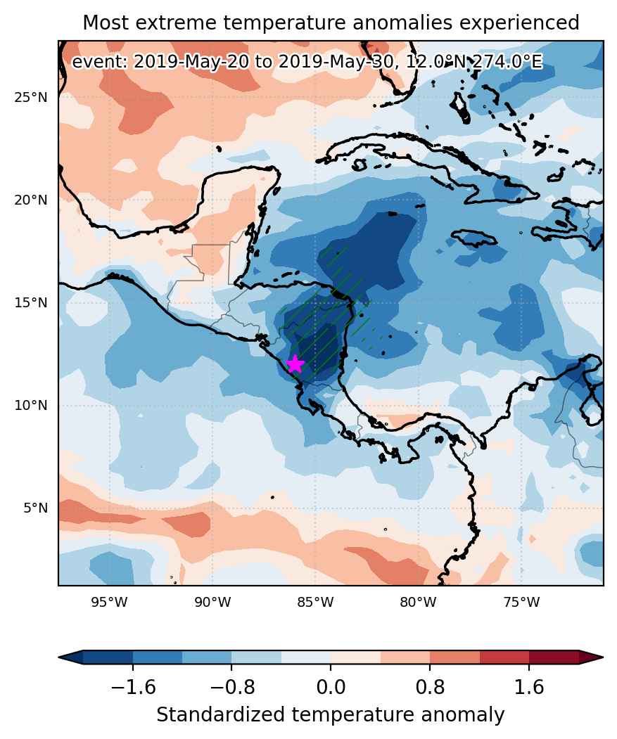

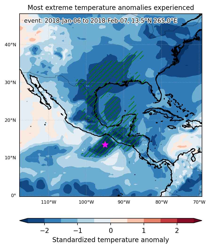
Fig. 1: Map of most extreme temperature anomalies (standardized) experienced during the event. The purple star indicates the center of the extreme event. Green hatching illustrates all areas under the effect of extremes at some time during the event.
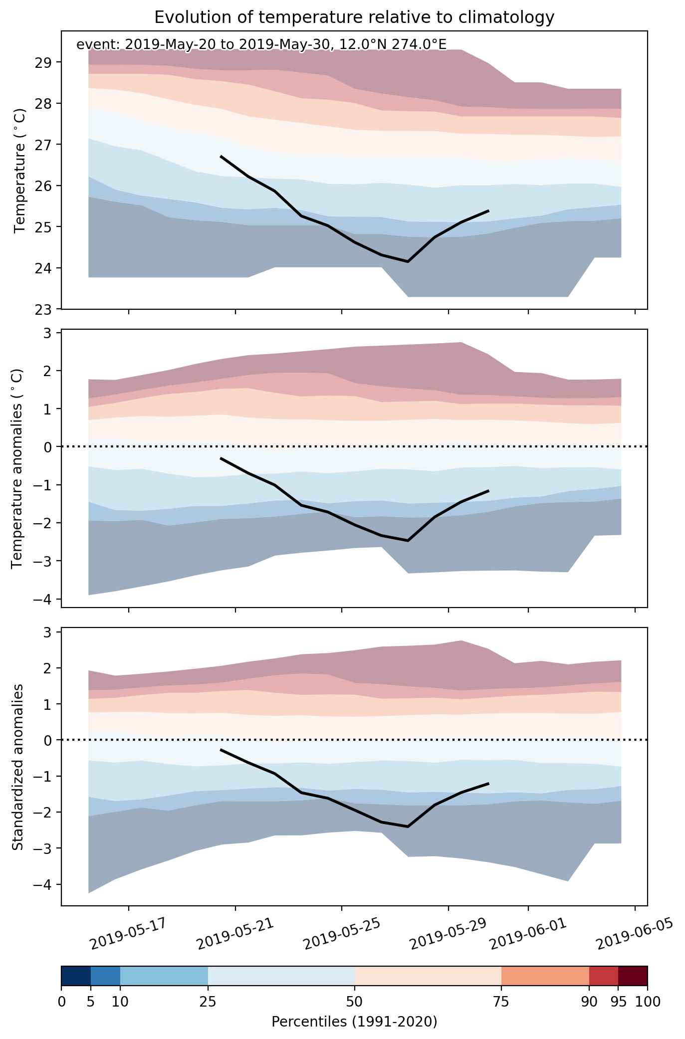


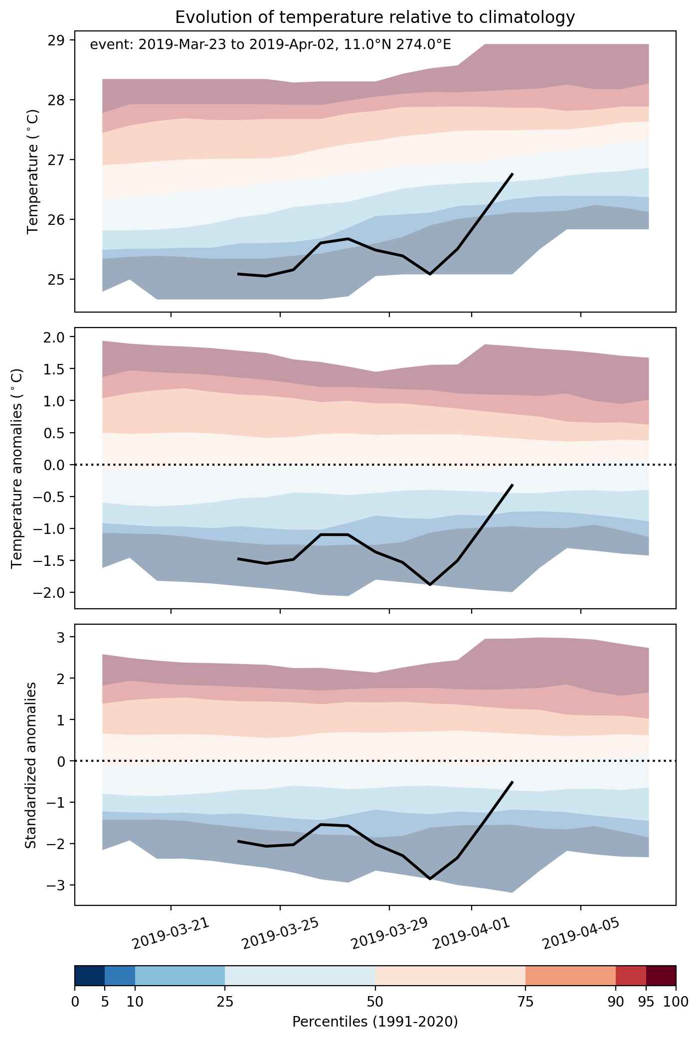
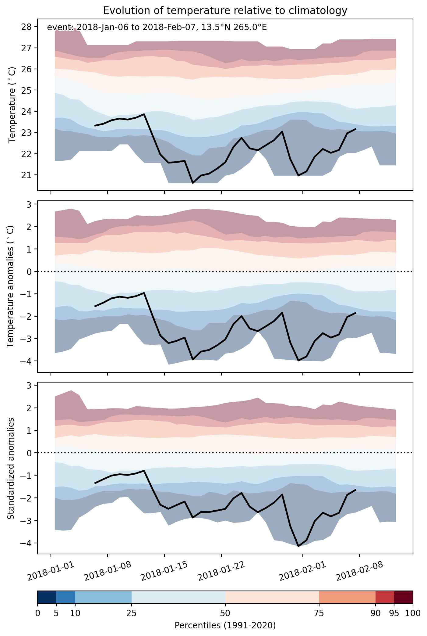
Fig. 2: Evolution of temperature at the center of the event. The climatological percentile distribution is illustrated with color shadings.
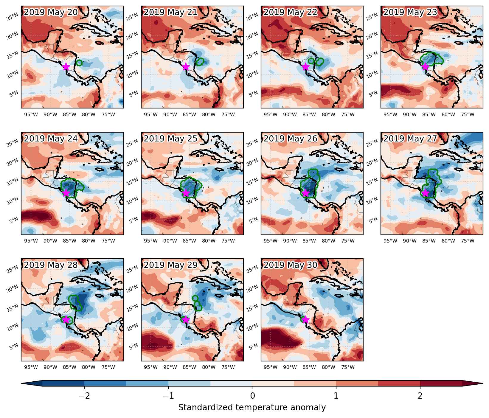


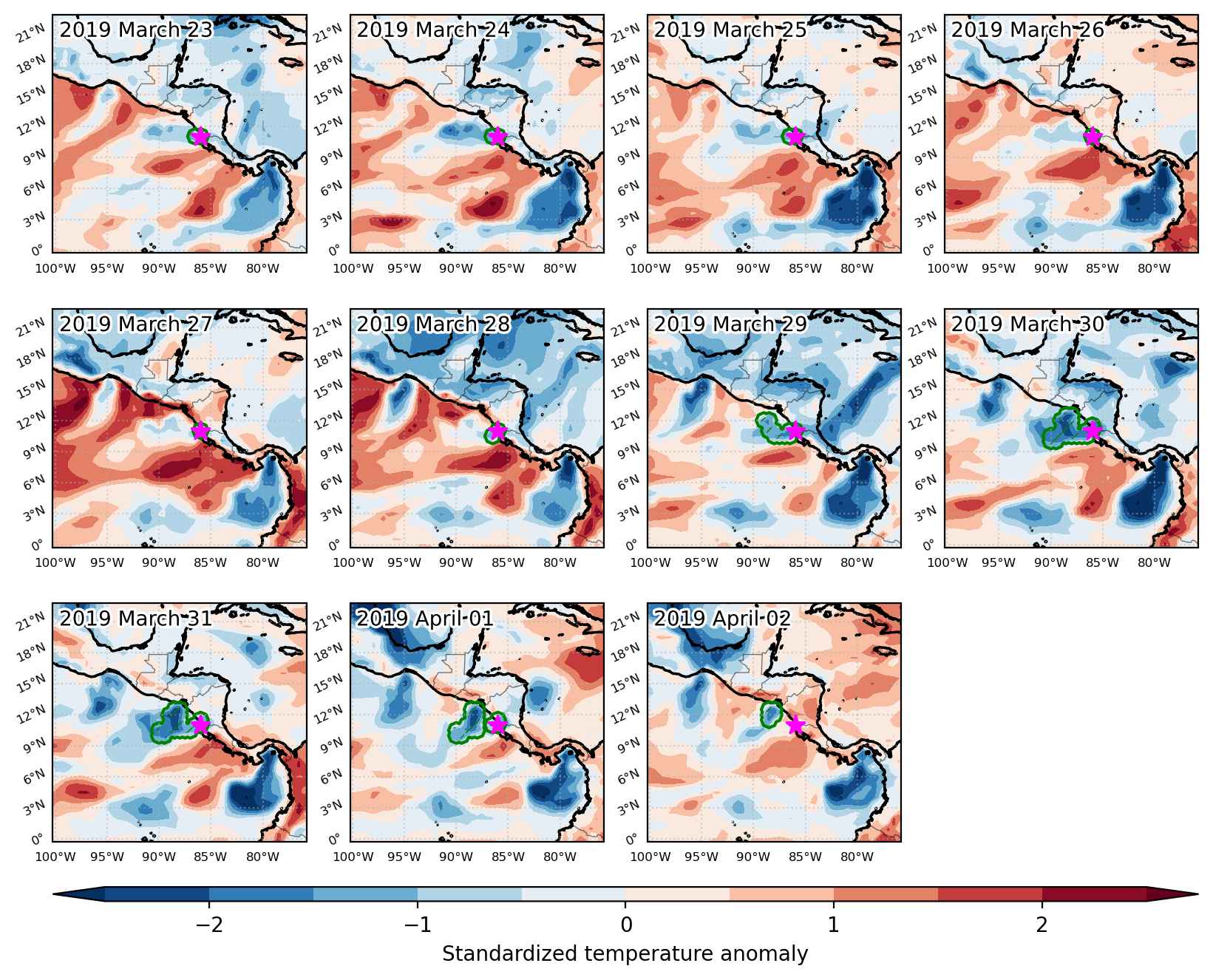
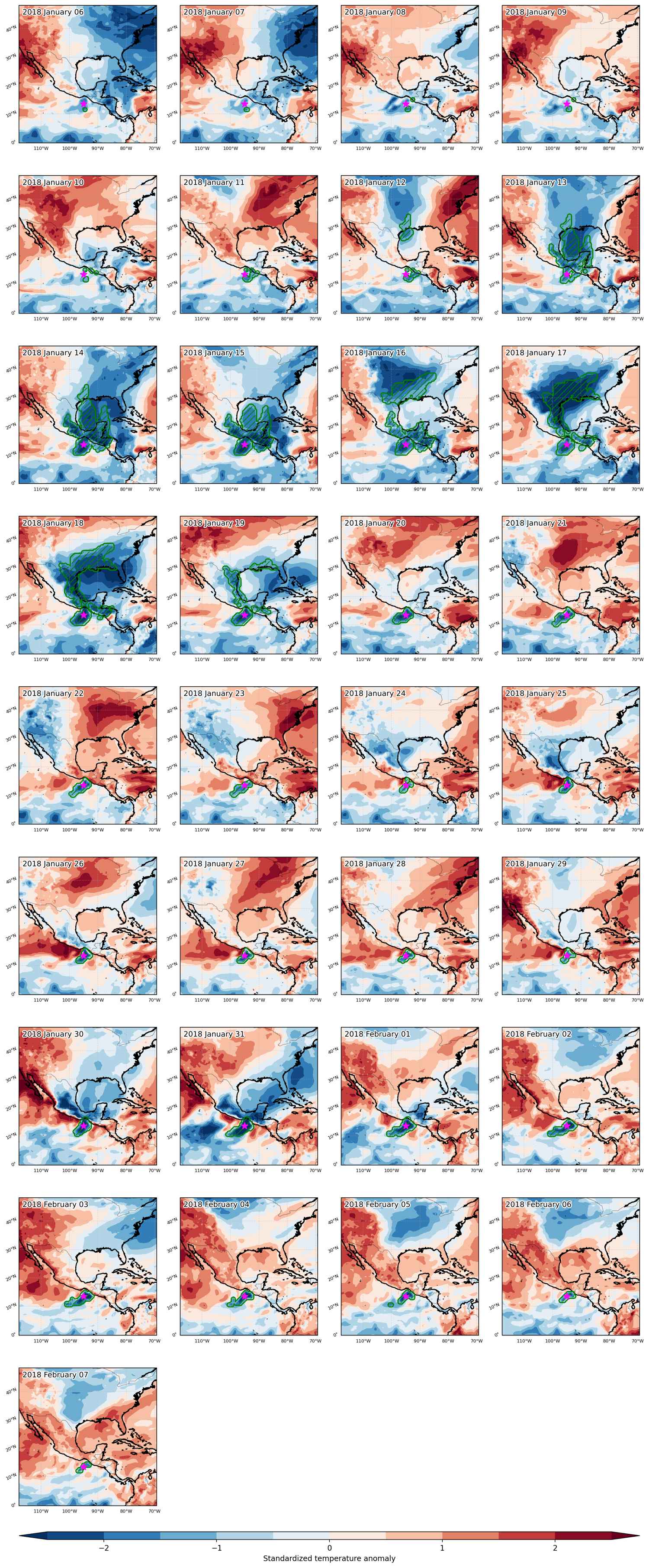
Fig. 3: Maps illustrating the evolution of standardized temperature anomalies during the event.

Event ID: Cold_spell_2019-May-20_to_2019-May-30_274.0_12.0
Cold spell occuring from March 23 2019 to April 02 2019 at 11.0°N 274.0°E

Download data: JSON

Event type: Cold spell

Countries affected (identified with ArcGIS Online; provided only for geographical reference):

  • Nicaragua

Duration: 11 days

Time span: March 23 2019 to April 02 2019

Statistics over entire affected area:

  • Mean temperature anomaly: -1.3 °C
  • Mean temperature: 25.7 °C
  • Minimum temperature anomaly: -1.9 °C
  • Minimum temperature: 24.7 °C

Event center: 11.0°N 274.0°E

Area affected: 69767 km$^2$


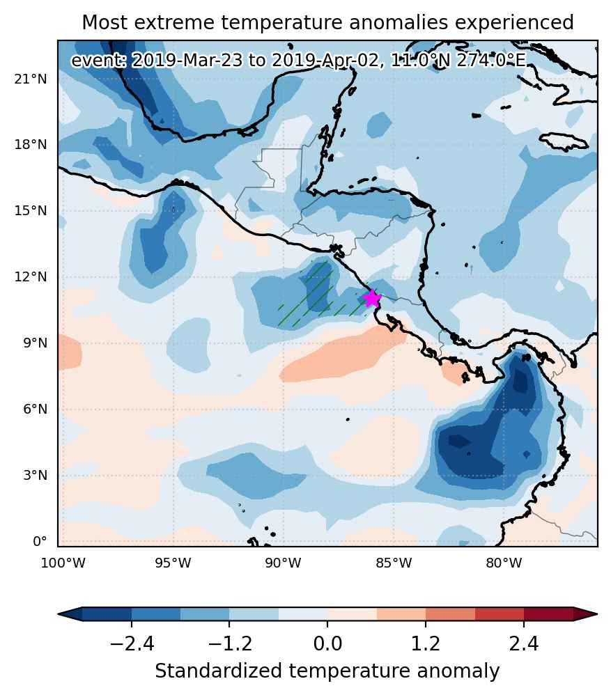
Fig. 1: Map of most extreme temperature anomalies (standardized) experienced during the event. The purple star indicates the center of the extreme event. Green hatching illustrates all areas under the effect of extremes at some time during the event.


Fig. 2: Evolution of temperature at the center of the event. The climatological percentile distribution is illustrated with color shadings.


Fig. 3: Maps illustrating the evolution of standardized temperature anomalies during the event.

Event ID: Cold_spell_2019-Mar-23_to_2019-Apr-02_274.0_11.0

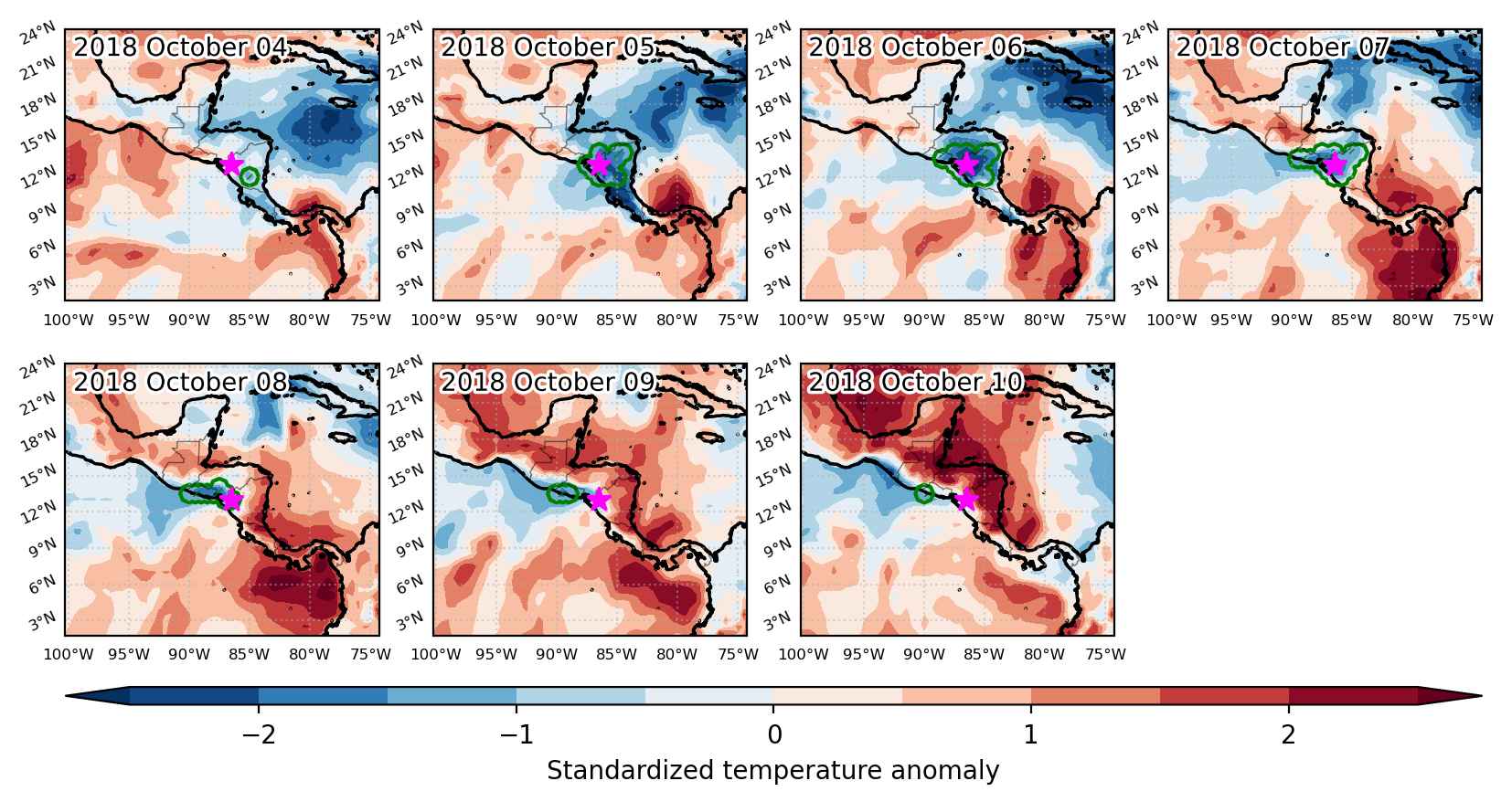
Cold spell occuring from October 04 2018 to October 10 2018 at 13.0°N 273.5°E

Download data: JSON

Event type: Cold spell

Countries affected (identified with ArcGIS Online; provided only for geographical reference):

  • El Salvador
  • Honduras
  • Nicaragua

Duration: 7 days

Time span: October 04 2018 to October 10 2018

Statistics over entire affected area:

  • Mean temperature anomaly: -1.7 °C
  • Mean temperature: 23.3 °C
  • Minimum temperature anomaly: -2.9 °C
  • Minimum temperature: 19.9 °C

Event center: 13.0°N 273.5°E

Area affected: 78254 km$^2$


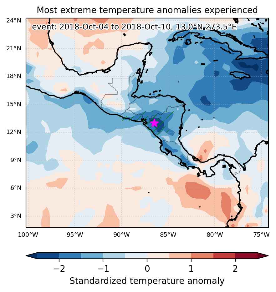
Fig. 1: Map of most extreme temperature anomalies (standardized) experienced during the event. The purple star indicates the center of the extreme event. Green hatching illustrates all areas under the effect of extremes at some time during the event.


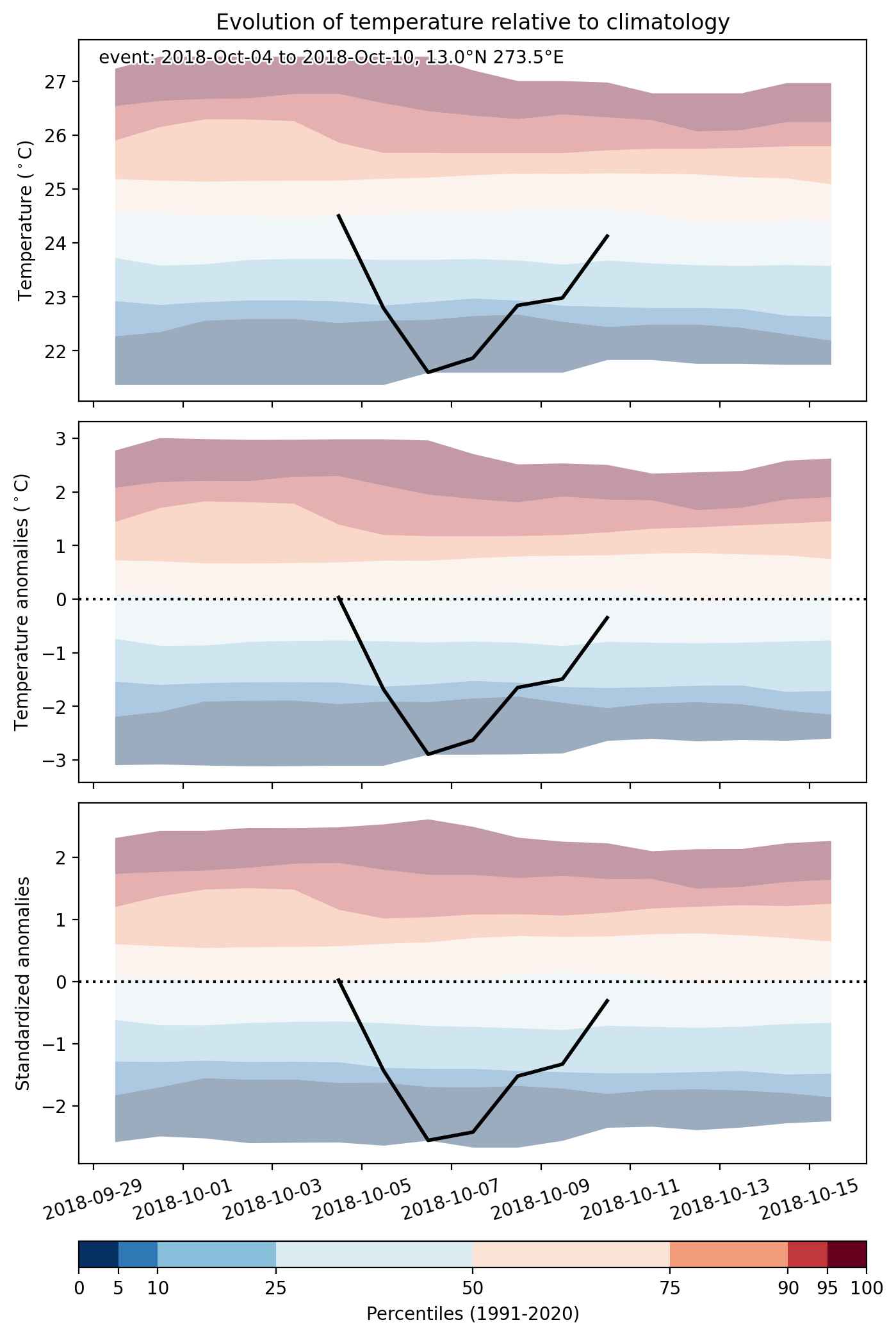
Fig. 2: Evolution of temperature at the center of the event. The climatological percentile distribution is illustrated with color shadings.


Fig. 3: Maps illustrating the evolution of standardized temperature anomalies during the event.

Event ID: Cold_spell_2018-Oct-04_to_2018-Oct-10_273.5_13.0

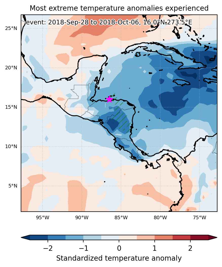
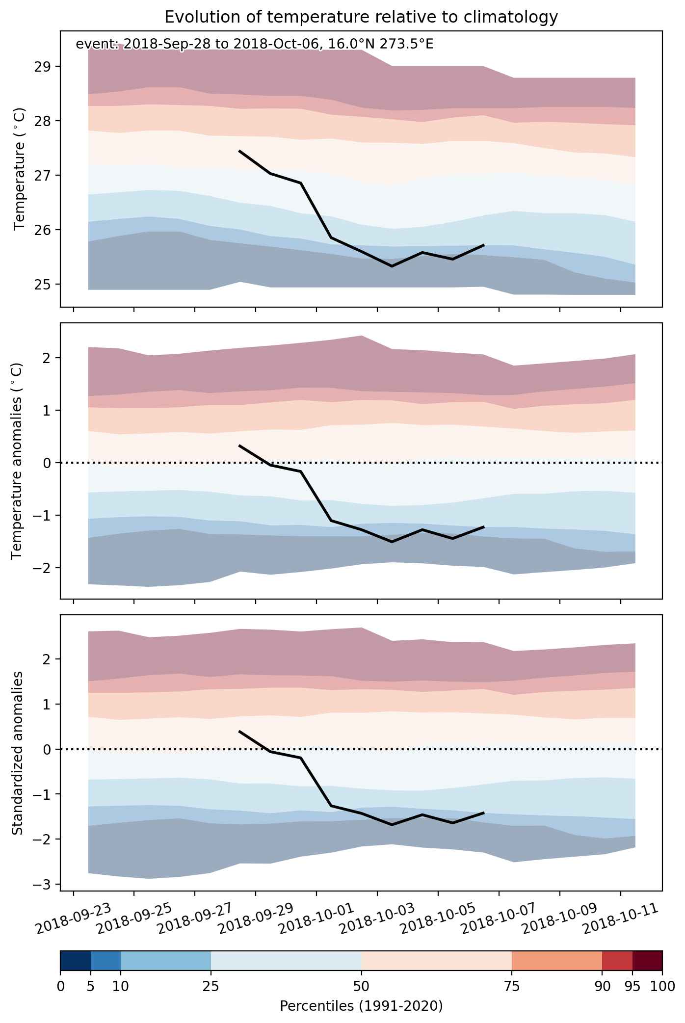
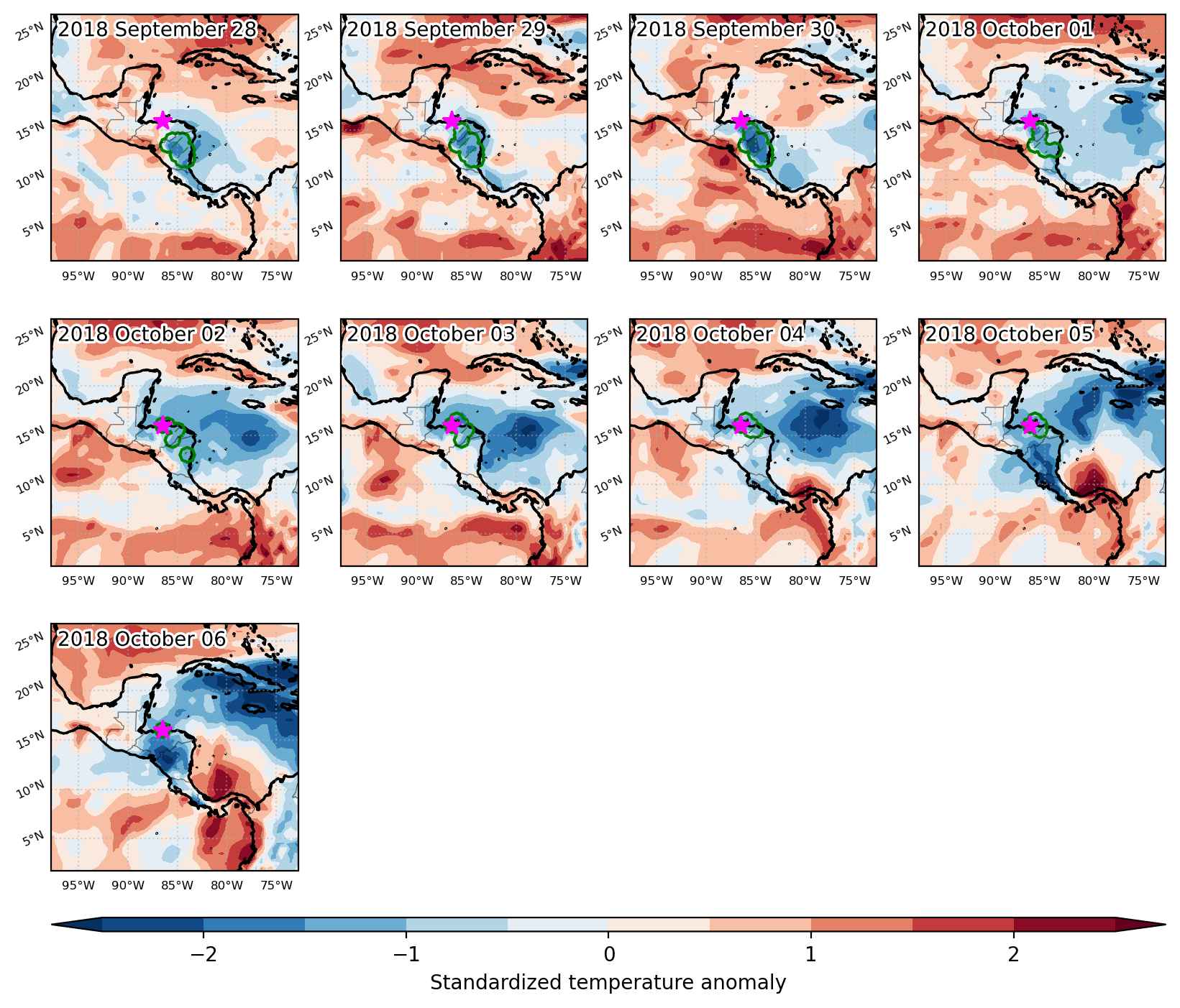
Cold spell occuring from September 28 2018 to October 06 2018 at 16.0°N 273.5°E

Download data: JSON

Event type: Cold spell

Countries affected (identified with ArcGIS Online; provided only for geographical reference):

  • Honduras
  • Nicaragua

Duration: 9 days

Time span: September 28 2018 to October 06 2018

Statistics over entire affected area:

  • Mean temperature anomaly: -1.3 °C
  • Mean temperature: 24.0 °C
  • Minimum temperature anomaly: -1.8 °C
  • Minimum temperature: 21.7 °C

Event center: 16.0°N 273.5°E

Area affected: 65952 km$^2$


Fig. 1: Map of most extreme temperature anomalies (standardized) experienced during the event. The purple star indicates the center of the extreme event. Green hatching illustrates all areas under the effect of extremes at some time during the event.


Fig. 2: Evolution of temperature at the center of the event. The climatological percentile distribution is illustrated with color shadings.


Fig. 3: Maps illustrating the evolution of standardized temperature anomalies during the event.

Event ID: Cold_spell_2018-Sep-28_to_2018-Oct-06_273.5_16.0

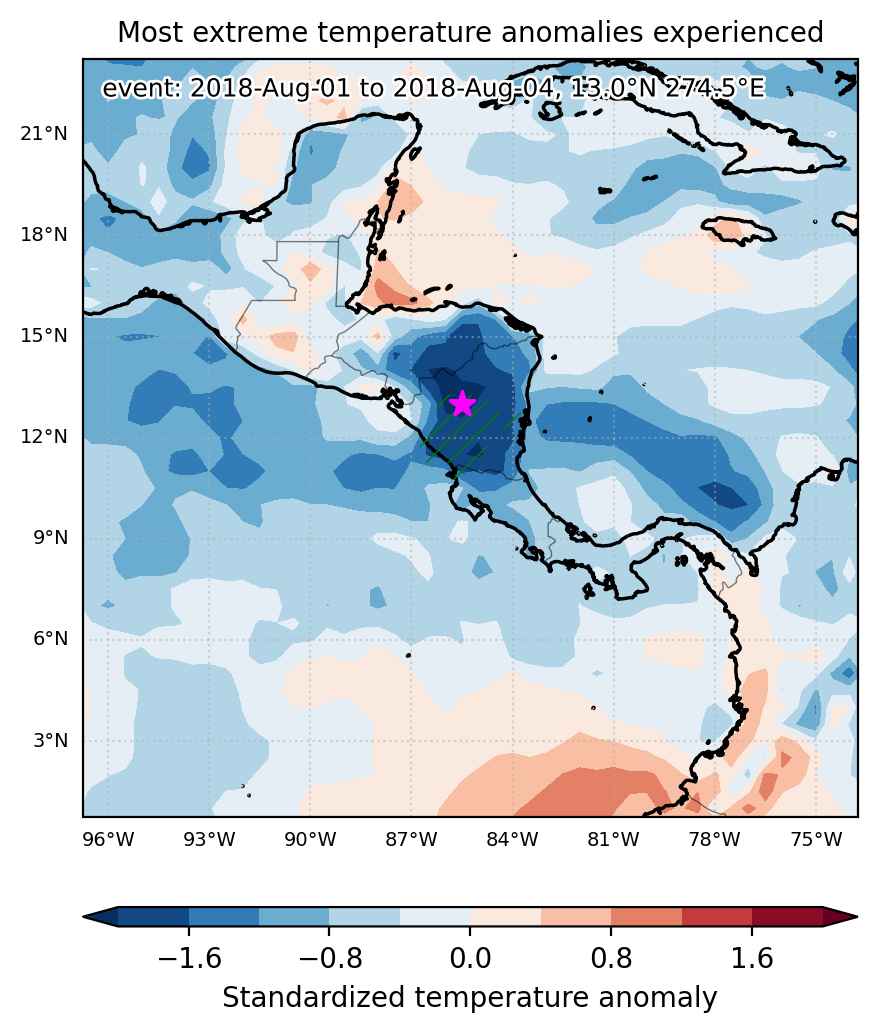
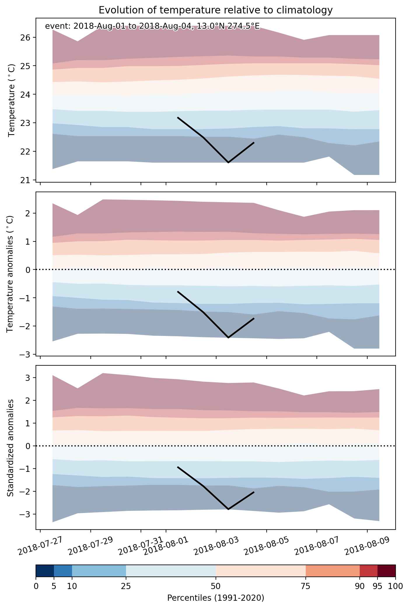
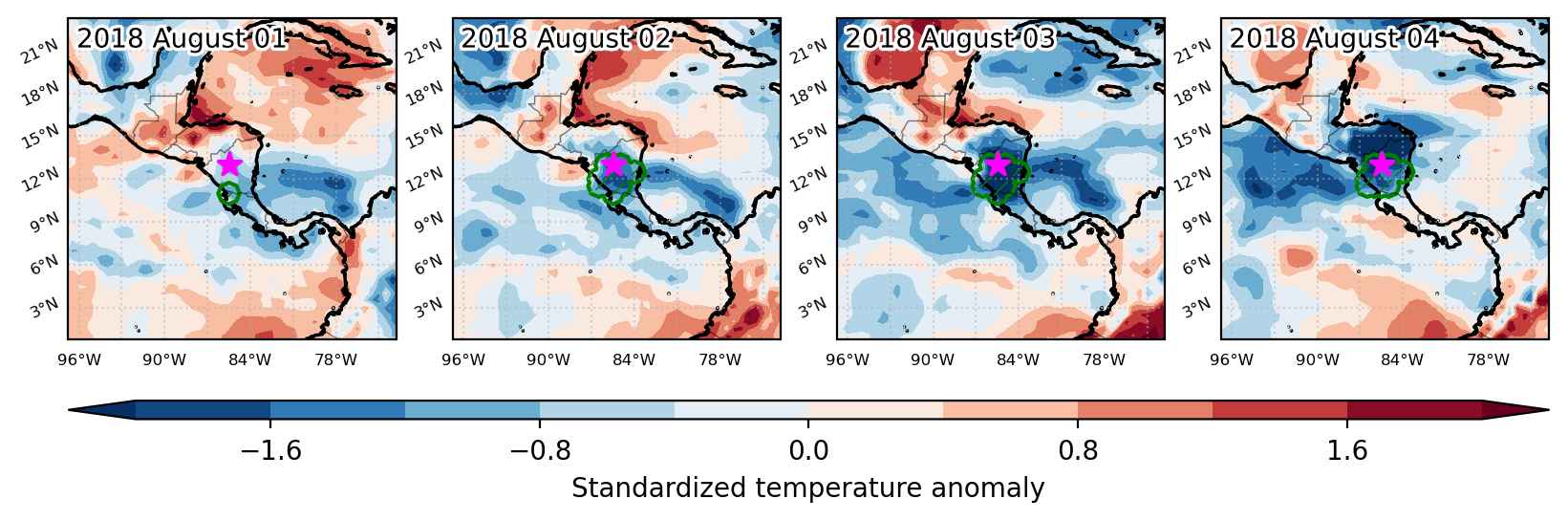
Cold spell occuring from August 01 2018 to August 04 2018 at 13.0°N 274.5°E

Download data: JSON

Event type: Cold spell

Countries affected (identified with ArcGIS Online; provided only for geographical reference):

  • Costa Rica
  • Nicaragua

Duration: 4 days

Time span: August 01 2018 to August 04 2018

Statistics over entire affected area:

  • Mean temperature anomaly: -1.6 °C
  • Mean temperature: 24.2 °C
  • Minimum temperature anomaly: -2.4 °C
  • Minimum temperature: 20.8 °C

Event center: 13.0°N 274.5°E

Area affected: 51369 km$^2$


Fig. 1: Map of most extreme temperature anomalies (standardized) experienced during the event. The purple star indicates the center of the extreme event. Green hatching illustrates all areas under the effect of extremes at some time during the event.


Fig. 2: Evolution of temperature at the center of the event. The climatological percentile distribution is illustrated with color shadings.


Fig. 3: Maps illustrating the evolution of standardized temperature anomalies during the event.

Event ID: Cold_spell_2018-Aug-01_to_2018-Aug-04_274.5_13.0

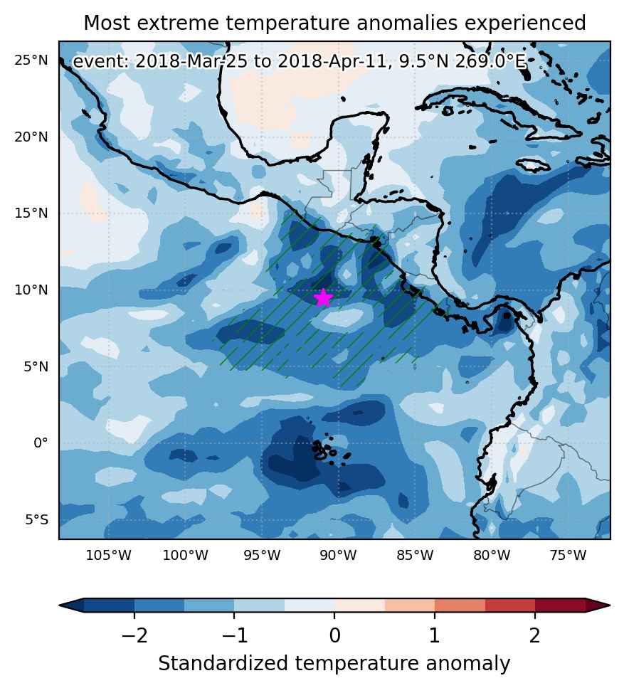
Cold spell occuring from March 25 2018 to April 11 2018 at 9.5°N 269.0°E

Download data: JSON

Event type: Cold spell

Countries affected (identified with ArcGIS Online; provided only for geographical reference):

  • Costa Rica
  • El Salvador
  • Guatemala
  • Honduras
  • Mexico
  • Nicaragua
  • Panama

Duration: 18 days

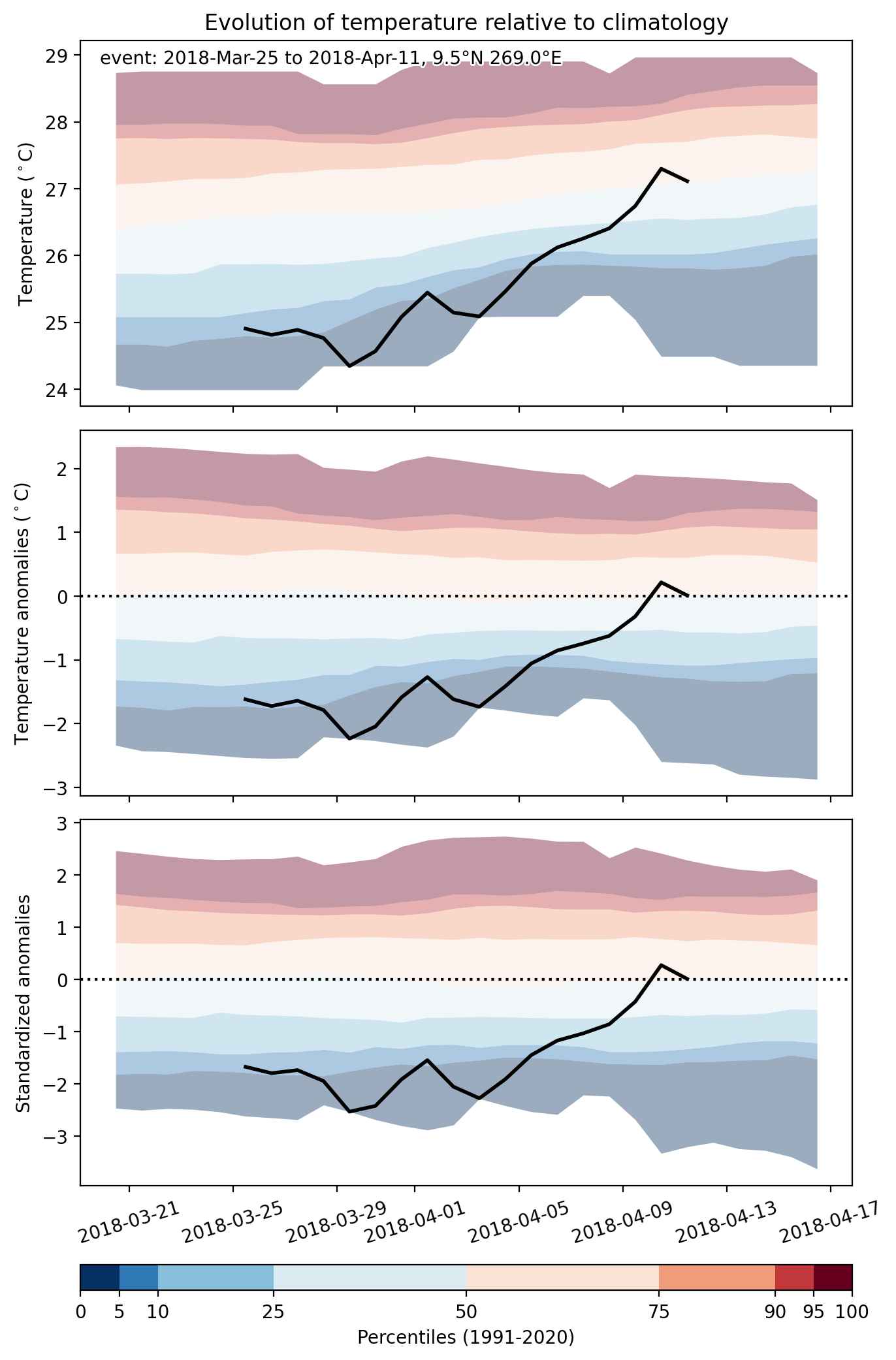
Time span: March 25 2018 to April 11 2018

Statistics over entire affected area:

  • Mean temperature anomaly: -1.2 °C
  • Mean temperature: 26.1 °C
  • Minimum temperature anomaly: -2.7 °C
  • Minimum temperature: 17.7 °C

Event center: 9.5°N 269.0°E

Area affected: 954603 km$^2$


Fig. 1: Map of most extreme temperature anomalies (standardized) experienced during the event. The purple star indicates the center of the extreme event. Green hatching illustrates all areas under the effect of extremes at some time during the event.


Fig. 2: Evolution of temperature at the center of the event. The climatological percentile distribution is illustrated with color shadings.


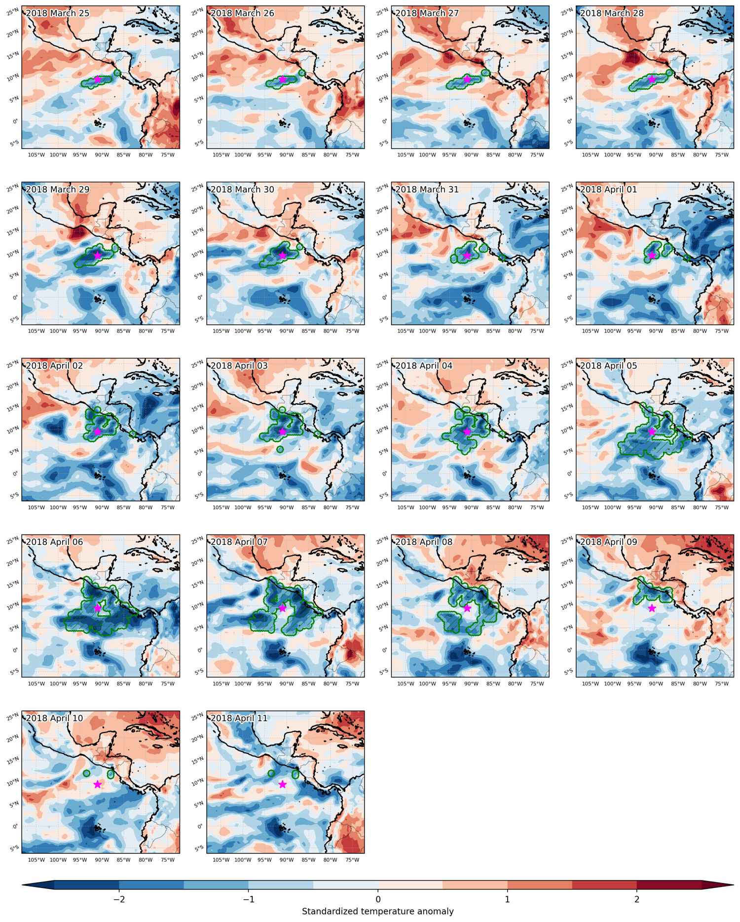
Fig. 3: Maps illustrating the evolution of standardized temperature anomalies during the event.

Event ID: Cold_spell_2018-Mar-25_to_2018-Apr-11_269.0_9.5

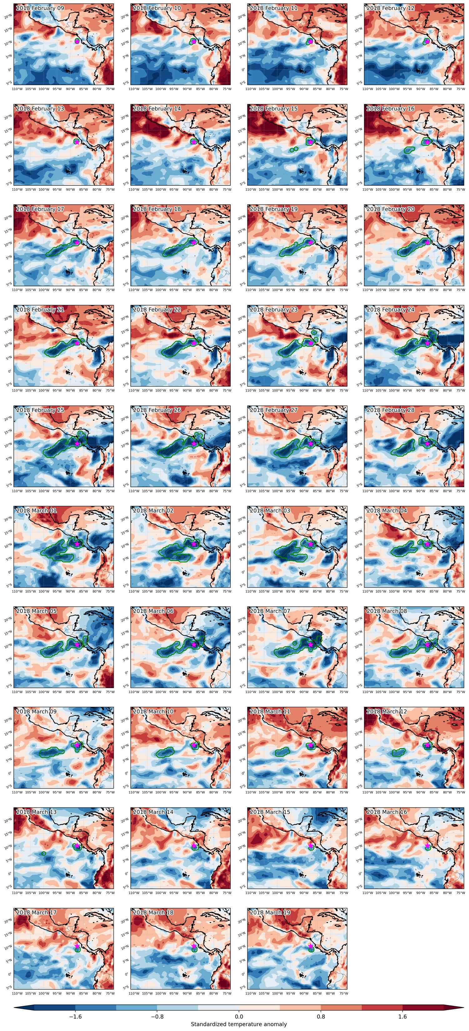
Cold spell occuring from February 09 2018 to March 19 2018 at 10.5°N 272.5°E

Download data: JSON

Event type: Cold spell

Countries affected (identified with ArcGIS Online; provided only for geographical reference):

  • Costa Rica
  • Honduras
  • Nicaragua

Duration: 39 days

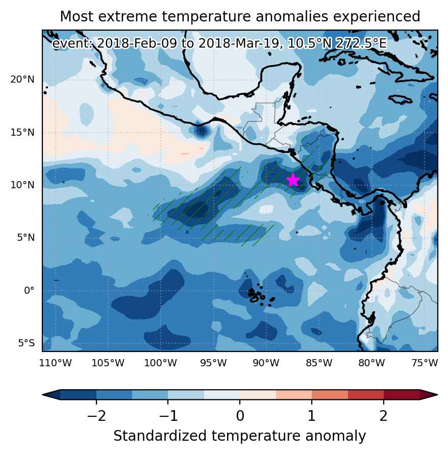
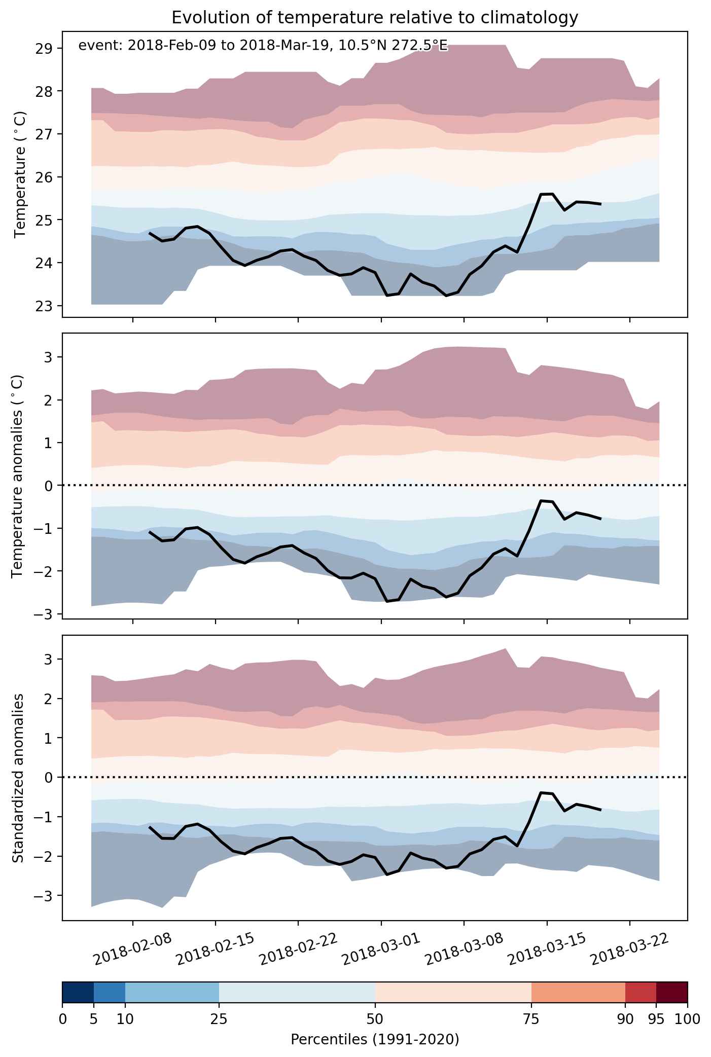
Time span: February 09 2018 to March 19 2018

Statistics over entire affected area:

  • Mean temperature anomaly: -1.3 °C
  • Mean temperature: 25.2 °C
  • Minimum temperature anomaly: -3.0 °C
  • Minimum temperature: 20.1 °C

Event center: 10.5°N 272.5°E

Area affected: 747875 km$^2$


Fig. 1: Map of most extreme temperature anomalies (standardized) experienced during the event. The purple star indicates the center of the extreme event. Green hatching illustrates all areas under the effect of extremes at some time during the event.


Fig. 2: Evolution of temperature at the center of the event. The climatological percentile distribution is illustrated with color shadings.


Fig. 3: Maps illustrating the evolution of standardized temperature anomalies during the event.

Event ID: Cold_spell_2018-Feb-09_to_2018-Mar-19_272.5_10.5

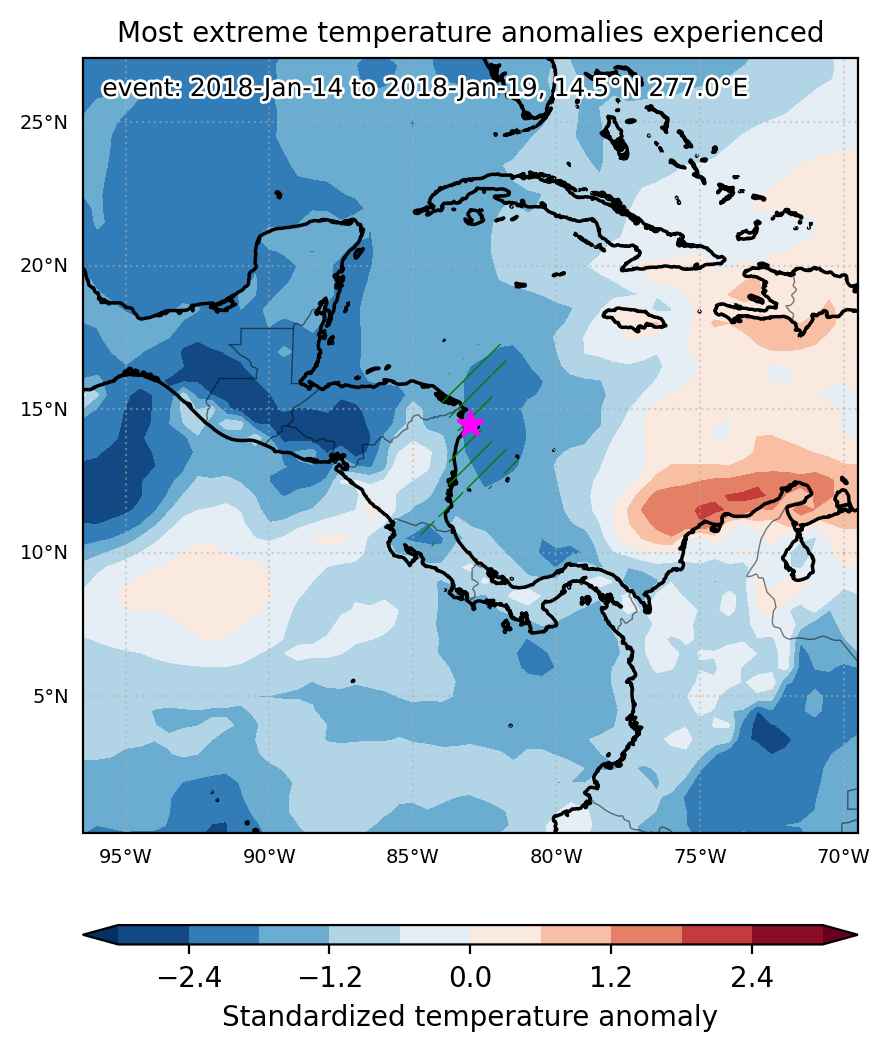
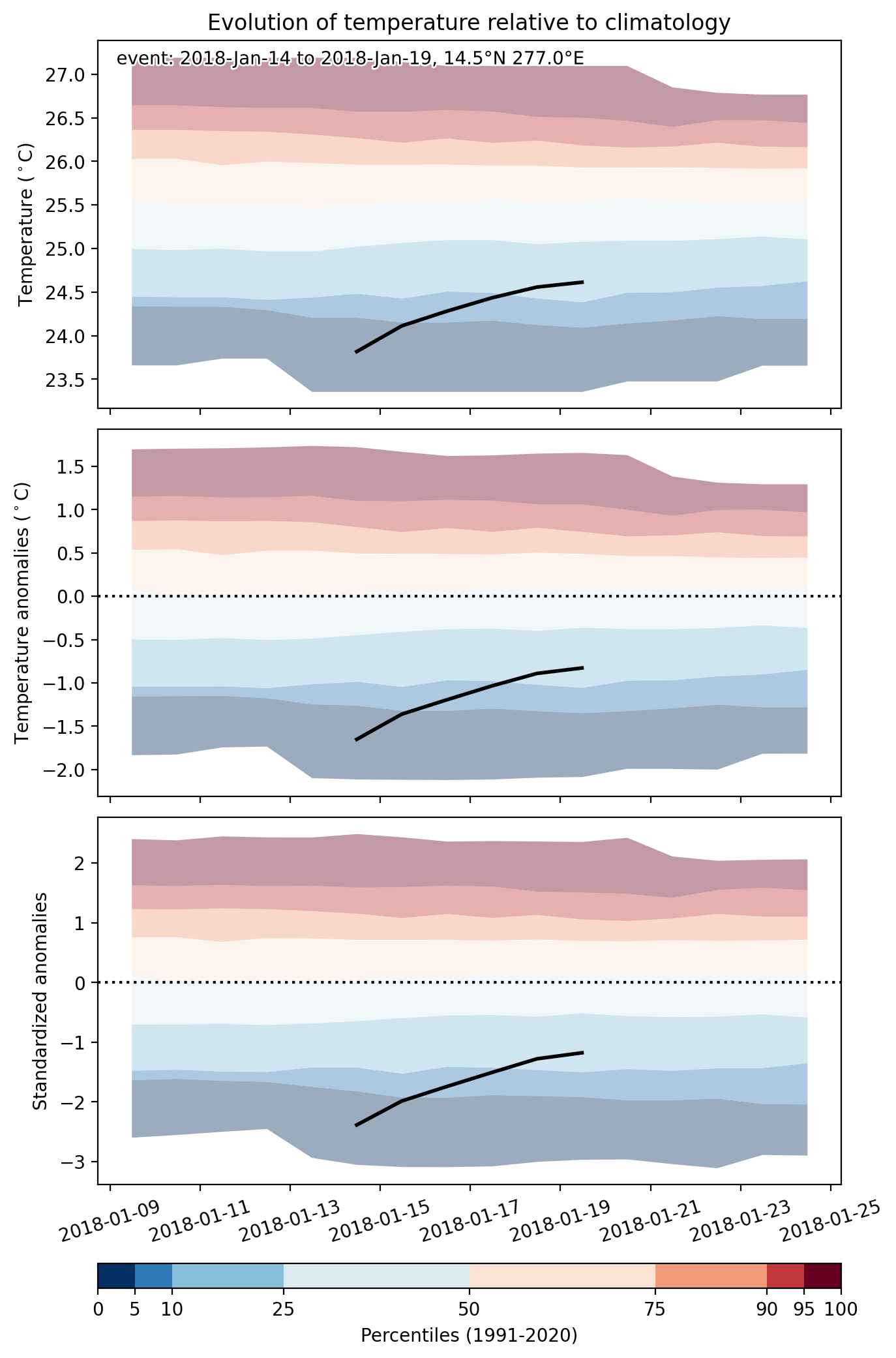
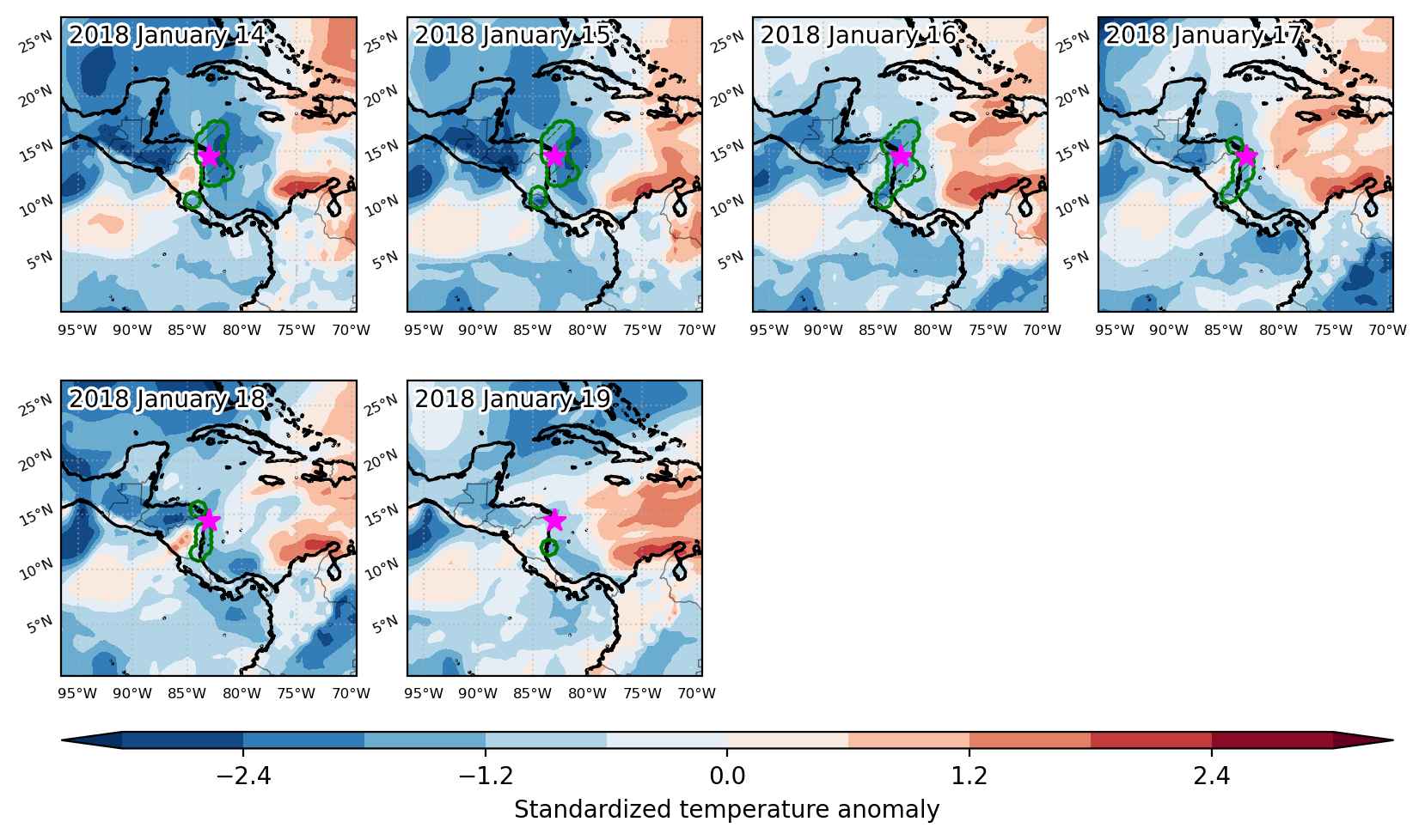
Cold spell occuring from January 14 2018 to January 19 2018 at 14.5°N 277.0°E

Download data: JSON

Event type: Cold spell

Countries affected (identified with ArcGIS Online; provided only for geographical reference):

  • Costa Rica
  • Nicaragua

Duration: 6 days

Time span: January 14 2018 to January 19 2018

Statistics over entire affected area:

  • Mean temperature anomaly: -1.2 °C
  • Mean temperature: 24.1 °C
  • Minimum temperature anomaly: -2.3 °C
  • Minimum temperature: 19.1 °C

Event center: 14.5°N 277.0°E

Area affected: 104834 km$^2$


Fig. 1: Map of most extreme temperature anomalies (standardized) experienced during the event. The purple star indicates the center of the extreme event. Green hatching illustrates all areas under the effect of extremes at some time during the event.


Fig. 2: Evolution of temperature at the center of the event. The climatological percentile distribution is illustrated with color shadings.


Fig. 3: Maps illustrating the evolution of standardized temperature anomalies during the event.

Event ID: Cold_spell_2018-Jan-14_to_2018-Jan-19_277.0_14.5

Cold spell occuring from January 06 2018 to February 07 2018 at 13.5°N 265.0°E

Download data: JSON

Event type: Cold spell

Countries affected (identified with ArcGIS Online; provided only for geographical reference):

  • Belize
  • El Salvador
  • Guatemala
  • Honduras
  • Mexico
  • Nicaragua
  • United States

Duration: 33 days

Time span: January 06 2018 to February 07 2018

Statistics over entire affected area:

  • Mean temperature anomaly: -5.0 °C
  • Mean temperature: 13.9 °C
  • Minimum temperature anomaly: -17.5 °C
  • Minimum temperature: -14.3 °C

Event center: 13.5°N 265.0°E

Area affected: 2926615 km$^2$


Fig. 1: Map of most extreme temperature anomalies (standardized) experienced during the event. The purple star indicates the center of the extreme event. Green hatching illustrates all areas under the effect of extremes at some time during the event.


Fig. 2: Evolution of temperature at the center of the event. The climatological percentile distribution is illustrated with color shadings.


Fig. 3: Maps illustrating the evolution of standardized temperature anomalies during the event.

Event ID: Cold_spell_2018-Jan-06_to_2018-Feb-07_265.0_13.5

Cold spell occuring from December 07 2017 to December 24 2017 at 11.5°N 262.5°E

Download data: JSON

Event type: Cold spell

Countries affected (identified with ArcGIS Online; provided only for geographical reference):

  • Belize
  • Costa Rica
  • El Salvador
  • Guatemala
  • Honduras
  • Mexico
  • Nicaragua
  • Panama
  • United States

Duration: 18 days

Time span: December 07 2017 to December 24 2017

Statistics over entire affected area:

  • Mean temperature anomaly: -4.4 °C
  • Mean temperature: 16.1 °C
  • Minimum temperature anomaly: -17.2 °C
  • Minimum temperature: -6.4 °C

Event center: 11.5°N 262.5°E

Area affected: 2759905 km$^2$


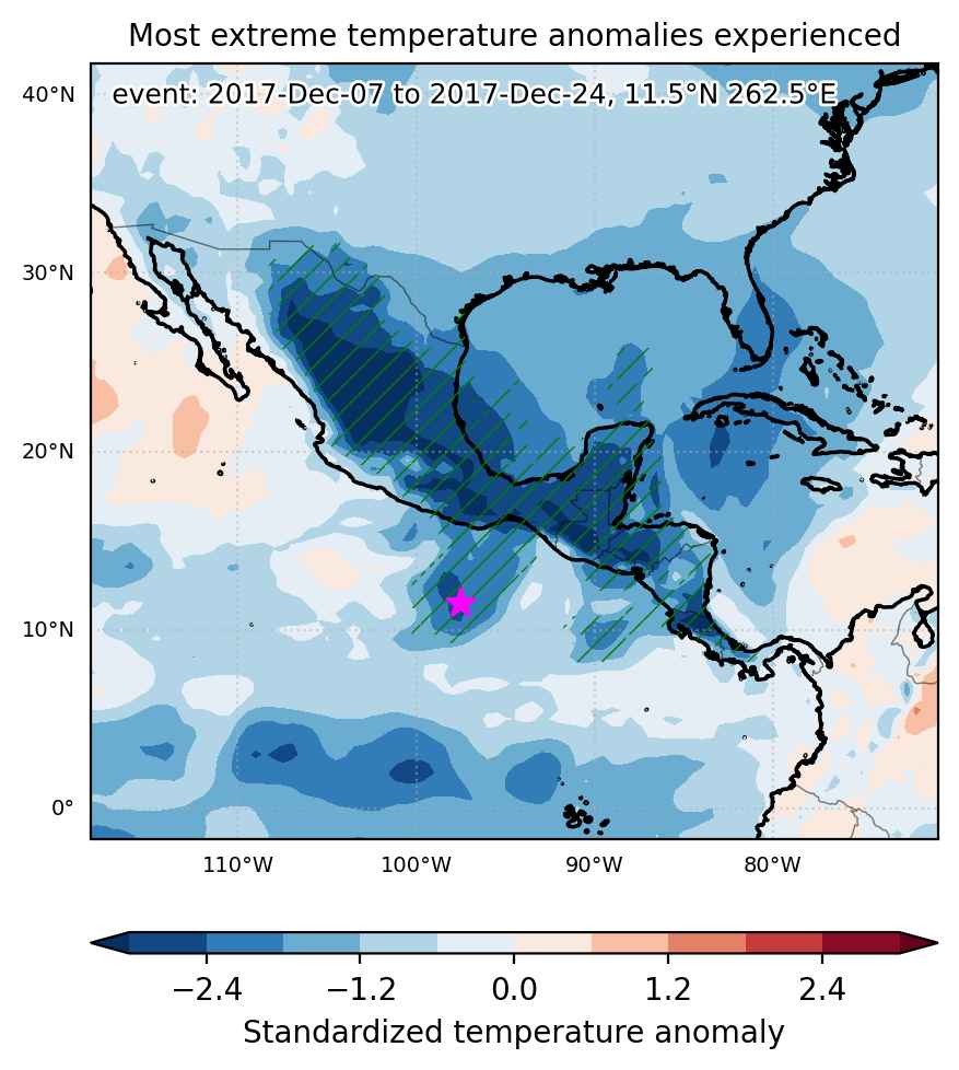
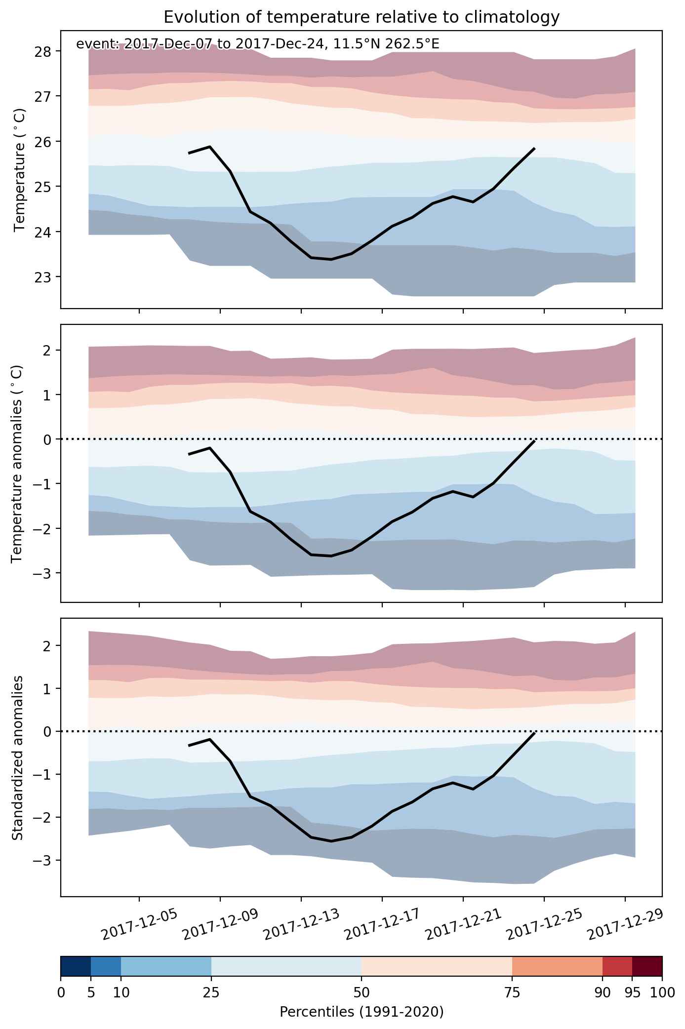
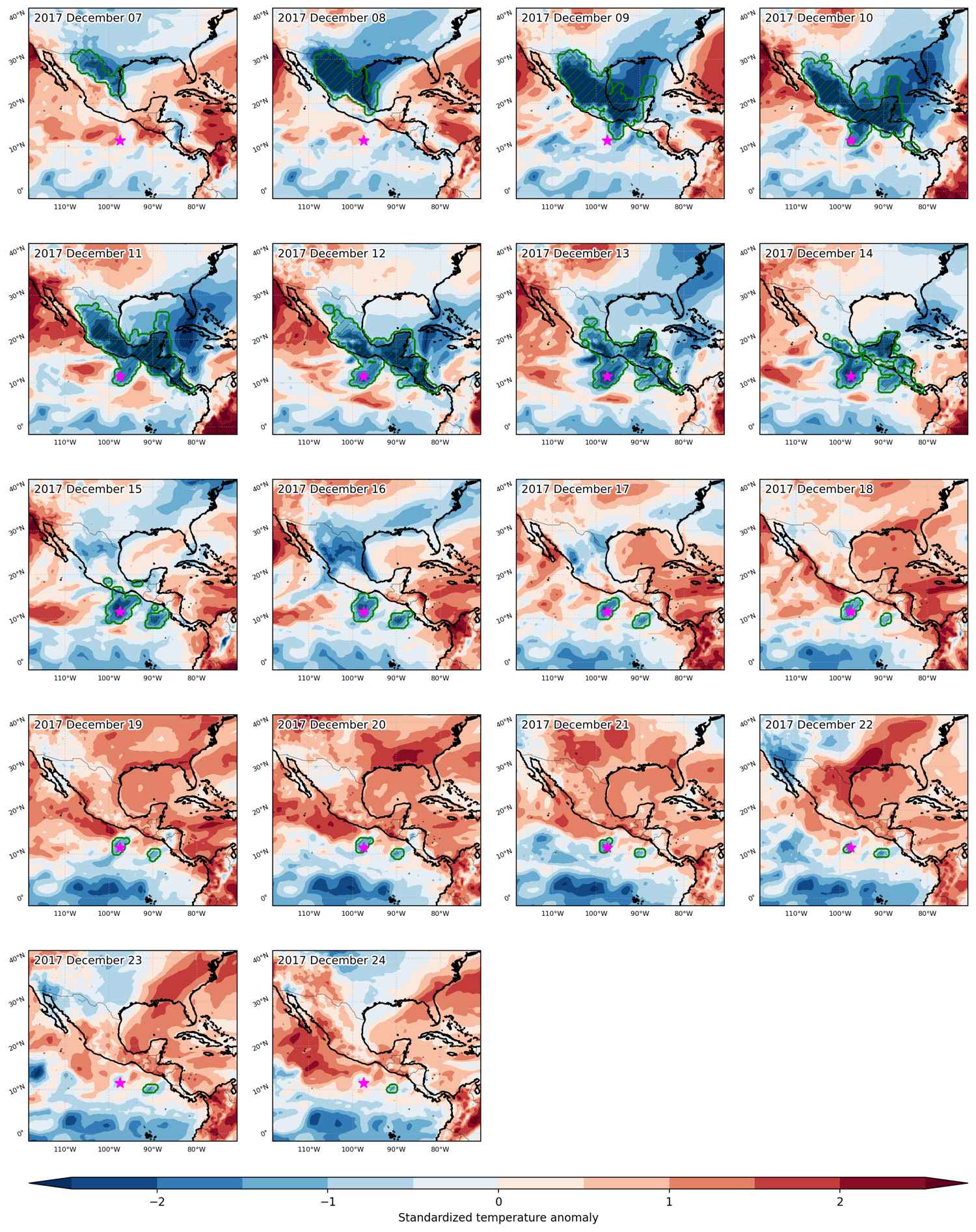
Fig. 1: Map of most extreme temperature anomalies (standardized) experienced during the event. The purple star indicates the center of the extreme event. Green hatching illustrates all areas under the effect of extremes at some time during the event.


Fig. 2: Evolution of temperature at the center of the event. The climatological percentile distribution is illustrated with color shadings.


Fig. 3: Maps illustrating the evolution of standardized temperature anomalies during the event.

Event ID: Cold_spell_2017-Dec-07_to_2017-Dec-24_262.5_11.5